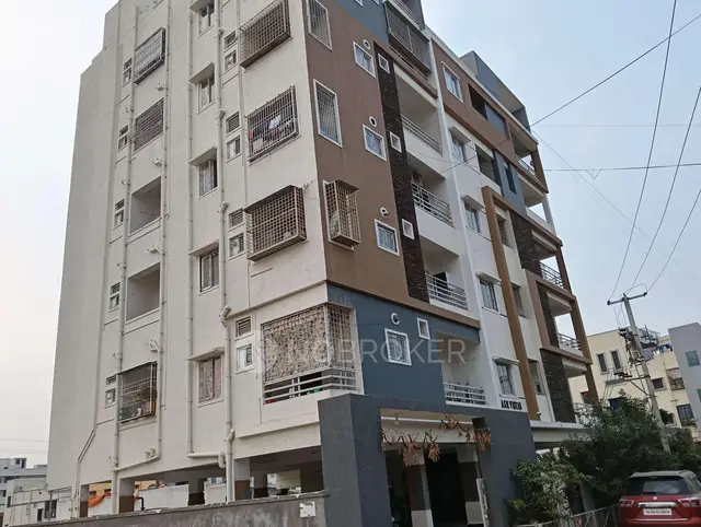
14TH Residency
CYBERCITY BUILDERS AND DEVELOPERS PRIVATE LIMITED · Rangareddy · RERA P02400002188
14TH RESIDENCY is a plotted development in Baghmahankal, Maheswaram Mandal, Ranga Reddy District, developed by the registered promoter CYBERCITY BUILDERS AND DEVELOPERS PRIVATE LIMITED. The layout proceedings record an extent of 89,657.1 sq. m. and describe plots, but the supplied record does not state the total plot count or plot-size configurations. The project is registered under TG-RERA registration number P02400002188, and the promoter’s Form B declaration states a completion undertaking of 31.12.2024.
01What we found
Read from TG-RERA filings, approvals, land and registration records and court records. A court case is counted only when the court record states this project's survey number with its village, or names the project.
02Check before you pay
7 items to check before you pay, 4 high - from the title chain, court records and approvals, each with what to ask the builder or your advocate. An item may not be a problem with the project: records can be incomplete.
1. Project at a glance
Project identity
| Field | Record |
|---|---|
| Registered project name | 14TH RESIDENCY RERA record |
| Project type | Plotted development / plotted layout RERA record |
| Phase or registered portion | Phase not separately identified in the supplied registration record; the filed layout document describes a draft layout RERA record |
| TG-RERA registration | P02400002188; registration certificate issued 30/10/2020, valid through 01/06/2025; the certificate states no extension RERA record |
| Registered promoter | CYBERCITY BUILDERS AND DEVELOPERS PRIVATE LIMITED RERA record Corporate record |
| RERA status in supplied record | Registration period has ended; no extension is recorded in the supplied certificate. This is separate from the project’s completion and occupancy status. |
Land and geographic identity
| Field | Record |
|---|---|
| Locality / revenue village | Baghmahankal; the layout proceedings identify Baghmankhal Village. RERA record Land records |
| Mandal | Maheswaram Mandal in the layout proceedings; the RERA land record does not disclose a mandal. Land records |
| District | Ranga Reddy RERA record Land records |
| PIN | 501359 RERA record |
| Project survey numbers recorded in the layout proceedings | 53, 54, 55, 57, 58, 59/1, 59/2, 60, 61, 62, 65, 71/P, 72, 76, 77, 78, 414/P |
| Survey numbers in RERA land fields | Not disclosed Land records |
| Registered site extent | Layout proceedings: 89,657.1 sq. m. RERA land record: total area 100,856.09 sq. m.; net area 89,657.10 sq. m.; affected area 11,198.99 sq. m. Land records |
| Boundaries in RERA land record | North: PROPOSED 100 FT ROAD; South: LAKE FTL; East and West: OTHERS PROPERTY Land records |
Development identity
| Field | Record |
|---|---|
| Layout proceedings / authority | Proceedings of the Commissioner, Thukkuguda Municipality, Ranga Reddy District; the document identifies HMDA as the authority from which final layout plans are to be released. |
| Principal layout approval identifier | Approval no. 000051/Lo/P g/HMDA/2020; proceedings no. Proc.No.G1/440/TM/RR/2019; file no. G1/440/TM/RR/2019. The document records approved date 29.05.2019. Approvals record |
| Approved built-up area | RERA fields state 10,856.09 sq. m.; a building or tower configuration is not supplied for this plotted development. RERA filing |
| Plot / layout arrangement | The filed layout proceedings refer to roads, organized open spaces, social infrastructure, and 36 mortgaged plots; a complete plot schedule or final layout drawing is not available in the supplied evidence. |
| Sanctioned floor configuration / parking levels | Not applicable to the plotted-layout description available here; no building floor or parking-level schedule is supplied. |
Offering and status
| Field | Record |
|---|---|
| Unit type and RERA-filed plot count / sizes | RERA unit-count, plot-size, booked and available schedules are not supplied. The filed allotment-letter template has blank plot number and extent fields. RERA unit table |
| RERA-filed completion undertaking | 31.12.2024, stated in the promoter’s Form B declaration dated 31 August 2020. |
| RERA registration certificate completion date | The supplied certificate records registration validity ending 01/06/2025; this is not an occupancy or completion certificate. |
| Construction / development stage | RERA header reports 70% completeness; the supplied record does not establish this as an independently verified site measurement. RERA record |
| Completion / occupancy certificate | No completion or occupancy certificate is supplied. The filed layout proceedings state that final layout release remained to be obtained; they are not an occupancy or completion certificate. |
2. The project story
14TH RESIDENCY is registered as a plotted development in Baghma(h)nkal, Ranga Reddy District. The layout proceedings identify Baghmankhal Village, Maheswaram Mandal, and a layout extent of 89,657.1 sq. m. The RERA land record separately describes a total area of 100,856.09 sq. m., a net area of 89,657.10 sq. m., and 11,198.99 sq. m. affected by road widening/FTL of tanks/nala widening. RERA record Land records
The filed layout document describes roads, open spaces, social infrastructure, and plots, including 36 plots recorded as mortgaged. It also lists layout works and services such as water-supply arrangements, storm-water drainage, park development, street lighting, and cycling tracks. These are features and conditions in the filed proceedings, not confirmation that they have been completed. The RERA header reports 70% completeness, but no independent site-progress verification is supplied. RERA record
No final layout plan release, completion certificate, or occupancy certificate is included in the reviewed documents. The RERA-filed allotment-letter template is incomplete, with plot number and extent left blank; the supplied material therefore does not establish the particular plot configuration offered to an individual buyer.
3. Master plan, architecture & building design
This is a plotted layout, not a documented multi-storey building scheme. The layout proceedings identify 89,657.1 sq. m. and enumerate survey numbers, roads, organized open spaces, social infrastructure, and mortgaged plots. They specify road area of 22,807.68 sq. m. (25.44%), organized open spaces of 13,538.77 sq. m. (15.10%), social infrastructure area of 2,241.43 sq. m. (2.50%), and a plotted area mortgage entry of 7,856.17 sq. m. (15.38% of plotted area).
The document directs the promoter to hand over the road, organized open-space, and social-infrastructure areas to the local body by registered gift deed before release of final layout plans from HMDA. The proceedings describe internal roads, including road widths recorded as “18 mts and above” and “60fts nd above roads,” and require roads to remain accessible to neighboring sites.
The supplied evidence does not include a readable final layout drawing or plot schedule from which to describe individual plot arrangement, dimensions, blocks, or exact circulation. The HMDA public layout lookup is reported as unavailable in the supplied record; this is a limitation of the review, not evidence that approval was refused. HMDA
4. Homes, configurations & floor plans
The project’s offering is plotted development. The supplied RERA data does not provide plot-wise unit counts, booked or available counts, or RERA-filed plot-size bands. The RERA-filed allotment-letter template leaves the plot number and extent blank. RERA unit table
A third-party vendor record lists plot sizes as 1,125–5,031 Sqft and 1125–5031 sq.ft (104.52–467.39 sq.m). These are vendor-reported figures, not RERA-filed plot schedule data. Promoter website
| Configuration | Units | Booked | Available | RERA saleable area | Measured carpet area | Loading |
|---|---|---|---|---|---|---|
| Plots | Not disclosed | Not disclosed | Not disclosed | Not disclosed | Not applicable | Not supplied |
Two drawings are recorded, but both are scans pending review; no plot or unit measurements have been produced from them. Apartment-style carpet area and loading are not established for this plotted project. Floor plans
5. Parking & vehicle circulation
The supplied project evidence does not establish a sanctioned parking count, visitor or accessible parking provision, parking allocation to individual plots, or a parking layout. The layout proceedings describe internal roads and require access to neighboring sites, but do not provide a complete vehicle-circulation drawing or parking schedule. A drawn or listed plot is not evidence of exclusive parking rights. RERA unit table
6. Amenities, recreation & open spaces
The layout proceedings identify the following facilities and land uses. They are recorded as proposed or required in the filed material; the supplied evidence does not independently verify completion.
| Facility | Description / size | Evidence source | Declared progress / verified status |
|---|---|---|---|
| Organized open spaces | 13,538.77 sq. m. (15.10%) | Handover to local body by registered gift deed is a stated condition; completed handover not established. | |
| Social infrastructure area | 2,241.43 sq. m. (2.50%) | Handover to local body by registered gift deed is a stated condition; completed handover not established. | |
| Park development | Size not stated | Listed as a layout facility; completion not independently verified. | |
| Cycling tracks | Size not stated | Development required by the proceedings; completion not independently verified. | |
| Avenue plantation | Quantity and area not stated | Listed as a layout facility; completion not independently verified. | |
| Vendor-listed recreation and community facilities | Basketball court, bike track, community garden, gym, indoor games, landscaped garden and play area; no sizes or capacities supplied | Promoter website | Third-party vendor listing; not established as sanctioned or delivered by the supplied project documents. |
7. Utilities, building services & safety
The layout proceedings list common septic tank/STP, internal water-supply pipelines, an overhead tank, transformer, rainwater-harvesting pits, bio-compost unit, and LED street lighting. The proceedings also require arrangements for potable-water connectivity and an underground storm-water drainage system. No capacities, as-built evidence, or independent commissioning records are supplied.
| Supplied record | Internal water-supply pipelines and overhead tank are listed; potable-water connectivity is required. Source, storage capacity, and treatment details are not supplied. |
|---|---|
| Status evidence | Proposed/listed in layout proceedings; completion not verified. |
| Supplied record | Common septic tank/STP is listed; underground storm-water drainage is required. |
|---|---|
| Status evidence | Proposed/listed or required; completion not verified. |
| Supplied record | Rainwater-harvesting pits are listed. |
|---|---|
| Status evidence | Listed; completion not verified. |
| Supplied record | Transformer and LED street lighting are listed. Backup power or EV charging details are not supplied. |
|---|---|
| Status evidence | Listed; completion not verified. |
| Supplied record | Bio-compost unit is listed. Waste segregation arrangements are not detailed. |
|---|---|
| Status evidence | Listed; completion not verified. |
| Supplied record | The RERA amenity record has a fire-protection item but no supporting system details or clearance document is supplied. |
|---|---|
| Status evidence | No compliance or completed fire-safety provision established. RERA amenities |
| Supplied record | No project-specific accessible-circulation, CCTV, or access-control evidence is supplied in the layout proceedings. |
|---|---|
| Status evidence | Not established. |
8. Location, access & connectivity
The registered location is Baghmahankal, Ranga Reddy District, PIN 501359; the layout proceedings identify Baghmankhal Village, Maheswaram Mandal. The RERA land-record boundaries include a PROPOSED 100 FT ROAD to the north and LAKE FTL to the south. The layout proceedings require internal roads to remain accessible to neighboring sites. RERA record Land records
A cadastral parcel centroid is recorded at 17.41528, 78.35459. The supplied location data lists Financial District (Nanakramguda) at 1.2 km, IndusInd Bank at 0.4 km, a bus station at 2.2 km, Manuu Polytechnic Hyderabad at 1.6 km, Sankaraya Eye Hospital at 1.6 km, ADP at 0.0 km, South India Shopping Mall at 2.6 km, a park at 1.2 km, and Nanakramguda Government Primary School at 0.5 km. These are supplied measured-location records, not travel-time claims. Location record
9. Developer & development status
The registered promoter is CYBERCITY BUILDERS AND DEVELOPERS PRIVATE LIMITED, a company. The supplied corporate record gives its address as Sathsurya Complex, Kavurihills, BAGHMAHANKAL, BAGHMAHANKAL, Ranga Reddy, 501359. No official website or project contact details are supplied. Corporate record RERA record
The promoter’s Form B declaration, signed by authorised signatory Sri Venu Vinod Vedra on 31 August 2020, states a completion undertaking of 31.12.2024 and discloses a memorandum of deposit of title deeds in favour of M/s Indian Bank, Kukatpally Branch, Hyderabad as an exception to its no-encumbrances statement. These are promoter declarations in the RERA-filed form.
The RERA certificate records registration validity from 30/10/2020 through 01/06/2025 and no extension in the supplied certificate. The RERA header reports 70% completeness; the supplied record does not independently verify that progress figure. No completion or occupancy certificate is supplied. RERA record
10. Approvals, official records & documents
| Identifier / date | P02400002188; issued 30/10/2020; valid through 01/06/2025 |
|---|---|
| What the supplied material establishes | FORM “C” records registration of 14TH RESIDENCY to the named promoter. No extension is recorded in the certificate. |
| Identifier / date | Approval no. 000051/Lo/P g/HMDA/2020; proceedings no. Proc.No.G1/440/TM/RR/2019; 29.05.2019 |
|---|---|
| What the supplied material establishes | Commissioner, Thukkuguda Municipality proceedings for a draft layout, with conditions and reference to final layout plans from HMDA. |
| Identifier / date | Office intimation G1/440/2020 dated 12.06.2020; DD nos. 109536 and 109535, each dated 23.06.2020 |
|---|---|
| What the supplied material establishes | References appearing in the layout proceedings. |
| Identifier / date | Mortgage deed 13974/2019, dated 31.07.2019 |
|---|---|
| What the supplied material establishes | Proceedings identify 36 plots as mortgaged in favour of the Metropolitan Commissioner, HMDA. |
| Identifier / date | L/358/2016, dated 17.01.2017 |
|---|---|
| What the supplied material establishes | Reference listed in the layout proceedings. |
| Identifier / date | Dated 31 August 2020 |
|---|---|
| What the supplied material establishes | Promoter’s declaration on title basis, disclosed Indian Bank memorandum of deposit of title deeds, and completion undertaking. |
| Identifier / date | Not supplied |
|---|---|
| What the supplied material establishes | No completion certificate or occupancy certificate is included in the reviewed project documents. Document index |
| Identifier / date | Final layout drawing not supplied; HMDA DPMS lookup reported unavailable from the public internet |
|---|---|
| What the supplied material establishes | The available material does not permit independent review of the final layout drawing or public portal status. HMDA |
1. Project at a glance
Project identity
Registered project name: 14TH RESIDENCY
Project type: Plotted development / plotted layout
Phase or registered portion: Phase not separately identified in the supplied registration record; the filed layout document describes a draft layout
TG-RERA registration: P02400002188; registration certificate issued 30/10/2020, valid through 01/06/2025; the certificate states no extension
Registered promoter: CYBERCITY BUILDERS AND DEVELOPERS PRIVATE LIMITED
RERA status in supplied record: Registration period has ended; no extension is recorded in the supplied certificate. This is separate from the project’s completion and occupancy status.
Land and geographic identity
Locality / revenue village: Baghmahankal; the layout proceedings identify Baghmankhal Village.
Mandal: Maheswaram Mandal in the layout proceedings; the RERA land record does not disclose a mandal.
District: Ranga Reddy
PIN: 501359
Project survey numbers recorded in the layout proceedings: 53, 54, 55, 57, 58, 59/1, 59/2, 60, 61, 62, 65, 71/P, 72, 76, 77, 78, 414/P
Survey numbers in RERA land fields: Not disclosed
Registered site extent: Layout proceedings: 89,657.1 sq. m. RERA land record: total area 100,856.09 sq. m.; net area 89,657.10 sq. m.; affected area 11,198.99 sq. m.
Boundaries in RERA land record: North: PROPOSED 100 FT ROAD; South: LAKE FTL; East and West: OTHERS PROPERTY
Development identity
Layout proceedings / authority: Proceedings of the Commissioner, Thukkuguda Municipality, Ranga Reddy District; the document identifies HMDA as the authority from which final layout plans are to be released.
Principal layout approval identifier: Approval no. 000051/Lo/P g/HMDA/2020; proceedings no. Proc.No.G1/440/TM/RR/2019; file no. G1/440/TM/RR/2019. The document records approved date 29.05.2019.
Approved built-up area: RERA fields state 10,856.09 sq. m.; a building or tower configuration is not supplied for this plotted development.
Plot / layout arrangement: The filed layout proceedings refer to roads, organized open spaces, social infrastructure, and 36 mortgaged plots; a complete plot schedule or final layout drawing is not available in the supplied evidence.
Sanctioned floor configuration / parking levels: Not applicable to the plotted-layout description available here; no building floor or parking-level schedule is supplied.
Offering and status
Unit type and RERA-filed plot count / sizes: RERA unit-count, plot-size, booked and available schedules are not supplied. The filed allotment-letter template has blank plot number and extent fields.
RERA-filed completion undertaking: 31.12.2024, stated in the promoter’s Form B declaration dated 31 August 2020.
RERA registration certificate completion date: The supplied certificate records registration validity ending 01/06/2025; this is not an occupancy or completion certificate.
Construction / development stage: RERA header reports 70% completeness; the supplied record does not establish this as an independently verified site measurement.
Completion / occupancy certificate: No completion or occupancy certificate is supplied. The filed layout proceedings state that final layout release remained to be obtained; they are not an occupancy or completion certificate.
2. The project story
14TH RESIDENCY is registered as a plotted development in Baghma(h)nkal, Ranga Reddy District. The layout proceedings identify Baghmankhal Village, Maheswaram Mandal, and a layout extent of 89,657.1 sq. m. The RERA land record separately describes a total area of 100,856.09 sq. m., a net area of 89,657.10 sq. m., and 11,198.99 sq. m. affected by road widening/FTL of tanks/nala widening.
The filed layout document describes roads, open spaces, social infrastructure, and plots, including 36 plots recorded as mortgaged. It also lists layout works and services such as water-supply arrangements, storm-water drainage, park development, street lighting, and cycling tracks. These are features and conditions in the filed proceedings, not confirmation that they have been completed. The RERA header reports 70% completeness, but no independent site-progress verification is supplied.
No final layout plan release, completion certificate, or occupancy certificate is included in the reviewed documents. The RERA-filed allotment-letter template is incomplete, with plot number and extent left blank; the supplied material therefore does not establish the particular plot configuration offered to an individual buyer.
3. Master plan, architecture & building design
This is a plotted layout, not a documented multi-storey building scheme. The layout proceedings identify 89,657.1 sq. m. and enumerate survey numbers, roads, organized open spaces, social infrastructure, and mortgaged plots. They specify road area of 22,807.68 sq. m. (25.44%), organized open spaces of 13,538.77 sq. m. (15.10%), social infrastructure area of 2,241.43 sq. m. (2.50%), and a plotted area mortgage entry of 7,856.17 sq. m. (15.38% of plotted area).
The document directs the promoter to hand over the road, organized open-space, and social-infrastructure areas to the local body by registered gift deed before release of final layout plans from HMDA. The proceedings describe internal roads, including road widths recorded as “18 mts and above” and “60fts nd above roads,” and require roads to remain accessible to neighboring sites.
The supplied evidence does not include a readable final layout drawing or plot schedule from which to describe individual plot arrangement, dimensions, blocks, or exact circulation. The HMDA public layout lookup is reported as unavailable in the supplied record; this is a limitation of the review, not evidence that approval was refused.
4. Homes, configurations & floor plans
The project’s offering is plotted development. The supplied RERA data does not provide plot-wise unit counts, booked or available counts, or RERA-filed plot-size bands. The RERA-filed allotment-letter template leaves the plot number and extent blank.
A third-party vendor record lists plot sizes as 1,125–5,031 Sqft and 1125–5031 sq.ft (104.52–467.39 sq.m). These are vendor-reported figures, not RERA-filed plot schedule data.
| Configuration | Units | Booked | Available | RERA saleable area | Measured carpet area | Loading |
|---|---|---|---|---|---|---|
| Plots | Not disclosed | Not disclosed | Not disclosed | Not disclosed | Not applicable | Not supplied |
Two drawings are recorded, but both are scans pending review; no plot or unit measurements have been produced from them. Apartment-style carpet area and loading are not established for this plotted project.
5. Parking & vehicle circulation
The supplied project evidence does not establish a sanctioned parking count, visitor or accessible parking provision, parking allocation to individual plots, or a parking layout. The layout proceedings describe internal roads and require access to neighboring sites, but do not provide a complete vehicle-circulation drawing or parking schedule. A drawn or listed plot is not evidence of exclusive parking rights.
6. Amenities, recreation & open spaces
The layout proceedings identify the following facilities and land uses. They are recorded as proposed or required in the filed material; the supplied evidence does not independently verify completion.
| Facility | Description / size | Evidence source | Declared progress / verified status |
|---|---|---|---|
| Organized open spaces | 13,538.77 sq. m. (15.10%) | Handover to local body by registered gift deed is a stated condition; completed handover not established. | |
| Social infrastructure area | 2,241.43 sq. m. (2.50%) | Handover to local body by registered gift deed is a stated condition; completed handover not established. | |
| Park development | Size not stated | Listed as a layout facility; completion not independently verified. | |
| Cycling tracks | Size not stated | Development required by the proceedings; completion not independently verified. | |
| Avenue plantation | Quantity and area not stated | Listed as a layout facility; completion not independently verified. | |
| Vendor-listed recreation and community facilities | Basketball court, bike track, community garden, gym, indoor games, landscaped garden and play area; no sizes or capacities supplied | Third-party vendor listing; not established as sanctioned or delivered by the supplied project documents. |
7. Utilities, building services & safety
The layout proceedings list common septic tank/STP, internal water-supply pipelines, an overhead tank, transformer, rainwater-harvesting pits, bio-compost unit, and LED street lighting. The proceedings also require arrangements for potable-water connectivity and an underground storm-water drainage system. No capacities, as-built evidence, or independent commissioning records are supplied.
| Supplied record | Internal water-supply pipelines and overhead tank are listed; potable-water connectivity is required. Source, storage capacity, and treatment details are not supplied. |
|---|---|
| Status evidence | Proposed/listed in layout proceedings; completion not verified. |
| Supplied record | Common septic tank/STP is listed; underground storm-water drainage is required. |
|---|---|
| Status evidence | Proposed/listed or required; completion not verified. |
| Supplied record | Rainwater-harvesting pits are listed. |
|---|---|
| Status evidence | Listed; completion not verified. |
| Supplied record | Transformer and LED street lighting are listed. Backup power or EV charging details are not supplied. |
|---|---|
| Status evidence | Listed; completion not verified. |
| Supplied record | Bio-compost unit is listed. Waste segregation arrangements are not detailed. |
|---|---|
| Status evidence | Listed; completion not verified. |
| Supplied record | The RERA amenity record has a fire-protection item but no supporting system details or clearance document is supplied. |
|---|---|
| Status evidence | No compliance or completed fire-safety provision established. |
| Supplied record | No project-specific accessible-circulation, CCTV, or access-control evidence is supplied in the layout proceedings. |
|---|---|
| Status evidence | Not established. |
8. Location, access & connectivity
The registered location is Baghmahankal, Ranga Reddy District, PIN 501359; the layout proceedings identify Baghmankhal Village, Maheswaram Mandal. The RERA land-record boundaries include a PROPOSED 100 FT ROAD to the north and LAKE FTL to the south. The layout proceedings require internal roads to remain accessible to neighboring sites.
A cadastral parcel centroid is recorded at 17.41528, 78.35459. The supplied location data lists Financial District (Nanakramguda) at 1.2 km, IndusInd Bank at 0.4 km, a bus station at 2.2 km, Manuu Polytechnic Hyderabad at 1.6 km, Sankaraya Eye Hospital at 1.6 km, ADP at 0.0 km, South India Shopping Mall at 2.6 km, a park at 1.2 km, and Nanakramguda Government Primary School at 0.5 km. These are supplied measured-location records, not travel-time claims.
9. Developer & development status
The registered promoter is CYBERCITY BUILDERS AND DEVELOPERS PRIVATE LIMITED, a company. The supplied corporate record gives its address as Sathsurya Complex, Kavurihills, BAGHMAHANKAL, BAGHMAHANKAL, Ranga Reddy, 501359. No official website or project contact details are supplied.
The promoter’s Form B declaration, signed by authorised signatory Sri Venu Vinod Vedra on 31 August 2020, states a completion undertaking of 31.12.2024 and discloses a memorandum of deposit of title deeds in favour of M/s Indian Bank, Kukatpally Branch, Hyderabad as an exception to its no-encumbrances statement. These are promoter declarations in the RERA-filed form.
The RERA certificate records registration validity from 30/10/2020 through 01/06/2025 and no extension in the supplied certificate. The RERA header reports 70% completeness; the supplied record does not independently verify that progress figure. No completion or occupancy certificate is supplied.
10. Approvals, official records & documents
| Identifier / date | P02400002188; issued 30/10/2020; valid through 01/06/2025 |
|---|---|
| What the supplied material establishes | FORM “C” records registration of 14TH RESIDENCY to the named promoter. No extension is recorded in the certificate. |
| Identifier / date | Approval no. 000051/Lo/P g/HMDA/2020; proceedings no. Proc.No.G1/440/TM/RR/2019; 29.05.2019 |
|---|---|
| What the supplied material establishes | Commissioner, Thukkuguda Municipality proceedings for a draft layout, with conditions and reference to final layout plans from HMDA. |
| Identifier / date | Office intimation G1/440/2020 dated 12.06.2020; DD nos. 109536 and 109535, each dated 23.06.2020 |
|---|---|
| What the supplied material establishes | References appearing in the layout proceedings. |
| Identifier / date | Mortgage deed 13974/2019, dated 31.07.2019 |
|---|---|
| What the supplied material establishes | Proceedings identify 36 plots as mortgaged in favour of the Metropolitan Commissioner, HMDA. |
| Identifier / date | L/358/2016, dated 17.01.2017 |
|---|---|
| What the supplied material establishes | Reference listed in the layout proceedings. |
| Identifier / date | Dated 31 August 2020 |
|---|---|
| What the supplied material establishes | Promoter’s declaration on title basis, disclosed Indian Bank memorandum of deposit of title deeds, and completion undertaking. |
| Identifier / date | Not supplied |
|---|---|
| What the supplied material establishes | No completion certificate or occupancy certificate is included in the reviewed project documents. |
| Identifier / date | Final layout drawing not supplied; HMDA DPMS lookup reported unavailable from the public internet |
|---|---|
| What the supplied material establishes | The available material does not permit independent review of the final layout drawing or public portal status. |
Frequently asked questions
Is 14TH RESIDENCY registered with Telangana RERA?
Yes. 14TH RESIDENCY is registered with the Telangana Real Estate Regulatory Authority as P02400002188; the registration status is New Project.
Who is the developer of 14TH RESIDENCY?
The promoter named in the RERA registration is CYBERCITY BUILDERS AND DEVELOPERS PRIVATE LIMITED.
Where is 14TH RESIDENCY located?
14TH RESIDENCY is in BAGHMAHANKAL, Rangareddy, Telangana (501359).
When will 14TH RESIDENCY be completed?
The promoter's proposed date of completion filed with RERA is 01/06/2025. This is the promoter's declaration, not a guarantee.
More projects in Rangareddy