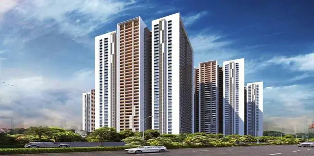
Kavuris Forest Nest
KAVURI HILLS DEVELOPERS PRIVATE LIMITED · Rangareddy · RERA P02400000545
KAVURIS FOREST NEST is a plotted development with residential open plots in IMAMGUDA VILLAGE, Maheshwaram, Ranga Reddy. It is being developed by KAVURI HILLS DEVELOPERS PRIVATE LIMITED. The project covers 200957.27 sq.mts and the final layout plan records 493 Nos of plots; tower, block, floor and plot-configuration details are not stated. Its TG-RERA registration is P02400000545, and its proposed completion date is 21/01/2021.
More from Kavuri Hills Developers Pvt Ltd · 2 projects →
01What we found
Read from TG-RERA filings, approvals, land and registration records and court records. A court case is counted only when the court record states this project's survey number with its village, or names the project.
02Check before you pay
12 items to check before you pay, 4 high - from the title chain, court records and approvals, each with what to ask the builder or your advocate. An item may not be a problem with the project: records can be incomplete.
1. Project at a glance
Project identity
| Field | Record |
|---|---|
| Registered project name | KAVURIS FOREST NEST RERA record |
| Project type | Plotted development / residential layout with open plots RERA record RERA filing |
| Phase / registered portion | The registration is for the project as a whole; no separate phase is identified in the supplied record. |
| TG-RERA registration | P02400000545; registered from 27/03/2019 to 21/01/2021. The certificate records no extension. Registration validity is distinct from the completion deadline and from any completion certification. |
| Registered promoter | KAVURI HILLS DEVELOPERS PRIVATE LIMITED RERA record Corporate record |
| RERA status | The project record describes it as On-Going Project. RERA record RERA filing |
Land and geographic identity
| Field | Record |
|---|---|
| Locality / revenue village | IMAMGUDA VILLAGE (also rendered “Immamguda” in the municipal proceedings) RERA record RERA filing |
| Mandal / district / PIN | Maheshwaram, Ranga Reddy, 501359 RERA record |
| Project survey numbers | 55/1, 55/2, 55/3 and 55/4 RERA record RERA filing |
| Subdivisions | No project subdivision identifiers are supplied. The land-record extract lists children under the filed survey numbers, but the filing does not identify which children comprise the project land. Land records |
| Registered site extent | The registration certificate and filing identify total land area as 200957.27 sq.mts, affected area as 1962.50 sq.mts, and net area as 198994.77 sq.mts. RERA filing |
| Boundaries | East: ROAD; West: ROAD; North: ROAD; South: ROAD RERA filing |
Development identity
| Field | Record |
|---|---|
| Sanctioning authority / principal layout approval | HMDA approval is cited in the municipal layout-release record; Final L.P. No. 01/LO/Plg/HMDA/2018, dated 05-02-2019, is identified there. Tukkuguda Municipality proceedings record release of the final layout. Approvals record |
| RERA-filed plan approval number | 101/LO/Plg/HMDA/2016 RERA filing Approvals record |
| Approved built-up area | 198994.77 sq.mts is the RERA-filed “Approved Built up Area” figure; the supplied records describe a plotted layout, not a building scheme. RERA filing |
| Plots | The final layout plan records 493 Nos of plots. |
| Buildings / floors / parking levels | Not disclosed in the supplied project record. This is a plotted layout; no tower count, floor configuration, or parking-level schedule is provided. RERA filing Document index |
Offering and status
| Field | Record |
|---|---|
| Offering | Residential open plots. Plot-by-plot dimensions, saleable-size range, and current inventory counts are not supplied here. RERA unit table |
| RERA-filed completion deadline | 21/01/2021 (original and revised proposed completion dates in the project filing). RERA filing |
| Completion / OC record | A Form 1A document is filed with architect and engineer completion certificates and municipal final-layout proceedings dated 01.06.2024. The material supplied does not identify a separate occupancy certificate or establish its scope as a building/tower OC; the project is a plotted layout. |
2. The project story
KAVURIS FOREST NEST is registered as a residential plotted development in Imamguda village, Maheshwaram mandal, Ranga Reddy district. The registered project covers survey numbers 55/1, 55/2, 55/3 and 55/4. The final layout plan identifies 493 plots, with associated roads, park, social-infrastructure and utility areas. RERA record RERA filing
The RERA filing sets a completion date of 21/01/2021. A later filing includes architect and engineer completion certificates and proceedings releasing the final open-plots layout in 2024. Those records concern layout completion/release; they do not provide plot-by-plot construction or possession status, nor a separate building occupancy certificate. The RERA-filed completion date, registration validity, and later completion documentation are distinct records. RERA filing
3. Master plan, architecture & building design
This is a plotted layout, rather than a tower or apartment development. The final layout plan records 493 plots and land-use components including roads, park, clubhouse and amenities, utilities, social infrastructure, and net site area. It also shows road-width annotations including “(45m) WIDE ROAD AS PER MASTER PLAN” and “PROPOSED 150'0"; the supplied extraction does not map those annotations to particular road segments.
The RERA filing gives a total area of 200957.27 sq.mts, an affected area of 1962.50 sq.mts, and a net area of 198994.77 sq.mts. The layout-plan extraction separately lists a net site area of 105644.70 sq.mts and records land-use figures; these are reproduced as stated in that document, without treating them as interchangeable area measures. RERA filing
No apartment floor plans, building count, floor configuration, building footprint, or building-by-building phase schedule is available for this plotted project. The supplied floor-plan set contains two scans pending measurement, with no completed software measurements. Floor plans
4. Homes, configurations & floor plans
The RERA-filed offering is open plots. The available layout extraction identifies 493 plots, but does not provide a plot-size schedule, plot-wise areas, or booked and available counts. Accordingly, no plot configuration or inventory table can be completed from the supplied evidence. RERA unit table
The floor-plan drawings have not been measured: two scans are pending, and the supplied record contains no software-measured carpet areas. Carpet-area and apartment saleable-area figures are therefore not applicable or established in this Overview. Floor plans
5. Parking & vehicle circulation
The layout plan records road areas and road-width annotations, but the supplied evidence does not state sanctioned resident or visitor parking counts, parking allocation by plot, parking facilities, ramps, or EV charging. A drawn road or plot layout does not establish an exclusive parking entitlement. RERA filing
6. Amenities, recreation & open spaces
| Description / size | Roads area 61815.85 Sq.Mts. in the final layout extraction; road-width annotations include “(5-22); WIDE ROAD”, “(45m) WIDE ROAD AS PER MASTER PLAN”, and “PROPOSED 150'0". |
|---|---|
| Declared progress / verified status | Layout-plan provision; no independent site verification supplied. |
| Description / size | 6443.51 (unit is not legible in the extracted area field); park area also appears in the municipal proceedings as 18520.55 Sq.Mtrs. |
|---|---|
| Declared progress / verified status | Layout and municipal-record references; no independent completion verification supplied. |
| Description / size | 645.43. Sq.Mts. |
|---|---|
| Declared progress / verified status | Plan provision; no delivery or independent verification evidence supplied. |
| Description / size | 2.50% in the final layout extraction; municipal proceedings record 4984.25 Sq.Mtrs. |
|---|---|
| Declared progress / verified status | Layout/municipal-record provision; no facility-by-facility completion evidence supplied. |
| Description / size | 18520.55 Sq.Mts, and 9.31% in the final layout extraction. |
|---|---|
| Declared progress / verified status | Plan provision; no independent site verification supplied. |
| Description / size | RERA amenities data reports YES, 100%. |
|---|---|
| Evidence source | RERA amenities |
| Declared progress / verified status | RERA-declared progress; not independently verified here. |
| Description / size | RERA amenities data reports 0%. |
|---|---|
| Evidence source | RERA amenities |
| Declared progress / verified status | RERA progress field; does not establish whether any particular facility is required or delivered. |
The promoter’s brochure lists additional facilities such as a swimming pool, gym, indoor games, restaurant and multipurpose hall. These are promoter-marketed claims, not established here as sanctioned or delivered project facilities.
7. Utilities, building services & safety
The municipal layout proceedings state that the layout is provided with water supply, sewerage and drainage disposal, street lighting, rainwater-harvesting structure and other civic amenities, and assign the applicant responsibility for their maintenance.
The RERA amenities data reports water supply, sewerage, storm-water drains and street lighting at 100%, while water conservation/rainwater harvesting and electrical meter room/sub-station/receiving station are each reported at 80%. These are RERA progress entries, not independent verification of operation, capacity, or statutory compliance. The same filing reports 0% for treatment and disposal of sewage and sullage water, solid-waste management and disposal, energy management, and fire protection/fire-safety requirements. RERA amenities
No capacities or detailed design information are supplied for water storage or treatment, sewerage treatment, electrical supply or backup, fire systems, waste facilities, security, accessibility, or building services. The promoter brochure describes treated water and 100% power back for common area facilities and 3 lights and 3 fans; these remain brochure claims.
8. Location, access & connectivity
The registered location is Imamguda village, Maheshwaram mandal, Ranga Reddy district, Telangana 501359. The municipal proceedings describe the project location as Immamguda, Maheshwaram. The supplied location record lists TGSRTC Bus Station, Maheshwaram, at 0.2 km, Community Health Centre Maheshwaram at 0.2 km, and the nearest sampled Outer Ring Road interchange at approximately 10.6 km. RERA record Location record
The location record supplies these distances only; it does not establish travel times, route conditions, or public-transport service frequency. Location record
9. Developer & development status
The registered legal promoter is KAVURI HILLS DEVELOPERS PRIVATE LIMITED, a private limited company. The RERA record identifies KAVURI RAVI KUMAR as an authorized signatory; the promoter’s Form B declaration, dated 4 December 2018 at Hyderabad, undertakes completion by 21/01/2021. Corporate record Parties record
The project filing records an SBI account at the KAVURI HILLS branch, with masked account number \\\\\\\*0160 and IFSC SBIN0012655. Parties record
The supplied evidence gives no current plot-wise construction, booking, or availability schedule. The Form 1A filing contains architect and engineer completion certificates and municipal proceedings for final layout release; it does not provide a tower-wise or plot-wise completion schedule.
10. Approvals, official records & documents
| Record | Supplied evidence |
|---|---|
| TG-RERA registration | Form C registration certificate for KAVURIS FOREST NEST, P02400000545, valid 27/03/2019–21/01/2021; certificate states no extension. |
| RERA-filed plan approval | 101/LO/Plg/HMDA/2016 is stated in the project filing. RERA filing |
| Final layout approval / release | Municipal proceedings identify Final L.P. No. 01/LO/Plg/HMDA/2018 and final layout release for open plots; the proceedings are dated 05-02-2019 in the extraction. |
| Layout plan | Final layout plan records 493 Nos plots and land-use components. |
| Completion-related filing | Form 1A filing includes architect and engineer completion certificates and proceedings for final layout release, with proceeding number G1/384/21/2019 and date 01.06.2024. No separate building/tower occupancy certificate is established in the supplied record. |
| Promoter declaration | Form B declaration by authorized signatory K. Ravi Kumar; includes the promoter’s title-basis statement and completion undertaking. |
The HMDA public layout lookup is reported as unavailable to public access in the supplied record; this is a limitation on independent portal verification, not evidence of refusal or non-approval. HMDA
1. Project at a glance
Project identity
Registered project name: KAVURIS FOREST NEST
Project type: Plotted development / residential layout with open plots
Phase / registered portion: The registration is for the project as a whole; no separate phase is identified in the supplied record.
TG-RERA registration: P02400000545; registered from 27/03/2019 to 21/01/2021. The certificate records no extension. Registration validity is distinct from the completion deadline and from any completion certification.
Registered promoter: KAVURI HILLS DEVELOPERS PRIVATE LIMITED
RERA status: The project record describes it as On-Going Project.
Land and geographic identity
Locality / revenue village: IMAMGUDA VILLAGE (also rendered “Immamguda” in the municipal proceedings)
Mandal / district / PIN: Maheshwaram, Ranga Reddy, 501359
Project survey numbers: 55/1, 55/2, 55/3 and 55/4
Subdivisions: No project subdivision identifiers are supplied. The land-record extract lists children under the filed survey numbers, but the filing does not identify which children comprise the project land.
Registered site extent: The registration certificate and filing identify total land area as 200957.27 sq.mts, affected area as 1962.50 sq.mts, and net area as 198994.77 sq.mts.
Boundaries: East: ROAD; West: ROAD; North: ROAD; South: ROAD
Development identity
Sanctioning authority / principal layout approval: HMDA approval is cited in the municipal layout-release record; Final L.P. No. 01/LO/Plg/HMDA/2018, dated 05-02-2019, is identified there. Tukkuguda Municipality proceedings record release of the final layout.
RERA-filed plan approval number: 101/LO/Plg/HMDA/2016
Approved built-up area: 198994.77 sq.mts is the RERA-filed “Approved Built up Area” figure; the supplied records describe a plotted layout, not a building scheme.
Plots: The final layout plan records 493 Nos of plots.
Buildings / floors / parking levels: Not disclosed in the supplied project record. This is a plotted layout; no tower count, floor configuration, or parking-level schedule is provided.
Offering and status
Offering: Residential open plots. Plot-by-plot dimensions, saleable-size range, and current inventory counts are not supplied here.
RERA-filed completion deadline: 21/01/2021 (original and revised proposed completion dates in the project filing).
Completion / OC record: A Form 1A document is filed with architect and engineer completion certificates and municipal final-layout proceedings dated 01.06.2024. The material supplied does not identify a separate occupancy certificate or establish its scope as a building/tower OC; the project is a plotted layout.
2. The project story
KAVURIS FOREST NEST is registered as a residential plotted development in Imamguda village, Maheshwaram mandal, Ranga Reddy district. The registered project covers survey numbers 55/1, 55/2, 55/3 and 55/4. The final layout plan identifies 493 plots, with associated roads, park, social-infrastructure and utility areas.
The RERA filing sets a completion date of 21/01/2021. A later filing includes architect and engineer completion certificates and proceedings releasing the final open-plots layout in 2024. Those records concern layout completion/release; they do not provide plot-by-plot construction or possession status, nor a separate building occupancy certificate. The RERA-filed completion date, registration validity, and later completion documentation are distinct records.
3. Master plan, architecture & building design
This is a plotted layout, rather than a tower or apartment development. The final layout plan records 493 plots and land-use components including roads, park, clubhouse and amenities, utilities, social infrastructure, and net site area. It also shows road-width annotations including “(45m) WIDE ROAD AS PER MASTER PLAN” and “PROPOSED 150'0"; the supplied extraction does not map those annotations to particular road segments.
The RERA filing gives a total area of 200957.27 sq.mts, an affected area of 1962.50 sq.mts, and a net area of 198994.77 sq.mts. The layout-plan extraction separately lists a net site area of 105644.70 sq.mts and records land-use figures; these are reproduced as stated in that document, without treating them as interchangeable area measures.
No apartment floor plans, building count, floor configuration, building footprint, or building-by-building phase schedule is available for this plotted project. The supplied floor-plan set contains two scans pending measurement, with no completed software measurements.
4. Homes, configurations & floor plans
The RERA-filed offering is open plots. The available layout extraction identifies 493 plots, but does not provide a plot-size schedule, plot-wise areas, or booked and available counts. Accordingly, no plot configuration or inventory table can be completed from the supplied evidence.
The floor-plan drawings have not been measured: two scans are pending, and the supplied record contains no software-measured carpet areas. Carpet-area and apartment saleable-area figures are therefore not applicable or established in this Overview.
5. Parking & vehicle circulation
The layout plan records road areas and road-width annotations, but the supplied evidence does not state sanctioned resident or visitor parking counts, parking allocation by plot, parking facilities, ramps, or EV charging. A drawn road or plot layout does not establish an exclusive parking entitlement.
6. Amenities, recreation & open spaces
| Description / size | Roads area 61815.85 Sq.Mts. in the final layout extraction; road-width annotations include “(5-22); WIDE ROAD”, “(45m) WIDE ROAD AS PER MASTER PLAN”, and “PROPOSED 150'0". |
|---|---|
| Declared progress / verified status | Layout-plan provision; no independent site verification supplied. |
| Description / size | 6443.51 (unit is not legible in the extracted area field); park area also appears in the municipal proceedings as 18520.55 Sq.Mtrs. |
|---|---|
| Declared progress / verified status | Layout and municipal-record references; no independent completion verification supplied. |
| Description / size | 645.43. Sq.Mts. |
|---|---|
| Declared progress / verified status | Plan provision; no delivery or independent verification evidence supplied. |
| Description / size | 2.50% in the final layout extraction; municipal proceedings record 4984.25 Sq.Mtrs. |
|---|---|
| Declared progress / verified status | Layout/municipal-record provision; no facility-by-facility completion evidence supplied. |
| Description / size | 18520.55 Sq.Mts, and 9.31% in the final layout extraction. |
|---|---|
| Declared progress / verified status | Plan provision; no independent site verification supplied. |
| Description / size | RERA amenities data reports YES, 100%. |
|---|---|
| Declared progress / verified status | RERA-declared progress; not independently verified here. |
| Description / size | RERA amenities data reports 0%. |
|---|---|
| Declared progress / verified status | RERA progress field; does not establish whether any particular facility is required or delivered. |
The promoter’s brochure lists additional facilities such as a swimming pool, gym, indoor games, restaurant and multipurpose hall. These are promoter-marketed claims, not established here as sanctioned or delivered project facilities.
7. Utilities, building services & safety
The municipal layout proceedings state that the layout is provided with water supply, sewerage and drainage disposal, street lighting, rainwater-harvesting structure and other civic amenities, and assign the applicant responsibility for their maintenance.
The RERA amenities data reports water supply, sewerage, storm-water drains and street lighting at 100%, while water conservation/rainwater harvesting and electrical meter room/sub-station/receiving station are each reported at 80%. These are RERA progress entries, not independent verification of operation, capacity, or statutory compliance. The same filing reports 0% for treatment and disposal of sewage and sullage water, solid-waste management and disposal, energy management, and fire protection/fire-safety requirements.
No capacities or detailed design information are supplied for water storage or treatment, sewerage treatment, electrical supply or backup, fire systems, waste facilities, security, accessibility, or building services. The promoter brochure describes treated water and 100% power back for common area facilities and 3 lights and 3 fans; these remain brochure claims.
8. Location, access & connectivity
The registered location is Imamguda village, Maheshwaram mandal, Ranga Reddy district, Telangana 501359. The municipal proceedings describe the project location as Immamguda, Maheshwaram. The supplied location record lists TGSRTC Bus Station, Maheshwaram, at 0.2 km, Community Health Centre Maheshwaram at 0.2 km, and the nearest sampled Outer Ring Road interchange at approximately 10.6 km.
The location record supplies these distances only; it does not establish travel times, route conditions, or public-transport service frequency.
9. Developer & development status
The registered legal promoter is KAVURI HILLS DEVELOPERS PRIVATE LIMITED, a private limited company. The RERA record identifies KAVURI RAVI KUMAR as an authorized signatory; the promoter’s Form B declaration, dated 4 December 2018 at Hyderabad, undertakes completion by 21/01/2021.
The project filing records an SBI account at the KAVURI HILLS branch, with masked account number \\\\\\\*0160 and IFSC SBIN0012655.
The supplied evidence gives no current plot-wise construction, booking, or availability schedule. The Form 1A filing contains architect and engineer completion certificates and municipal proceedings for final layout release; it does not provide a tower-wise or plot-wise completion schedule.
10. Approvals, official records & documents
TG-RERA registration: Form C registration certificate for KAVURIS FOREST NEST, P02400000545, valid 27/03/2019–21/01/2021; certificate states no extension.
RERA-filed plan approval: 101/LO/Plg/HMDA/2016 is stated in the project filing.
Final layout approval / release: Municipal proceedings identify Final L.P. No. 01/LO/Plg/HMDA/2018 and final layout release for open plots; the proceedings are dated 05-02-2019 in the extraction.
Layout plan: Final layout plan records 493 Nos plots and land-use components.
Completion-related filing: Form 1A filing includes architect and engineer completion certificates and proceedings for final layout release, with proceeding number G1/384/21/2019 and date 01.06.2024. No separate building/tower occupancy certificate is established in the supplied record.
Promoter declaration: Form B declaration by authorized signatory K. Ravi Kumar; includes the promoter’s title-basis statement and completion undertaking.
The HMDA public layout lookup is reported as unavailable to public access in the supplied record; this is a limitation on independent portal verification, not evidence of refusal or non-approval.
Frequently asked questions
Is KAVURIS FOREST NEST registered with Telangana RERA?
Yes. KAVURIS FOREST NEST is registered with the Telangana Real Estate Regulatory Authority as P02400000545; the registration status is On-Going Project.
Who is the developer of KAVURIS FOREST NEST?
The promoter named in the RERA registration is KAVURI HILLS DEVELOPERS PRIVATE LIMITED.
Where is KAVURIS FOREST NEST located?
KAVURIS FOREST NEST is in IMAMGUDA VILLAGE, Imamguda, Maheshwaram, Rangareddy, Telangana (501359).
When will KAVURIS FOREST NEST be completed?
The promoter's proposed date of completion filed with RERA is 21/01/2021. This is the promoter's declaration, not a guarantee.
More projects in Imamguda