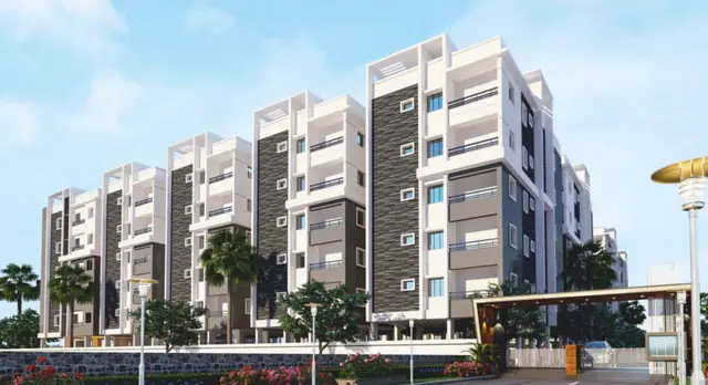
Eeshanya County
NAAM EESHANYA INFRA · Rangareddy · RERA P02400010328
EESHANYA COUNTY is a plotted development at Jogammaguda, Farooqnagar Mandal, Ranga Reddy District, developed by registered promoter NAAM EESHANYA INFRA, a partnership. The layout record states a total layout area of 53821.7 sq.m and a net layout area of 50658.5 sq.m, with 196 plots and no building or floor configuration disclosed. The software-read plot schedule gives sizes from 131.83 sq.m to 380.7 sq.m. It is registered with TG-RERA under P02400010328, and the project identity record lists proposed completion as 09/02/2029.
01What we found
Read from TG-RERA filings, approvals, land and registration records and court records. A court case is counted only when the court record states this project's survey number with its village, or names the project.
02Check before you pay
6 items to check before you pay, 3 high - from the title chain, court records and approvals, each with what to ask the builder or your advocate. An item may not be a problem with the project: records can be incomplete.
1. Project at a glance
Project identity
| Field | Record |
|---|---|
| Registered project name | EESHANYA COUNTY RERA record |
| Project type | Plotted development / open-plot layout RERA record |
| Phase / registered portion | A single registered project is identified; no separate phase name or phase-wise scope is disclosed. RERA record Approvals record |
| TG-RERA registration | P02400010328 RERA record |
| Registration validity | 09/10/2025 to 09/10/2028. This is the registration period, not the project’s completion date. RERA record |
| Registered promoter | NAAM EESHANYA INFRA, a partnership. RERA record Corporate record |
| RERA status | Registered project; the registration certificate records a three-year validity period. Approvals record |
Land and geographic identity
| Field | Record |
|---|---|
| Locality / revenue village | Jogammaguda (also written “Jagammaguda” in the filed layout documents); the RERA registration records Jogammaguda. RERA record |
| Mandal | Farooqnagar RERA record |
| District | Ranga Reddy RERA record |
| PIN | 509202 in the project identity record. The registration certificate also lists the promoter address with PIN 500089; that is a promoter-address entry, not the project PIN. RERA record |
| Project survey numbers | SY NOS 61, 62, 63, 64, 65, 69, 70, 71, 72/PART, 73/PART AND 74. The filed layout also includes survey no. 71 without a subdivision in its survey list. RERA record |
| Site and layout areas | The layout record states Total Layout Area 53821.7 sq.m and Net Layout Area 50658.5 sq.m. The registered land details state total area 50658.50 sq.m, affected area 2663.84 sq.m, and net area 47994.66 sq.m. RERA filing |
| Boundaries | North: ROAD; South: NEIGHBOURS PLOTS; East and West: NEIGHBOURS OPEN LAND. RERA filing |
Development identity
| Field | Record |
|---|---|
| Sanctioning authority | Hyderabad Metropolitan Development Authority (HMDA); the draft layout letter records delegation to Rameshwaram Gram Panchayat. |
| Principal layout approval | 0765/HMDA/SWDL/2025, dated 09/10/2025; application/file no. 004492/HMDA/01335/SWDL/SKP1/2025. The filed instrument is titled DRAFT LAYOUT LETTER and identifies the category as Draft Layout. |
| Approved built-up area | Not disclosed as a building built-up area for this plotted layout. The registration fields list 31851.18 sq.m as approved built-up area; the layout drawing identifies that same figure as Plotted Area. RERA filing |
| Buildings / floors | No building count, floor configuration, tower height or apartment-floor arrangement is disclosed; this is a plotted development. RERA record |
| Roads and open space | Layout allocation includes 12,756.73 sq.m road area, 3,805.52 sq.m organized open space / park area, 1,269.74 sq.m social infrastructure area, 338.10 sq.m utilities area and 637.18 sq.m buffer zone area. |
| Parking | The filed layout records 0.00 sq.m common parking area. Individual plot parking provision or allocation is not established in the supplied records. |
Offering and status
| Field | Record |
|---|---|
| Unit type | Residential plots; a software-read layout schedule identifies 196 plots. RERA record Layout record |
| Plot size information | Software-read schedule: 196 plots, sizes from 131.83 sq.m to 380.7 sq.m; median 165.55 sq.m. These measurements are drawing-derived and should be checked against the approved drawing. Layout record |
| Booked / available | Not disclosed in the supplied RERA inventory data. RERA unit table |
| Construction stage | No independently verified site-progress measurement is supplied. The registration is for a new project; the draft layout letter requires development works to be completed within THREE (3) YEARS. RERA record |
| Completion dates | Promoter’s Form B undertaking states 09-Oct-2028; the project identity record lists proposed completion as 09/02/2029. These dates are not the registration-validity dates. RERA record |
| Occupancy / completion certificate | No occupancy or completion certificate is supplied. The layout approval is a draft layout permission, not an occupancy certificate. |
2. The project story
EESHANYA COUNTY is registered with TG-RERA as a plotted development at Jogammaguda, Farooqnagar Mandal, Ranga Reddy District. The registered land description covers survey numbers 61, 62, 63, 64, 65, 69, 70, 71, 72/PART, 73/PART and 74. The filed HMDA instrument describes a proposed residential open-plotted layout and records a draft layout permission. RERA record
The drawing-derived plot schedule contains 196 plots. The layout allocation is principally for plots, internal roads, organized open space/park, social infrastructure and utilities. The supplied evidence does not establish booked or available plot counts, site-completion progress, or an occupancy/completion certificate. The promoter’s Form B gives a completion undertaking of 09-Oct-2028; the project identity record separately lists a proposed completion date of 09/02/2029. Layout record RERA record
The layout permission includes mortgage plots reserved in favour of the Metropolitan Commissioner, HMDA: plots 164 to 196 under document 11392/2025, and plots 151 to 163 under document 11393/2025. The draft permission states that mortgaged plots may not be sold and that final layout release depends on completion of specified works and handovers.
3. Master plan, architecture & building design
This is a plotted layout, not a building or apartment scheme. The filed drawing states a total layout area of 53821.7 sq.m and a net layout area of 50658.5 sq.m. The registration land details separately report total area 50658.50 sq.m, affected area 2663.84 sq.m, and net area 47994.66 sq.m. RERA filing
The filed layout’s land-use schedule is:
| Layout component | Area | Share stated in drawing |
|---|---|---|
| Plotted Area | 31851.18 sq.m | 62.87% |
| Road Area | 12756.73 sq.m | 25.18% |
| Organized Open Space / Park Area | 3805.52 sq.m | 7.51% |
| Social Infrastructure Area | 1269.74 sq.m | 2.51% |
| Utilities Area | 338.10 sq.m | 0.67% |
| Buffer zone area | 637.18 sq.m | 1.26% |
| Road widening area | 2663.84 sq.m | Separately identified as affected area |
The layout drawing identifies road widths including 18.0 m, 30.0 m, 12.19m and 9.14m, along with several feet-based labels; the draft layout letter also specifies road widths of 18 mts and 60 feet.
Software measurement of the drawing schedule identifies 196 plots. The drawing extraction records plot sizes from 131.83 sq.m to 380.7 sq.m; this is a software-measured drawing result, not a RERA-filed inventory disclosure. No building footprints, building heights, floor plans or apartment configurations apply to the plotted layout. Layout record Floor plans
4. Homes, configurations & floor plans
The RERA-registered offering is plots, not apartments. The supplied records do not provide RERA unit-type inventory counts, booking counts, availability counts or a RERA-filed saleable-area schedule. The plot count and dimensions below are read from the approved layout drawing by software and are not a RERA inventory disclosure. RERA unit table Layout record
| Plot-size band | Plot count | Basis |
|---|---|---|
| 150–200 sq.yd (125–167 sq.m) | 116 | Software-read layout schedule |
| 200–250 sq.yd (167–209 sq.m) | 66 | Software-read layout schedule |
| 250–300 sq.yd (209–251 sq.m) | 5 | Software-read layout schedule |
| 300–400 sq.yd (251–334 sq.m) | 6 | Software-read layout schedule |
| 400–500 sq.yd (334–418 sq.m) | 3 | Software-read layout schedule |
The software-read schedule gives the smallest plot as 131.83 sq.m, median as 165.55 sq.m, and largest as 380.7 sq.m. No apartment carpet area, balcony, utility or common-area loading applies to this plotted offering. Layout record
5. Parking & vehicle circulation
The filed layout schedule records 0.00 sq.m for common parking area. The supplied RERA data does not establish individual plot parking spaces, visitor parking, accessible parking, EV facilities, or a parking-allocation arrangement.
The layout drawing identifies internal roads, including stated widths of 18.0 m, 30.0 m, 12.19m and 9.14m; the draft layout letter also records 18 mts and 60 feet. These are layout-road details, not evidence of a particular plot’s exclusive parking rights.
6. Amenities, recreation & open spaces
The filed layout includes organized open space/park and social-infrastructure land. RERA amenity fields mark internal roads and footpaths, water supply, sewerage, green strip/tot-lot/park, street lighting, electrical meter room/sub-station/receiving station, and aggregate recreational open space as “YES”; the listed progress values are 0. These entries indicate RERA-filed availability fields, not independently verified completion. RERA amenities
| Facility | Description / size | Evidence source | Declared progress / verified status |
|---|---|---|---|
| Organized open space / park | 3805.52 sq.m; the layout also separately lists open-space components of 888.71 sq.m, 2393.97 sq.m and 522.84 sq.m. | Shown in draft layout; completion not independently verified. | |
| Tot-lot / park | Tot-lot and park development are referenced in the filed layout permission. | Approval condition / proposed provision; completion not independently verified. | |
| Social infrastructure | 1269.74 sq.m allocated. | Layout allocation; facility type and delivered status not disclosed. | |
| Internal roads and footpaths | Road area 12756.73 sq.m. | RERA amenities | RERA amenity field marked “YES”; completion not independently verified. |
| Community buildings | No area or facility description supplied; RERA amenity field has no “YES” entry. | RERA amenities | Not established. |
The promoter’s website/vendor material lists additional proposed or marketed features, including a club house, children’s play area, jogging track, gymnasium, CCTV and cricket net practice. These are not established as delivered or approved facilities by the project records summarized above. Promoter website
7. Utilities, building services & safety
The filed draft layout permission identifies 338.10 sq.m of utilities area and lists a common septic tank/STP, overhead tank, transformer, rainwater-harvesting pits and bio-compost unit among the proposed layout utilities. The RERA amenity fields mark water supply, sewerage, street lighting and an electrical meter room/sub-station/receiving station “YES”; their progress values are 0, and no capacities or completion verification are supplied. RERA amenities
The layout permission also specifies that a garbage house is to be provided within the premises, a rainwater-harvesting structure (percolation pit) is to be constructed, and transformer space is to be provided. These are stated requirements or filed proposals; the evidence does not verify installation or operation.
No project-specific fire-system design, emergency access verification, accessibility plan, security-system installation, utility capacity, water source or completed service record is supplied. The layout approval’s conditions refer to safety and services requirements, but those conditions alone do not establish implementation or statutory compliance.
8. Location, access & connectivity
The registered project location is Jogammaguda, Farooqnagar Mandal, Ranga Reddy District, Telangana, PIN 509202. The cadastral parcel centroid supplied for the land is 17.010799087300807, 78.176125824358. RERA record Cadastral map
The filed layout identifies an existing road width of 18.0 m and proposed road widths including 30.0 m; the draft layout letter also refers to 18 mts and 60 feet roads. A sampled location record lists the nearest sampled Outer Ring Road interchange at approximately 36.4 km. Location record
9. Developer & development status
The registered promoter is NAAM EESHANYA INFRA, identified in the project records as a partnership, with GSTIN 36AAWFN8050H1ZQ. The supplied promoter address is Plot No. 6B and 7B, 4th Floor, Jogammaguda, Farooqnagar, Ranga Reddy, Telangana, PIN 509202. The project registration certificate separately records a promoter-address PIN of 500089. Corporate record Parties record
The registration records TAPADIYA NEERAJ PRAKASH as authorized signatory. The supplied partnership record names Neeraj Prakash Tapadiya, Kandagatla Shravan Kumar, Rajoli Mahaveer, Mohammad Adil Mustafa and Abdul Wahab Khan as partners. Parties record
The supplied evidence does not contain an independently verified construction-progress assessment or a completed-site inspection. The promoter’s Form B declares a completion undertaking of 09-Oct-2028; the project identity record lists 09/02/2029 as the proposed completion date. No occupancy or completion certificate is supplied. RERA record
10. Approvals, official records & documents
| Record | Supplied evidence |
|---|---|
| TG-RERA registration | Form C certificate for EESHANYA COUNTY, registration no. P02400010328, valid 09/10/2025–09/10/2028. |
| HMDA layout permission | Draft Layout Letter for layout permit 0765/HMDA/SWDL/2025, dated 09/10/2025; application/file no. 004492/HMDA/01335/SWDL/SKP1/2025. |
| Layout plan | Filed drawing for a proposed draft residential open-plotted layout, with the land-use allocation and survey schedule described above. |
| HMDA mortgage deeds | Documents 11392/2025 and 11393/2025, both dated 22/09/2025, concern plotted areas reserved in favour of the Metropolitan Commissioner, HMDA. |
| Road-widening gift deed | Gift deed 11391/2025, dated 22/09/2025, for 2663.84 sq.m of road-affected area to the Panchayat Secretary, Rameshwaram Grampanchayath. |
| Promoter declaration | Form B declaration by authorized signatory Neeraj Prakash Tapadiya, verified 13-October-2025, including the promoter’s completion undertaking and encumbrance declaration. |
| Occupancy / completion certificate | None supplied. The available HMDA record is a draft layout permission and does not evidence an occupancy or completion certificate. |
1. Project at a glance
Project identity
Registered project name: EESHANYA COUNTY
Project type: Plotted development / open-plot layout
Phase / registered portion: A single registered project is identified; no separate phase name or phase-wise scope is disclosed.
TG-RERA registration: P02400010328
Registration validity: 09/10/2025 to 09/10/2028. This is the registration period, not the project’s completion date.
Registered promoter: NAAM EESHANYA INFRA, a partnership.
RERA status: Registered project; the registration certificate records a three-year validity period.
Land and geographic identity
Locality / revenue village: Jogammaguda (also written “Jagammaguda” in the filed layout documents); the RERA registration records Jogammaguda.
Mandal: Farooqnagar
District: Ranga Reddy
PIN: 509202 in the project identity record. The registration certificate also lists the promoter address with PIN 500089; that is a promoter-address entry, not the project PIN.
Project survey numbers: SY NOS 61, 62, 63, 64, 65, 69, 70, 71, 72/PART, 73/PART AND 74. The filed layout also includes survey no. 71 without a subdivision in its survey list.
Site and layout areas: The layout record states Total Layout Area 53821.7 sq.m and Net Layout Area 50658.5 sq.m. The registered land details state total area 50658.50 sq.m, affected area 2663.84 sq.m, and net area 47994.66 sq.m.
Boundaries: North: ROAD; South: NEIGHBOURS PLOTS; East and West: NEIGHBOURS OPEN LAND.
Development identity
Sanctioning authority: Hyderabad Metropolitan Development Authority (HMDA); the draft layout letter records delegation to Rameshwaram Gram Panchayat.
Principal layout approval: 0765/HMDA/SWDL/2025, dated 09/10/2025; application/file no. 004492/HMDA/01335/SWDL/SKP1/2025. The filed instrument is titled DRAFT LAYOUT LETTER and identifies the category as Draft Layout.
Approved built-up area: Not disclosed as a building built-up area for this plotted layout. The registration fields list 31851.18 sq.m as approved built-up area; the layout drawing identifies that same figure as Plotted Area.
Buildings / floors: No building count, floor configuration, tower height or apartment-floor arrangement is disclosed; this is a plotted development.
Roads and open space: Layout allocation includes 12,756.73 sq.m road area, 3,805.52 sq.m organized open space / park area, 1,269.74 sq.m social infrastructure area, 338.10 sq.m utilities area and 637.18 sq.m buffer zone area.
Parking: The filed layout records 0.00 sq.m common parking area. Individual plot parking provision or allocation is not established in the supplied records.
Offering and status
Unit type: Residential plots; a software-read layout schedule identifies 196 plots.
Plot size information: Software-read schedule: 196 plots, sizes from 131.83 sq.m to 380.7 sq.m; median 165.55 sq.m. These measurements are drawing-derived and should be checked against the approved drawing.
Booked / available: Not disclosed in the supplied RERA inventory data.
Construction stage: No independently verified site-progress measurement is supplied. The registration is for a new project; the draft layout letter requires development works to be completed within THREE (3) YEARS.
Completion dates: Promoter’s Form B undertaking states 09-Oct-2028; the project identity record lists proposed completion as 09/02/2029. These dates are not the registration-validity dates.
Occupancy / completion certificate: No occupancy or completion certificate is supplied. The layout approval is a draft layout permission, not an occupancy certificate.
2. The project story
EESHANYA COUNTY is registered with TG-RERA as a plotted development at Jogammaguda, Farooqnagar Mandal, Ranga Reddy District. The registered land description covers survey numbers 61, 62, 63, 64, 65, 69, 70, 71, 72/PART, 73/PART and 74. The filed HMDA instrument describes a proposed residential open-plotted layout and records a draft layout permission.
The drawing-derived plot schedule contains 196 plots. The layout allocation is principally for plots, internal roads, organized open space/park, social infrastructure and utilities. The supplied evidence does not establish booked or available plot counts, site-completion progress, or an occupancy/completion certificate. The promoter’s Form B gives a completion undertaking of 09-Oct-2028; the project identity record separately lists a proposed completion date of 09/02/2029.
The layout permission includes mortgage plots reserved in favour of the Metropolitan Commissioner, HMDA: plots 164 to 196 under document 11392/2025, and plots 151 to 163 under document 11393/2025. The draft permission states that mortgaged plots may not be sold and that final layout release depends on completion of specified works and handovers.
3. Master plan, architecture & building design
This is a plotted layout, not a building or apartment scheme. The filed drawing states a total layout area of 53821.7 sq.m and a net layout area of 50658.5 sq.m. The registration land details separately report total area 50658.50 sq.m, affected area 2663.84 sq.m, and net area 47994.66 sq.m.
The filed layout’s land-use schedule is:
| Layout component | Area | Share stated in drawing |
|---|---|---|
| Plotted Area | 31851.18 sq.m | 62.87% |
| Road Area | 12756.73 sq.m | 25.18% |
| Organized Open Space / Park Area | 3805.52 sq.m | 7.51% |
| Social Infrastructure Area | 1269.74 sq.m | 2.51% |
| Utilities Area | 338.10 sq.m | 0.67% |
| Buffer zone area | 637.18 sq.m | 1.26% |
| Road widening area | 2663.84 sq.m | Separately identified as affected area |
The layout drawing identifies road widths including 18.0 m, 30.0 m, 12.19m and 9.14m, along with several feet-based labels; the draft layout letter also specifies road widths of 18 mts and 60 feet.
Software measurement of the drawing schedule identifies 196 plots. The drawing extraction records plot sizes from 131.83 sq.m to 380.7 sq.m; this is a software-measured drawing result, not a RERA-filed inventory disclosure. No building footprints, building heights, floor plans or apartment configurations apply to the plotted layout.
4. Homes, configurations & floor plans
The RERA-registered offering is plots, not apartments. The supplied records do not provide RERA unit-type inventory counts, booking counts, availability counts or a RERA-filed saleable-area schedule. The plot count and dimensions below are read from the approved layout drawing by software and are not a RERA inventory disclosure.
| Plot-size band | Plot count | Basis |
|---|---|---|
| 150–200 sq.yd (125–167 sq.m) | 116 | Software-read layout schedule |
| 200–250 sq.yd (167–209 sq.m) | 66 | Software-read layout schedule |
| 250–300 sq.yd (209–251 sq.m) | 5 | Software-read layout schedule |
| 300–400 sq.yd (251–334 sq.m) | 6 | Software-read layout schedule |
| 400–500 sq.yd (334–418 sq.m) | 3 | Software-read layout schedule |
The software-read schedule gives the smallest plot as 131.83 sq.m, median as 165.55 sq.m, and largest as 380.7 sq.m. No apartment carpet area, balcony, utility or common-area loading applies to this plotted offering.
5. Parking & vehicle circulation
The filed layout schedule records 0.00 sq.m for common parking area. The supplied RERA data does not establish individual plot parking spaces, visitor parking, accessible parking, EV facilities, or a parking-allocation arrangement.
The layout drawing identifies internal roads, including stated widths of 18.0 m, 30.0 m, 12.19m and 9.14m; the draft layout letter also records 18 mts and 60 feet. These are layout-road details, not evidence of a particular plot’s exclusive parking rights.
6. Amenities, recreation & open spaces
The filed layout includes organized open space/park and social-infrastructure land. RERA amenity fields mark internal roads and footpaths, water supply, sewerage, green strip/tot-lot/park, street lighting, electrical meter room/sub-station/receiving station, and aggregate recreational open space as “YES”; the listed progress values are 0. These entries indicate RERA-filed availability fields, not independently verified completion.
| Facility | Description / size | Evidence source | Declared progress / verified status |
|---|---|---|---|
| Organized open space / park | 3805.52 sq.m; the layout also separately lists open-space components of 888.71 sq.m, 2393.97 sq.m and 522.84 sq.m. | Shown in draft layout; completion not independently verified. | |
| Tot-lot / park | Tot-lot and park development are referenced in the filed layout permission. | Approval condition / proposed provision; completion not independently verified. | |
| Social infrastructure | 1269.74 sq.m allocated. | Layout allocation; facility type and delivered status not disclosed. | |
| Internal roads and footpaths | Road area 12756.73 sq.m. | RERA amenity field marked “YES”; completion not independently verified. | |
| Community buildings | No area or facility description supplied; RERA amenity field has no “YES” entry. | Not established. |
The promoter’s website/vendor material lists additional proposed or marketed features, including a club house, children’s play area, jogging track, gymnasium, CCTV and cricket net practice. These are not established as delivered or approved facilities by the project records summarized above.
7. Utilities, building services & safety
The filed draft layout permission identifies 338.10 sq.m of utilities area and lists a common septic tank/STP, overhead tank, transformer, rainwater-harvesting pits and bio-compost unit among the proposed layout utilities. The RERA amenity fields mark water supply, sewerage, street lighting and an electrical meter room/sub-station/receiving station “YES”; their progress values are 0, and no capacities or completion verification are supplied.
The layout permission also specifies that a garbage house is to be provided within the premises, a rainwater-harvesting structure (percolation pit) is to be constructed, and transformer space is to be provided. These are stated requirements or filed proposals; the evidence does not verify installation or operation.
No project-specific fire-system design, emergency access verification, accessibility plan, security-system installation, utility capacity, water source or completed service record is supplied. The layout approval’s conditions refer to safety and services requirements, but those conditions alone do not establish implementation or statutory compliance.
8. Location, access & connectivity
The registered project location is Jogammaguda, Farooqnagar Mandal, Ranga Reddy District, Telangana, PIN 509202. The cadastral parcel centroid supplied for the land is 17.010799087300807, 78.176125824358.
The filed layout identifies an existing road width of 18.0 m and proposed road widths including 30.0 m; the draft layout letter also refers to 18 mts and 60 feet roads. A sampled location record lists the nearest sampled Outer Ring Road interchange at approximately 36.4 km.
9. Developer & development status
The registered promoter is NAAM EESHANYA INFRA, identified in the project records as a partnership, with GSTIN 36AAWFN8050H1ZQ. The supplied promoter address is Plot No. 6B and 7B, 4th Floor, Jogammaguda, Farooqnagar, Ranga Reddy, Telangana, PIN 509202. The project registration certificate separately records a promoter-address PIN of 500089.
The registration records TAPADIYA NEERAJ PRAKASH as authorized signatory. The supplied partnership record names Neeraj Prakash Tapadiya, Kandagatla Shravan Kumar, Rajoli Mahaveer, Mohammad Adil Mustafa and Abdul Wahab Khan as partners.
The supplied evidence does not contain an independently verified construction-progress assessment or a completed-site inspection. The promoter’s Form B declares a completion undertaking of 09-Oct-2028; the project identity record lists 09/02/2029 as the proposed completion date. No occupancy or completion certificate is supplied.
10. Approvals, official records & documents
TG-RERA registration: Form C certificate for EESHANYA COUNTY, registration no. P02400010328, valid 09/10/2025–09/10/2028.
HMDA layout permission: Draft Layout Letter for layout permit 0765/HMDA/SWDL/2025, dated 09/10/2025; application/file no. 004492/HMDA/01335/SWDL/SKP1/2025.
Layout plan: Filed drawing for a proposed draft residential open-plotted layout, with the land-use allocation and survey schedule described above.
HMDA mortgage deeds: Documents 11392/2025 and 11393/2025, both dated 22/09/2025, concern plotted areas reserved in favour of the Metropolitan Commissioner, HMDA.
Road-widening gift deed: Gift deed 11391/2025, dated 22/09/2025, for 2663.84 sq.m of road-affected area to the Panchayat Secretary, Rameshwaram Grampanchayath.
Promoter declaration: Form B declaration by authorized signatory Neeraj Prakash Tapadiya, verified 13-October-2025, including the promoter’s completion undertaking and encumbrance declaration.
Occupancy / completion certificate: None supplied. The available HMDA record is a draft layout permission and does not evidence an occupancy or completion certificate.
Frequently asked questions
Is EESHANYA COUNTY registered with Telangana RERA?
Yes. EESHANYA COUNTY is registered with the Telangana Real Estate Regulatory Authority as P02400010328; the registration status is New Project.
Who is the developer of EESHANYA COUNTY?
The promoter named in the RERA registration is NAAM EESHANYA INFRA.
Where is EESHANYA COUNTY located?
EESHANYA COUNTY is in JOGAMMAGUDA, Farooqnagar, Rangareddy, Telangana (509202).
When will EESHANYA COUNTY be completed?
The promoter's proposed date of completion filed with RERA is 09/02/2029. This is the promoter's declaration, not a guarantee.
More projects in Farooqnagar