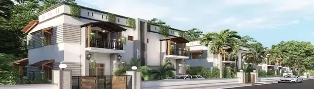
Radhakrishna Gokulam
M/S NSY TELANGANA DEVELOPERS · Rangareddy · RERA P02400010076
RADHAKRISHNA GOKULAM is a plotted development in Bandaravirala, Abdullapurmet Mandal, Ranga Reddy District. The registered promoter is M/S NSY TELANGANA DEVELOPERS. The project has a registered site extent of 19381.82 sq.m and 68 plots, with plot sizes of 139.35–390.19 sq.m. It is registered with TG-RERA as P02400010076, with proposed completion on 08/12/2028.
More from Nsy Telangana Developers · 2 projects →
01What we found
Read from TG-RERA filings, approvals, land and registration records and court records. A court case is counted only when the court record states this project's survey number with its village, or names the project.
02Check before you pay
10 items to check before you pay, 4 high - from the title chain, court records and approvals, each with what to ask the builder or your advocate. An item may not be a problem with the project: records can be incomplete.
1. Project at a glance
Project identity
| Field | Record |
|---|---|
| Registered project name | RADHAKRISHNA GOKULAM RERA record |
| Project type | Plotted development / layout with open plots RERA record RERA filing |
| Phase / registered portion | Phase not separately identified; registration is for the project. The approved layout drawing lists 68 plots. RERA record Layout record |
| TG-RERA registration | P02400010076 RERA record |
| Registration validity | 08/08/2025 to 08/08/2028 (three years, unless extended by the Authority). This is registration validity, not a statement that the project is complete. RERA record |
| Registered promoter | M/S NSY TELANGANA DEVELOPERS RERA record Corporate record |
| RERA status | Registered; project status is recorded as New Project. RERA record RERA filing |
Land and geographic identity
| Field | Record |
|---|---|
| Locality / revenue village | Bandaravirala is the RERA-recorded village/locality. The submitted layout documents also use BANDI RAVIRYAL, Banda, and Bandaraviryala. RERA record RERA filing |
| Mandal | Abdullapurmet RERA record RERA filing |
| District / PIN | Ranga Reddy / 501505 RERA record RERA filing |
| Project survey number(s) | 293P (also written 293p, 293/p in submitted layout records). RERA record RERA filing |
| Registered site extent | 19381.82 sq.m; the record gives the same figure as the total and net layout area. RERA filing Layout record |
| Boundaries in RERA filing | East: NEIGHBOURS LAND; West: NEIGHBOURS LAND; North: EXESISTING LAYOUT; South: EXESISTING LAYOUT. RERA filing |
| RERA-filed road widening / FTL / nala widening affected area | 0 sq.m RERA filing |
Development identity
| Field | Record |
|---|---|
| Planning / sanctioning authority | Hyderabad Metropolitan Development Authority (HMDA) RERA filing Approvals record |
| Principal layout approval identifier | 0304/HMDA/SWDL/2025; the submitted approval records also identify L.P.NO.000181/LO/PLG/HMDA/2022 and file/application 002025/HMDA/00600/SWDL/GTK/2025. Approvals record |
| Approval date shown in project record | 08/08/2025 in the RERA project information. The extracted HMDA draft-layout document also contains 02/06/2025 as an approval date. RERA filing Approvals record |
| Approved built-up area | 11970.27 sq.m is recorded in the RERA built-up-area field. The filed layout area statement labels 11970.27 sq.m as plotted area; it is not a building built-up-area figure in that drawing. RERA filing |
| Building / floor configuration | Not applicable to the registered plotted layout as described in the supplied records; no building count, floor configuration, or tower schedule is provided. RERA record RERA filing |
| Plot count | 68 plots, read from the plot schedule on the approved layout drawing. Layout record |
| Mortgage-area field | RERA filing records 2531.60 sq.m as mortgage area. RERA filing |
Offering and status
| Field | Record |
|---|---|
| Unit type | Plots RERA record RERA filing |
| Plot size range | 139.35–390.19 sq.m (166.7–466.7 sq yd), software-read from the layout drawing’s plot schedule; verify against the drawing before relying on a particular plot measurement. Layout record |
| Booked / available plots | Counts not supplied in the evidence provided. |
| Construction / development stage | Recorded as a New Project. No independently verified site-progress report is supplied. RERA record RERA filing |
| Completion date | RERA project information gives proposed completion as 08/12/2028; the Form B declaration states completion by 08/08/2028. RERA record RERA filing |
| Occupancy / completion certificate | No occupancy or completion certificate is included in the supplied project records. The submitted HMDA document refers to a future final-layout release and states that plot construction is not permitted until final layout issuance. |
2. The project story
- RADHAKRISHNA GOKULAM is a proposed open-plot layout registered with TG-RERA as P02400010076. Its RERA identity places it in Bandaravirala, Abdullapurmet Mandal, Ranga Reddy District, on survey 293P, with a registered site extent of 19381.82 sq.m. RERA record RERA filing
- The submitted layout drawing schedules 68 plots. Its area statement allocates land to plots, roads, open space, social infrastructure and utilities. The HMDA document describes the development works as including road formation, drainage, water-supply infrastructure, electrical lines and street lighting, avenue planting, park development and rainwater-harvesting pits. These are approval-document requirements or proposed works, not evidence that the works have been completed. Layout record
- The project is recorded as new, with a proposed completion date in the RERA filing. No site inspection, independently verified progress percentage, completed phase, or occupancy/completion certificate is supplied. The HMDA document also states that buildings may not be constructed on plots until final layout issuance. RERA filing RERA record
3. Master plan, architecture & building design
This is a plotted layout, not a supplied apartment or tower plan. The submitted drawing gives a total and net layout area of 19381.82 sq.m and a plot schedule of 68 plots. Plot sizes were software-read from the drawing; the smallest is 139.35 sq.m, the median 139.35 sq.m, and the largest 390.19 sq.m. Layout record
| Layout land use | Area | Share of layout |
|---|---|---|
| Plotted area | 11970.27 sq.m | 61.76% |
| Road area | 5313.75 sq.m | 27.42% |
| Open space / park area | 1457.05 sq.m | 7.52% |
| Social infrastructure area | 485.38 sq.m | 2.50% |
| Utility area | 155.38 sq.m | 0.80% |
| Total layout area | 19381.82 sq.m | 100% |
Layout record
The drawing lists internal and adjoining road widths including 9.14m Other Internal Road, 30m Wide Main Road, 30m WIDE Proposed road, 30' - 0" WIDE ROAD, 40' - 0" WIDE ROAD, 40' WIDE ROAD, and 100'-0" WIDE MASTER PLANA ROAD. These are drawing labels; the evidence does not provide a site survey confirming road construction or present access conditions.
No building footprints, residential floor configurations, floor areas by building, or apartment plans are supplied. The RERA built-up-area field records 11970.27 sq.m, while the submitted layout area statement identifies that same figure as plotted area; no separate building built-up-area breakdown is provided. RERA filing
4. Homes, configurations & floor plans
The offering is plots, not apartments. The layout drawing’s plot schedule lists 68 plots. The following size bands are software-derived from the drawing and should be checked against the approved drawing for an individual plot. Layout record
| Plot size band | Plot count |
|---|---|
| 150–200 sq yd (125–167 sq.m) | 42 |
| 200–250 sq yd (167–209 sq.m) | 13 |
| 250–300 sq yd (209–251 sq.m) | 5 |
| 300–400 sq yd (251–334 sq.m) | 6 |
| 400–500 sq yd (334–418 sq.m) | 2 |
The supplied records do not state booked or available plot counts, individual plot pricing, or an allottee-specific plot allocation. No home carpet-area or apartment saleable-area schedule applies to this plotted offering. Layout record RERA filing
5. Parking & vehicle circulation
- The layout’s filed area statement records 0.00 sq.m as common parking area. The approval-plan extraction lists no sanctioned count of car or two-wheeler spaces, parking levels, visitor spaces, accessible spaces, or EV charging bays.
- The drawing and approval records identify roads and require layout accessibility, but do not establish a parking-allocation arrangement for individual plots. A vendor listing describes dedicated bike-parking space; this is a third-party description, not a RERA-filed or sanctioned parking count. Promoter website
6. Amenities, recreation & open spaces
The layout drawing and HMDA document identify open space, social infrastructure and utility land, and list proposed layout facilities. The supplied evidence does not establish that any facility is complete or independently verified. Layout record RERA amenities
| Facility | Description / size | Evidence source | Declared progress / verified status |
|---|---|---|---|
| Park / organized open space | 1457.05 sq.m; 7.52% of layout Layout record | Approved-layout drawing and HMDA document | Shown in layout records; completion not verified |
| Tot-lot | Listed as a layout facility; no size supplied | HMDA document | Required by the approval conditions; completion not verified |
| Social infrastructure | 485.38 sq.m; 2.50% Layout record | Layout area statement | Allocated area shown; facility details and completion status not supplied |
| Utility area | 155.38 sq.m; 0.80% Layout record | Layout area statement | Allocated area shown; completion not verified |
| Avenue / peripheral planting | No area or quantity supplied | HMDA document | Required/proposed; completion not verified |
| Cycling tracks | No size supplied | HMDA document | Listed among proposed layout facilities; completion not verified |
A third-party listing mentions a children’s play area and a park, but those descriptions are not evidence of delivered facilities. Promoter website
7. Utilities, building services & safety
- The HMDA document lists proposed layout infrastructure including internal water-supply lines, an overhead tank, a water-supply source, underground drainage and storm-water drainage, a common septic tank/STP, electrical supply lines, street lighting, a transformer and rainwater-harvesting pits. It also lists solid-waste handling/bio-compost facilities in its layout-facility descriptions. These are document-listed works; no completion certification or independent service-capacity evidence is supplied.
- The RERA amenities record marks water supply, sewerage/septic tank/STP, rainwater harvesting, electrical/substation provision and street lighting as “YES,” with progress fields shown as 0. It also lists storm-water drains, sewage treatment/disposal, solid-waste management, energy management and fire-safety requirements without a supplied completion measure. RERA amenities
- The approval document includes conditions concerning a transformer space, garbage house, rainwater harvesting, service connections and safety-related provisions. It does not provide a verified water source yield, tank capacity, STP capacity, backup-power capacity, fire-system design or operational status. No lift or building-accessibility information is applicable or supplied for this plotted layout.
8. Location, access & connectivity
- The registered location is Bandaravirala, Abdullapurmet Mandal, Ranga Reddy District, Telangana, PIN 501505. The project filing describes the site’s north and south boundaries as an existing layout and east and west boundaries as neighbours’ land. RERA record RERA filing RERA filing
- The location record gives an approximate distance of 7.9 km to the nearest sampled Outer Ring Road interchange. This is a supplied location-data measurement, not a travel-time estimate. Location record
- A third-party listing provides distances to nearby schools, hospitals, colleges and local places; those are vendor-supplied figures rather than RERA-filed project particulars. No public-transport route or service frequency is established in the supplied records. Promoter website
9. Developer & development status
- The registered promoter is M/S NSY TELANGANA DEVELOPERS, identified in the filing as a Partnership. The corporate identifier supplied is GSTIN 36AARFN7738H1ZM. The RERA certificate gives a promoter address in Hayathnagar, Ranga Reddy, PIN 501505; the project filing lists an address at 43, SRIKRISHNA HILLS, BANDARAVIRALA, Abdullapurmet, Ranga Reddy, 501505. Corporate record RERA filing
- The project is recorded as new. Its registration is valid through 08/08/2028, while the RERA project-information field states proposed completion by 08/12/2028; the Form B declaration states completion by 08/08/2028. No independently verified construction progress or occupancy/completion certificate is supplied. RERA record RERA filing
10. Approvals, official records & documents
| Identifier / date | P02400010076; valid 08/08/2025–08/08/2028 |
|---|---|
| Evidence and scope | Form C certificate for RADHAKRISHNA GOKULAM and M/S NSY TELANGANA DEVELOPERS. |
| Identifier / date | 0304/HMDA/SWDL/2025; 08/08/2025 in the project record |
|---|---|
| Evidence and scope | HMDA layout-plan record for survey 293P; extracted draft-layout document describes development conditions and infrastructure. Approvals record |
| Identifier / date | L.P.NO.000181/LO/PLG/HMDA/2022; 002025/HMDA/00600/SWDL/GTK/2025 |
|---|---|
| Evidence and scope | Identifiers appearing in the submitted layout records. |
| Identifier / date | Document 590853 |
|---|---|
| Evidence and scope | Submitted layout drawing and plot schedule; 68 plots and layout land-use statement. |
| Identifier / date | Document 590856, dated 12/08/2025 |
|---|---|
| Evidence and scope | Promoter declaration that includes an undertaking to complete by 08/08/2028 and statements about title, encumbrances, funds and approvals. These are promoter declarations. |
| Identifier / date | Not supplied |
|---|---|
| Evidence and scope | No project completion or occupancy certificate is included in the documents provided. |
The HMDA document identifies the layout as a draft-layout permission and includes conditions concerning development works and final-layout release. Its detailed conditions and the implications of the project’s approval status are addressed in the approvals review.
1. Project at a glance
Project identity
Registered project name: RADHAKRISHNA GOKULAM
Project type: Plotted development / layout with open plots
Phase / registered portion: Phase not separately identified; registration is for the project. The approved layout drawing lists 68 plots.
TG-RERA registration: P02400010076
Registration validity: 08/08/2025 to 08/08/2028 (three years, unless extended by the Authority). This is registration validity, not a statement that the project is complete.
Registered promoter: M/S NSY TELANGANA DEVELOPERS
RERA status: Registered; project status is recorded as New Project.
Land and geographic identity
Locality / revenue village: Bandaravirala is the RERA-recorded village/locality. The submitted layout documents also use BANDI RAVIRYAL, Banda, and Bandaraviryala.
Mandal: Abdullapurmet
District / PIN: Ranga Reddy / 501505
Project survey number(s): 293P (also written 293p, 293/p in submitted layout records).
Registered site extent: 19381.82 sq.m; the record gives the same figure as the total and net layout area.
Boundaries in RERA filing: East: NEIGHBOURS LAND; West: NEIGHBOURS LAND; North: EXESISTING LAYOUT; South: EXESISTING LAYOUT.
RERA-filed road widening / FTL / nala widening affected area: 0 sq.m
Development identity
Planning / sanctioning authority: Hyderabad Metropolitan Development Authority (HMDA)
Principal layout approval identifier: 0304/HMDA/SWDL/2025; the submitted approval records also identify L.P.NO.000181/LO/PLG/HMDA/2022 and file/application 002025/HMDA/00600/SWDL/GTK/2025.
Approval date shown in project record: 08/08/2025 in the RERA project information. The extracted HMDA draft-layout document also contains 02/06/2025 as an approval date.
Approved built-up area: 11970.27 sq.m is recorded in the RERA built-up-area field. The filed layout area statement labels 11970.27 sq.m as plotted area; it is not a building built-up-area figure in that drawing.
Building / floor configuration: Not applicable to the registered plotted layout as described in the supplied records; no building count, floor configuration, or tower schedule is provided.
Plot count: 68 plots, read from the plot schedule on the approved layout drawing.
Mortgage-area field: RERA filing records 2531.60 sq.m as mortgage area.
Offering and status
Unit type: Plots
Plot size range: 139.35–390.19 sq.m (166.7–466.7 sq yd), software-read from the layout drawing’s plot schedule; verify against the drawing before relying on a particular plot measurement.
Booked / available plots: Counts not supplied in the evidence provided.
Construction / development stage: Recorded as a New Project. No independently verified site-progress report is supplied.
Completion date: RERA project information gives proposed completion as 08/12/2028; the Form B declaration states completion by 08/08/2028.
Occupancy / completion certificate: No occupancy or completion certificate is included in the supplied project records. The submitted HMDA document refers to a future final-layout release and states that plot construction is not permitted until final layout issuance.
2. The project story
- RADHAKRISHNA GOKULAM is a proposed open-plot layout registered with TG-RERA as P02400010076. Its RERA identity places it in Bandaravirala, Abdullapurmet Mandal, Ranga Reddy District, on survey 293P, with a registered site extent of 19381.82 sq.m.
- The submitted layout drawing schedules 68 plots. Its area statement allocates land to plots, roads, open space, social infrastructure and utilities. The HMDA document describes the development works as including road formation, drainage, water-supply infrastructure, electrical lines and street lighting, avenue planting, park development and rainwater-harvesting pits. These are approval-document requirements or proposed works, not evidence that the works have been completed.
- The project is recorded as new, with a proposed completion date in the RERA filing. No site inspection, independently verified progress percentage, completed phase, or occupancy/completion certificate is supplied. The HMDA document also states that buildings may not be constructed on plots until final layout issuance.
3. Master plan, architecture & building design
This is a plotted layout, not a supplied apartment or tower plan. The submitted drawing gives a total and net layout area of 19381.82 sq.m and a plot schedule of 68 plots. Plot sizes were software-read from the drawing; the smallest is 139.35 sq.m, the median 139.35 sq.m, and the largest 390.19 sq.m.
| Layout land use | Area | Share of layout |
|---|---|---|
| Plotted area | 11970.27 sq.m | 61.76% |
| Road area | 5313.75 sq.m | 27.42% |
| Open space / park area | 1457.05 sq.m | 7.52% |
| Social infrastructure area | 485.38 sq.m | 2.50% |
| Utility area | 155.38 sq.m | 0.80% |
| Total layout area | 19381.82 sq.m | 100% |
The drawing lists internal and adjoining road widths including 9.14m Other Internal Road, 30m Wide Main Road, 30m WIDE Proposed road, 30' - 0" WIDE ROAD, 40' - 0" WIDE ROAD, 40' WIDE ROAD, and 100'-0" WIDE MASTER PLANA ROAD. These are drawing labels; the evidence does not provide a site survey confirming road construction or present access conditions.
No building footprints, residential floor configurations, floor areas by building, or apartment plans are supplied. The RERA built-up-area field records 11970.27 sq.m, while the submitted layout area statement identifies that same figure as plotted area; no separate building built-up-area breakdown is provided.
4. Homes, configurations & floor plans
The offering is plots, not apartments. The layout drawing’s plot schedule lists 68 plots. The following size bands are software-derived from the drawing and should be checked against the approved drawing for an individual plot.
150–200 sq yd (125–167 sq.m): 42
200–250 sq yd (167–209 sq.m): 13
250–300 sq yd (209–251 sq.m): 5
300–400 sq yd (251–334 sq.m): 6
400–500 sq yd (334–418 sq.m): 2
The supplied records do not state booked or available plot counts, individual plot pricing, or an allottee-specific plot allocation. No home carpet-area or apartment saleable-area schedule applies to this plotted offering.
5. Parking & vehicle circulation
- The layout’s filed area statement records 0.00 sq.m as common parking area. The approval-plan extraction lists no sanctioned count of car or two-wheeler spaces, parking levels, visitor spaces, accessible spaces, or EV charging bays.
- The drawing and approval records identify roads and require layout accessibility, but do not establish a parking-allocation arrangement for individual plots. A vendor listing describes dedicated bike-parking space; this is a third-party description, not a RERA-filed or sanctioned parking count.
6. Amenities, recreation & open spaces
The layout drawing and HMDA document identify open space, social infrastructure and utility land, and list proposed layout facilities. The supplied evidence does not establish that any facility is complete or independently verified.
| Facility | Description / size | Evidence source | Declared progress / verified status |
|---|---|---|---|
| Park / organized open space | 1457.05 sq.m; 7.52% of layout | Approved-layout drawing and HMDA document | Shown in layout records; completion not verified |
| Tot-lot | Listed as a layout facility; no size supplied | HMDA document | Required by the approval conditions; completion not verified |
| Social infrastructure | 485.38 sq.m; 2.50% | Layout area statement | Allocated area shown; facility details and completion status not supplied |
| Utility area | 155.38 sq.m; 0.80% | Layout area statement | Allocated area shown; completion not verified |
| Avenue / peripheral planting | No area or quantity supplied | HMDA document | Required/proposed; completion not verified |
| Cycling tracks | No size supplied | HMDA document | Listed among proposed layout facilities; completion not verified |
A third-party listing mentions a children’s play area and a park, but those descriptions are not evidence of delivered facilities.
7. Utilities, building services & safety
- The HMDA document lists proposed layout infrastructure including internal water-supply lines, an overhead tank, a water-supply source, underground drainage and storm-water drainage, a common septic tank/STP, electrical supply lines, street lighting, a transformer and rainwater-harvesting pits. It also lists solid-waste handling/bio-compost facilities in its layout-facility descriptions. These are document-listed works; no completion certification or independent service-capacity evidence is supplied.
- The RERA amenities record marks water supply, sewerage/septic tank/STP, rainwater harvesting, electrical/substation provision and street lighting as “YES,” with progress fields shown as 0. It also lists storm-water drains, sewage treatment/disposal, solid-waste management, energy management and fire-safety requirements without a supplied completion measure.
- The approval document includes conditions concerning a transformer space, garbage house, rainwater harvesting, service connections and safety-related provisions. It does not provide a verified water source yield, tank capacity, STP capacity, backup-power capacity, fire-system design or operational status. No lift or building-accessibility information is applicable or supplied for this plotted layout.
8. Location, access & connectivity
- The registered location is Bandaravirala, Abdullapurmet Mandal, Ranga Reddy District, Telangana, PIN 501505. The project filing describes the site’s north and south boundaries as an existing layout and east and west boundaries as neighbours’ land.
- The location record gives an approximate distance of 7.9 km to the nearest sampled Outer Ring Road interchange. This is a supplied location-data measurement, not a travel-time estimate.
- A third-party listing provides distances to nearby schools, hospitals, colleges and local places; those are vendor-supplied figures rather than RERA-filed project particulars. No public-transport route or service frequency is established in the supplied records.
9. Developer & development status
- The registered promoter is M/S NSY TELANGANA DEVELOPERS, identified in the filing as a Partnership. The corporate identifier supplied is GSTIN 36AARFN7738H1ZM. The RERA certificate gives a promoter address in Hayathnagar, Ranga Reddy, PIN 501505; the project filing lists an address at 43, SRIKRISHNA HILLS, BANDARAVIRALA, Abdullapurmet, Ranga Reddy, 501505.
- The project is recorded as new. Its registration is valid through 08/08/2028, while the RERA project-information field states proposed completion by 08/12/2028; the Form B declaration states completion by 08/08/2028. No independently verified construction progress or occupancy/completion certificate is supplied.
10. Approvals, official records & documents
| Identifier / date | P02400010076; valid 08/08/2025–08/08/2028 |
|---|---|
| Evidence and scope | Form C certificate for RADHAKRISHNA GOKULAM and M/S NSY TELANGANA DEVELOPERS. |
| Identifier / date | 0304/HMDA/SWDL/2025; 08/08/2025 in the project record |
|---|---|
| Evidence and scope | HMDA layout-plan record for survey 293P; extracted draft-layout document describes development conditions and infrastructure. |
| Identifier / date | L.P.NO.000181/LO/PLG/HMDA/2022; 002025/HMDA/00600/SWDL/GTK/2025 |
|---|---|
| Evidence and scope | Identifiers appearing in the submitted layout records. |
| Identifier / date | Document 590853 |
|---|---|
| Evidence and scope | Submitted layout drawing and plot schedule; 68 plots and layout land-use statement. |
| Identifier / date | Document 590856, dated 12/08/2025 |
|---|---|
| Evidence and scope | Promoter declaration that includes an undertaking to complete by 08/08/2028 and statements about title, encumbrances, funds and approvals. These are promoter declarations. |
| Identifier / date | Not supplied |
|---|---|
| Evidence and scope | No project completion or occupancy certificate is included in the documents provided. |
The HMDA document identifies the layout as a draft-layout permission and includes conditions concerning development works and final-layout release. Its detailed conditions and the implications of the project’s approval status are addressed in the approvals review.
Frequently asked questions
Is RADHAKRISHNA GOKULAM registered with Telangana RERA?
Yes. RADHAKRISHNA GOKULAM is registered with the Telangana Real Estate Regulatory Authority as P02400010076; the registration status is New Project.
Who is the developer of RADHAKRISHNA GOKULAM?
The promoter named in the RERA registration is M/S NSY TELANGANA DEVELOPERS.
Where is RADHAKRISHNA GOKULAM located?
RADHAKRISHNA GOKULAM is in BANDARAVIRALA, Abdullapurmet, Rangareddy, Telangana (501505).
When will RADHAKRISHNA GOKULAM be completed?
The promoter's proposed date of completion filed with RERA is 08/12/2028. This is the promoter's declaration, not a guarantee.
More projects in Bandaravirala