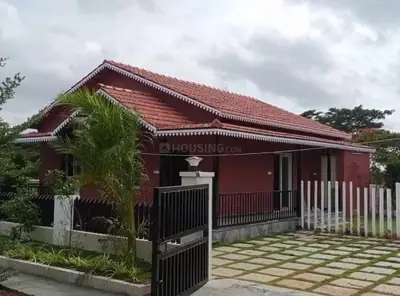
Mango Groves
YERPULA · Sangareddy · RERA P01100010698
MANGO GROVES is a plotted development in Zaheerabad Mandal, Sangareddy, with the RERA registration identifying ZAHEERABAD and the filed layout documents identifying Pastapur Village. The registered promoter is YERPULA RAGOTHAM. The project records 114678.45 sq.m total site area and 114374.64 sq.m net layout area; it is an open-plot layout, with plots labelled through PLOT - 168 in the filed drawing and 381 plots stated in the municipal tentative approval. Its TG-RERA registration is P01100010698, and the promoter’s Form B declaration states completion by 30/01/2028.
01What we found
Read from TG-RERA filings, approvals, land and registration records and court records. A court case is counted only when the court record states this project's survey number with its village, or names the project.
02Check before you pay
7 items to check before you pay, 2 high - from the title chain, court records and approvals, each with what to ask the builder or your advocate. An item may not be a problem with the project: records can be incomplete.
1. Project at a glance
Project identity
| Field | Record |
|---|---|
| Registered project name | MANGO GROVES |
| Project type | Plotted development / open-plot layout RERA record |
| Phase or registered portion | Not separately identified in the supplied record; registration is for the project |
| TG-RERA registration | P01100010698 |
| Registration validity | 31/01/2026–30/01/2028; this is registration validity, not a statement that the project is complete |
| Registered promoter | YERPULA RAGOTHAM |
| RERA status | Registered; the certificate states that quarterly updates are required |
Land and geographic identity
| Field | Record |
|---|---|
| Revenue village | ZAHEERABAD in the RERA registration; the filed layout and municipal approval identify Pastapur Village |
| Locality | Zaheerabad Mandal / Pastapur Village, as recorded in the RERA and layout documents |
| Mandal / district / PIN | ZAHEERABAD / Sangareddy / 502318 RERA record |
| Project survey numbers and subdivisions | 70, 71/A, 83/1A, 84/P, 88/Aa |
| Registered site area | The RERA filing records 114678.45 sq.m total site area and 114374.64 sq.m net layout area; the drawing identifies 303.81 sq.m as affected area RERA filing Layout record |
| Boundaries | East: EXISTING NALA; west and south: EXISTING 30 ROAD; north: OTHERS LAND RERA filing |
Development identity
| Field | Record |
|---|---|
| Sanctioning authority | The RERA-filed final layout drawing identifies DTCP; the separate tentative layout approval is by Zaheerabad Municipality Approvals record |
| Principal layout approval shown in RERA filing | Final L.P. No. 0005/FLT/3057/2023, shown on the filed drawing with date 31/01/2026 Approvals record |
| Other layout number in the filed record | Tentative L.P. No. 0014/ZAHE/SWDL/2026, approved 31/01/2026 by Zaheerabad Municipality |
| Approved built-up area | 61760.75 sq.m is recorded as approved built-up area in the RERA land details; the filed layout identifies this figure as plotted area RERA filing Layout record |
| Building / tower count and floor configuration | Not applicable to the plotted layout; no residential buildings or floor configuration are established in the supplied project record |
| Plots | The filed layout drawing labels plots through PLOT - 168; the tentative municipal approval states 381 plots. |
| Parking | The filed layout records 0.00 sq.m common parking area; no plot-wise parking allocation is supplied |
Offering and status
| Field | Record |
|---|---|
| Unit type | Open plots |
| Plot count | The filed final-layout drawing labels plots through PLOT - 168; the municipal tentative approval states 381 plots |
| Plot size range / plot-wise schedule | Not established in the supplied extracted records; the drawing-derived plot list is incomplete Layout record |
| Booked / available plots | Not disclosed in the supplied evidence Document index |
| Construction stage | The registration record labels the project New Project; no independent site-progress verification is supplied RERA record |
| Completion commitment | The promoter’s Form B declaration states completion by 30/01/2028 |
| Registration-validity end date | 30/01/2028 |
| Completion / occupancy certificate | No completion or occupancy certificate is supplied; the final-layout extraction records completion as not certified |
2. The project story
MANGO GROVES is registered as a plotted development at Zaheerabad, with the registration identifying survey numbers 70, 71/A, 83/1A, 84/P and 88/Aa. The RERA registration names ZAHEERABAD as the village, while the filed layout documents identify the site as Pastapur Village.
The filed layout drawing depicts plots, internal roads, open spaces, social-infrastructure and utility land, and a nala buffer. It records 114678.45 sq.m total site area and 114374.64 sq.m net layout area. The promoter’s Form B declares a completion date of 30/01/2028; that is a promoter undertaking, not independently verified progress. No occupancy or completion certificate, or site-verified construction-progress report, is included in the supplied evidence.
3. Master plan, architecture & building design
This is a plotted layout rather than a tower or apartment scheme. The filed final-layout drawing records a total site area of 114678.45 sq.m, net layout area of 114374.64 sq.m, and an affected area of 303.81 sq.m. It records 61760.75 sq.m of plotted area, 38170.68 sq.m of roads, 10295.90 sq.m of open space, 2874.79 sq.m of social infrastructure, and 1147.61 sq.m of utility area. Layout record
The drawing also identifies a 124.79 sq.m buffer area. The municipal tentative-layout approval records a nala wider than 10 m and a 9 m buffer to be maintained in accordance with the Irrigation Department NOC.
The filed drawing shows roads including an 18m Wide Main Road and internal approach roads labelled 18.29m, 12.19m, 12.3m and 11.63m. It records 0.00 sq.m for common parking, facilities and amenities areas. The drawing-derived plot count and plot-size information are incomplete; no plot-size bands can be reliably reported from the supplied extract. Layout record
4. Homes, configurations & floor plans
The offering evidenced in the RERA-filed layout is open plots, not apartments. No complete plot-size schedule, plot-wise saleable-area register, or booked and available inventory is supplied. The final-layout drawing labels plots through PLOT - 168, while the municipal tentative approval states 381 plots; a complete plot-level inventory cannot be established from the extracts provided. Layout record
| Units | Final drawing labels through PLOT - 168; tentative municipal approval states 381 |
|---|---|
| Booked | Not disclosed |
| Available | Not disclosed |
| RERA saleable area | Plot-wise area not disclosed in supplied record |
| Measured carpet area | Not applicable |
| Loading | Not supplied |
The floor-plan review contains two layout sheets and no apartment floor plans; no software-measured carpet areas or apartment configurations are available. Floor plans
5. Parking & vehicle circulation
The filed layout records 0.00 sq.m as common parking area. The supplied evidence does not establish parking-space counts, visitor or accessible parking, plot-wise parking rights, or exclusive parking allocations.
Road circulation is shown in the layout, including the 18m Wide Main Road and labelled internal approach roads of 18.29m, 12.19m, 12.3m and 11.63m. The municipal tentative approval states that roads are to remain accessible to neighbouring sites and that no compound wall or fencing is to be constructed around the site.
6. Amenities, recreation & open spaces
The RERA-filed drawing and municipal tentative approval identify land reservations and proposed layout works. Progress percentages in the supplied amenities schedule are 0; these records do not establish that the facilities have been completed or independently inspected. RERA amenities
| Facility | Description / size | Evidence source | Declared progress / verified status |
|---|---|---|---|
| Open spaces / parks | Drawing records 10295.90 sq.m open space; the tentative municipal approval records 12313.9 sq.m reserved for open space (park) | Listed in plans; completion not verified | |
| Social infrastructure | 2874.79 sq.m in the filed drawing; tentative approval records 3438.25 sq.m | Reserved; facility type and completion not established | |
| Utility land | 1147.61 sq.m in the filed drawing; tentative approval describes land for utilities such as a water reservoir as 1372.54 sq.m | Reserved; completion not verified | |
| Tot-lot | Named in the filed layout extraction and municipal conditions; no size supplied | Planned/conditioned; completion not verified | |
| Community buildings | Listed in the RERA-filed amenities schedule; no size or description supplied | RERA amenities | Progress shown as 0; completion not verified |
| Sports / indoor recreation | No specific facility established by the supplied RERA-filed evidence | RERA amenities | Not disclosed |
7. Utilities, building services & safety
The RERA-filed material identifies proposed layout infrastructure and utility reservations, but does not establish installed capacities, completed works, or independent testing. The municipal tentative approval lists a water reservoir, septic tank, Sewerage Treatment Plant, electric transformer, Solid Waste Management, Over Head tank, storm water drains, underground drainage lines, street lights, park development and rain water harvesting pits.
| Evidence in the project record | Water supply appears in the RERA-filed amenities schedule; the tentative approval lists a water reservoir and overhead tank RERA amenities |
|---|---|
| Status indicated by supplied evidence | Listed/proposed; source, storage capacity and completion not verified |
| Evidence in the project record | Amenities schedule lists sewerage, septic tank and STP; tentative approval also lists underground drainage lines and storm water drains RERA amenities |
|---|---|
| Status indicated by supplied evidence | Listed/proposed; capacity, reuse and completion not verified |
| Evidence in the project record | Utility provision and electrical meter room/sub-station/receiving station are listed; tentative approval identifies a transformer and street lights RERA amenities |
|---|---|
| Status indicated by supplied evidence | Listed/proposed; supply and backup capacity not disclosed |
| Evidence in the project record | Solid-waste management and disposal appears in the RERA-filed schedule; tentative approval lists Solid Waste Management and a garbage house RERA amenities |
|---|---|
| Status indicated by supplied evidence | Listed/proposed; operating arrangements not verified |
| Evidence in the project record | Rainwater harvesting appears in the RERA-filed schedule; tentative approval lists rainwater-harvesting pits RERA amenities |
|---|---|
| Status indicated by supplied evidence | Listed/proposed; quantity and completion not verified |
| Evidence in the project record | No project-specific fire-system, accessible-circulation or safety-completion evidence is supplied |
|---|---|
| Status indicated by supplied evidence | Not established |
8. Location, access & connectivity
The registered location is ZAHEERABAD, Sangareddy, 502318. The registration identifies ZAHEERABAD as the village; the layout documents identify Pastapur Village in Zaheerabad Mandal. The supplied geocode is recorded for Pastapur, Zahirabad mandal, Sangareddy, Telangana, 502220. Location record
The filed drawing shows existing roads and internal layout roads, including an 18m Wide Main Road and internal approach roads labelled 18.29m, 12.19m, 12.3m and 11.63m. The supplied location data lists the nearest sampled Outer Ring Road interchange at approximately 68.2 km. Location record No public-transport details or other measured landmark distances are supplied.
9. Developer & development status
The RERA registration names YERPULA RAGOTHAM as the registered promoter. The registration certificate gives the promoter address as PLOT NO 91, Secunderabad, Hyderabad, 500011, Telangana. A promoter filing states that he operates as a sole proprietor.
The promoter’s Form B declares a project completion date of 30/01/2028. The registration certificate remains valid through 30/01/2028; this is separate from the completion undertaking. No independent construction-progress verification or occupancy/completion certificate is supplied.
10. Approvals, official records & documents
| Identifier / date | P01100010698; valid 31/01/2026–30/01/2028 |
|---|---|
| Evidence and scope | Form C certificate for MANGO GROVES naming YERPULA RAGOTHAM |
| Identifier / date | 0005/FLT/3057/2023; drawing text records 31/01/2026 |
|---|---|
| Evidence and scope | Layout plan filed with the RERA application; identifies DTCP and the project survey numbers |
| Identifier / date | 0014/ZAHE/SWDL/2026; 31/01/2026 |
|---|---|
| Evidence and scope | Zaheerabad Municipality approval for a tentative layout; the document states that tentative approval is not proof of land title |
| Identifier / date | Project reference 19/2023; dated 31 JAN 2026 |
|---|---|
| Evidence and scope | Promoter declaration including title and encumbrance statements and a completion undertaking |
| Identifier / date | Not supplied |
|---|---|
| Evidence and scope | No completion or occupancy certificate is included in the reviewed documents |
1. Project at a glance
Project identity
Registered project name: MANGO GROVES
Project type: Plotted development / open-plot layout
Phase or registered portion: Not separately identified in the supplied record; registration is for the project
TG-RERA registration: P01100010698
Registration validity: 31/01/2026–30/01/2028; this is registration validity, not a statement that the project is complete
Registered promoter: YERPULA RAGOTHAM
RERA status: Registered; the certificate states that quarterly updates are required
Land and geographic identity
Revenue village: ZAHEERABAD in the RERA registration; the filed layout and municipal approval identify Pastapur Village
Locality: Zaheerabad Mandal / Pastapur Village, as recorded in the RERA and layout documents
Mandal / district / PIN: ZAHEERABAD / Sangareddy / 502318
Project survey numbers and subdivisions: 70, 71/A, 83/1A, 84/P, 88/Aa
Registered site area: The RERA filing records 114678.45 sq.m total site area and 114374.64 sq.m net layout area; the drawing identifies 303.81 sq.m as affected area
Boundaries: East: EXISTING NALA; west and south: EXISTING 30 ROAD; north: OTHERS LAND
Development identity
Sanctioning authority: The RERA-filed final layout drawing identifies DTCP; the separate tentative layout approval is by Zaheerabad Municipality
Principal layout approval shown in RERA filing: Final L.P. No. 0005/FLT/3057/2023, shown on the filed drawing with date 31/01/2026
Other layout number in the filed record: Tentative L.P. No. 0014/ZAHE/SWDL/2026, approved 31/01/2026 by Zaheerabad Municipality
Approved built-up area: 61760.75 sq.m is recorded as approved built-up area in the RERA land details; the filed layout identifies this figure as plotted area
Building / tower count and floor configuration: Not applicable to the plotted layout; no residential buildings or floor configuration are established in the supplied project record
Plots: The filed layout drawing labels plots through PLOT - 168; the tentative municipal approval states 381 plots.
Parking: The filed layout records 0.00 sq.m common parking area; no plot-wise parking allocation is supplied
Offering and status
Unit type: Open plots
Plot count: The filed final-layout drawing labels plots through PLOT - 168; the municipal tentative approval states 381 plots
Plot size range / plot-wise schedule: Not established in the supplied extracted records; the drawing-derived plot list is incomplete
Booked / available plots: Not disclosed in the supplied evidence
Construction stage: The registration record labels the project New Project; no independent site-progress verification is supplied
Completion commitment: The promoter’s Form B declaration states completion by 30/01/2028
Registration-validity end date: 30/01/2028
Completion / occupancy certificate: No completion or occupancy certificate is supplied; the final-layout extraction records completion as not certified
2. The project story
MANGO GROVES is registered as a plotted development at Zaheerabad, with the registration identifying survey numbers 70, 71/A, 83/1A, 84/P and 88/Aa. The RERA registration names ZAHEERABAD as the village, while the filed layout documents identify the site as Pastapur Village.
The filed layout drawing depicts plots, internal roads, open spaces, social-infrastructure and utility land, and a nala buffer. It records 114678.45 sq.m total site area and 114374.64 sq.m net layout area. The promoter’s Form B declares a completion date of 30/01/2028; that is a promoter undertaking, not independently verified progress. No occupancy or completion certificate, or site-verified construction-progress report, is included in the supplied evidence.
3. Master plan, architecture & building design
This is a plotted layout rather than a tower or apartment scheme. The filed final-layout drawing records a total site area of 114678.45 sq.m, net layout area of 114374.64 sq.m, and an affected area of 303.81 sq.m. It records 61760.75 sq.m of plotted area, 38170.68 sq.m of roads, 10295.90 sq.m of open space, 2874.79 sq.m of social infrastructure, and 1147.61 sq.m of utility area.
The drawing also identifies a 124.79 sq.m buffer area. The municipal tentative-layout approval records a nala wider than 10 m and a 9 m buffer to be maintained in accordance with the Irrigation Department NOC.
The filed drawing shows roads including an 18m Wide Main Road and internal approach roads labelled 18.29m, 12.19m, 12.3m and 11.63m. It records 0.00 sq.m for common parking, facilities and amenities areas. The drawing-derived plot count and plot-size information are incomplete; no plot-size bands can be reliably reported from the supplied extract.
4. Homes, configurations & floor plans
The offering evidenced in the RERA-filed layout is open plots, not apartments. No complete plot-size schedule, plot-wise saleable-area register, or booked and available inventory is supplied. The final-layout drawing labels plots through PLOT - 168, while the municipal tentative approval states 381 plots; a complete plot-level inventory cannot be established from the extracts provided.
| Units | Final drawing labels through PLOT - 168; tentative municipal approval states 381 |
|---|---|
| Booked | Not disclosed |
| Available | Not disclosed |
| RERA saleable area | Plot-wise area not disclosed in supplied record |
| Measured carpet area | Not applicable |
| Loading | Not supplied |
The floor-plan review contains two layout sheets and no apartment floor plans; no software-measured carpet areas or apartment configurations are available.
5. Parking & vehicle circulation
The filed layout records 0.00 sq.m as common parking area. The supplied evidence does not establish parking-space counts, visitor or accessible parking, plot-wise parking rights, or exclusive parking allocations.
Road circulation is shown in the layout, including the 18m Wide Main Road and labelled internal approach roads of 18.29m, 12.19m, 12.3m and 11.63m. The municipal tentative approval states that roads are to remain accessible to neighbouring sites and that no compound wall or fencing is to be constructed around the site.
6. Amenities, recreation & open spaces
The RERA-filed drawing and municipal tentative approval identify land reservations and proposed layout works. Progress percentages in the supplied amenities schedule are 0; these records do not establish that the facilities have been completed or independently inspected.
| Facility | Description / size | Evidence source | Declared progress / verified status |
|---|---|---|---|
| Open spaces / parks | Drawing records 10295.90 sq.m open space; the tentative municipal approval records 12313.9 sq.m reserved for open space (park) | Listed in plans; completion not verified | |
| Social infrastructure | 2874.79 sq.m in the filed drawing; tentative approval records 3438.25 sq.m | Reserved; facility type and completion not established | |
| Utility land | 1147.61 sq.m in the filed drawing; tentative approval describes land for utilities such as a water reservoir as 1372.54 sq.m | Reserved; completion not verified | |
| Tot-lot | Named in the filed layout extraction and municipal conditions; no size supplied | Planned/conditioned; completion not verified | |
| Community buildings | Listed in the RERA-filed amenities schedule; no size or description supplied | Progress shown as 0; completion not verified | |
| Sports / indoor recreation | No specific facility established by the supplied RERA-filed evidence | Not disclosed |
7. Utilities, building services & safety
The RERA-filed material identifies proposed layout infrastructure and utility reservations, but does not establish installed capacities, completed works, or independent testing. The municipal tentative approval lists a water reservoir, septic tank, Sewerage Treatment Plant, electric transformer, Solid Waste Management, Over Head tank, storm water drains, underground drainage lines, street lights, park development and rain water harvesting pits.
| Evidence in the project record | Water supply appears in the RERA-filed amenities schedule; the tentative approval lists a water reservoir and overhead tank |
|---|---|
| Status indicated by supplied evidence | Listed/proposed; source, storage capacity and completion not verified |
| Evidence in the project record | Amenities schedule lists sewerage, septic tank and STP; tentative approval also lists underground drainage lines and storm water drains |
|---|---|
| Status indicated by supplied evidence | Listed/proposed; capacity, reuse and completion not verified |
| Evidence in the project record | Utility provision and electrical meter room/sub-station/receiving station are listed; tentative approval identifies a transformer and street lights |
|---|---|
| Status indicated by supplied evidence | Listed/proposed; supply and backup capacity not disclosed |
| Evidence in the project record | Solid-waste management and disposal appears in the RERA-filed schedule; tentative approval lists Solid Waste Management and a garbage house |
|---|---|
| Status indicated by supplied evidence | Listed/proposed; operating arrangements not verified |
| Evidence in the project record | Rainwater harvesting appears in the RERA-filed schedule; tentative approval lists rainwater-harvesting pits |
|---|---|
| Status indicated by supplied evidence | Listed/proposed; quantity and completion not verified |
| Evidence in the project record | No project-specific fire-system, accessible-circulation or safety-completion evidence is supplied |
|---|---|
| Status indicated by supplied evidence | Not established |
8. Location, access & connectivity
The registered location is ZAHEERABAD, Sangareddy, 502318. The registration identifies ZAHEERABAD as the village; the layout documents identify Pastapur Village in Zaheerabad Mandal. The supplied geocode is recorded for Pastapur, Zahirabad mandal, Sangareddy, Telangana, 502220.
The filed drawing shows existing roads and internal layout roads, including an 18m Wide Main Road and internal approach roads labelled 18.29m, 12.19m, 12.3m and 11.63m. The supplied location data lists the nearest sampled Outer Ring Road interchange at approximately 68.2 km. No public-transport details or other measured landmark distances are supplied.
9. Developer & development status
The RERA registration names YERPULA RAGOTHAM as the registered promoter. The registration certificate gives the promoter address as PLOT NO 91, Secunderabad, Hyderabad, 500011, Telangana. A promoter filing states that he operates as a sole proprietor.
The promoter’s Form B declares a project completion date of 30/01/2028. The registration certificate remains valid through 30/01/2028; this is separate from the completion undertaking. No independent construction-progress verification or occupancy/completion certificate is supplied.
10. Approvals, official records & documents
| Identifier / date | P01100010698; valid 31/01/2026–30/01/2028 |
|---|---|
| Evidence and scope | Form C certificate for MANGO GROVES naming YERPULA RAGOTHAM |
| Identifier / date | 0005/FLT/3057/2023; drawing text records 31/01/2026 |
|---|---|
| Evidence and scope | Layout plan filed with the RERA application; identifies DTCP and the project survey numbers |
| Identifier / date | 0014/ZAHE/SWDL/2026; 31/01/2026 |
|---|---|
| Evidence and scope | Zaheerabad Municipality approval for a tentative layout; the document states that tentative approval is not proof of land title |
| Identifier / date | Project reference 19/2023; dated 31 JAN 2026 |
|---|---|
| Evidence and scope | Promoter declaration including title and encumbrance statements and a completion undertaking |
| Identifier / date | Not supplied |
|---|---|
| Evidence and scope | No completion or occupancy certificate is included in the reviewed documents |
Frequently asked questions
Is MANGO GROVES registered with Telangana RERA?
Yes. MANGO GROVES is registered with the Telangana Real Estate Regulatory Authority as P01100010698; the registration status is New Project.
Who is the developer of MANGO GROVES?
The promoter named in the RERA registration is YERPULA.
Where is MANGO GROVES located?
MANGO GROVES is in ZAHEERABAD MANDAL, ZAHEERABAD, Sangareddy, Telangana (502318).
When will MANGO GROVES be completed?
The promoter's proposed date of completion filed with RERA is 30/05/2028. This is the promoter's declaration, not a guarantee.
More projects in Zaheerabad