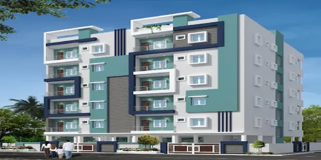
Marigold
MILESTONE DEVELOPERS AND OTHERS · Medchal-Malkajgiri · RERA P02200010888
MARIGOLD is a plotted development in Medchal, Medchal Mandal, Medchal-Malkajgiri district. The registered promoter is MILESTONE DEVELOPERS AND OTHERS. The layout covers a total site extent of 149,288.95 sq.m and comprises 274 individual plots; no apartment towers, building count, floor configuration or plot configurations are stated. It is registered under TG-RERA number P02200010888, with proposed completion listed as 15/02/2029.
More from Milestone Developers · 3 projects →
01What we found
Read from TG-RERA filings, approvals, land and registration records and court records. A court case is counted only when the court record states this project's survey number with its village, or names the project.
02Check before you pay
7 items to check before you pay, 3 high - from the title chain, court records and approvals, each with what to ask the builder or your advocate. An item may not be a problem with the project: records can be incomplete.
1. Project at a glance
Project identity
| Item | Project record |
|---|---|
| Registered project name | MARIGOLD RERA record |
| Project type | Plotted development / plotted layout RERA record RERA filing |
| Phase / registered portion | The record identifies MARIGOLD as a new project; no separate phase name is stated. The registration covers the project land identified below. RERA record |
| TG-RERA registration | P02200010888 RERA record |
| Registration validity | 16 October 2025 to 15 October 2028. This is the registration period, not the project completion deadline. RERA record |
| Registered promoter | MILESTONE DEVELOPERS AND OTHERS in the project record; the filed registration certificate names MILESTONE DEVELOPERS. RERA record RERA filing |
| Promoter entity type | The project record says “Others”; the filed documents describe M/s. Milestone Developers as a partnership firm. RERA filing |
| RERA status | Registered; the registration certificate is Form C. RERA record |
Land and geographic identity
| Item | Project record |
|---|---|
| Locality | Medchal; the filed layout and registration records identify the site as Athvelli / Atevelly Village. RERA record |
| Revenue village | Atevelly; documents also render the village name as Athvelli. RERA record |
| Mandal | Medchal RERA record |
| District | Medchal-Malkajgiri RERA record |
| PIN | 501401 RERA record |
| Project survey numbers and subdivisions | 33P, 34, 35, 36, 37, 38, 39P, 41P, 42P43, 43, 44P, 46, 47, 50, 51P, 52, 53P, 54P, 65P, 184P, 185P, 189P, 190P, 205P, 207P, 208P, 209, 210P, 213, 214, 215, 216, 217, 218, 219P, 220, 221, 222, 223P, 224P, 229P, 230, 231, 232P. |
| Total site extent | 149,288.95 sq.m RERA record |
| Road-affected area | 669.17 sq.m RERA record |
| Net site area | 142,456.00 sq.m in the draft-layout letter. |
| Boundaries | East: Nala; west: 30 m wide existing road and 45 m wide proposed road; north: Nala widening road; south: open land. RERA filing |
| Approval identifier | 003953/LO/HMDA/0824/MED/2024 RERA record |
Development identity
| Item | Project record |
|---|---|
| Sanctioning authority | Hyderabad Metropolitan Development Authority (HMDA) |
| Principal layout approval | HMDA draft layout permission 003953/LO/HMDA/0824/MED/2024, approved 16 October 2025. |
| Layout scale | The filed draft-layout letter states 274 plots. |
| Approved built-up area | The filed layout information records proposed built-up area as 0.00, both excluding and including parking. This is a plotted layout, not a building scheme. |
| Buildings / floors | No apartment towers, building count or floor configuration is stated for this plotted development. |
| Internal roads | The layout record lists 12.00 m, 9.14 m and 15.24 m internal roads, and identifies a 30.00 m existing road and 45.00 m proposed road at the site boundary. |
Offering and status
| Item | Project record |
|---|---|
| Offered product | Individual plots in a 274-plot layout, as stated in the filed draft-layout letter. |
| Plot count and sizes | Drawing-derived schedule: 274 plots; software-read plot sizes range from 145.11 sq.m to 891.87 sq.m, with a median of 271.74 sq.m. These measurements are read from the layout drawing and should be checked against it. Layout record |
| Booked / available plots | Not disclosed in the supplied project record. RERA record |
| Construction / development progress | The project record shows 70% completeness; this is a recorded progress figure, not an independent site inspection. RERA record |
| Completion dates | The RERA Form B declaration states completion by 15-10-2028; the project record separately lists proposed completion as 15/02/2029. RERA record |
| Occupancy / completion certificate | Not stated in the supplied record. The project is a plotted layout; no occupancy certificate is provided here. RERA record |
2. The project story
MARIGOLD is registered as a plotted development at Atevelly (also written Athvelli), in Medchal Mandal, Medchal-Malkajgiri district. The filed HMDA draft-layout letter describes 274 plots over a net site area of 142,456.00 sq.m, with roads, parks/open space, social infrastructure and utility land shown in the layout schedule. RERA record
The project record reports 70% completeness, but the supplied material does not include an independent site-progress inspection or a phase- or plot-wise completion statement. The filed HMDA letter sets out development and handover conditions for final layout release; the RERA registration certificate itself is valid through 15 October 2028. RERA record
3. Master plan, architecture & building design
This is a plotted layout rather than a multi-storey building project. The HMDA draft-layout record identifies 274 individual plots and records a total site area of 149,288.95 sq.m, a road-affected area of 669.17 sq.m and a net site area of 142,456.00 sq.m. It records no proposed built-up area (0.00, excluding and including parking).
The layout drawing’s area schedule allocates 87,542.16 sq.m to plots, 38,504.05 sq.m to roads, 10,717.96 sq.m to organized open space/park, 3,653.41 sq.m to social infrastructure, 337.38 sq.m to utilities and 1,872.67 sq.m to buffer zone. The drawing extraction identifies the net-layout base as 142,629.79 sq.m; these are drawing-derived figures, not a separate measurement of each plot on the ground. Layout record
The filed HMDA letter identifies internal roads of 12.00 m, 9.14 m and 15.24 m, alongside a 30.00 m existing road and 45.00 m proposed road at the boundary. It also specifies roads, storm-water drainage, water supply, electrical lines and street lighting as development works.
4. Homes, configurations & floor plans
The offering is plots, not apartments. The HMDA draft-layout letter states a total of 274 plots. The plot schedule was software-read from the approved layout drawing; its recorded sizes range from 145.11 sq.m to 891.87 sq.m, with a median of 271.74 sq.m. The drawing’s plot measurements should be verified against the original schedule. Layout record
| Configuration | Units | Booked | Available | RERA saleable area | Measured carpet area | Loading (if supplied) |
|---|---|---|---|---|---|---|
| Individual plots | 274 (layout drawing schedule) | Not disclosed | Not disclosed | Not stated plot-by-plot in the supplied RERA data | Not applicable | Not supplied |
The vendor record lists plot-size examples of 1,561 sq.ft and 8,998 sq.ft, but these are vendor-supplied marketing details, not the RERA-filed plot schedule. Promoter website
5. Parking & vehicle circulation
The supplied layout record lists 0.00 sq.m as common parking area; it does not provide a count of parking spaces or a plot-level parking allocation. As this is a plotted development, no building parking levels or parking-per-home ratio are recorded.
The HMDA layout record identifies internal roads and requires road formation, drainage and access works. The supplied evidence does not establish visitor parking, accessible parking, EV charging, parking allotment arrangements or separation of pedestrian and vehicle routes.
6. Amenities, recreation & open spaces
The filed layout schedule records 10,717.96 sq.m of organized open space/park and 3,653.41 sq.m of social infrastructure; it records no separate amenity area (0.00). The HMDA draft-layout letter also names a tot-lot, park development, avenue plantation and rainwater-harvesting pits among the layout elements or development works. These are filed or drawing-recorded provisions; the supplied material does not independently verify that they have been completed.
| Facility | Description / size | Evidence source | Declared progress / verified status |
|---|---|---|---|
| Park / organized open space | 10,717.96 sq.m | Filed layout schedule | Provision recorded; completion not independently verified |
| Social infrastructure area | 3,653.41 sq.m | Filed layout schedule | Area recorded; facility details and completion not supplied |
| Tot-lot | Named in layout information; no size supplied | Completion not independently verified | |
| Avenue plantation | Named as a layout development work | Completion not independently verified | |
| Rainwater-harvesting pits | Named as a layout development work | Completion not independently verified | |
| Kids’ play areas / sand pits; central green; visitor parking; water storage; entry/exit gate | Vendor-listed features; no dimensions supplied | Promoter website | Marketing/vendor claims; not independently verified |
7. Utilities, building services & safety
The HMDA draft-layout letter specifies internal water-supply lines, an overhead tank and sumps, an assured water-supply source, electrical supply lines, street lighting, a transformer/transformer yard, underground utility ducting, storm-water drainage and a common septic tank/STP or independent sewage-disposal system. It also names rainwater-harvesting pits, solid-waste segregation/disposal and a bio-compost unit. These are approval-recorded development requirements or provisions; the supplied evidence does not establish their installed capacity or completed operational status.
The supplied record does not state water-storage capacity, STP capacity, electrical load or backup, lift provision, fire systems, CCTV, security-system specifications or accessible-design features. The HMDA letter includes a requirement for underground storm-water drainage and channelization of Nalas, but no project-specific completion verification is supplied.
8. Location, access & connectivity
The official project location is Atevelly/Athvelli Village, Medchal Mandal, Medchal-Malkajgiri district, PIN 501401. The filed layout record identifies a 30 m wide existing road and a 45 m wide proposed road along the western boundary, with internal road widths listed as 12.00 m, 9.14 m and 15.24 m. The cadastral parcel centroid is recorded as 17.64053, 78.50017. RERA record Location record
The location dataset lists the nearest sampled Outer Ring Road interchange at approximately 2.4 km. Vendor-supplied connectivity details list Medchal Bus Stop at 0.4 km and Medchal Railway Station at 1.3 km, along with schools, hospitals and shopping locations at stated distances; these are vendor claims, not independently verified travel measurements. Location record Promoter website
9. Developer & development status
The RERA registration certificate names MILESTONE DEVELOPERS as promoter, and the project record identifies the registered promoter as MILESTONE DEVELOPERS AND OTHERS. The filed documents describe Milestone Developers as a partnership firm, represented for project matters by partner/authorized signatory Gaddam Ramakrishna Reddy. The supplied corporate identifier is GSTIN 36ABCFM7496H1ZT. RERA record Corporate record
The project record reports 70% completeness; this is a recorded figure and is not supported here by an independent site inspection. The filed RERA Form B states a completion undertaking of 15-10-2028. RERA record
10. Approvals, official records & documents
| Identifier / date | P02200010888; valid 16 October 2025–15 October 2028 |
|---|---|
| Scope and source | Form C certificate for MARIGOLD, naming MILESTONE DEVELOPERS as promoter. |
| Identifier / date | 003953/LO/HMDA/0824/MED/2024; approved 16 October 2025 |
|---|---|
| Scope and source | Draft layout for a 274-plot development at Athvelli, Medchal Mandal. The filed letter records development and handover conditions for final layout release. |
| Identifier / date | File no. CA/2016/74470; LTP licence TS/006239/2025 |
|---|---|
| Scope and source | Drawing and area schedule filed for the plotted layout. |
| Identifier / date | 2940/2025, 2941/2025, 2932/2025, and 2942/2025 (as identified in the supplied approval extracts) |
|---|---|
| Scope and source | HMDA mortgage/security records relating to specified plots and development obligations. |
| Identifier / date | Form B declaration dated 20 January 2026; supplementary-share undertaking dated May 2026 |
|---|---|
| Scope and source | Promoter and landowner declarations filed for the project. |
The supplied approval material describes HMDA permission as a draft layout and makes final layout release subject to development and handover conditions. No final layout release document or occupancy/completion certificate is included in the supplied overview evidence.
1. Project at a glance
Project identity
Registered project name: MARIGOLD
Project type: Plotted development / plotted layout
Phase / registered portion: The record identifies MARIGOLD as a new project; no separate phase name is stated. The registration covers the project land identified below.
TG-RERA registration: P02200010888
Registration validity: 16 October 2025 to 15 October 2028. This is the registration period, not the project completion deadline.
Registered promoter: MILESTONE DEVELOPERS AND OTHERS in the project record; the filed registration certificate names MILESTONE DEVELOPERS.
Promoter entity type: The project record says “Others”; the filed documents describe M/s. Milestone Developers as a partnership firm.
RERA status: Registered; the registration certificate is Form C.
Land and geographic identity
Locality: Medchal; the filed layout and registration records identify the site as Athvelli / Atevelly Village.
Revenue village: Atevelly; documents also render the village name as Athvelli.
Mandal: Medchal
District: Medchal-Malkajgiri
PIN: 501401
Project survey numbers and subdivisions: 33P, 34, 35, 36, 37, 38, 39P, 41P, 42P43, 43, 44P, 46, 47, 50, 51P, 52, 53P, 54P, 65P, 184P, 185P, 189P, 190P, 205P, 207P, 208P, 209, 210P, 213, 214, 215, 216, 217, 218, 219P, 220, 221, 222, 223P, 224P, 229P, 230, 231, 232P.
Total site extent: 149,288.95 sq.m
Road-affected area: 669.17 sq.m
Net site area: 142,456.00 sq.m in the draft-layout letter.
Boundaries: East: Nala; west: 30 m wide existing road and 45 m wide proposed road; north: Nala widening road; south: open land.
Approval identifier: 003953/LO/HMDA/0824/MED/2024
Development identity
Sanctioning authority: Hyderabad Metropolitan Development Authority (HMDA)
Principal layout approval: HMDA draft layout permission 003953/LO/HMDA/0824/MED/2024, approved 16 October 2025.
Layout scale: The filed draft-layout letter states 274 plots.
Approved built-up area: The filed layout information records proposed built-up area as 0.00, both excluding and including parking. This is a plotted layout, not a building scheme.
Buildings / floors: No apartment towers, building count or floor configuration is stated for this plotted development.
Internal roads: The layout record lists 12.00 m, 9.14 m and 15.24 m internal roads, and identifies a 30.00 m existing road and 45.00 m proposed road at the site boundary.
Offering and status
Offered product: Individual plots in a 274-plot layout, as stated in the filed draft-layout letter.
Plot count and sizes: Drawing-derived schedule: 274 plots; software-read plot sizes range from 145.11 sq.m to 891.87 sq.m, with a median of 271.74 sq.m. These measurements are read from the layout drawing and should be checked against it.
Booked / available plots: Not disclosed in the supplied project record.
Construction / development progress: The project record shows 70% completeness; this is a recorded progress figure, not an independent site inspection.
Completion dates: The RERA Form B declaration states completion by 15-10-2028; the project record separately lists proposed completion as 15/02/2029.
Occupancy / completion certificate: Not stated in the supplied record. The project is a plotted layout; no occupancy certificate is provided here.
2. The project story
MARIGOLD is registered as a plotted development at Atevelly (also written Athvelli), in Medchal Mandal, Medchal-Malkajgiri district. The filed HMDA draft-layout letter describes 274 plots over a net site area of 142,456.00 sq.m, with roads, parks/open space, social infrastructure and utility land shown in the layout schedule.
The project record reports 70% completeness, but the supplied material does not include an independent site-progress inspection or a phase- or plot-wise completion statement. The filed HMDA letter sets out development and handover conditions for final layout release; the RERA registration certificate itself is valid through 15 October 2028.
3. Master plan, architecture & building design
This is a plotted layout rather than a multi-storey building project. The HMDA draft-layout record identifies 274 individual plots and records a total site area of 149,288.95 sq.m, a road-affected area of 669.17 sq.m and a net site area of 142,456.00 sq.m. It records no proposed built-up area (0.00, excluding and including parking).
The layout drawing’s area schedule allocates 87,542.16 sq.m to plots, 38,504.05 sq.m to roads, 10,717.96 sq.m to organized open space/park, 3,653.41 sq.m to social infrastructure, 337.38 sq.m to utilities and 1,872.67 sq.m to buffer zone. The drawing extraction identifies the net-layout base as 142,629.79 sq.m; these are drawing-derived figures, not a separate measurement of each plot on the ground.
The filed HMDA letter identifies internal roads of 12.00 m, 9.14 m and 15.24 m, alongside a 30.00 m existing road and 45.00 m proposed road at the boundary. It also specifies roads, storm-water drainage, water supply, electrical lines and street lighting as development works.
4. Homes, configurations & floor plans
The offering is plots, not apartments. The HMDA draft-layout letter states a total of 274 plots. The plot schedule was software-read from the approved layout drawing; its recorded sizes range from 145.11 sq.m to 891.87 sq.m, with a median of 271.74 sq.m. The drawing’s plot measurements should be verified against the original schedule.
| Configuration | Units | Booked | Available | RERA saleable area | Measured carpet area | Loading (if supplied) |
|---|---|---|---|---|---|---|
| Individual plots | 274 (layout drawing schedule) | Not disclosed | Not disclosed | Not stated plot-by-plot in the supplied RERA data | Not applicable | Not supplied |
The vendor record lists plot-size examples of 1,561 sq.ft and 8,998 sq.ft, but these are vendor-supplied marketing details, not the RERA-filed plot schedule.
5. Parking & vehicle circulation
The supplied layout record lists 0.00 sq.m as common parking area; it does not provide a count of parking spaces or a plot-level parking allocation. As this is a plotted development, no building parking levels or parking-per-home ratio are recorded.
The HMDA layout record identifies internal roads and requires road formation, drainage and access works. The supplied evidence does not establish visitor parking, accessible parking, EV charging, parking allotment arrangements or separation of pedestrian and vehicle routes.
6. Amenities, recreation & open spaces
The filed layout schedule records 10,717.96 sq.m of organized open space/park and 3,653.41 sq.m of social infrastructure; it records no separate amenity area (0.00). The HMDA draft-layout letter also names a tot-lot, park development, avenue plantation and rainwater-harvesting pits among the layout elements or development works. These are filed or drawing-recorded provisions; the supplied material does not independently verify that they have been completed.
| Facility | Description / size | Evidence source | Declared progress / verified status |
|---|---|---|---|
| Park / organized open space | 10,717.96 sq.m | Filed layout schedule | Provision recorded; completion not independently verified |
| Social infrastructure area | 3,653.41 sq.m | Filed layout schedule | Area recorded; facility details and completion not supplied |
| Tot-lot | Named in layout information; no size supplied | Completion not independently verified | |
| Avenue plantation | Named as a layout development work | Completion not independently verified | |
| Rainwater-harvesting pits | Named as a layout development work | Completion not independently verified | |
| Kids’ play areas / sand pits; central green; visitor parking; water storage; entry/exit gate | Vendor-listed features; no dimensions supplied | Marketing/vendor claims; not independently verified |
7. Utilities, building services & safety
The HMDA draft-layout letter specifies internal water-supply lines, an overhead tank and sumps, an assured water-supply source, electrical supply lines, street lighting, a transformer/transformer yard, underground utility ducting, storm-water drainage and a common septic tank/STP or independent sewage-disposal system. It also names rainwater-harvesting pits, solid-waste segregation/disposal and a bio-compost unit. These are approval-recorded development requirements or provisions; the supplied evidence does not establish their installed capacity or completed operational status.
The supplied record does not state water-storage capacity, STP capacity, electrical load or backup, lift provision, fire systems, CCTV, security-system specifications or accessible-design features. The HMDA letter includes a requirement for underground storm-water drainage and channelization of Nalas, but no project-specific completion verification is supplied.
8. Location, access & connectivity
The official project location is Atevelly/Athvelli Village, Medchal Mandal, Medchal-Malkajgiri district, PIN 501401. The filed layout record identifies a 30 m wide existing road and a 45 m wide proposed road along the western boundary, with internal road widths listed as 12.00 m, 9.14 m and 15.24 m. The cadastral parcel centroid is recorded as 17.64053, 78.50017.
The location dataset lists the nearest sampled Outer Ring Road interchange at approximately 2.4 km. Vendor-supplied connectivity details list Medchal Bus Stop at 0.4 km and Medchal Railway Station at 1.3 km, along with schools, hospitals and shopping locations at stated distances; these are vendor claims, not independently verified travel measurements.
9. Developer & development status
The RERA registration certificate names MILESTONE DEVELOPERS as promoter, and the project record identifies the registered promoter as MILESTONE DEVELOPERS AND OTHERS. The filed documents describe Milestone Developers as a partnership firm, represented for project matters by partner/authorized signatory Gaddam Ramakrishna Reddy. The supplied corporate identifier is GSTIN 36ABCFM7496H1ZT.
The project record reports 70% completeness; this is a recorded figure and is not supported here by an independent site inspection. The filed RERA Form B states a completion undertaking of 15-10-2028.
10. Approvals, official records & documents
| Identifier / date | P02200010888; valid 16 October 2025–15 October 2028 |
|---|---|
| Scope and source | Form C certificate for MARIGOLD, naming MILESTONE DEVELOPERS as promoter. |
| Identifier / date | 003953/LO/HMDA/0824/MED/2024; approved 16 October 2025 |
|---|---|
| Scope and source | Draft layout for a 274-plot development at Athvelli, Medchal Mandal. The filed letter records development and handover conditions for final layout release. |
| Identifier / date | File no. CA/2016/74470; LTP licence TS/006239/2025 |
|---|---|
| Scope and source | Drawing and area schedule filed for the plotted layout. |
| Identifier / date | 2940/2025, 2941/2025, 2932/2025, and 2942/2025 (as identified in the supplied approval extracts) |
|---|---|
| Scope and source | HMDA mortgage/security records relating to specified plots and development obligations. |
| Identifier / date | Form B declaration dated 20 January 2026; supplementary-share undertaking dated May 2026 |
|---|---|
| Scope and source | Promoter and landowner declarations filed for the project. |
The supplied approval material describes HMDA permission as a draft layout and makes final layout release subject to development and handover conditions. No final layout release document or occupancy/completion certificate is included in the supplied overview evidence.
Frequently asked questions
Is MARIGOLD registered with Telangana RERA?
Yes. MARIGOLD is registered with the Telangana Real Estate Regulatory Authority as P02200010888; the registration status is New Project.
Who is the developer of MARIGOLD?
The promoter named in the RERA registration is MILESTONE DEVELOPERS AND OTHERS.
Where is MARIGOLD located?
MARIGOLD is in MEDCHAL, Atevelly, Medchal-Malkajgiri, Telangana (501401).
When will MARIGOLD be completed?
The promoter's proposed date of completion filed with RERA is 15/02/2029. This is the promoter's declaration, not a guarantee.
More projects in Atevelly