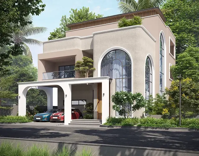
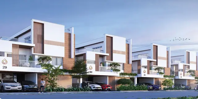
Gigaciti Phase - 4
VERTEX KLR DEVELOPERS LLP · Rangareddy · RERA P02400004256
GIGACITI PHASE - 4 is a residential plotted development in Thukkuguda Municipality, Mankal, Maheshwaram mandal, Ranga Reddy district, developed by the registered promoter VERTEX KLR DEVELOPERS LLP. The site extent is 70,639.46 sq. m.; it is a plotted layout, and buildings, floors and a complete plot count are not disclosed in the supplied project record. The project offers residential plots, with drawing-derived sizes from 334.45 sq. m. (400.0 sq. yd.) to 549.22 sq. m. (656.9 sq. yd.). It is registered with TG-RERA as P02400004256, and the promoter-declared completion undertaking is 01st Oct 2024.
More from Vertex Klr Developers LLP · 9 projects →
01What we found
Read from TG-RERA filings, approvals, land and registration records and court records. A court case is counted only when the court record states this project's survey number with its village, or names the project.
02Check before you pay
12 items to check before you pay, 4 high - from the title chain, court records and approvals, each with what to ask the builder or your advocate. An item may not be a problem with the project: records can be incomplete.
1. Project at a glance
Project identity
| Field | Record |
|---|---|
| Registered project name | GIGACITI PHASE - 4 RERA record |
| Project type | Plotted development / residential open-plot layout RERA record |
| Phase / registered portion | Phase 4; the registration covers the project identified as GIGACITI PHASE - 4. The supplied records do not specify a further phase-wise parcel breakdown. RERA record |
| TG-RERA registration | P02400004256; granted under section 5. |
| Registration validity | 14/03/2022–01/10/2024; the certificate states “2 years” and says validity is subject to extension by the Authority. The supplied certificate records no extension. Registration validity is separate from the completion undertaking and from any completion/occupancy certificate. |
| RERA-recorded status | New Project in the project filing. Current construction/completion status is not independently verified in the supplied records. RERA record RERA filing |
| Registered promoter | VERTEX KLR DEVELOPERS LLP (LLP). RERA record Corporate record |
Land and geographic identity
| Field | Record |
|---|---|
| Revenue village | Mankal (also written “Mankhal” in the filed approval/title documents). RERA record Land records |
| Locality / municipality | Thukkuguda Municipality; RERA filing locality is “THUKKUGUDA MUNCIPALITY.” RERA record RERA filing |
| Mandal | Maheshwaram. RERA record |
| District | Ranga Reddy. RERA record |
| PIN | 501359. RERA record |
| All project survey numbers as filed | 86/P, 90/P and 92/P. The supplied project identity does not name further subdivisions. RERA record Land records |
| Registered site extent | 70,639.46 sq. m. in the RERA filing and layout approval. RERA filing |
| Net / total area | Filing states total area and net area are each 70,639.46 sq. m. RERA filing |
| Boundaries in filing | North: 50 FT WIDE ROAD; South: 100 FT WIDE ROAD; East: OTHERS LAND; West: GIGACITI PHASE-1. RERA filing |
Development identity
| Field | Record |
|---|---|
| Sanctioning / layout authority | Hyderabad Metropolitan Development Authority (HMDA) issued the final layout letter; Thukkuguda Municipality proceedings are also filed. Approvals record |
| Principal layout approval | 000331/LO/Plg/HMDA/2021, approved 08 March, 2022 (HMDA final layout letter). The RERA filing also gives 00331/LO/PLG/HMDA/2021. Approvals record |
| Municipality proceedings | Proc.No.G1/1130/TGM/RR/2021, dated 06.11.2021, for release of a draft plotted layout. Approvals record |
| Approved site extent | 70,639.46 Sqm. |
| Approved built-up area | The RERA filing records 70,639.46 sq. m. as “Approved Built up Area”; the supplied layout documents describe an open-plot layout, not building plans. RERA filing |
| Buildings / floors | Not disclosed in the supplied project record; individual building permission is to be considered separately under the approval conditions. |
| Layout mortgage shown in RERA filing | 7,466.72 sq. m.; the filing describes plots 14–25 as mortgage area. The municipality proceedings identify plots 14–25 and 86–94 as mortgaged to HMDA pending the stated layout conditions. RERA filing |
| Approved vs RERA-declared plot count | The drawing-derived layout record identifies at least 95 plots, but the plot list is incomplete. A complete RERA-declared plot count is not supplied. Layout record |
Offering and status
| Field | Record |
|---|---|
| Offering | Residential plots in a plotted layout; unit-level plot inventory, bookings and availability are not supplied. Layout record |
| Drawing-derived plot sizes | Software-read drawing data identifies sizes from 334.45 sq. m. (400.0 sq. yd.) to 549.22 sq. m. (656.9 sq. yd.); plot extraction is incomplete and should be checked against the drawing. Layout record |
| Promoter-declared completion undertaking | 01st Oct 2024 in Form B; the registration certificate separately gives validity through 01/10/2024. |
| Revised completion date | Not supplied. RERA record |
| Construction / layout-development stage | RERA filing lists infrastructure items and some percentage figures, but the supplied record does not establish an independently verified current site stage. RERA amenities |
| Completion / occupancy certificate status | No project completion or occupancy certificate is supplied. The HMDA final layout letter is a layout approval, not evidence of project completion or occupancy certification. Document index |
2. The project story
GIGACITI PHASE - 4 is a residential plotted layout registered with TG-RERA as P02400004256. The filed project location is Mankal revenue village, Maheshwaram mandal, Ranga Reddy district, at Thukkuguda Municipality; the site is identified by Survey Nos. 86/P, 90/P and 92/P. The filed extent is 70,639.46 sq. m. RERA record Land records
The project provides plots rather than apartment or villa units. A software-assisted reading of the layout drawing identifies at least 95 plots, but the plotted list is incomplete, so this is not a confirmed full inventory. The drawing’s area statement allocates 48,226.42 sq. m. to plots, 15,027.49 sq. m. to roads, 5,617.07 sq. m. to parks/open space and utility area, and 1,768.39 sq. m. to social infrastructure; these are drawing-derived figures, not separate RERA unit disclosures. Layout record
The municipality’s 2021 proceedings released a draft layout and stated that development works were to be completed within three years; HMDA’s final layout letter is dated 08 March, 2022. The supplied documents do not establish the present physical completion of the layout works, the current plot inventory, or a project completion/occupancy certificate. RERA amenities
3. Master plan, architecture & building design
This is a plotted-layout project, not a multi-storey building scheme in the supplied drawings. The sanctioned site extent is 70,639.46 Sqm. The RERA filing labels the same figure as approved built-up area, but the supplied sanction documents describe a residential open-plot layout and do not provide building plans, building count, floors, or building footprints. Individual building permissions are to be considered separately under the HMDA final-layout conditions. RERA filing
The drawing-derived land-use statement is:
| Layout component | Area | Share of net layout area | Evidence |
|---|---|---|---|
| Plots | 48,226.42 sq. m. | 68.3% | Software-read approved layout drawing Layout record |
| Roads | 15,027.49 sq. m. | 21.3% | Software-read approved layout drawing Layout record |
| Parks / open space / utility area | 5,617.07 sq. m. | 8.0% | Software-read approved layout drawing Layout record |
| Social infrastructure | 1,768.39 sq. m. | 2.5% | Software-read approved layout drawing Layout record |
| Amenities | 0.00 sq. m. | 0.0% | Software-read approved layout drawing Layout record |
The layout record reports 95 plots as a minimum because the drawing’s plot list is incomplete; it identifies 83 plots with extracted sizes. Extracted sizes range from 334.45 sq. m. (400.0 sq. yd.) to 549.22 sq. m. (656.9 sq. yd.). Layout record
The municipality proceedings specify black-topped or cement-concrete roads, footpaths, storm-water drainage, underground drainage and water-supply lines, street lighting, transformer provision, avenue planting, park development and rainwater-harvesting pits. They also require public access through roads and identify plots 14–25 and 86–94 as mortgaged to HMDA in the draft-layout proceedings. The HMDA final-layout letter records roads and open spaces taken over by the local authority and a deed of relinquishment concerning mortgaged plots.
No supplied building floor plans contain measured homes: the drawing review records three drawings, with one scan pending and two drawings without flats. Floor plans
4. Homes, configurations & floor plans
The project offers plots, not apartment configurations. The supplied records do not include a complete RERA plot-inventory table showing plot-by-plot booking or availability. Layout record
| Configuration | Units | Booked | Available | RERA saleable area | Measured carpet area | Loading (if supplied) |
|---|---|---|---|---|---|---|
| Residential plots | At least 95 in software-read layout; list incomplete | Not supplied | Not supplied | Not supplied | Not applicable | Not supplied |
The drawing-derived plot-size bands are 57 plots in 300–400 sq. yd., 21 in 400–500 sq. yd., and 5 in 500–1,000 sq. yd. for the extracted plot list. The same drawing extraction identifies common printed sizes of 400 SQYDS (55 plots), 484.44 SQYDS (20 plots), and 656.86 SQYDS (4 plots), plus 400SQYDS (2 plots). These are software-read figures from an incomplete plot list, not RERA-filed unit areas or verified plot availability. Layout record
5. Parking & vehicle circulation
No resident, visitor, accessible, or other parking-space count, parking allocation schedule, or plot-specific parking entitlement is supplied. A separate parking facility is not identified in the supplied layout records. Document index Layout record
The layout approval requires roads to remain open for access, internal roads to provide accessibility to neighboring sites, and footpaths to be paved; the municipality proceedings also call for cycling tracks. These are approval conditions, not evidence of completed works.
6. Amenities, recreation & open spaces
The RERA filing lists infrastructure and amenity categories with recorded percentage figures. These figures are project-filed declarations and are not independent verification of completion. The municipality and HMDA documents also set out layout-development requirements. RERA amenities
| Description / size | Internal roads and footpaths; no area or length supplied |
|---|---|
| Evidence source | RERA-filed amenity schedule; municipality proceedings RERA amenities |
| Declared progress / verified status | RERA schedule: 40%; not independently verified |
| Description / size | Internal water-supply lines and protected water supply; no capacity supplied |
|---|---|
| Evidence source | RERA-filed amenity schedule; municipality proceedings RERA amenities |
| Declared progress / verified status | RERA schedule: 0%; not independently verified |
| Description / size | Sewerage chambers, lines, septic tank/STP; no capacity supplied |
|---|---|
| Evidence source | RERA-filed amenity schedule; municipality proceedings RERA amenities |
| Declared progress / verified status | RERA schedule: 50% for sewerage; not independently verified |
| Description / size | Storm-water drainage system; no capacity supplied |
|---|---|
| Evidence source | RERA-filed amenity schedule; municipality proceedings RERA amenities |
| Declared progress / verified status | RERA schedule: 50%; not independently verified |
| Description / size | Green strip, tot lot or park; drawing area statement includes 5,617.07 sq. m. for parks/open space and utility area |
|---|---|
| Evidence source | RERA-filed amenity schedule; layout drawing RERA amenities Layout record |
| Declared progress / verified status | RERA schedule: 0%; not independently verified |
| Description / size | Street lights; municipality proceedings specify LED lighting |
|---|---|
| Evidence source | RERA-filed amenity schedule; municipality proceedings RERA amenities |
| Declared progress / verified status | RERA schedule: 0%; not independently verified |
| Description / size | Community-building category; no building size or facility details supplied |
|---|---|
| Evidence source | RERA-filed amenity schedule RERA amenities |
| Declared progress / verified status | RERA schedule: 0%; not independently verified |
| Description / size | Solid-waste management/disposal; proceedings require a disposal area, bio-compost unit and source segregation |
|---|---|
| Evidence source | RERA-filed amenity schedule; municipality proceedings RERA amenities |
| Declared progress / verified status | RERA schedule: 0%; not independently verified |
| Description / size | Rainwater-harvesting pits/structures; no count or capacity supplied |
|---|---|
| Evidence source | RERA-filed amenity schedule; municipality and HMDA documents RERA amenities |
| Declared progress / verified status | RERA schedule: 0%; not independently verified |
| Description / size | Electrical service category; proceedings require a transformer yard and electricity facilities |
|---|---|
| Evidence source | RERA-filed amenity schedule; municipality proceedings RERA amenities |
| Declared progress / verified status | RERA schedule: 0%; not independently verified |
| Description / size | Aggregate open-space category; no separate facility dimensions supplied |
|---|---|
| Evidence source | RERA-filed amenity schedule; layout drawing RERA amenities Layout record |
| Declared progress / verified status | RERA schedule: 0%; not independently verified |
No clubhouse or indoor recreation facility is specified in the supplied RERA-filed layout material. RERA amenities Layout record
7. Utilities, building services & safety
The filed layout-development requirements include protected water supply, internal water-supply lines, an overhead tank and sumps; underground sewerage lines with a common septic tank/STP; storm-water drainage and rainwater-harvesting structures; electrical supply lines, transformer and street lighting; underground ducting for utilities; and solid-waste segregation and bio-compost provision. The supplied records do not give capacities, source yield, treatment specifications, or confirmation that these systems are complete.
The municipality proceedings require a sewerage treatment plant for a layout exceeding 10 acres, with a separate area in addition to mandatory open spaces, and require roads, footpaths and cycling tracks. The RERA amenity schedule records fire-protection/fire-safety requirements at 0% and provides no project-specific fire-system description. No building-level lifts, emergency stairs, backup power, CCTV, access-control system or accessibility design details are supplied. RERA amenities
8. Location, access & connectivity
The registered project location is Mankal revenue village, Maheshwaram mandal, Ranga Reddy district, Thukkuguda Municipality, PIN 501359. The filed site boundaries identify a 50 FT WIDE ROAD to the north and a 100 FT WIDE ROAD to the south. RERA record RERA filing
The available location record lists the nearest sampled Outer Ring Road interchange at approximately 10.6 km, TGSRTC Bus Station, Maheshwaram at 0.2 km, and Community Health Centre Maheshwaram at 0.2 km. These are supplied location-record distances; no travel times are provided. Location record
The municipality proceedings require the layout roads to connect to the nearest existing public road and remain open for access to neighboring sites. The supplied evidence does not provide a measured distance to the airport or a verified travel-time estimate.
9. Developer & development status
The registered legal promoter is VERTEX KLR DEVELOPERS LLP, an LLP. The project filing gives GSTIN 36AARFV1740M1ZL and an office address at VERTEX CORPORATE, JUBILEE ENCLAVE, MANKHAL VILLAGE, THUKKUGUDA MUNCIPALITY, Maheshwaram, Ranga Reddy, 501359. Corporate record RERA filing
The RERA registration certificate records the promoter office as Village: Madhapur, Mandal: Serilingampally, District: Ranga Reddy, Pin: 500081. The supplied record does not identify an official project contact number or email address.
Form B is a promoter declaration undertaking completion by 01st Oct 2024. The TG-RERA certificate gives registration validity through 01/10/2024; the supplied certificate does not record an extension. Neither date establishes physical completion. No current independently verified construction or layout-work progress, complete plot inventory, or completion/occupancy certificate is supplied. RERA amenities
10. Approvals, official records & documents
| Supplied document / identifier | P02400004256, Form C, issued 14/03/2022 |
|---|---|
| What it establishes | Registration for GIGACITI PHASE - 4, valid through 01/10/2024 unless extended by the Authority. |
| Supplied document / identifier | Proc.No.G1/1130/TGM/RR/2021, 06.11.2021 |
|---|---|
| What it establishes | Draft plotted-layout release for 70,639.46 Sq.Mtrs. in Survey Nos. 86/P, 90/P and 92/P; includes layout-development conditions. |
| Supplied document / identifier | 000331/LO/Plg/HMDA/2021, 08 March, 2022 |
|---|---|
| What it establishes | Final residential open-plot layout approval for 70,639.46 Sqm in Survey Nos. 86/p, 90/p and 92/p. |
| Supplied document / identifier | 051265/LT/SMD/FLT/U6/HMDA/24122021 |
|---|---|
| What it establishes | Application/file reference printed on the final layout letter. |
| Supplied document / identifier | 11.12.2021, advocate G. Chandra Sekhar |
|---|---|
| What it establishes | Title opinion covering Survey Nos. 86/P, 90/P and 92/P; the report notes that ROR records for 1960 to 1974 were not traced. |
| Supplied document / identifier | 197834 |
|---|---|
| What it establishes | Promoter-declared title basis, encumbrance statement, statutory commitments and completion undertaking. |
| Supplied document / identifier | 205688, two sheets Layout record |
|---|---|
| What it establishes | Drawing-derived plot and land-use extraction; the plot list is incomplete. |
| Supplied document / identifier | No building-specific permission, project completion certificate, or occupancy certificate is supplied in this evidence set. Document index |
|---|---|
| What it establishes | No building or occupancy status can be established from the supplied documents. |
1. Project at a glance
Project identity
Registered project name: GIGACITI PHASE - 4
Project type: Plotted development / residential open-plot layout
Phase / registered portion: Phase 4; the registration covers the project identified as GIGACITI PHASE - 4. The supplied records do not specify a further phase-wise parcel breakdown.
TG-RERA registration: P02400004256; granted under section 5.
Registration validity: 14/03/2022–01/10/2024; the certificate states “2 years” and says validity is subject to extension by the Authority. The supplied certificate records no extension. Registration validity is separate from the completion undertaking and from any completion/occupancy certificate.
RERA-recorded status: New Project in the project filing. Current construction/completion status is not independently verified in the supplied records.
Registered promoter: VERTEX KLR DEVELOPERS LLP (LLP).
Land and geographic identity
Revenue village: Mankal (also written “Mankhal” in the filed approval/title documents).
Locality / municipality: Thukkuguda Municipality; RERA filing locality is “THUKKUGUDA MUNCIPALITY.”
Mandal: Maheshwaram.
District: Ranga Reddy.
PIN: 501359.
All project survey numbers as filed: 86/P, 90/P and 92/P. The supplied project identity does not name further subdivisions.
Registered site extent: 70,639.46 sq. m. in the RERA filing and layout approval.
Net / total area: Filing states total area and net area are each 70,639.46 sq. m.
Boundaries in filing: North: 50 FT WIDE ROAD; South: 100 FT WIDE ROAD; East: OTHERS LAND; West: GIGACITI PHASE-1.
Development identity
Sanctioning / layout authority: Hyderabad Metropolitan Development Authority (HMDA) issued the final layout letter; Thukkuguda Municipality proceedings are also filed.
Principal layout approval: 000331/LO/Plg/HMDA/2021, approved 08 March, 2022 (HMDA final layout letter). The RERA filing also gives 00331/LO/PLG/HMDA/2021.
Municipality proceedings: Proc.No.G1/1130/TGM/RR/2021, dated 06.11.2021, for release of a draft plotted layout.
Approved site extent: 70,639.46 Sqm.
Approved built-up area: The RERA filing records 70,639.46 sq. m. as “Approved Built up Area”; the supplied layout documents describe an open-plot layout, not building plans.
Buildings / floors: Not disclosed in the supplied project record; individual building permission is to be considered separately under the approval conditions.
Layout mortgage shown in RERA filing: 7,466.72 sq. m.; the filing describes plots 14–25 as mortgage area. The municipality proceedings identify plots 14–25 and 86–94 as mortgaged to HMDA pending the stated layout conditions.
Approved vs RERA-declared plot count: The drawing-derived layout record identifies at least 95 plots, but the plot list is incomplete. A complete RERA-declared plot count is not supplied.
Offering and status
Offering: Residential plots in a plotted layout; unit-level plot inventory, bookings and availability are not supplied.
Drawing-derived plot sizes: Software-read drawing data identifies sizes from 334.45 sq. m. (400.0 sq. yd.) to 549.22 sq. m. (656.9 sq. yd.); plot extraction is incomplete and should be checked against the drawing.
Promoter-declared completion undertaking: 01st Oct 2024 in Form B; the registration certificate separately gives validity through 01/10/2024.
Revised completion date: Not supplied.
Construction / layout-development stage: RERA filing lists infrastructure items and some percentage figures, but the supplied record does not establish an independently verified current site stage.
Completion / occupancy certificate status: No project completion or occupancy certificate is supplied. The HMDA final layout letter is a layout approval, not evidence of project completion or occupancy certification.
2. The project story
GIGACITI PHASE - 4 is a residential plotted layout registered with TG-RERA as P02400004256. The filed project location is Mankal revenue village, Maheshwaram mandal, Ranga Reddy district, at Thukkuguda Municipality; the site is identified by Survey Nos. 86/P, 90/P and 92/P. The filed extent is 70,639.46 sq. m.
The project provides plots rather than apartment or villa units. A software-assisted reading of the layout drawing identifies at least 95 plots, but the plotted list is incomplete, so this is not a confirmed full inventory. The drawing’s area statement allocates 48,226.42 sq. m. to plots, 15,027.49 sq. m. to roads, 5,617.07 sq. m. to parks/open space and utility area, and 1,768.39 sq. m. to social infrastructure; these are drawing-derived figures, not separate RERA unit disclosures.
The municipality’s 2021 proceedings released a draft layout and stated that development works were to be completed within three years; HMDA’s final layout letter is dated 08 March, 2022. The supplied documents do not establish the present physical completion of the layout works, the current plot inventory, or a project completion/occupancy certificate.
3. Master plan, architecture & building design
This is a plotted-layout project, not a multi-storey building scheme in the supplied drawings. The sanctioned site extent is 70,639.46 Sqm. The RERA filing labels the same figure as approved built-up area, but the supplied sanction documents describe a residential open-plot layout and do not provide building plans, building count, floors, or building footprints. Individual building permissions are to be considered separately under the HMDA final-layout conditions.
The drawing-derived land-use statement is:
| Layout component | Area | Share of net layout area | Evidence |
|---|---|---|---|
| Plots | 48,226.42 sq. m. | 68.3% | Software-read approved layout drawing |
| Roads | 15,027.49 sq. m. | 21.3% | Software-read approved layout drawing |
| Parks / open space / utility area | 5,617.07 sq. m. | 8.0% | Software-read approved layout drawing |
| Social infrastructure | 1,768.39 sq. m. | 2.5% | Software-read approved layout drawing |
| Amenities | 0.00 sq. m. | 0.0% | Software-read approved layout drawing |
The layout record reports 95 plots as a minimum because the drawing’s plot list is incomplete; it identifies 83 plots with extracted sizes. Extracted sizes range from 334.45 sq. m. (400.0 sq. yd.) to 549.22 sq. m. (656.9 sq. yd.).
The municipality proceedings specify black-topped or cement-concrete roads, footpaths, storm-water drainage, underground drainage and water-supply lines, street lighting, transformer provision, avenue planting, park development and rainwater-harvesting pits. They also require public access through roads and identify plots 14–25 and 86–94 as mortgaged to HMDA in the draft-layout proceedings. The HMDA final-layout letter records roads and open spaces taken over by the local authority and a deed of relinquishment concerning mortgaged plots.
No supplied building floor plans contain measured homes: the drawing review records three drawings, with one scan pending and two drawings without flats.
4. Homes, configurations & floor plans
The project offers plots, not apartment configurations. The supplied records do not include a complete RERA plot-inventory table showing plot-by-plot booking or availability.
| Configuration | Units | Booked | Available | RERA saleable area | Measured carpet area | Loading (if supplied) |
|---|---|---|---|---|---|---|
| Residential plots | At least 95 in software-read layout; list incomplete | Not supplied | Not supplied | Not supplied | Not applicable | Not supplied |
The drawing-derived plot-size bands are 57 plots in 300–400 sq. yd., 21 in 400–500 sq. yd., and 5 in 500–1,000 sq. yd. for the extracted plot list. The same drawing extraction identifies common printed sizes of 400 SQYDS (55 plots), 484.44 SQYDS (20 plots), and 656.86 SQYDS (4 plots), plus 400SQYDS (2 plots). These are software-read figures from an incomplete plot list, not RERA-filed unit areas or verified plot availability.
5. Parking & vehicle circulation
No resident, visitor, accessible, or other parking-space count, parking allocation schedule, or plot-specific parking entitlement is supplied. A separate parking facility is not identified in the supplied layout records.
The layout approval requires roads to remain open for access, internal roads to provide accessibility to neighboring sites, and footpaths to be paved; the municipality proceedings also call for cycling tracks. These are approval conditions, not evidence of completed works.
6. Amenities, recreation & open spaces
The RERA filing lists infrastructure and amenity categories with recorded percentage figures. These figures are project-filed declarations and are not independent verification of completion. The municipality and HMDA documents also set out layout-development requirements.
| Description / size | Internal roads and footpaths; no area or length supplied |
|---|---|
| Evidence source | RERA-filed amenity schedule; municipality proceedings |
| Declared progress / verified status | RERA schedule: 40%; not independently verified |
| Description / size | Internal water-supply lines and protected water supply; no capacity supplied |
|---|---|
| Evidence source | RERA-filed amenity schedule; municipality proceedings |
| Declared progress / verified status | RERA schedule: 0%; not independently verified |
| Description / size | Sewerage chambers, lines, septic tank/STP; no capacity supplied |
|---|---|
| Evidence source | RERA-filed amenity schedule; municipality proceedings |
| Declared progress / verified status | RERA schedule: 50% for sewerage; not independently verified |
| Description / size | Storm-water drainage system; no capacity supplied |
|---|---|
| Evidence source | RERA-filed amenity schedule; municipality proceedings |
| Declared progress / verified status | RERA schedule: 50%; not independently verified |
| Description / size | Green strip, tot lot or park; drawing area statement includes 5,617.07 sq. m. for parks/open space and utility area |
|---|---|
| Evidence source | RERA-filed amenity schedule; layout drawing |
| Declared progress / verified status | RERA schedule: 0%; not independently verified |
| Description / size | Street lights; municipality proceedings specify LED lighting |
|---|---|
| Evidence source | RERA-filed amenity schedule; municipality proceedings |
| Declared progress / verified status | RERA schedule: 0%; not independently verified |
| Description / size | Community-building category; no building size or facility details supplied |
|---|---|
| Evidence source | RERA-filed amenity schedule |
| Declared progress / verified status | RERA schedule: 0%; not independently verified |
| Description / size | Solid-waste management/disposal; proceedings require a disposal area, bio-compost unit and source segregation |
|---|---|
| Evidence source | RERA-filed amenity schedule; municipality proceedings |
| Declared progress / verified status | RERA schedule: 0%; not independently verified |
| Description / size | Rainwater-harvesting pits/structures; no count or capacity supplied |
|---|---|
| Evidence source | RERA-filed amenity schedule; municipality and HMDA documents |
| Declared progress / verified status | RERA schedule: 0%; not independently verified |
| Description / size | Electrical service category; proceedings require a transformer yard and electricity facilities |
|---|---|
| Evidence source | RERA-filed amenity schedule; municipality proceedings |
| Declared progress / verified status | RERA schedule: 0%; not independently verified |
| Description / size | Aggregate open-space category; no separate facility dimensions supplied |
|---|---|
| Evidence source | RERA-filed amenity schedule; layout drawing |
| Declared progress / verified status | RERA schedule: 0%; not independently verified |
No clubhouse or indoor recreation facility is specified in the supplied RERA-filed layout material.
7. Utilities, building services & safety
The filed layout-development requirements include protected water supply, internal water-supply lines, an overhead tank and sumps; underground sewerage lines with a common septic tank/STP; storm-water drainage and rainwater-harvesting structures; electrical supply lines, transformer and street lighting; underground ducting for utilities; and solid-waste segregation and bio-compost provision. The supplied records do not give capacities, source yield, treatment specifications, or confirmation that these systems are complete.
The municipality proceedings require a sewerage treatment plant for a layout exceeding 10 acres, with a separate area in addition to mandatory open spaces, and require roads, footpaths and cycling tracks. The RERA amenity schedule records fire-protection/fire-safety requirements at 0% and provides no project-specific fire-system description. No building-level lifts, emergency stairs, backup power, CCTV, access-control system or accessibility design details are supplied.
8. Location, access & connectivity
The registered project location is Mankal revenue village, Maheshwaram mandal, Ranga Reddy district, Thukkuguda Municipality, PIN 501359. The filed site boundaries identify a 50 FT WIDE ROAD to the north and a 100 FT WIDE ROAD to the south.
The available location record lists the nearest sampled Outer Ring Road interchange at approximately 10.6 km, TGSRTC Bus Station, Maheshwaram at 0.2 km, and Community Health Centre Maheshwaram at 0.2 km. These are supplied location-record distances; no travel times are provided.
The municipality proceedings require the layout roads to connect to the nearest existing public road and remain open for access to neighboring sites. The supplied evidence does not provide a measured distance to the airport or a verified travel-time estimate.
9. Developer & development status
The registered legal promoter is VERTEX KLR DEVELOPERS LLP, an LLP. The project filing gives GSTIN 36AARFV1740M1ZL and an office address at VERTEX CORPORATE, JUBILEE ENCLAVE, MANKHAL VILLAGE, THUKKUGUDA MUNCIPALITY, Maheshwaram, Ranga Reddy, 501359.
The RERA registration certificate records the promoter office as Village: Madhapur, Mandal: Serilingampally, District: Ranga Reddy, Pin: 500081. The supplied record does not identify an official project contact number or email address.
Form B is a promoter declaration undertaking completion by 01st Oct 2024. The TG-RERA certificate gives registration validity through 01/10/2024; the supplied certificate does not record an extension. Neither date establishes physical completion. No current independently verified construction or layout-work progress, complete plot inventory, or completion/occupancy certificate is supplied.
10. Approvals, official records & documents
| Supplied document / identifier | P02400004256, Form C, issued 14/03/2022 |
|---|---|
| What it establishes | Registration for GIGACITI PHASE - 4, valid through 01/10/2024 unless extended by the Authority. |
| Supplied document / identifier | Proc.No.G1/1130/TGM/RR/2021, 06.11.2021 |
|---|---|
| What it establishes | Draft plotted-layout release for 70,639.46 Sq.Mtrs. in Survey Nos. 86/P, 90/P and 92/P; includes layout-development conditions. |
| Supplied document / identifier | 000331/LO/Plg/HMDA/2021, 08 March, 2022 |
|---|---|
| What it establishes | Final residential open-plot layout approval for 70,639.46 Sqm in Survey Nos. 86/p, 90/p and 92/p. |
| Supplied document / identifier | 051265/LT/SMD/FLT/U6/HMDA/24122021 |
|---|---|
| What it establishes | Application/file reference printed on the final layout letter. |
| Supplied document / identifier | 11.12.2021, advocate G. Chandra Sekhar |
|---|---|
| What it establishes | Title opinion covering Survey Nos. 86/P, 90/P and 92/P; the report notes that ROR records for 1960 to 1974 were not traced. |
| Supplied document / identifier | 197834 |
|---|---|
| What it establishes | Promoter-declared title basis, encumbrance statement, statutory commitments and completion undertaking. |
| Supplied document / identifier | 205688, two sheets |
|---|---|
| What it establishes | Drawing-derived plot and land-use extraction; the plot list is incomplete. |
| Supplied document / identifier | No building-specific permission, project completion certificate, or occupancy certificate is supplied in this evidence set. |
|---|---|
| What it establishes | No building or occupancy status can be established from the supplied documents. |
Other registrations of Gigaciti
Frequently asked questions
Is GIGACITI PHASE - 4 registered with Telangana RERA?
Yes. GIGACITI PHASE - 4 is registered with the Telangana Real Estate Regulatory Authority as P02400004256; the registration status is New Project.
Who is the developer of GIGACITI PHASE - 4?
The promoter named in the RERA registration is VERTEX KLR DEVELOPERS LLP.
Where is GIGACITI PHASE - 4 located?
GIGACITI PHASE - 4 is in THUKKUGUDA MUNCIPALITY, Mankal, Maheshwaram, Rangareddy, Telangana (501359).
When will GIGACITI PHASE - 4 be completed?
The promoter's proposed date of completion filed with RERA is 01/10/2024. This is the promoter's declaration, not a guarantee.
More projects in Mankal