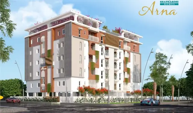
Raj Mahadev
RAJESH INFRA DEVELOPERS · Rangareddy · RERA P02400010503
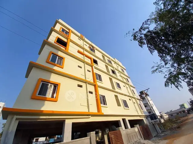
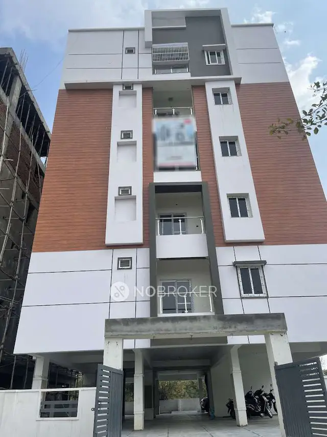
RAJ MAHADEV is a residential apartment project in MANNEGUDA, Abdullapurmet mandal, Ranga Reddy district, being developed by RAJESH INFRA DEVELOPERS. The project occupies 668.88 sq. m and comprises one building with 1 Stilt + 5 Floors and 20 homes, all configured as 2BHK. It is registered under TG-RERA number P02400010503, with a proposed completion date of 15/04/2029.
01What we found
Read from TG-RERA filings, approvals, land and registration records and court records. A court case is counted only when the court record states this project's survey number with its village, or names the project.
02Check before you pay
7 items to check before you pay, 2 high - from the title chain, court records and approvals, each with what to ask the builder or your advocate. An item may not be a problem with the project: records can be incomplete.
1. Project at a glance
Project identity
| Item | Project record |
|---|---|
| Registered project name | RAJ MAHADEV RERA record |
| Project type | Residential apartment project; the registration certificate identifies the project type as “plotted,” while the filed building permit and RERA unit schedule describe a residential apartment building. This profile follows the building-permit and unit records for the development described below. RERA record RERA unit table |
| Phase / registered portion | No phase name or phase number disclosed. The registration and permit records describe one building. RERA record |
| TG-RERA registration | P02400010503; valid 15/12/2025–15/12/2028. RERA record |
| RERA status | Registered; registration validity is separate from the project’s stated completion deadline. RERA record |
| Registered promoter | RAJESH INFRA DEVELOPERS; partnership. RERA record Corporate record RERA filing |
| Project status in filing | “New Project.” RERA record RERA filing |
Land and geographic identity
| Item | Project record |
|---|---|
| Locality | MANNEGUDA RERA record RERA filing |
| Revenue village | MANNA GUDA (also rendered “MANNEGUDA” in approval and title documents) RERA record RERA filing |
| Mandal | Abdullapurmet RERA record RERA filing |
| District | Ranga Reddy RERA record RERA filing |
| PIN | 501510 RERA record |
| Project survey numbers as recorded | 52/, 56/, 57/, 58/, 59/ in the filed project identity and permit; the title records provide subdivisions/variants including 52/E, 56/E, 56/A, 57/E, 58/E, 59/E and OCR-rendered forms. Plot numbers identified in the permit and title records are 77, 78, 95 and 96. RERA record RERA filing |
| Registered site extent | 668.88 sq. m; permit records show gross and net plot area both as 668.88 sq. m. RERA filing |
| Boundaries in RERA filing | East: 30 WIDE ROAD; West: 30FT WIDE ROAD; North: PLOT NOS 79 AND 94; South: PLOT NOS76 AND 97. RERA filing |
| Permit-area deductions | Road-affected area, nala-widening area, water-bodies area, splay area and total plot deductions are each recorded as 0 sq. m. |
Development identity
| Item | Project record |
|---|---|
| Sanctioning authority / principal approval | GHMC building permit order, approval no. 0024/TKJL/SWBP/2025, dated 15/12/2025. The filed plan record also gives file no. 010807/TKJL/00031/SWBP/2025. Approvals record |
| Building | One residential building, named “PROP BUILDING” in the plan extraction. |
| Sanctioned configuration | 1 Stilt + 5 Floors. |
| Approved built-up area | 1786.8 sq. m excluding parking; 2145.18 sq. m including parking in the filed plan extraction. The permit also records 1786.8 sq. m for residential upper floors. |
| Proposed coverage / vacant plot area | 358.38 sq. m proposed coverage (54 %); 309.06 sq. m vacant plot area. |
| Parking recorded in sanction data | 16.00 car parking spaces; total parking area 358.38 sq. m. No separate parking level beyond the stilt is identified in the supplied extraction. |
| Unit count | 20 units in both the building-permit record and RERA unit schedule. RERA unit table |
Offering and status
| Item | Project record |
|---|---|
| Filed configuration | 2BHK, 20 units. RERA unit table RERA unit details |
| RERA-filed saleable area | 111.48 sq. m per unit. RERA unit table RERA unit details |
| Booked / available | 0 booked / 20 available, as last read from the TG-RERA portal; that record has no stated as-of date, so counts are indicative. RERA unit table |
| Completion date in permit | Construction to be completed before 15/12/2028. |
| Completion undertaking in Form B | The promoter’s Form B declares completion by 15/12/2028. |
| Proposed completion in project header | 15/04/2029. The supplied evidence does not explain this date alongside the permit and Form B dates. RERA record |
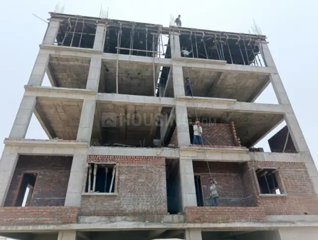
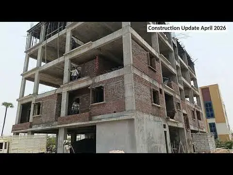
| Construction stage | No construction-progress percentage or independent site-progress verification is supplied. RERA record Document index |
| Occupancy certificate | Not supplied as issued. The permit requires an occupancy certificate before occupation. |
2. The project story
RAJ MAHADEV is recorded as a 20-unit residential development on a 668.88 sq. m site at Manneguda, in Abdullapurmet mandal, Ranga Reddy district. The filed building-permit documents describe one building with a stilt and five floors, containing 20 dwelling units; the RERA unit schedule identifies all 20 as 2BHK units. RERA record RERA unit details
The permit and the promoter’s Form B give a completion deadline of 15/12/2028; the project header separately records a proposed completion date of 15/04/2029. These dates are reported as recorded, not reconciled here. The supplied material does not establish construction progress or an issued occupancy certificate. The permit requires an occupancy certificate before occupation. RERA record
3. Master plan, architecture & building design
The filed plan describes a single residential building on a gross/net plot area of 668.88 sq. m, with proposed coverage of 358.38 sq. m and vacant plot area of 309.06 sq. m. It records proposed built-up area of 1786.8 sq. m excluding parking and 2145.18 sq. m including parking. These are plan-extracted figures; no separate FSI-counted area is supplied.
The sanctioned building configuration is 1 Stilt + 5 Floors. The permit data records a proposed building height of 17.7 m, a “Height of the Building” of 14.5 m, and a permissible height of 15.00 m; “Height from Ground Level” is also recorded as 14.5 m in the plan extraction. The supplied evidence does not explain the different height labels, so they are reported as stated.
The plan lists setbacks as front 3.0 m, rear 3.5 m, side 1 2.5 m and side 2 4.5 m, with a note that 1.0 m is transferred from Side1 to Side2. The filed plan records an existing/proposed road width of 9.14 m and a 4.5m Wide Drive Way. Detailed floor-by-floor layouts, flat positions, lift/stair counts, entrances, exits and internal circulation are not established by the supplied extracts.
The plan requires a tot-lot to be maintained as greenery, tree planting along the periphery and front, and a rainwater-harvesting percolation pit. The permit extraction records 25 trees and one rainwater-harvesting pit; it does not establish that these works are complete.
4. Homes, configurations & floor plans
| Configuration | Units | Booked | Available | RERA saleable area | Measured carpet area | Loading (if supplied) |
|---|---|---|---|---|---|---|
| 2BHK | 20 | 0 | 20 | 111.48 sq. m | Software-measured range: 66.7–71.5 sq. m; median 69.5 sq. m (748 sq. ft median) | 38% |
RERA records the 2BHK configuration and saleable area of 111.48 sq. m per unit. Carpet figures are software measurements from approved floor-plan drawing geometry, not RERA-filed disclosures; eight flat designs were measured and all eight are marked as needing review. The drawing record says its measured carpet area is smaller than saleable area, which also counts the home’s share of common areas. RERA unit details Floor plans
The supplied sample plan measurement identifies living/dining, kitchen, two bedrooms, two toilets and a balcony. For the measured flat labelled “03,” the kitchen is recorded as 3.56 m × 2.5 m; bedrooms as 3.45 m × 3.45 m and 3.56 m × 3.95 m; toilets as 2.3 m × 1.25 m and 1.56 m × 1.87 m; and balcony as 1.78 m × 1.98 m. These are drawing-based measurements, not independent site measurements or RERA area declarations. RERA unit details
5. Parking & vehicle circulation
The filed plan records 16.00 car parking spaces and 358.38 sq. m total parking area. Parking is associated with the stilt in the 1 Stilt + 5 Floors configuration; the supplied records do not identify basement, podium, mechanical or surface parking arrangements, nor visitor, accessible or two-wheeler counts.
The building-permit conditions state that the stilt approved for parking must be used exclusively for vehicle parking and not partitioned or converted to another use. The evidence does not provide unit-wise parking allocations or establish exclusive ownership of any bay. The plan refers to a 4.5m Wide Drive Way, but detailed ramp and vehicle-entry/exit arrangements are not supplied.
6. Amenities, recreation & open spaces
The RERA amenity schedule marks internal roads and footpaths, water supply, sewerage, storm-water drains, green strip/tot-lot/park, street lighting, rainwater harvesting and an electrical meter room/sub-station/receiving station as available. Each listed item shows 0% progress; “available” is the filed status, not evidence of completed or independently verified facilities. RERA amenities
| Facility | Description / size | Evidence source | Declared progress / verified status |
|---|---|---|---|
| Green strip / tot-lot / park | Tot-lot and peripheral greenery; no size supplied. | RERA amenities | RERA schedule marks available; 0% shown. Permit requires tot-lot and greenery; completion not verified. |
| Internal roads & footpaths | No dimensions or extent supplied. | RERA amenities | Marked available; 0% shown. |
| Community buildings | No description or size supplied. | RERA amenities | Listed; 0% shown; availability not stated. |
| Indoor games, children’s play area/sand pits, yoga areas and “normal park / central green” | Vendor-reported facilities; no sizes or quantities supplied. | Promoter website | Vendor claims only; no RERA progress or completion evidence supplied. |
7. Utilities, building services & safety
The filed plan extraction records a 20775.00 Ltrs. water tank, a 1.5MX1.5MX1.5M percolation pit, space for a transformer and a garbage house. The permit extraction separately records one rainwater-harvesting pit. These are plan/permit provisions; completion and operational capacity are not independently verified.
The RERA amenity schedule lists water supply, sewerage, storm-water drains, water conservation/rainwater harvesting, and an electrical meter room/sub-station/receiving station as available, each with 0% progress. It lists sewage treatment/disposal, solid-waste management, energy management and fire protection/fire-safety requirements without marking them available; each shows 0%. No STP capacity, power-backup capacity, lift count/capacity, CCTV system, access-control system or accessibility provisions are supplied in the project records. RERA amenities
The permit requires an occupancy Fire NOC from the Director (EV&DM) before an occupancy certificate is issued. It also requires construction in accordance with the sanctioned plan and provides conditions concerning sanitation, plumbing, fire safety, lifts and electrical installations. These are permit conditions, not evidence that the systems are installed, tested or cleared.
8. Location, access & connectivity
The registered project location is MANNA GUDA, Abdullapurmet, Ranga Reddy, 501510, also identified as Manneguda in the project and permit records. The recorded plot boundaries include roads on the east and west; the building-plan extraction gives an existing and proposed road width of 9.14 m and notes a 4.5m Wide Drive Way. RERA record RERA filing
The supplied location record gives the nearest sampled Outer Ring Road interchange as approximately 3.7 km away. A promoter/vendor source mentions Nagarjuna Sagar Road, Nehru Outer Ring Road, L.B. Nagar metro station and nearby landmarks, but the supplied data does not provide verified distances for those claims. Location record Promoter website
9. Developer & development status
The registered promoter is RAJESH INFRA DEVELOPERS, identified in the RERA filing as a partnership. Its GSTIN is 36ABLFR2582A1Z8. DESU RAJESWARA REDDY is identified as the authorized signatory. The supplied promoter address is MY HOME AVATAR, PUPPALAGUDA, MANNEGUDA, Abdullapurmet, Ranga Reddy, 501510; no official contact details are supplied. Corporate record RERA filing Parties record RERA filing
The filed permit covers one building and 20 dwelling units. No construction-stage percentage or independently verified site-progress information is provided. The permit states construction was to commence before 13/06/2026 and be completed before 15/12/2028; Form B also records a completion undertaking of 15/12/2028. The project header records 15/04/2029 as the proposed completion date. The supplied documents do not establish whether an extension has been granted or an occupancy certificate issued. RERA record RERA record Document index
10. Approvals, official records & documents
| Identifier / date | P02400010503; valid 15/12/2025–15/12/2028 |
|---|---|
| What the supplied record establishes | Registration of RAJ MAHADEV under the named promoter; certificate conditions include quarterly updates. |
| Identifier / date | Approval no. 0024/TKJL/SWBP/2025; 15/12/2025 |
|---|---|
| What the supplied record establishes | Permit record for one residential building, 1 Stilt + 5 Floors, with 20 dwelling units. |
| Identifier / date | File no. 010807/TKJL/00031/SWBP/2025 |
|---|---|
| What the supplied record establishes | Plan-extracted site, area, setback, building, parking and utility details. |
| Identifier / date | Declared 29-01-2026 |
|---|---|
| What the supplied record establishes | Promoter’s project declaration, including completion undertaking by 15/12/2028; the OCR-extracted encumbrance clause does not establish which alternative was completed. |
| Identifier / date | Sale deed 10341/2025; gift deeds 6929/2019, 6934/2019, 6937/2019, 6943/2019 |
|---|---|
| What the supplied record establishes | Title-chain documents listed in the filed title material; detailed deed and survey/subdivision records are addressed in the Land & Title section. |
| Identifier / date | 10615/2025, dated 02/12/2025 |
|---|---|
| What the supplied record establishes | Filed record describes a mortgage of 186.55 sq. m of first-floor built-up area in favour of the municipal authority. |
| Identifier / date | Not supplied as issued |
|---|---|
| What the supplied record establishes | The permit requires an occupancy certificate before occupation. |
1. Project at a glance
Project identity
Registered project name: RAJ MAHADEV
Project type: Residential apartment project; the registration certificate identifies the project type as “plotted,” while the filed building permit and RERA unit schedule describe a residential apartment building. This profile follows the building-permit and unit records for the development described below.
Phase / registered portion: No phase name or phase number disclosed. The registration and permit records describe one building.
TG-RERA registration: P02400010503; valid 15/12/2025–15/12/2028.
RERA status: Registered; registration validity is separate from the project’s stated completion deadline.
Registered promoter: RAJESH INFRA DEVELOPERS; partnership.
Project status in filing: “New Project.”
Land and geographic identity
Locality: MANNEGUDA
Revenue village: MANNA GUDA (also rendered “MANNEGUDA” in approval and title documents)
Mandal: Abdullapurmet
District: Ranga Reddy
PIN: 501510
Project survey numbers as recorded: 52/, 56/, 57/, 58/, 59/ in the filed project identity and permit; the title records provide subdivisions/variants including 52/E, 56/E, 56/A, 57/E, 58/E, 59/E and OCR-rendered forms. Plot numbers identified in the permit and title records are 77, 78, 95 and 96.
Registered site extent: 668.88 sq. m; permit records show gross and net plot area both as 668.88 sq. m.
Boundaries in RERA filing: East: 30 WIDE ROAD; West: 30FT WIDE ROAD; North: PLOT NOS 79 AND 94; South: PLOT NOS76 AND 97.
Permit-area deductions: Road-affected area, nala-widening area, water-bodies area, splay area and total plot deductions are each recorded as 0 sq. m.
Development identity
Sanctioning authority / principal approval: GHMC building permit order, approval no. 0024/TKJL/SWBP/2025, dated 15/12/2025. The filed plan record also gives file no. 010807/TKJL/00031/SWBP/2025.
Building: One residential building, named “PROP BUILDING” in the plan extraction.
Sanctioned configuration: 1 Stilt + 5 Floors.
Approved built-up area: 1786.8 sq. m excluding parking; 2145.18 sq. m including parking in the filed plan extraction. The permit also records 1786.8 sq. m for residential upper floors.
Proposed coverage / vacant plot area: 358.38 sq. m proposed coverage (54 %); 309.06 sq. m vacant plot area.
Parking recorded in sanction data: 16.00 car parking spaces; total parking area 358.38 sq. m. No separate parking level beyond the stilt is identified in the supplied extraction.
Unit count: 20 units in both the building-permit record and RERA unit schedule.
Offering and status
Filed configuration: 2BHK, 20 units.
RERA-filed saleable area: 111.48 sq. m per unit.
Booked / available: 0 booked / 20 available, as last read from the TG-RERA portal; that record has no stated as-of date, so counts are indicative.
Completion date in permit: Construction to be completed before 15/12/2028.
Completion undertaking in Form B: The promoter’s Form B declares completion by 15/12/2028.
Proposed completion in project header: 15/04/2029. The supplied evidence does not explain this date alongside the permit and Form B dates.
Construction stage: No construction-progress percentage or independent site-progress verification is supplied.
Occupancy certificate: Not supplied as issued. The permit requires an occupancy certificate before occupation.
2. The project story
RAJ MAHADEV is recorded as a 20-unit residential development on a 668.88 sq. m site at Manneguda, in Abdullapurmet mandal, Ranga Reddy district. The filed building-permit documents describe one building with a stilt and five floors, containing 20 dwelling units; the RERA unit schedule identifies all 20 as 2BHK units.
The permit and the promoter’s Form B give a completion deadline of 15/12/2028; the project header separately records a proposed completion date of 15/04/2029. These dates are reported as recorded, not reconciled here. The supplied material does not establish construction progress or an issued occupancy certificate. The permit requires an occupancy certificate before occupation.
3. Master plan, architecture & building design
The filed plan describes a single residential building on a gross/net plot area of 668.88 sq. m, with proposed coverage of 358.38 sq. m and vacant plot area of 309.06 sq. m. It records proposed built-up area of 1786.8 sq. m excluding parking and 2145.18 sq. m including parking. These are plan-extracted figures; no separate FSI-counted area is supplied.
The sanctioned building configuration is 1 Stilt + 5 Floors. The permit data records a proposed building height of 17.7 m, a “Height of the Building” of 14.5 m, and a permissible height of 15.00 m; “Height from Ground Level” is also recorded as 14.5 m in the plan extraction. The supplied evidence does not explain the different height labels, so they are reported as stated.
The plan lists setbacks as front 3.0 m, rear 3.5 m, side 1 2.5 m and side 2 4.5 m, with a note that 1.0 m is transferred from Side1 to Side2. The filed plan records an existing/proposed road width of 9.14 m and a 4.5m Wide Drive Way. Detailed floor-by-floor layouts, flat positions, lift/stair counts, entrances, exits and internal circulation are not established by the supplied extracts.
The plan requires a tot-lot to be maintained as greenery, tree planting along the periphery and front, and a rainwater-harvesting percolation pit. The permit extraction records 25 trees and one rainwater-harvesting pit; it does not establish that these works are complete.
4. Homes, configurations & floor plans
| Configuration | Units | Booked | Available | RERA saleable area | Measured carpet area | Loading (if supplied) |
|---|---|---|---|---|---|---|
| 2BHK | 20 | 0 | 20 | 111.48 sq. m | Software-measured range: 66.7–71.5 sq. m; median 69.5 sq. m (748 sq. ft median) | 38% |
RERA records the 2BHK configuration and saleable area of 111.48 sq. m per unit. Carpet figures are software measurements from approved floor-plan drawing geometry, not RERA-filed disclosures; eight flat designs were measured and all eight are marked as needing review. The drawing record says its measured carpet area is smaller than saleable area, which also counts the home’s share of common areas.
The supplied sample plan measurement identifies living/dining, kitchen, two bedrooms, two toilets and a balcony. For the measured flat labelled “03,” the kitchen is recorded as 3.56 m × 2.5 m; bedrooms as 3.45 m × 3.45 m and 3.56 m × 3.95 m; toilets as 2.3 m × 1.25 m and 1.56 m × 1.87 m; and balcony as 1.78 m × 1.98 m. These are drawing-based measurements, not independent site measurements or RERA area declarations.
5. Parking & vehicle circulation
The filed plan records 16.00 car parking spaces and 358.38 sq. m total parking area. Parking is associated with the stilt in the 1 Stilt + 5 Floors configuration; the supplied records do not identify basement, podium, mechanical or surface parking arrangements, nor visitor, accessible or two-wheeler counts.
The building-permit conditions state that the stilt approved for parking must be used exclusively for vehicle parking and not partitioned or converted to another use. The evidence does not provide unit-wise parking allocations or establish exclusive ownership of any bay. The plan refers to a 4.5m Wide Drive Way, but detailed ramp and vehicle-entry/exit arrangements are not supplied.
6. Amenities, recreation & open spaces
The RERA amenity schedule marks internal roads and footpaths, water supply, sewerage, storm-water drains, green strip/tot-lot/park, street lighting, rainwater harvesting and an electrical meter room/sub-station/receiving station as available. Each listed item shows 0% progress; “available” is the filed status, not evidence of completed or independently verified facilities.
| Facility | Description / size | Evidence source | Declared progress / verified status |
|---|---|---|---|
| Green strip / tot-lot / park | Tot-lot and peripheral greenery; no size supplied. | RERA schedule marks available; 0% shown. Permit requires tot-lot and greenery; completion not verified. | |
| Internal roads & footpaths | No dimensions or extent supplied. | Marked available; 0% shown. | |
| Community buildings | No description or size supplied. | Listed; 0% shown; availability not stated. | |
| Indoor games, children’s play area/sand pits, yoga areas and “normal park / central green” | Vendor-reported facilities; no sizes or quantities supplied. | Vendor claims only; no RERA progress or completion evidence supplied. |
7. Utilities, building services & safety
The filed plan extraction records a 20775.00 Ltrs. water tank, a 1.5MX1.5MX1.5M percolation pit, space for a transformer and a garbage house. The permit extraction separately records one rainwater-harvesting pit. These are plan/permit provisions; completion and operational capacity are not independently verified.
The RERA amenity schedule lists water supply, sewerage, storm-water drains, water conservation/rainwater harvesting, and an electrical meter room/sub-station/receiving station as available, each with 0% progress. It lists sewage treatment/disposal, solid-waste management, energy management and fire protection/fire-safety requirements without marking them available; each shows 0%. No STP capacity, power-backup capacity, lift count/capacity, CCTV system, access-control system or accessibility provisions are supplied in the project records.
The permit requires an occupancy Fire NOC from the Director (EV&DM) before an occupancy certificate is issued. It also requires construction in accordance with the sanctioned plan and provides conditions concerning sanitation, plumbing, fire safety, lifts and electrical installations. These are permit conditions, not evidence that the systems are installed, tested or cleared.
8. Location, access & connectivity
The registered project location is MANNA GUDA, Abdullapurmet, Ranga Reddy, 501510, also identified as Manneguda in the project and permit records. The recorded plot boundaries include roads on the east and west; the building-plan extraction gives an existing and proposed road width of 9.14 m and notes a 4.5m Wide Drive Way.
The supplied location record gives the nearest sampled Outer Ring Road interchange as approximately 3.7 km away. A promoter/vendor source mentions Nagarjuna Sagar Road, Nehru Outer Ring Road, L.B. Nagar metro station and nearby landmarks, but the supplied data does not provide verified distances for those claims.
9. Developer & development status
The registered promoter is RAJESH INFRA DEVELOPERS, identified in the RERA filing as a partnership. Its GSTIN is 36ABLFR2582A1Z8. DESU RAJESWARA REDDY is identified as the authorized signatory. The supplied promoter address is MY HOME AVATAR, PUPPALAGUDA, MANNEGUDA, Abdullapurmet, Ranga Reddy, 501510; no official contact details are supplied.
The filed permit covers one building and 20 dwelling units. No construction-stage percentage or independently verified site-progress information is provided. The permit states construction was to commence before 13/06/2026 and be completed before 15/12/2028; Form B also records a completion undertaking of 15/12/2028. The project header records 15/04/2029 as the proposed completion date. The supplied documents do not establish whether an extension has been granted or an occupancy certificate issued.
10. Approvals, official records & documents
| Identifier / date | P02400010503; valid 15/12/2025–15/12/2028 |
|---|---|
| What the supplied record establishes | Registration of RAJ MAHADEV under the named promoter; certificate conditions include quarterly updates. |
| Identifier / date | Approval no. 0024/TKJL/SWBP/2025; 15/12/2025 |
|---|---|
| What the supplied record establishes | Permit record for one residential building, 1 Stilt + 5 Floors, with 20 dwelling units. |
| Identifier / date | File no. 010807/TKJL/00031/SWBP/2025 |
|---|---|
| What the supplied record establishes | Plan-extracted site, area, setback, building, parking and utility details. |
| Identifier / date | Declared 29-01-2026 |
|---|---|
| What the supplied record establishes | Promoter’s project declaration, including completion undertaking by 15/12/2028; the OCR-extracted encumbrance clause does not establish which alternative was completed. |
| Identifier / date | Sale deed 10341/2025; gift deeds 6929/2019, 6934/2019, 6937/2019, 6943/2019 |
|---|---|
| What the supplied record establishes | Title-chain documents listed in the filed title material; detailed deed and survey/subdivision records are addressed in the Land & Title section. |
| Identifier / date | 10615/2025, dated 02/12/2025 |
|---|---|
| What the supplied record establishes | Filed record describes a mortgage of 186.55 sq. m of first-floor built-up area in favour of the municipal authority. |
| Identifier / date | Not supplied as issued |
|---|---|
| What the supplied record establishes | The permit requires an occupancy certificate before occupation. |
Frequently asked questions
Is RAJ MAHADEV registered with Telangana RERA?
Yes. RAJ MAHADEV is registered with the Telangana Real Estate Regulatory Authority as P02400010503; the registration status is New Project.
Who is the developer of RAJ MAHADEV?
The promoter named in the RERA registration is RAJESH INFRA DEVELOPERS.
Where is RAJ MAHADEV located?
RAJ MAHADEV is in MANNEGUDA, MANNA GUDA, Abdullapurmet, Rangareddy, Telangana (501510).
When will RAJ MAHADEV be completed?
The promoter's proposed date of completion filed with RERA is 15/04/2029. This is the promoter's declaration, not a guarantee.
More projects in Manna Guda