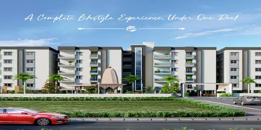
Luckie Township Phase-II
SWATHI PROMOTERS PRIVATE LIMITED · Rangareddy · RERA P02400003780
Luckie Township Phase-II is a residential plotted development in Kothur, Kothur Mandal, Ranga Reddy District, developed by the registered promoter SWATHI PROMOTERS PRIVATE LIMITED. The registered site extent is 46639.45 sq.m, and the development is a residential open-plot layout; the supplied records do not disclose a plot count or plot-size configurations. The project is registered with TG-RERA under **P02400003780**, with proposed completion by **31/07/2024**.
More from Swathi Promoters Pvt Ltd · 12 projects →
01What we found
Read from TG-RERA filings, approvals, land and registration records and court records. A court case is counted only when the court record states this project's survey number with its village, or names the project.
02Check before you pay
13 items to check before you pay, 5 high - from the title chain, court records and approvals, each with what to ask the builder or your advocate. An item may not be a problem with the project: records can be incomplete.
1. Project at a glance
Project identity
| Field | Record |
|---|---|
| Registered project name | Luckie Township Phase-II RERA record |
| Project type | Plotted development / residential open-plot layout RERA record |
| Phase / registered portion | Phase-II; registered as the project “Luckie Township Phase-II” RERA record |
| TG-RERA registration | P02400003780 RERA record |
| Registration validity | 20 December 2021 to 31 July 2024; the supplied certificate records no extension. Registration validity is separate from the layout’s final-layout approval and any occupancy/completion certification. Approvals record |
| Registered promoter | SWATHI PROMOTERS PRIVATE LIMITED RERA record Corporate record |
| RERA status in supplied record | The registration period ended 31 July 2024; no extension is recorded in the supplied certificate. Approvals record |
Land and geographic identity
| Field | Record |
|---|---|
| Locality / revenue village | Kothur; the approval documents identify Kothur(Kothur) Village. RERA record |
| Mandal / district / PIN | Kothur Mandal, Ranga Reddy District, PIN 509228. RERA record RERA filing |
| Project survey number as filed | 212/P RERA record RERA filing |
| Survey notation in layout approvals | Sy.No. 212/PART (draft and final layout records). |
| Cadastral record | Survey 212/P, subdivision P; the Bhu Bharati GIS entry reports a whole-survey extent of 51663.55 sq.m. This is a cadastral record, not the registered layout extent. Cadastral map |
| Registered site extent | 46639.45 sq.m RERA filing |
| Net / total site area in layout record | Total site area 46639.45 sq.m; net site area 46639.45 sq.m; master-plan road affected area 0. |
| Boundaries in RERA filing | East: OTHERS LAND; West: OTHERS LAND; North: Existing Layout; South: OTHERS LAND. RERA filing |
Development identity
| Field | Record |
|---|---|
| Sanctioning authority | Hyderabad Metropolitan Development Authority (HMDA). Approvals record |
| Principal layout permit | 000284/LO/Plg/HMDA/2021, dated 31 July 2021; the RERA filing also lists 000284/LO/Plg/HMDA/2 as the plan approval number. Approvals record RERA filing |
| Final-layout record | Final Layout Permit 000284/LO/Plg/HMDA/2021, dated 03 January 2023. |
| Approved built-up area | 30380.4 sq.m is recorded as approved built-up area in the RERA filing. For this plotted layout, the supplied layout area statement separately identifies 30380.4 sq.m as plotted area. RERA filing Layout record |
| Building / floor configuration | Not disclosed in the supplied project records; the approval is for a plotted layout, not a multi-storey building scheme. Individual building permissions are to be considered separately under the final-layout conditions. |
| Plot and layout arrangement | The layout drawing area statement identifies plots, roads, parks/open space and social infrastructure; plot-level count and sizes are not fully available in the supplied drawing-derived data. Layout record |
| Authority-mortgaged plots | Plots 129 to 158, extent 4735.32 sq.m, recorded as mortgaged to the Metropolitan Commissioner, HMDA in the draft layout record. |
Offering and status
| Field | Record |
|---|---|
| Offered product | Residential plots; plot-wise RERA inventory, booked/available counts, and RERA-filed saleable-area schedule are not supplied here. RERA record RERA unit table |
| Plot-size range | Not established by the supplied TG-RERA inventory or drawing extraction. The vendor record advertises “saleable 810 - 9000 sq.ft”; this is a promoter-marketing/third-party listing detail, not a TG-RERA-filed plot-size schedule. Promoter website |
| Construction / development stage | The RERA-filed architect’s certificate dated 19 April 2024 reports percentage work completed, but the supplied extraction does not provide the numerical percentages. The amenities record gives item-level percentages, which are reported as declarations below. These are not independent site-verification findings. RERA amenities |
| Completion deadline | The RERA registration record states proposed completion by 31/07/2024. RERA record RERA filing |
| Occupancy / completion record | The supplied HMDA final-layout letter is dated 03 January 2023. A separate architect’s certificate dated 30-09-2023 identifies an HMDA occupancy-certificate number, 057076/LT/SMD/FLT/U6/HMDA/29092 022, dated 03-01-2023. The supplied material does not specify a separate tower or building scope; the project is a plotted layout. |
2. The project story
Luckie Township Phase-II is recorded with TG-RERA as a residential plotted development in Kothur village, Kothur Mandal, Ranga Reddy District. The HMDA layout documents describe an open-plot layout on survey 212/PART and record a site area of 46639.45 sq.m. The RERA filing identifies the project survey as 212/P. RERA record RERA filing
The project’s principal development is the subdivision and servicing of land for residential plots rather than construction of a project-wide apartment or villa building. HMDA’s draft layout letter identifies roads, open space, parks, social infrastructure and utility/development works. The final-layout letter records that roads and open spaces were taken over by the local authority through registered gift deed 7353/2022; it also records a relinquishment deed concerning the mortgaged plots, 8861/2022.
The RERA registration certificate sets 31 July 2024 as the project completion date. An architect’s certificate dated 19 April 2024 reports percentage completion for the registered phase, but its numerical progress figures are not present in the supplied extraction. Separately, the RERA-filed amenities record reports item-level progress percentages; these remain reported figures, not independent verification of conditions on site. RERA amenities
3. Master plan, architecture & building design
The HMDA layout area statement records a total and net site area of 46639.45 sq.m, with 0 master-plan road affected area. Its land-use figures are: 30380.4 sq.m plotted area, 11130.45 sq.m layout road area, 3960.51 sq.m park area, 1168.02 sq.m social infrastructure area, and 0 amenities area. The drawing-derived layout summary groups the 3960.51 sq.m as parks/open space and reports the 1168.02 sq.m as social infrastructure. Layout record
The layout is subject to HMDA conditions for road formation, storm-water drainage, underground drainage and common septic tank/STP, internal water supply and overhead tank, electrical lines and street lights, avenue planting, park development and rainwater-harvesting pits. The draft letter also specifies that the roads are to remain open for access to neighbouring sites and identifies road widths of 18 mts and above and 60 feet and above. These are approval conditions, not confirmation that every work is complete.
The supplied layout sheets have not yielded a complete plot-by-plot schedule: the drawing-derived record says plot data are incomplete and no plot sizes were extracted. The project evidence does not provide building footprints, individual plot dimensions, or a building/floor plan schedule. Layout record Floor plans
4. Homes, configurations & floor plans
This is a plotted layout, so the relevant product is individual residential plots rather than apartment configurations. A RERA-filed plot inventory table with plot count, plot sizes, booked plots, available plots or saleable areas is not present in the supplied data. RERA record RERA unit table
| Configuration | Units | Booked | Available | RERA saleable area | Measured carpet area | Loading (if supplied) |
|---|---|---|---|---|---|---|
| Residential plots | Not disclosed in supplied inventory | Not disclosed | Not disclosed | Not disclosed | Not applicable | Not supplied |
The layout drawing extraction reports plots complete: false, plots with size: 0; accordingly, plot count and size bands cannot be reliably presented from the supplied drawing data. The floor-plan set contains two layout sheets and no dwelling floor plans were measured. Layout record Floor plans
5. Parking & vehicle circulation
The supplied records do not state a sanctioned car-parking or two-wheeler-parking count, visitor or accessible parking provision, or plot-wise parking allocation. Because this is a plotted development, no building parking levels or parking-to-home ratio can be established from the available evidence.
For vehicle circulation, the layout record identifies internal roads and says roads must remain open for access to neighbouring sites. The draft approval conditions call for development of roads and prohibit a compound wall/fencing that would obstruct access; the supplied evidence does not establish completed road works or a separate pedestrian-only network.
6. Amenities, recreation & open spaces
The facilities below are drawn from the HMDA layout conditions and RERA-filed amenities progress record. The percentages are recorded reports; they do not independently verify completion.
| Description / size | Park area 3960.51 sq.m; layout drawing also labels organized open space/park/utility area 3960.51 sq.m. |
|---|---|
| Evidence source | Layout record |
| Declared progress / verified status | Amenities record: Green Strip/TOT LOT/Park 100%; not independently verified. RERA amenities |
| Description / size | Area or building details not supplied. |
|---|---|
| Evidence source | RERA amenities |
| Declared progress / verified status | Amenities record: 0%; not independently verified. RERA amenities |
| Description / size | 1168.02 sq.m in the HMDA layout area statement. |
|---|---|
| Evidence source | Layout record |
| Declared progress / verified status | No separate progress percentage supplied for this land-use component. |
| Description / size | Required by the HMDA draft layout conditions; no size or route plan supplied. |
|---|---|
| Declared progress / verified status | Completion status not established. |
| Description / size | Third-party/vendor listing mentions “Club House”; no size or sanctioned project-document detail supplied. |
|---|---|
| Evidence source | Promoter website |
| Declared progress / verified status | Marketing/listing claim; not established as sanctioned or delivered. |
| Description / size | Third-party/vendor listing names this facility; no size or layout drawing detail supplied. |
|---|---|
| Evidence source | Promoter website |
| Declared progress / verified status | Marketing/listing claim; not established as sanctioned or delivered. |
| Description / size | Vendor listing mentions flower gardens; HMDA conditions require avenue planting and greenery. No area or planting schedule supplied. |
|---|---|
| Evidence source | Promoter website |
| Declared progress / verified status | Amenities record reports landscaping/tree planting at 100%; not independently verified. |
| Description / size | Third-party/vendor listing names visitor parking; no count or location supplied in the project records. |
|---|---|
| Evidence source | Promoter website |
| Declared progress / verified status | Marketing/listing claim; not established as sanctioned or delivered. |
7. Utilities, building services & safety
HMDA’s draft layout conditions identify proposed infrastructure including internal water-supply pipelines and an overhead tank, an assured water-supply source, underground drainage with a common septic tank/STP, underground storm-water drainage, electrical supply lines, a transformer, street lighting, rainwater-harvesting pits, underground utility ducting and a solid-waste disposal area with a bio-compost unit. These describe approval requirements; they do not, by themselves, establish installation or operational status.
The RERA-filed architect’s certificate dated 19 April 2024 lists internal roads and footpaths, water supply, sewerage, storm-water drains, landscaping, street lighting, sewage treatment/disposal, solid-waste management, rainwater harvesting, energy management, fire protection, and an electrical meter room/sub-station/receiving station among the development works. It is a work-progress certificate, not an independent statutory-compliance finding.
The amenities record reports water supply at 90%, sewerage, storm-water drains and water conservation/rainwater harvesting at 100%, and street lighting and electrical meter room/sub-station/receiving station at 0%. It also records 0% for treatment and disposal of sewage and sullage water, solid-waste management and disposal, energy management, and fire protection/fire-safety requirements. These are recorded progress figures, not independently verified completion statuses. RERA amenities
The supplied project material does not specify water-storage capacities, STP capacity, electrical-load capacity, backup-generation provision, fire-system specifications, accessibility arrangements, CCTV/security systems, or lift provision. The vendor listing mentions power backup, water storage and 24×7 security, but the supplied approval and RERA project records do not establish their scope or delivery. Promoter website Document index
8. Location, access & connectivity
The registered project location is Kothur village, Kothur Mandal, Ranga Reddy District, Telangana, PIN 509228. The RERA filing records the site as survey 212/P, and HMDA’s layout letters identify 212/PART in Kothur(Kothur) Village. RERA record RERA filing
The layout approval requires internal roads to remain open for public and neighbouring-site access. The supplied location record identifies the nearest sampled Outer Ring Road interchange at approximately 17.1 km. No public-transport stop distances or other independently measured landmark distances are provided. Location record
9. Developer & development status
The registered legal promoter is SWATHI PROMOTERS PRIVATE LIMITED, a private limited company. The supplied corporate record gives GSTIN 36AAJCS9335A1ZC. The RERA filing lists its address as SVSS NIVAS, CZECH COLONY, KOTHUR, KOTHUR, Kothur, Ranga Reddy, 509228; the registration certificate also contains a promoter-office entry in Ameerpet, Hyderabad, PIN 500018. RERA record Corporate record Parties record
The RERA registration identifies the project as Luckie Township Phase-II, registration P02400003780, with proposed completion by 31/07/2024 and registration validity ending on that date. No extension is recorded on the supplied certificate. The 19 April 2024 architect’s certificate reports project-work percentages, but the extracted record does not include the numerical values. RERA record
The Form B declaration names M. Radesh Reddy as a director representing SWATHI PROMOTERS (P) LTD.; its extracted declaration date and completion undertaking are not legible enough to report as dates.
10. Approvals, official records & documents
| Identifier / date | P02400003780; issued 20/12/2021; valid to 31/07/2024 |
|---|---|
| What the supplied record establishes | Registration for Luckie Township Phase-II; no extension recorded in the supplied certificate. |
| Identifier / date | 000284/LO/Plg/HMDA/2021; 31 July 2021 |
|---|---|
| What the supplied record establishes | Draft open-plot layout approval for survey 212/PART, Kothur(Kothur) Village; includes development conditions and records plots 129–158 mortgaged to HMDA. |
| Identifier / date | Final Layout Permit 000284/LO/Plg/HMDA/2021; 03 January 2023 |
|---|---|
| What the supplied record establishes | Final residential open-plot layout record for 46,639.45 sq.m in survey 212/PART; records roads/open spaces gifted to the local authority and a relinquishment deed concerning mortgaged plots. |
| Identifier / date | 19-04-2024; TG-RERA P02400003780 |
|---|---|
| What the supplied record establishes | Reports percentage work completed for the registered phase and lists development works; the supplied extraction does not include numerical completion percentages. |
| Identifier / date | 30-09-2023; OC number 057076/LT/SMD/FLT/U6/HMDA/29092 022, dated 03-01-2023 |
|---|---|
| What the supplied record establishes | The certificate identifies an HMDA occupancy-certificate number. The supplied extraction does not state a separate building/tower scope. |
| Identifier / date | Document 183897 |
|---|---|
| What the supplied record establishes | Two layout sheets are identified; drawing-derived plot data are incomplete and no plot sizes were extracted. Layout record Document index |
| Identifier / date | Document 183900 |
|---|---|
| What the supplied record establishes | Promoter declaration concerning title, encumbrances and statutory undertakings; the extracted declaration/completion dates are not legible. |
| Identifier / date | Document 437755 |
|---|---|
| What the supplied record establishes | Architect’s progress certificate for internal and external development works, including roads, utilities and safety-related items. |
1. Project at a glance
Project identity
Registered project name: Luckie Township Phase-II
Project type: Plotted development / residential open-plot layout
Phase / registered portion: Phase-II; registered as the project “Luckie Township Phase-II”
TG-RERA registration: P02400003780
Registration validity: 20 December 2021 to 31 July 2024; the supplied certificate records no extension. Registration validity is separate from the layout’s final-layout approval and any occupancy/completion certification.
Registered promoter: SWATHI PROMOTERS PRIVATE LIMITED
RERA status in supplied record: The registration period ended 31 July 2024; no extension is recorded in the supplied certificate.
Land and geographic identity
Locality / revenue village: Kothur; the approval documents identify Kothur(Kothur) Village.
Mandal / district / PIN: Kothur Mandal, Ranga Reddy District, PIN 509228.
Project survey number as filed: 212/P
Survey notation in layout approvals: Sy.No. 212/PART (draft and final layout records).
Cadastral record: Survey 212/P, subdivision P; the Bhu Bharati GIS entry reports a whole-survey extent of 51663.55 sq.m. This is a cadastral record, not the registered layout extent.
Registered site extent: 46639.45 sq.m
Net / total site area in layout record: Total site area 46639.45 sq.m; net site area 46639.45 sq.m; master-plan road affected area 0.
Boundaries in RERA filing: East: OTHERS LAND; West: OTHERS LAND; North: Existing Layout; South: OTHERS LAND.
Development identity
Sanctioning authority: Hyderabad Metropolitan Development Authority (HMDA).
Principal layout permit: 000284/LO/Plg/HMDA/2021, dated 31 July 2021; the RERA filing also lists 000284/LO/Plg/HMDA/2 as the plan approval number.
Final-layout record: Final Layout Permit 000284/LO/Plg/HMDA/2021, dated 03 January 2023.
Approved built-up area: 30380.4 sq.m is recorded as approved built-up area in the RERA filing. For this plotted layout, the supplied layout area statement separately identifies 30380.4 sq.m as plotted area.
Building / floor configuration: Not disclosed in the supplied project records; the approval is for a plotted layout, not a multi-storey building scheme. Individual building permissions are to be considered separately under the final-layout conditions.
Plot and layout arrangement: The layout drawing area statement identifies plots, roads, parks/open space and social infrastructure; plot-level count and sizes are not fully available in the supplied drawing-derived data.
Authority-mortgaged plots: Plots 129 to 158, extent 4735.32 sq.m, recorded as mortgaged to the Metropolitan Commissioner, HMDA in the draft layout record.
Offering and status
Offered product: Residential plots; plot-wise RERA inventory, booked/available counts, and RERA-filed saleable-area schedule are not supplied here.
Plot-size range: Not established by the supplied TG-RERA inventory or drawing extraction. The vendor record advertises “saleable 810 - 9000 sq.ft”; this is a promoter-marketing/third-party listing detail, not a TG-RERA-filed plot-size schedule.
Construction / development stage: The RERA-filed architect’s certificate dated 19 April 2024 reports percentage work completed, but the supplied extraction does not provide the numerical percentages. The amenities record gives item-level percentages, which are reported as declarations below. These are not independent site-verification findings.
Completion deadline: The RERA registration record states proposed completion by 31/07/2024.
Occupancy / completion record: The supplied HMDA final-layout letter is dated 03 January 2023. A separate architect’s certificate dated 30-09-2023 identifies an HMDA occupancy-certificate number, 057076/LT/SMD/FLT/U6/HMDA/29092 022, dated 03-01-2023. The supplied material does not specify a separate tower or building scope; the project is a plotted layout.
2. The project story
Luckie Township Phase-II is recorded with TG-RERA as a residential plotted development in Kothur village, Kothur Mandal, Ranga Reddy District. The HMDA layout documents describe an open-plot layout on survey 212/PART and record a site area of 46639.45 sq.m. The RERA filing identifies the project survey as 212/P.
The project’s principal development is the subdivision and servicing of land for residential plots rather than construction of a project-wide apartment or villa building. HMDA’s draft layout letter identifies roads, open space, parks, social infrastructure and utility/development works. The final-layout letter records that roads and open spaces were taken over by the local authority through registered gift deed 7353/2022; it also records a relinquishment deed concerning the mortgaged plots, 8861/2022.
The RERA registration certificate sets 31 July 2024 as the project completion date. An architect’s certificate dated 19 April 2024 reports percentage completion for the registered phase, but its numerical progress figures are not present in the supplied extraction. Separately, the RERA-filed amenities record reports item-level progress percentages; these remain reported figures, not independent verification of conditions on site.
3. Master plan, architecture & building design
The HMDA layout area statement records a total and net site area of 46639.45 sq.m, with 0 master-plan road affected area. Its land-use figures are: 30380.4 sq.m plotted area, 11130.45 sq.m layout road area, 3960.51 sq.m park area, 1168.02 sq.m social infrastructure area, and 0 amenities area. The drawing-derived layout summary groups the 3960.51 sq.m as parks/open space and reports the 1168.02 sq.m as social infrastructure.
The layout is subject to HMDA conditions for road formation, storm-water drainage, underground drainage and common septic tank/STP, internal water supply and overhead tank, electrical lines and street lights, avenue planting, park development and rainwater-harvesting pits. The draft letter also specifies that the roads are to remain open for access to neighbouring sites and identifies road widths of 18 mts and above and 60 feet and above. These are approval conditions, not confirmation that every work is complete.
The supplied layout sheets have not yielded a complete plot-by-plot schedule: the drawing-derived record says plot data are incomplete and no plot sizes were extracted. The project evidence does not provide building footprints, individual plot dimensions, or a building/floor plan schedule.
4. Homes, configurations & floor plans
This is a plotted layout, so the relevant product is individual residential plots rather than apartment configurations. A RERA-filed plot inventory table with plot count, plot sizes, booked plots, available plots or saleable areas is not present in the supplied data.
| Configuration | Units | Booked | Available | RERA saleable area | Measured carpet area | Loading (if supplied) |
|---|---|---|---|---|---|---|
| Residential plots | Not disclosed in supplied inventory | Not disclosed | Not disclosed | Not disclosed | Not applicable | Not supplied |
The layout drawing extraction reports plots complete: false, plots with size: 0; accordingly, plot count and size bands cannot be reliably presented from the supplied drawing data. The floor-plan set contains two layout sheets and no dwelling floor plans were measured.
5. Parking & vehicle circulation
The supplied records do not state a sanctioned car-parking or two-wheeler-parking count, visitor or accessible parking provision, or plot-wise parking allocation. Because this is a plotted development, no building parking levels or parking-to-home ratio can be established from the available evidence.
For vehicle circulation, the layout record identifies internal roads and says roads must remain open for access to neighbouring sites. The draft approval conditions call for development of roads and prohibit a compound wall/fencing that would obstruct access; the supplied evidence does not establish completed road works or a separate pedestrian-only network.
6. Amenities, recreation & open spaces
The facilities below are drawn from the HMDA layout conditions and RERA-filed amenities progress record. The percentages are recorded reports; they do not independently verify completion.
| Description / size | Park area 3960.51 sq.m; layout drawing also labels organized open space/park/utility area 3960.51 sq.m. |
|---|---|
| Declared progress / verified status | Amenities record: Green Strip/TOT LOT/Park 100%; not independently verified. |
| Description / size | Area or building details not supplied. |
|---|---|
| Declared progress / verified status | Amenities record: 0%; not independently verified. |
| Description / size | 1168.02 sq.m in the HMDA layout area statement. |
|---|---|
| Declared progress / verified status | No separate progress percentage supplied for this land-use component. |
| Description / size | Required by the HMDA draft layout conditions; no size or route plan supplied. |
|---|---|
| Declared progress / verified status | Completion status not established. |
| Description / size | Third-party/vendor listing mentions “Club House”; no size or sanctioned project-document detail supplied. |
|---|---|
| Declared progress / verified status | Marketing/listing claim; not established as sanctioned or delivered. |
| Description / size | Third-party/vendor listing names this facility; no size or layout drawing detail supplied. |
|---|---|
| Declared progress / verified status | Marketing/listing claim; not established as sanctioned or delivered. |
| Description / size | Vendor listing mentions flower gardens; HMDA conditions require avenue planting and greenery. No area or planting schedule supplied. |
|---|---|
| Declared progress / verified status | Amenities record reports landscaping/tree planting at 100%; not independently verified. |
| Description / size | Third-party/vendor listing names visitor parking; no count or location supplied in the project records. |
|---|---|
| Declared progress / verified status | Marketing/listing claim; not established as sanctioned or delivered. |
7. Utilities, building services & safety
HMDA’s draft layout conditions identify proposed infrastructure including internal water-supply pipelines and an overhead tank, an assured water-supply source, underground drainage with a common septic tank/STP, underground storm-water drainage, electrical supply lines, a transformer, street lighting, rainwater-harvesting pits, underground utility ducting and a solid-waste disposal area with a bio-compost unit. These describe approval requirements; they do not, by themselves, establish installation or operational status.
The RERA-filed architect’s certificate dated 19 April 2024 lists internal roads and footpaths, water supply, sewerage, storm-water drains, landscaping, street lighting, sewage treatment/disposal, solid-waste management, rainwater harvesting, energy management, fire protection, and an electrical meter room/sub-station/receiving station among the development works. It is a work-progress certificate, not an independent statutory-compliance finding.
The amenities record reports water supply at 90%, sewerage, storm-water drains and water conservation/rainwater harvesting at 100%, and street lighting and electrical meter room/sub-station/receiving station at 0%. It also records 0% for treatment and disposal of sewage and sullage water, solid-waste management and disposal, energy management, and fire protection/fire-safety requirements. These are recorded progress figures, not independently verified completion statuses.
The supplied project material does not specify water-storage capacities, STP capacity, electrical-load capacity, backup-generation provision, fire-system specifications, accessibility arrangements, CCTV/security systems, or lift provision. The vendor listing mentions power backup, water storage and 24×7 security, but the supplied approval and RERA project records do not establish their scope or delivery.
8. Location, access & connectivity
The registered project location is Kothur village, Kothur Mandal, Ranga Reddy District, Telangana, PIN 509228. The RERA filing records the site as survey 212/P, and HMDA’s layout letters identify 212/PART in Kothur(Kothur) Village.
The layout approval requires internal roads to remain open for public and neighbouring-site access. The supplied location record identifies the nearest sampled Outer Ring Road interchange at approximately 17.1 km. No public-transport stop distances or other independently measured landmark distances are provided.
9. Developer & development status
The registered legal promoter is SWATHI PROMOTERS PRIVATE LIMITED, a private limited company. The supplied corporate record gives GSTIN 36AAJCS9335A1ZC. The RERA filing lists its address as SVSS NIVAS, CZECH COLONY, KOTHUR, KOTHUR, Kothur, Ranga Reddy, 509228; the registration certificate also contains a promoter-office entry in Ameerpet, Hyderabad, PIN 500018.
The RERA registration identifies the project as Luckie Township Phase-II, registration P02400003780, with proposed completion by 31/07/2024 and registration validity ending on that date. No extension is recorded on the supplied certificate. The 19 April 2024 architect’s certificate reports project-work percentages, but the extracted record does not include the numerical values.
The Form B declaration names M. Radesh Reddy as a director representing SWATHI PROMOTERS (P) LTD.; its extracted declaration date and completion undertaking are not legible enough to report as dates.
10. Approvals, official records & documents
| Identifier / date | P02400003780; issued 20/12/2021; valid to 31/07/2024 |
|---|---|
| What the supplied record establishes | Registration for Luckie Township Phase-II; no extension recorded in the supplied certificate. |
| Identifier / date | 000284/LO/Plg/HMDA/2021; 31 July 2021 |
|---|---|
| What the supplied record establishes | Draft open-plot layout approval for survey 212/PART, Kothur(Kothur) Village; includes development conditions and records plots 129–158 mortgaged to HMDA. |
| Identifier / date | Final Layout Permit 000284/LO/Plg/HMDA/2021; 03 January 2023 |
|---|---|
| What the supplied record establishes | Final residential open-plot layout record for 46,639.45 sq.m in survey 212/PART; records roads/open spaces gifted to the local authority and a relinquishment deed concerning mortgaged plots. |
| Identifier / date | 19-04-2024; TG-RERA P02400003780 |
|---|---|
| What the supplied record establishes | Reports percentage work completed for the registered phase and lists development works; the supplied extraction does not include numerical completion percentages. |
| Identifier / date | 30-09-2023; OC number 057076/LT/SMD/FLT/U6/HMDA/29092 022, dated 03-01-2023 |
|---|---|
| What the supplied record establishes | The certificate identifies an HMDA occupancy-certificate number. The supplied extraction does not state a separate building/tower scope. |
| Identifier / date | Document 183897 |
|---|---|
| What the supplied record establishes | Two layout sheets are identified; drawing-derived plot data are incomplete and no plot sizes were extracted. |
| Identifier / date | Document 183900 |
|---|---|
| What the supplied record establishes | Promoter declaration concerning title, encumbrances and statutory undertakings; the extracted declaration/completion dates are not legible. |
| Identifier / date | Document 437755 |
|---|---|
| What the supplied record establishes | Architect’s progress certificate for internal and external development works, including roads, utilities and safety-related items. |
Other registrations of Luckie Township
Frequently asked questions
Is Luckie Township Phase-II registered with Telangana RERA?
Yes. Luckie Township Phase-II is registered with the Telangana Real Estate Regulatory Authority as P02400003780; the registration status is New Project.
Who is the developer of Luckie Township Phase-II?
The promoter named in the RERA registration is SWATHI PROMOTERS PRIVATE LIMITED.
Where is Luckie Township Phase-II located?
Luckie Township Phase-II is in KOTHUR, Rangareddy, Telangana (509228).
When will Luckie Township Phase-II be completed?
The promoter's proposed date of completion filed with RERA is 31/07/2024. This is the promoter's declaration, not a guarantee.
More projects in Kothur