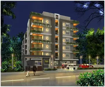
Prime Town
MARGASHREE VENTURES · Rangareddy · RERA P02400001373
PRIME TOWN is a plotted development in Guntapalle, Abdullapurmet mandal, Ranga Reddy district, developed by registered promoter MARGASHREE VENTURES. The registered site extent is 42,925.05 sq.m, with a net area of 36,194.46 sq.m; no towers, blocks, floors, complete plot count or plot-size schedule are stated in the supplied records. The offering is plots. TG-RERA registration is P02400001373, and the declared completion date is 19/08/2022.
01What we found
Read from TG-RERA filings, approvals, land and registration records and court records. A court case is counted only when the court record states this project's survey number with its village, or names the project.
02Check before you pay
10 items to check before you pay, 3 high - from the title chain, court records and approvals, each with what to ask the builder or your advocate. An item may not be a problem with the project: records can be incomplete.
1. Project at a glance
Project identity
| Item | Record |
|---|---|
| Registered project name | PRIME TOWN RERA record |
| Project type | Plotted development / open-plot layout RERA record |
| Phase or registered portion | Not separately identified; registration is for the project land in Survey Nos. 220, 221, 222, 223, 226 and 227 |
| TG-RERA registration | P02400001373 RERA record |
| Registration validity | 11/11/2019 to 19/08/2022; the certificate states a period of 2 years. No extension is recorded in the supplied certificate. This is the registration period, not a statement of completion or occupancy status. RERA record |
| Registered promoter | MARGASHREE VENTURES RERA record |
| RERA status | New Project in the supplied project record; registration certificate confirms registration under section 5. Current registration status after 19/08/2022 is not established by the supplied certificate. RERA record |
Land and geographic identity
| Item | Record |
|---|---|
| Locality / revenue village | Guntapalle (also rendered “GUNTHAPALLY” or “Gunthapali” in filed documents) RERA record |
| Mandal / district / PIN | Abdullapurmet, Ranga Reddy, 501512 RERA record |
| Project survey numbers | Survey Nos. 220, 221, 222, 223, 226 and 227 RERA record |
| Subdivisions | The project filing names the parent survey numbers and does not specify which subdivisions comprise the project. Bhu Bharati records show subdivisions for Survey Nos. 220–223, 226 and 227; the supplied records do not map those subdivisions to the project land. RERA record Land records |
| Registered site extent | 42,925.05 sq.m total area; 6,730.59 sq.m identified as affected by road widening/FTL/Nala widening; net area 36,194.46 sq.m RERA filing |
| Layout extent in HMDA draft letter | 36,194.46 sq.m |
| Boundaries | North: neighbours’ land; South: road; East: neighbours’ land; West: neighbours’ land RERA filing |
Development identity
| Item | Record |
|---|---|
| Sanctioning authority | Hyderabad Metropolitan Development Authority (HMDA) |
| Principal layout approval | Draft Layout Permit No. 000252/LO/Plg/HMDA/2019, dated 21 August 2019 |
| RERA-filed plan approval number | 000252/LO/PLG/HMDA/2 RERA record |
| Approved built-up area | 22,785.25 sq.m, as recorded in the project filing; the supplied material does not identify a building or floor configuration for this plotted layout RERA filing |
| Buildings / floors | No building, tower, floor or apartment configuration is established in the supplied project records. HMDA’s draft letter says the applicant shall not construct buildings in the plots. |
| Layout land-use allocation | Plotted area: 22,785.25 sq.m; roads: 9,031.78 sq.m; parks/open space including utility area: 3,453.34 sq.m; social infrastructure: 923.90 sq.m; amenities: 0.00 sq.m, as software-read from the approved layout drawing. Layout record |
| Plot count and sizes | The supplied layout extraction does not provide a complete plot count or plot-size schedule. Layout record |
Offering and status
| Item | Record |
|---|---|
| Offering | Plots; plot numbers, plot-size bands and plot-level availability are not established by the supplied RERA data. RERA record Layout record |
| Booked / available counts | Not disclosed in the supplied evidence. RERA filing |
| Declared completion date | 19/08/2022 in the project record; this is the declared project completion date, separate from registration validity. RERA record |
| Construction / development stage | Project record reports 80% completeness; the supplied material does not specify the measurement date, work items included or independent site verification. RERA record |
| Occupancy / completion certificate | No project completion certificate or occupancy certificate is supplied. The project is a plotted layout; final HMDA layout release is a separate matter. Document index |
2. The project story
PRIME TOWN is recorded with TG-RERA as a plotted development in Guntapalle, Abdullapurmet mandal, Ranga Reddy district. The registered land identity covers Survey Nos. 220, 221, 222, 223, 226 and 227. The RERA certificate identifies the project and promoter, while the HMDA-filed draft layout letter describes an open-plot layout with a net layout extent of 36,194.46 sq.m. RERA record
The layout record allocates land to plots, roads, open space and social infrastructure. HMDA’s draft letter sets out development and handover conditions before final layout release, including roads, open space and social infrastructure. It also states that buildings are not to be constructed in the plots under this permission. Accordingly, the supplied evidence supports describing a plotted layout, not a project of RERA-registered apartment buildings. Layout record
The project record reports 80% completeness, but does not provide a dated, independently verified site inspection or a work-by-work progress statement. The declared completion date is 19/08/2022; no completion certificate or occupancy certificate is included in the evidence supplied for this Overview. RERA record Document index
3. Master plan, architecture & building design
The filed HMDA draft layout letter identifies a 36,194.46 sq.m layout in Survey Nos. 220, 221, 222, 223, 226 and 227, Guntapalle. It gives a draft layout permit number of 000252/LO/Plg/HMDA/2019 and specifies road widths of 45 mtrs and 18 mts. The material describes a plotted layout; it does not establish apartment blocks, building footprints, floors, lifts or tower heights.
The layout drawing extraction reports the following land-use areas, read by software from the drawing; these are not independently surveyed measurements:
| Layout component | Area | Share of net layout area | Evidence |
|---|---|---|---|
| Plots | 22,785.25 sq.m | 63.0% | Software-read from layout drawing Layout record |
| Roads | 9,031.78 sq.m | 25.0% | Software-read from layout drawing Layout record; HMDA draft letter also records 9,031.78 Sq.mtrs |
| Parks / open space, including utility area | 3,453.34 sq.m | 9.5% | Software-read from layout drawing Layout record; HMDA draft letter records 3,453.34 Sq.mtrs |
| Social infrastructure | 923.90 sq.m | 2.6% | Software-read from layout drawing Layout record; HMDA draft letter records 923.90 Sq.mtrs |
| Amenities | 0.00 sq.m | 0.0% | Software-read from layout drawing Layout record |
The project filing separately records approved built-up area of 22,785.25 sq.m. The supplied evidence does not state that this figure is FSI-counted area, gross built-up area, or plot saleable area; it is therefore retained as the filing’s “Approved Built up Area” figure. RERA filing
The HMDA draft letter identifies a proposed 45 mtrs master-plan road-affected area of 6,730.59 sq.m and requires development works and handover of designated roads, open space and social infrastructure before final layout release. The drawing-derived plot count and plot sizes are incomplete, so plot arrangement and size bands cannot be fully described here. Layout record
4. Homes, configurations & floor plans
This is a plotted project. The supplied evidence does not contain RERA unit-type counts, booked/available plot counts, plot-size bands or a complete plot schedule. The one drawing record is a layout sheet with no measured plot areas; no apartment floor plan or software-measured carpet-area data is available. RERA record Layout record Floor plans
The RERA certificate lists the survey numbers but does not supply a unit-by-unit inventory in the evidence provided. The filed HMDA draft letter identifies plots reserved as mortgage security, but that reservation information does not establish which plots are available for sale.
5. Parking & vehicle circulation
No project-wide parking-space count, visitor parking allocation, accessible parking provision, mechanical parking or plot-specific parking allocation is established in the supplied evidence. This is a plotted layout, and the drawing extraction reports 9,031.78 sq.m of roads; HMDA’s draft letter also refers to road widths of 45 mtrs and 18 mts and requires roads to be opened for access to neighbouring sites. The material does not specify driveway geometry, pedestrian separation or parking arrangements for individual plots. Layout record
6. Amenities, recreation & open spaces
The project documents identify layout-level open space, social infrastructure and utility-related provisions. The project’s RERA amenity register includes progress percentages, which are presented as recorded declarations and are not independent verification of completion.
| Description / size | Internal roads and footpaths; no further dimensions in the amenity entry |
|---|---|
| Evidence source | RERA amenities; HMDA draft letter |
| Declared progress / verified status | 60% in the amenity register; not independently verified RERA amenities |
| Description / size | Layout open-space area, including utility area: 3,453.34 sq.m in the HMDA draft letter |
|---|---|
| Evidence source | RERA amenities |
| Declared progress / verified status | 0% in the amenity register; not independently verified RERA amenities |
| Description / size | Aggregate area of recreational open space; area not separately stated in this register |
|---|---|
| Evidence source | RERA amenities |
| Declared progress / verified status | 30% in the amenity register; not independently verified RERA amenities |
| Description / size | Social infrastructure area: 923.90 sq.m in the HMDA draft letter |
|---|---|
| Evidence source | RERA amenities |
| Declared progress / verified status | Community buildings recorded at 0%; not independently verified RERA amenities |
| Description / size | Listed among the HMDA draft letter’s amenities/utilities; no size or quantity supplied |
|---|---|
| Declared progress / verified status | Progress not stated in the supplied record |
| Description / size | Listed among the HMDA draft letter’s amenities/utilities; no size or quantity supplied |
|---|---|
| Declared progress / verified status | Progress not stated in the supplied record |
The RERA amenity register also records water conservation/rainwater harvesting at 0% progress. The HMDA draft letter lists rain water harvesting pits and avenue plantation among the planned layout provisions; the supplied evidence does not establish their completion. RERA amenities
7. Utilities, building services & safety
The HMDA draft layout letter lists layout-level service provisions including internal water-supply pipelines, an overhead tank, a transformer, rain water harvesting pits, storm-water drains, underground drainage lines, street lights, solid-waste provision, a bio-compost unit and a common septic tank / STP. It also requires arrangements for potable-water connectivity, a transformer yard in the area earmarked for utilities, and space for solid-waste disposal. These are listed provisions in the draft permission, not confirmation that each facility has been installed or is operational.
The project amenity register records water supply at 50% and sewerage (chamber, lines, septic tank, STP) at 80%. It records storm-water drains, treatment/disposal of sewage and sullage water, solid-waste management, energy management, fire protection and fire-safety requirements, and the electrical meter room/sub-station/receiving station at 0% progress where a percentage is shown. These figures are project-record progress entries, not independent verification. RERA amenities
The supplied evidence does not specify utility capacities, water source, storage capacity, treatment capacity, power-backup arrangements, fire-system design or clearances, CCTV/security provisions, accessibility features or building services such as lifts. RERA amenities
8. Location, access & connectivity
The recorded project location is Guntapalle, Abdullapurmet mandal, Ranga Reddy district, Telangana, PIN 501512. The filed layout letter identifies Survey Nos. 220, 221, 222, 223, 226 and 227 and states that roads are to be opened for access to neighbouring sites. RERA record
The supplied location data gives these approximate distances to sampled nearby points:
| Nearby point | Distance |
|---|---|
| Outer Ring Road (nearest sampled interchange, approx) | 7.7 km |
| HDFC Bank | 1.5 km |
| Brilliant Group of Institutions | 1.5 km |
| Urban Primary Health Centre Abdullapur | 1.1 km |
| Shiva Gardens | 1.2 km |
| ZPHS School | 0.9 km |
Location record
The evidence does not provide verified public-transport routes, travel times or a detailed approach-road description beyond the layout’s stated road widths and access condition. Location record
9. Developer & development status
The registered promoter is MARGASHREE VENTURES. The project filing identifies the entity as a partnership and names RAVI RAJU KURAPATI as authorized signatory, with RAVINDRA KUMAR MALKAJGIRI, SANDEEP KUMAR REDDY BOLLAMPALLI and SANTHOSH KUMAR ADAM as partners. RERA record RERA filing Corporate record
The RERA certificate gives a promoter office address of Saroornagar, Saroornagar mandal, Ranga Reddy district, PIN 500035; the project filing separately records a Guntapalle address. No official promoter website or contact details are supplied in the evidence used for this Overview. RERA filing
The project record reports 80% completeness and a declared completion date of 19/08/2022. The available records do not provide a dated, independently verified progress assessment, a revised completion timeline, or a completion/occupancy certificate. The RERA registration certificate states validity through 19/08/2022, which is distinct from the project’s completion deadline. RERA record
10. Approvals, official records & documents
| Record | Supplied evidence and scope |
|---|---|
| TG-RERA registration certificate | Form “C” certificate for PRIME TOWN, registration P02400001373, issued 11/11/2019; records validity to 19/08/2022 and Survey Nos. 220, 221, 222, 223, 226 and 227. |
| HMDA draft layout letter | Draft open-plot layout letter for 36,194.46 sq.m in Guntapalle, Survey Nos. 220, 221, 222, 223, 226 and 227; Layout Permit No. 000252/LO/Plg/HMDA/2019, dated 21 August 2019. |
| HMDA-filed title-related instruments | The draft letter refers to mortgage deeds 9257/2019 and 9256/2019 and gift deed 9255/2019, dated 1 August 2019; the supplied extraction identifies mortgage-security plots and the road-affected gift area. |
| Panchayat permission fragment | Document 69823 contains an OCR fragment naming Gram Panchayath Gunthapali and references AJ 23831 and 925512019, but does not provide a legible approval heading, land description or terms sufficient to establish the permission’s nature or scope. |
| Promoter Form B declaration | Affidavit-cum-declaration by KURAPATI RAVI RAJU for PRIME TOWN, dated 3 September 2019; includes promoter declarations concerning title, encumbrances, completion and project accounts. |
| Completion / occupancy certificate | No such certificate is included in the supplied evidence. Document index |
| Approved layout drawing | The supplied drawing extraction provides layout land-use figures, but plot counts and plot sizes are incomplete; the layout document itself is not text-extracted in full. Layout record Document index |
1. Project at a glance
Project identity
Registered project name: PRIME TOWN
Project type: Plotted development / open-plot layout
Phase or registered portion: Not separately identified; registration is for the project land in Survey Nos. 220, 221, 222, 223, 226 and 227
TG-RERA registration: P02400001373
Registration validity: 11/11/2019 to 19/08/2022; the certificate states a period of 2 years. No extension is recorded in the supplied certificate. This is the registration period, not a statement of completion or occupancy status.
Registered promoter: MARGASHREE VENTURES
RERA status: New Project in the supplied project record; registration certificate confirms registration under section 5. Current registration status after 19/08/2022 is not established by the supplied certificate.
Land and geographic identity
Locality / revenue village: Guntapalle (also rendered “GUNTHAPALLY” or “Gunthapali” in filed documents)
Mandal / district / PIN: Abdullapurmet, Ranga Reddy, 501512
Project survey numbers: Survey Nos. 220, 221, 222, 223, 226 and 227
Subdivisions: The project filing names the parent survey numbers and does not specify which subdivisions comprise the project. Bhu Bharati records show subdivisions for Survey Nos. 220–223, 226 and 227; the supplied records do not map those subdivisions to the project land.
Registered site extent: 42,925.05 sq.m total area; 6,730.59 sq.m identified as affected by road widening/FTL/Nala widening; net area 36,194.46 sq.m
Layout extent in HMDA draft letter: 36,194.46 sq.m
Boundaries: North: neighbours’ land; South: road; East: neighbours’ land; West: neighbours’ land
Development identity
Sanctioning authority: Hyderabad Metropolitan Development Authority (HMDA)
Principal layout approval: Draft Layout Permit No. 000252/LO/Plg/HMDA/2019, dated 21 August 2019
RERA-filed plan approval number: 000252/LO/PLG/HMDA/2
Approved built-up area: 22,785.25 sq.m, as recorded in the project filing; the supplied material does not identify a building or floor configuration for this plotted layout
Buildings / floors: No building, tower, floor or apartment configuration is established in the supplied project records. HMDA’s draft letter says the applicant shall not construct buildings in the plots.
Layout land-use allocation: Plotted area: 22,785.25 sq.m; roads: 9,031.78 sq.m; parks/open space including utility area: 3,453.34 sq.m; social infrastructure: 923.90 sq.m; amenities: 0.00 sq.m, as software-read from the approved layout drawing.
Plot count and sizes: The supplied layout extraction does not provide a complete plot count or plot-size schedule.
Offering and status
Offering: Plots; plot numbers, plot-size bands and plot-level availability are not established by the supplied RERA data.
Booked / available counts: Not disclosed in the supplied evidence.
Declared completion date: 19/08/2022 in the project record; this is the declared project completion date, separate from registration validity.
Construction / development stage: Project record reports 80% completeness; the supplied material does not specify the measurement date, work items included or independent site verification.
Occupancy / completion certificate: No project completion certificate or occupancy certificate is supplied. The project is a plotted layout; final HMDA layout release is a separate matter.
2. The project story
PRIME TOWN is recorded with TG-RERA as a plotted development in Guntapalle, Abdullapurmet mandal, Ranga Reddy district. The registered land identity covers Survey Nos. 220, 221, 222, 223, 226 and 227. The RERA certificate identifies the project and promoter, while the HMDA-filed draft layout letter describes an open-plot layout with a net layout extent of 36,194.46 sq.m.
The layout record allocates land to plots, roads, open space and social infrastructure. HMDA’s draft letter sets out development and handover conditions before final layout release, including roads, open space and social infrastructure. It also states that buildings are not to be constructed in the plots under this permission. Accordingly, the supplied evidence supports describing a plotted layout, not a project of RERA-registered apartment buildings.
The project record reports 80% completeness, but does not provide a dated, independently verified site inspection or a work-by-work progress statement. The declared completion date is 19/08/2022; no completion certificate or occupancy certificate is included in the evidence supplied for this Overview.
3. Master plan, architecture & building design
The filed HMDA draft layout letter identifies a 36,194.46 sq.m layout in Survey Nos. 220, 221, 222, 223, 226 and 227, Guntapalle. It gives a draft layout permit number of 000252/LO/Plg/HMDA/2019 and specifies road widths of 45 mtrs and 18 mts. The material describes a plotted layout; it does not establish apartment blocks, building footprints, floors, lifts or tower heights.
The layout drawing extraction reports the following land-use areas, read by software from the drawing; these are not independently surveyed measurements:
| Layout component | Area | Share of net layout area | Evidence |
|---|---|---|---|
| Plots | 22,785.25 sq.m | 63.0% | Software-read from layout drawing |
| Roads | 9,031.78 sq.m | 25.0% | Software-read from layout drawing; HMDA draft letter also records 9,031.78 Sq.mtrs |
| Parks / open space, including utility area | 3,453.34 sq.m | 9.5% | Software-read from layout drawing; HMDA draft letter records 3,453.34 Sq.mtrs |
| Social infrastructure | 923.90 sq.m | 2.6% | Software-read from layout drawing; HMDA draft letter records 923.90 Sq.mtrs |
| Amenities | 0.00 sq.m | 0.0% | Software-read from layout drawing |
The project filing separately records approved built-up area of 22,785.25 sq.m. The supplied evidence does not state that this figure is FSI-counted area, gross built-up area, or plot saleable area; it is therefore retained as the filing’s “Approved Built up Area” figure.
The HMDA draft letter identifies a proposed 45 mtrs master-plan road-affected area of 6,730.59 sq.m and requires development works and handover of designated roads, open space and social infrastructure before final layout release. The drawing-derived plot count and plot sizes are incomplete, so plot arrangement and size bands cannot be fully described here.
4. Homes, configurations & floor plans
This is a plotted project. The supplied evidence does not contain RERA unit-type counts, booked/available plot counts, plot-size bands or a complete plot schedule. The one drawing record is a layout sheet with no measured plot areas; no apartment floor plan or software-measured carpet-area data is available.
The RERA certificate lists the survey numbers but does not supply a unit-by-unit inventory in the evidence provided. The filed HMDA draft letter identifies plots reserved as mortgage security, but that reservation information does not establish which plots are available for sale.
5. Parking & vehicle circulation
No project-wide parking-space count, visitor parking allocation, accessible parking provision, mechanical parking or plot-specific parking allocation is established in the supplied evidence. This is a plotted layout, and the drawing extraction reports 9,031.78 sq.m of roads; HMDA’s draft letter also refers to road widths of 45 mtrs and 18 mts and requires roads to be opened for access to neighbouring sites. The material does not specify driveway geometry, pedestrian separation or parking arrangements for individual plots.
6. Amenities, recreation & open spaces
The project documents identify layout-level open space, social infrastructure and utility-related provisions. The project’s RERA amenity register includes progress percentages, which are presented as recorded declarations and are not independent verification of completion.
| Description / size | Internal roads and footpaths; no further dimensions in the amenity entry |
|---|---|
| Evidence source | HMDA draft letter |
| Declared progress / verified status | 60% in the amenity register; not independently verified |
| Description / size | Layout open-space area, including utility area: 3,453.34 sq.m in the HMDA draft letter |
|---|---|
| Declared progress / verified status | 0% in the amenity register; not independently verified |
| Description / size | Aggregate area of recreational open space; area not separately stated in this register |
|---|---|
| Declared progress / verified status | 30% in the amenity register; not independently verified |
| Description / size | Social infrastructure area: 923.90 sq.m in the HMDA draft letter |
|---|---|
| Declared progress / verified status | Community buildings recorded at 0%; not independently verified |
| Description / size | Listed among the HMDA draft letter’s amenities/utilities; no size or quantity supplied |
|---|---|
| Declared progress / verified status | Progress not stated in the supplied record |
| Description / size | Listed among the HMDA draft letter’s amenities/utilities; no size or quantity supplied |
|---|---|
| Declared progress / verified status | Progress not stated in the supplied record |
The RERA amenity register also records water conservation/rainwater harvesting at 0% progress. The HMDA draft letter lists rain water harvesting pits and avenue plantation among the planned layout provisions; the supplied evidence does not establish their completion.
7. Utilities, building services & safety
The HMDA draft layout letter lists layout-level service provisions including internal water-supply pipelines, an overhead tank, a transformer, rain water harvesting pits, storm-water drains, underground drainage lines, street lights, solid-waste provision, a bio-compost unit and a common septic tank / STP. It also requires arrangements for potable-water connectivity, a transformer yard in the area earmarked for utilities, and space for solid-waste disposal. These are listed provisions in the draft permission, not confirmation that each facility has been installed or is operational.
The project amenity register records water supply at 50% and sewerage (chamber, lines, septic tank, STP) at 80%. It records storm-water drains, treatment/disposal of sewage and sullage water, solid-waste management, energy management, fire protection and fire-safety requirements, and the electrical meter room/sub-station/receiving station at 0% progress where a percentage is shown. These figures are project-record progress entries, not independent verification.
The supplied evidence does not specify utility capacities, water source, storage capacity, treatment capacity, power-backup arrangements, fire-system design or clearances, CCTV/security provisions, accessibility features or building services such as lifts.
8. Location, access & connectivity
The recorded project location is Guntapalle, Abdullapurmet mandal, Ranga Reddy district, Telangana, PIN 501512. The filed layout letter identifies Survey Nos. 220, 221, 222, 223, 226 and 227 and states that roads are to be opened for access to neighbouring sites.
The supplied location data gives these approximate distances to sampled nearby points:
Outer Ring Road (nearest sampled interchange, approx): 7.7 km
HDFC Bank: 1.5 km
Brilliant Group of Institutions: 1.5 km
Urban Primary Health Centre Abdullapur: 1.1 km
Shiva Gardens: 1.2 km
ZPHS School: 0.9 km
The evidence does not provide verified public-transport routes, travel times or a detailed approach-road description beyond the layout’s stated road widths and access condition.
9. Developer & development status
The registered promoter is MARGASHREE VENTURES. The project filing identifies the entity as a partnership and names RAVI RAJU KURAPATI as authorized signatory, with RAVINDRA KUMAR MALKAJGIRI, SANDEEP KUMAR REDDY BOLLAMPALLI and SANTHOSH KUMAR ADAM as partners.
The RERA certificate gives a promoter office address of Saroornagar, Saroornagar mandal, Ranga Reddy district, PIN 500035; the project filing separately records a Guntapalle address. No official promoter website or contact details are supplied in the evidence used for this Overview.
The project record reports 80% completeness and a declared completion date of 19/08/2022. The available records do not provide a dated, independently verified progress assessment, a revised completion timeline, or a completion/occupancy certificate. The RERA registration certificate states validity through 19/08/2022, which is distinct from the project’s completion deadline.
10. Approvals, official records & documents
TG-RERA registration certificate: Form “C” certificate for PRIME TOWN, registration P02400001373, issued 11/11/2019; records validity to 19/08/2022 and Survey Nos. 220, 221, 222, 223, 226 and 227.
HMDA draft layout letter: Draft open-plot layout letter for 36,194.46 sq.m in Guntapalle, Survey Nos. 220, 221, 222, 223, 226 and 227; Layout Permit No. 000252/LO/Plg/HMDA/2019, dated 21 August 2019.
HMDA-filed title-related instruments: The draft letter refers to mortgage deeds 9257/2019 and 9256/2019 and gift deed 9255/2019, dated 1 August 2019; the supplied extraction identifies mortgage-security plots and the road-affected gift area.
Panchayat permission fragment: Document 69823 contains an OCR fragment naming Gram Panchayath Gunthapali and references AJ 23831 and 925512019, but does not provide a legible approval heading, land description or terms sufficient to establish the permission’s nature or scope.
Promoter Form B declaration: Affidavit-cum-declaration by KURAPATI RAVI RAJU for PRIME TOWN, dated 3 September 2019; includes promoter declarations concerning title, encumbrances, completion and project accounts.
Completion / occupancy certificate: No such certificate is included in the supplied evidence.
Approved layout drawing: The supplied drawing extraction provides layout land-use figures, but plot counts and plot sizes are incomplete; the layout document itself is not text-extracted in full.
Frequently asked questions
Is PRIME TOWN registered with Telangana RERA?
Yes. PRIME TOWN is registered with the Telangana Real Estate Regulatory Authority as P02400001373; the registration status is New Project.
Who is the developer of PRIME TOWN?
The promoter named in the RERA registration is MARGASHREE VENTURES.
Where is PRIME TOWN located?
PRIME TOWN is in GUNTAPALLE, Abdullapurmet, Rangareddy, Telangana (501512).
When will PRIME TOWN be completed?
The promoter's proposed date of completion filed with RERA is 19/08/2022. This is the promoter's declaration, not a guarantee.
More projects in Guntapalle