Rrr County
GRUPE BUILDERS & DEVELOPERS LLP · Yadadri Bhuvanagiri · RERA P02000005351
RRR COUNTY is a plotted development located in CHOUTUPPAL, Choutuppal mandal, Yadadri Bhuvanagiri district. The registered promoter is GRUPE BUILDERS & DEVELOPERS LLP. The project has a site area of 161874.3 sq.m and the layout drawing shows 449 plots; plot sizes range from 138.0 sq.m (165.0 sq.yd) to 847.0 sq.m (1013.0 sq.yd). It is registered with TG-RERA under P02000005351, with a proposed completion date of 04/10/2025.
More from Grupe Builders & Developers LLP · 7 projects →
01What we found
Read from TG-RERA filings, approvals, land and registration records and court records. A court case is counted only when the court record states this project's survey number with its village, or names the project.
02Check before you pay
9 items to check before you pay, 5 high - from the title chain, court records and approvals, each with what to ask the builder or your advocate. An item may not be a problem with the project: records can be incomplete.
1. Project at a glance
Project identity
| Field | Record |
|---|---|
| Registered project name | RRR COUNTY RERA record |
| Project type | Plotted development / open-plot layout RERA record |
| Phase / registered portion | A single registered plotted-layout project is identified; a separate phase designation is not disclosed. RERA record |
| TG-RERA registration | P02000005351 Approvals record |
| Registration validity | 25/11/2022 to 04/10/2025; the certificate says the period may be extended by the Authority under the Act and Rules. The supplied certificate records no extension. This is the registration period, not a construction-completion or occupancy certificate. |
| Registered legal promoter | GRUPE BUILDERS & DEVELOPERS LLP RERA record Corporate record |
| RERA-record status | The project is recorded as “New Project”; the supplied record gives a proposed completion date of 04/10/2025. Current registration status is not established by the supplied certificate alone. RERA record RERA filing |
Land and geographic identity
| Field | Record |
|---|---|
| Locality / revenue village | Locality: CHOUTUPPAL; revenue village in the RERA identity: S.LINGOTAM. The layout documents also identify Swamulavari Lingotam Village. RERA record RERA filing |
| Mandal | Choutuppal RERA record RERA filing |
| District | Yadadri Bhuvanagiri RERA record RERA filing |
| PIN | 508252 RERA record |
| Project survey numbers / subdivisions | 261/PART, 262/PART, 263/PART, 264/PART, 272/PART RERA record Land records |
| Registered site extent | 161874.3 sq.m RERA filing |
| Net area / affected area | RERA filing states net area 161874.30 sq.m and area affected in road widening/FTL of tanks/nala widening 0. The HMDA layout letter states net site area 161874.3 sq.m and master-plan road affected area 0. RERA filing |
| Boundaries as filed | East: NEIGHBOURS LAND; West: ROAD WIDTH 37; North: LAND BELONGS TO CHERUKURI GOPINATH; South: NEIGHBOURS LAND IN SY NO 264. RERA filing |
| Map location | Supplied geocode: 17.294565, 78.9498893, named Swamulavari Lingotam, Choutuppal mandal, Yadadri Bhuvanagiri, Telangana, 508252. Location record |
Development identity
| Field | Record |
|---|---|
| Sanctioning authority | Hyderabad Metropolitan Development Authority (HMDA) Approvals record |
| Principal layout approval | 000194/LO/Plg/HMDA/2022, dated 04 October, 2022; the filed instrument is an HMDA Draft layout Letter for an open-plot layout. Approvals record |
| Local-body proceeding | Grama Panchayath, Swamulavari Lingotam proceeding GPS/01/2022-LLP, dated 07/10/2022. Approvals record |
| Approved built-up area | Not disclosed as a building-development figure; the RERA filing lists 99013.16 sq.m as approved built-up area, while the layout drawing identifies this area as plotted area. RERA filing Layout record |
| Buildings / floors | This is a plotted layout, not an apartment-building scheme. Building count, floor configuration and parking levels are not disclosed. RERA record |
| RERA project scale | RERA land filing records 161874.3 sq.m total site area; the layout drawing’s software-read count is 449 plots. RERA filing Layout record |
Offering and status
| Field | Record |
|---|---|
| Unit type | Plots; RERA-filed unit inventory and plot-wise booked/available counts are not supplied. RERA record RERA filing |
| Plot count and size range | Drawing-derived software reading: 449 plots, smallest 138.0 sq.m (165.0 sq.yd), median 184.0 sq.m (220.1 sq.yd), largest 847.0 sq.m (1013.0 sq.yd). These measurements are read from the layout drawing and should be checked against it. Layout record |
| Construction / completion status | The promoter’s Form B declares completion by 04/10/2025. An architect’s Form 1A dated 24/07/2025 reports percentages for common-area facilities; it is not an independent site inspection. No current overall construction-stage figure is supplied here. |
| Occupancy / completion certificate | No occupancy or completion certificate is identified in the supplied project documents. For a plotted layout, an OC for homes is not established by this record. Document index |
2. The project story
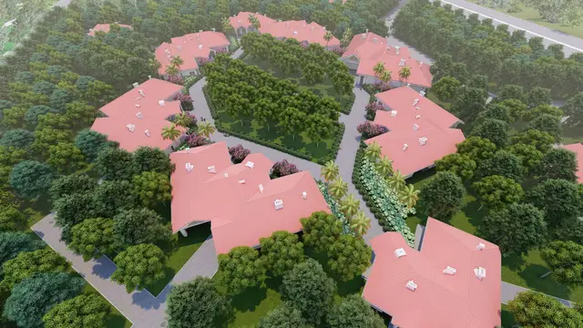
RRR COUNTY is registered with TG-RERA as a plotted-development project on land identified in the filing as 261/PART, 262/PART, 263/PART, 264/PART and 272/PART, at S.LINGOTAM, Choutuppal mandal, Yadadri Bhuvanagiri district. The RERA-filed site extent is 161874.3 sq.m. The layout drawing shows plots arranged with internal roads, parks/open space and social-infrastructure land; it does not describe a scheme of apartment towers or a RERA-filed house inventory. RERA record Land records Layout record
HMDA’s 04 October, 2022 instrument is a draft-layout letter, with final layout release subject to development and handover conditions. The local-body proceeding dated 07/10/2022 also concerns the draft open-plot layout. The project’s Form B declares a completion date of 04/10/2025; the architect’s Form 1A dated 24/07/2025 provides reported completion percentages for common-area facilities. Those are filed declarations/certification, not independent verification of present site condition.
The supplied record does not establish current plot-by-plot availability, current construction progress, or an occupancy/completion certificate. It also does not include a completed final-layout release certificate. Document index Layout record
3. Master plan, architecture & building design
This is a plotted layout, so the relevant design evidence is the layout arrangement and its area statement rather than building or apartment plans. The drawing-derived area statement, based on net layout area of 161874.3 sq.m, records 99013.16 sq.m plotted area, 44739.93 sq.m roads, 13885.83 sq.m organised open space/park area, and 4234.91 sq.m social-infrastructure area; amenity area is recorded as 0.00. The area figures and the 449-plot count are software-read from the layout drawing, not independently surveyed. Layout record
HMDA’s draft-layout letter separately records total and net site area of 161874.3 Sq.m, 0 master-plan road affected area, and the same land-use areas. It describes the layout as open plots, not buildings, and identifies no tower, floor, apartment-circulation or building-footprint design.
The HMDA letter names two sets of plots mortgaged to the Metropolitan Commissioner, HMDA: plots 257 to 280, 296 to 325, 338 to 353 and 354 to 366, extent 15732.20 Sq.mts; and plots 248, 284 to 295 and 326 to 337, extent 5075.65 Sq.mtrs. The letter also requires roads, organised open space and social-infrastructure area to be handed over to the local body by registered gift deed before release of final layout plans.
4. Homes, configurations & floor plans
The RERA-filed offering is plotted development. The supplied evidence does not provide a RERA unit-type schedule with plot-wise saleable area, booked counts or available counts. The layout drawing was read by software for plot counts and areas; the data cautions that these should be verified against the drawing. RERA record RERA filing Layout record
| Configuration | Units | Booked | Available | RERA saleable area | Measured carpet area | Loading (if supplied) |
|---|---|---|---|---|---|---|
| Plots | 449 (software-measured from layout drawing) | Not disclosed | Not disclosed | Not supplied plot-by-plot | Not applicable | Not supplied |
Drawing-derived plot-size summary: 138.0 sq.m smallest, 184.0 sq.m median, and 847.0 sq.m largest; the corresponding supplied square-yard readings are 165.0 sq.yd, 220.1 sq.yd, and 1013.0 sq.yd. These are software-measured drawing figures, not RERA-filed unit-area disclosures. Layout record
The supplied floor-plan records contain three layout sheets and no measured floor plans or apartment configurations. No room dimensions, building orientation, balconies, utility areas or typical-floor arrangements are established for the plots. Floor plans
5. Parking & vehicle circulation
No sanctioned parking-space count, visitor or accessible-parking provision, parking levels, or plot-wise parking allocation is supplied. The layout record is for plots, not apartment parking. RERA record
The HMDA draft-layout letter requires internal roads to be opened for access to neighbouring sites and calls for development of roads and footpaths; its conditions also refer to cycling tracks and underground ducting of utilities. The supplied record does not establish completed road works, a vehicle-entry/exit arrangement, pedestrian separation, or EV charging.
6. Amenities, recreation & open spaces
The RERA-filed Form 1A dated 24/07/2025 lists common-area facilities and reports percentages for them. The amenity table records 100% for internal roads and footpaths, water supply, sewerage, storm-water drains, green strip/TOT LOT/park, street lighting, water conservation/rainwater harvesting, and electrical meter room/sub-station/receiving station; it records 0% for community buildings, sewage/sullage treatment and disposal, solid-waste management and disposal, energy management, fire protection/fire-safety requirements, and aggregate recreational open-space area. These are figures reported in the filed architect certificate, not independent verification of completed facilities. RERA amenities
| Description / size | 13885.83 sq.m; layout area statement reports 8.6% of net layout area (HMDA letter prints 8.58 %). |
|---|---|
| Evidence source | Layout record |
| Declared progress / verified status | RERA-filed Form 1A amenity table reports green strip/TOT LOT/park at 100%; no independent site verification supplied. RERA amenities |
| Description / size | 4234.91 sq.m; HMDA letter prints 2.62%. |
|---|---|
| Evidence source | Layout record |
| Declared progress / verified status | Area is in the filed layout statement; completion status is not separately established. |
| Description / size | Required in the HMDA draft-layout conditions; no size or quantity supplied. |
|---|---|
| Declared progress / verified status | Required condition; completion not independently verified. |
| Description / size | No building or size particulars supplied. |
|---|---|
| Evidence source | RERA amenities |
| Declared progress / verified status | RERA-filed amenity table reports 0%. RERA amenities |
| Description / size | Required in HMDA layout conditions; no quantity supplied. |
|---|---|
| Declared progress / verified status | The architect certificate lists landscaping and tree planting; the supplied amenity table’s progress is not separately quantified for this item. |
The layout drawing’s land-use statement records 44739.93 sq.m of roads (27.6% in the software-derived statement; 27.64% in the HMDA letter). The HMDA letter also requires handover of roads, organised open space and social-infrastructure area to the local body by registered gift deed before final layout release. Layout record
7. Utilities, building services & safety
HMDA’s draft-layout conditions specify proposed infrastructure including potable-water connectivity and internal water-supply pipelines, underground storm-water drainage, underground ducting of utilities, paved footpaths, LED street lighting and cycling tracks. The letter lists storm-water drains, underground drainage lines, a common septic tank/STP, an overhead tank, electrical supply lines, transformer, rainwater-harvesting pits and solid-waste disposal/bio-compost facilities among the layout utilities. These are approval conditions and listed facilities, not proof that each is operating or complete.
The architect’s Form 1A records water supply, sewerage (chamber, lines, septic tank, STP), storm-water drains, water conservation/rainwater harvesting, street lighting and an electrical meter room/sub-station/receiving station. Its amenity progress table reports 100% for water supply, sewerage, storm-water drains, street lighting, water conservation/rainwater harvesting and electrical meter room/sub-station/receiving station. The certificate is a project-filed architect document; independent completion verification is not supplied. RERA amenities
The supplied record does not specify water-source capacity, tank capacity, sewage-treatment capacity, electrical or backup capacity, CCTV/security systems, fire systems, accessibility provisions, or a building-lift configuration. The RERA-filed amenity table reports 0% for fire protection/fire-safety requirements, energy management, and solid-waste management and disposal. RERA amenities
8. Location, access & connectivity
The registered location is S.LINGOTAM, Choutuppal mandal, Yadadri Bhuvanagiri district, PIN 508252. The layout documents call the revenue village Swamulavari Lingotam. The supplied geocode is 17.294565, 78.9498893. RERA record RERA filing Location record
A supplied location record gives the nearest sampled Outer Ring Road interchange as approximately 33.5 km. No other independently measured distances, public-transport details or travel times are supplied. Location record
9. Developer & development status
The registered promoter is GRUPE BUILDERS & DEVELOPERS LLP, an LLP, with GSTIN 36AAXFG4121F1ZC. The RERA filing identifies GOLI GURUNATH as authorized signatory and GOLI UTTAM as partner. The promoter address in the RERA record is B, Nagarjuna Colony, Swamulavari Lingotam, Choutuppal, Yadadri Bhuvanagiri, 508252. Corporate record Parties record RERA filing
The promoter’s Form B declares the project completion date as 04/10/2025. The architect’s Form 1A, dated 24/07/2025, records common-area facility progress; the supplied data does not establish current overall progress or independently verify site completion. No phase-wise construction schedule or plot-wise sales status is supplied. RERA filing
10. Approvals, official records & documents
| Record | Evidence and scope |
|---|---|
| TG-RERA registration | Form C registers RRR COUNTY, registration P02000005351, under section 5; certificate validity 25/11/2022–04/10/2025. |
| HMDA layout instrument | HMDA Draft layout Letter 000194/LO/Plg/HMDA/2022, dated 04 October, 2022, for the open-plot layout over the five stated survey-number parts. It says it is not proof of title and makes final layout release subject to conditions. |
| HMDA processing intimation | Application 056236/GHT/LT/U6/HMDA/12082022; the document describes the proposal as under process and states it is not approval or permission for development. |
| Local-body proceeding | Grama Panchayath, Swamulavari Lingotam proceeding GPS/01/2022-LLP, dated 07/10/2022, concerning the draft open-plot layout and recording development conditions. |
| Layout drawing | Three-sheet approved-layout drawing record, source document 273902; software-extracted plot count, plot sizes and area statement are subject to checking against the drawing. Layout record |
| Architect’s completion certificate | Form 1A dated 24/07/2025, for RERA registration P02000005351, reporting common-area facilities and percentages. |
| Promoter declaration | Form B affidavit by authorized signatory Goli Gurunath; declares land free from encumbrances and completion by 04/10/2025. These are promoter declarations. |
| Occupancy / completion certificate | No occupancy or completion certificate is identified in the supplied project-document record. Document index |
1. Project at a glance
Project identity
Registered project name: RRR COUNTY
Project type: Plotted development / open-plot layout
Phase / registered portion: A single registered plotted-layout project is identified; a separate phase designation is not disclosed.
TG-RERA registration: P02000005351
Registration validity: 25/11/2022 to 04/10/2025; the certificate says the period may be extended by the Authority under the Act and Rules. The supplied certificate records no extension. This is the registration period, not a construction-completion or occupancy certificate.
Registered legal promoter: GRUPE BUILDERS & DEVELOPERS LLP
RERA-record status: The project is recorded as “New Project”; the supplied record gives a proposed completion date of 04/10/2025. Current registration status is not established by the supplied certificate alone.
Land and geographic identity
Locality / revenue village: Locality: CHOUTUPPAL; revenue village in the RERA identity: S.LINGOTAM. The layout documents also identify Swamulavari Lingotam Village.
Mandal: Choutuppal
District: Yadadri Bhuvanagiri
PIN: 508252
Project survey numbers / subdivisions: 261/PART, 262/PART, 263/PART, 264/PART, 272/PART
Registered site extent: 161874.3 sq.m
Net area / affected area: RERA filing states net area 161874.30 sq.m and area affected in road widening/FTL of tanks/nala widening 0. The HMDA layout letter states net site area 161874.3 sq.m and master-plan road affected area 0.
Boundaries as filed: East: NEIGHBOURS LAND; West: ROAD WIDTH 37; North: LAND BELONGS TO CHERUKURI GOPINATH; South: NEIGHBOURS LAND IN SY NO 264.
Map location: Supplied geocode: 17.294565, 78.9498893, named Swamulavari Lingotam, Choutuppal mandal, Yadadri Bhuvanagiri, Telangana, 508252.
Development identity
Sanctioning authority: Hyderabad Metropolitan Development Authority (HMDA)
Principal layout approval: 000194/LO/Plg/HMDA/2022, dated 04 October, 2022; the filed instrument is an HMDA Draft layout Letter for an open-plot layout.
Local-body proceeding: Grama Panchayath, Swamulavari Lingotam proceeding GPS/01/2022-LLP, dated 07/10/2022.
Approved built-up area: Not disclosed as a building-development figure; the RERA filing lists 99013.16 sq.m as approved built-up area, while the layout drawing identifies this area as plotted area.
Buildings / floors: This is a plotted layout, not an apartment-building scheme. Building count, floor configuration and parking levels are not disclosed.
RERA project scale: RERA land filing records 161874.3 sq.m total site area; the layout drawing’s software-read count is 449 plots.
Offering and status
Unit type: Plots; RERA-filed unit inventory and plot-wise booked/available counts are not supplied.
Plot count and size range: Drawing-derived software reading: 449 plots, smallest 138.0 sq.m (165.0 sq.yd), median 184.0 sq.m (220.1 sq.yd), largest 847.0 sq.m (1013.0 sq.yd). These measurements are read from the layout drawing and should be checked against it.
Construction / completion status: The promoter’s Form B declares completion by 04/10/2025. An architect’s Form 1A dated 24/07/2025 reports percentages for common-area facilities; it is not an independent site inspection. No current overall construction-stage figure is supplied here.
Occupancy / completion certificate: No occupancy or completion certificate is identified in the supplied project documents. For a plotted layout, an OC for homes is not established by this record.
2. The project story
RRR COUNTY is registered with TG-RERA as a plotted-development project on land identified in the filing as 261/PART, 262/PART, 263/PART, 264/PART and 272/PART, at S.LINGOTAM, Choutuppal mandal, Yadadri Bhuvanagiri district. The RERA-filed site extent is 161874.3 sq.m. The layout drawing shows plots arranged with internal roads, parks/open space and social-infrastructure land; it does not describe a scheme of apartment towers or a RERA-filed house inventory.
HMDA’s 04 October, 2022 instrument is a draft-layout letter, with final layout release subject to development and handover conditions. The local-body proceeding dated 07/10/2022 also concerns the draft open-plot layout. The project’s Form B declares a completion date of 04/10/2025; the architect’s Form 1A dated 24/07/2025 provides reported completion percentages for common-area facilities. Those are filed declarations/certification, not independent verification of present site condition.
The supplied record does not establish current plot-by-plot availability, current construction progress, or an occupancy/completion certificate. It also does not include a completed final-layout release certificate.
3. Master plan, architecture & building design
This is a plotted layout, so the relevant design evidence is the layout arrangement and its area statement rather than building or apartment plans. The drawing-derived area statement, based on net layout area of 161874.3 sq.m, records 99013.16 sq.m plotted area, 44739.93 sq.m roads, 13885.83 sq.m organised open space/park area, and 4234.91 sq.m social-infrastructure area; amenity area is recorded as 0.00. The area figures and the 449-plot count are software-read from the layout drawing, not independently surveyed.
HMDA’s draft-layout letter separately records total and net site area of 161874.3 Sq.m, 0 master-plan road affected area, and the same land-use areas. It describes the layout as open plots, not buildings, and identifies no tower, floor, apartment-circulation or building-footprint design.
The HMDA letter names two sets of plots mortgaged to the Metropolitan Commissioner, HMDA: plots 257 to 280, 296 to 325, 338 to 353 and 354 to 366, extent 15732.20 Sq.mts; and plots 248, 284 to 295 and 326 to 337, extent 5075.65 Sq.mtrs. The letter also requires roads, organised open space and social-infrastructure area to be handed over to the local body by registered gift deed before release of final layout plans.
4. Homes, configurations & floor plans
The RERA-filed offering is plotted development. The supplied evidence does not provide a RERA unit-type schedule with plot-wise saleable area, booked counts or available counts. The layout drawing was read by software for plot counts and areas; the data cautions that these should be verified against the drawing.
| Configuration | Units | Booked | Available | RERA saleable area | Measured carpet area | Loading (if supplied) |
|---|---|---|---|---|---|---|
| Plots | 449 (software-measured from layout drawing) | Not disclosed | Not disclosed | Not supplied plot-by-plot | Not applicable | Not supplied |
Drawing-derived plot-size summary: 138.0 sq.m smallest, 184.0 sq.m median, and 847.0 sq.m largest; the corresponding supplied square-yard readings are 165.0 sq.yd, 220.1 sq.yd, and 1013.0 sq.yd. These are software-measured drawing figures, not RERA-filed unit-area disclosures.
The supplied floor-plan records contain three layout sheets and no measured floor plans or apartment configurations. No room dimensions, building orientation, balconies, utility areas or typical-floor arrangements are established for the plots.
5. Parking & vehicle circulation
No sanctioned parking-space count, visitor or accessible-parking provision, parking levels, or plot-wise parking allocation is supplied. The layout record is for plots, not apartment parking.
The HMDA draft-layout letter requires internal roads to be opened for access to neighbouring sites and calls for development of roads and footpaths; its conditions also refer to cycling tracks and underground ducting of utilities. The supplied record does not establish completed road works, a vehicle-entry/exit arrangement, pedestrian separation, or EV charging.
6. Amenities, recreation & open spaces
The RERA-filed Form 1A dated 24/07/2025 lists common-area facilities and reports percentages for them. The amenity table records 100% for internal roads and footpaths, water supply, sewerage, storm-water drains, green strip/TOT LOT/park, street lighting, water conservation/rainwater harvesting, and electrical meter room/sub-station/receiving station; it records 0% for community buildings, sewage/sullage treatment and disposal, solid-waste management and disposal, energy management, fire protection/fire-safety requirements, and aggregate recreational open-space area. These are figures reported in the filed architect certificate, not independent verification of completed facilities.
| Description / size | 13885.83 sq.m; layout area statement reports 8.6% of net layout area (HMDA letter prints 8.58 %). |
|---|---|
| Declared progress / verified status | RERA-filed Form 1A amenity table reports green strip/TOT LOT/park at 100%; no independent site verification supplied. |
| Description / size | 4234.91 sq.m; HMDA letter prints 2.62%. |
|---|---|
| Declared progress / verified status | Area is in the filed layout statement; completion status is not separately established. |
| Description / size | Required in the HMDA draft-layout conditions; no size or quantity supplied. |
|---|---|
| Declared progress / verified status | Required condition; completion not independently verified. |
| Description / size | No building or size particulars supplied. |
|---|---|
| Declared progress / verified status | RERA-filed amenity table reports 0%. |
| Description / size | Required in HMDA layout conditions; no quantity supplied. |
|---|---|
| Declared progress / verified status | The architect certificate lists landscaping and tree planting; the supplied amenity table’s progress is not separately quantified for this item. |
The layout drawing’s land-use statement records 44739.93 sq.m of roads (27.6% in the software-derived statement; 27.64% in the HMDA letter). The HMDA letter also requires handover of roads, organised open space and social-infrastructure area to the local body by registered gift deed before final layout release.
7. Utilities, building services & safety
HMDA’s draft-layout conditions specify proposed infrastructure including potable-water connectivity and internal water-supply pipelines, underground storm-water drainage, underground ducting of utilities, paved footpaths, LED street lighting and cycling tracks. The letter lists storm-water drains, underground drainage lines, a common septic tank/STP, an overhead tank, electrical supply lines, transformer, rainwater-harvesting pits and solid-waste disposal/bio-compost facilities among the layout utilities. These are approval conditions and listed facilities, not proof that each is operating or complete.
The architect’s Form 1A records water supply, sewerage (chamber, lines, septic tank, STP), storm-water drains, water conservation/rainwater harvesting, street lighting and an electrical meter room/sub-station/receiving station. Its amenity progress table reports 100% for water supply, sewerage, storm-water drains, street lighting, water conservation/rainwater harvesting and electrical meter room/sub-station/receiving station. The certificate is a project-filed architect document; independent completion verification is not supplied.
The supplied record does not specify water-source capacity, tank capacity, sewage-treatment capacity, electrical or backup capacity, CCTV/security systems, fire systems, accessibility provisions, or a building-lift configuration. The RERA-filed amenity table reports 0% for fire protection/fire-safety requirements, energy management, and solid-waste management and disposal.
8. Location, access & connectivity
The registered location is S.LINGOTAM, Choutuppal mandal, Yadadri Bhuvanagiri district, PIN 508252. The layout documents call the revenue village Swamulavari Lingotam. The supplied geocode is 17.294565, 78.9498893.
A supplied location record gives the nearest sampled Outer Ring Road interchange as approximately 33.5 km. No other independently measured distances, public-transport details or travel times are supplied.
9. Developer & development status
The registered promoter is GRUPE BUILDERS & DEVELOPERS LLP, an LLP, with GSTIN 36AAXFG4121F1ZC. The RERA filing identifies GOLI GURUNATH as authorized signatory and GOLI UTTAM as partner. The promoter address in the RERA record is B, Nagarjuna Colony, Swamulavari Lingotam, Choutuppal, Yadadri Bhuvanagiri, 508252.
The promoter’s Form B declares the project completion date as 04/10/2025. The architect’s Form 1A, dated 24/07/2025, records common-area facility progress; the supplied data does not establish current overall progress or independently verify site completion. No phase-wise construction schedule or plot-wise sales status is supplied.
10. Approvals, official records & documents
TG-RERA registration: Form C registers RRR COUNTY, registration P02000005351, under section 5; certificate validity 25/11/2022–04/10/2025.
HMDA layout instrument: HMDA Draft layout Letter 000194/LO/Plg/HMDA/2022, dated 04 October, 2022, for the open-plot layout over the five stated survey-number parts. It says it is not proof of title and makes final layout release subject to conditions.
HMDA processing intimation: Application 056236/GHT/LT/U6/HMDA/12082022; the document describes the proposal as under process and states it is not approval or permission for development.
Local-body proceeding: Grama Panchayath, Swamulavari Lingotam proceeding GPS/01/2022-LLP, dated 07/10/2022, concerning the draft open-plot layout and recording development conditions.
Layout drawing: Three-sheet approved-layout drawing record, source document 273902; software-extracted plot count, plot sizes and area statement are subject to checking against the drawing.
Architect’s completion certificate: Form 1A dated 24/07/2025, for RERA registration P02000005351, reporting common-area facilities and percentages.
Promoter declaration: Form B affidavit by authorized signatory Goli Gurunath; declares land free from encumbrances and completion by 04/10/2025. These are promoter declarations.
Occupancy / completion certificate: No occupancy or completion certificate is identified in the supplied project-document record.
Frequently asked questions
Is RRR COUNTY registered with Telangana RERA?
Yes. RRR COUNTY is registered with the Telangana Real Estate Regulatory Authority as P02000005351; the registration status is New Project.
Who is the developer of RRR COUNTY?
The promoter named in the RERA registration is GRUPE BUILDERS & DEVELOPERS LLP.
Where is RRR COUNTY located?
RRR COUNTY is in CHOUTUPPAL, S.LINGOTAM, Yadadri Bhuvanagiri, Telangana (508252).
When will RRR COUNTY be completed?
The promoter's proposed date of completion filed with RERA is 04/10/2025. This is the promoter's declaration, not a guarantee.
More projects in Choutuppal