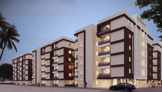
Vaarahi Vaahini Enclave
M/S VARAHI BUILDERS AND DEVELOPERS · Medchal-Malkajgiri · RERA P02200003132
VAARAHI VAAHINI ENCLAVE is a plotted development in Dundigal-Tanda, Dundigal Gandimaisamma Mandal, Medchal-Malkajgiri District. The registered promoter is M/S Varahi Builders And Developers. The layout covers 46388.66 sq.m and has 178 drawing-numbered plots; residential buildings, towers, floors and plot configurations are not stated. It is registered with TG-RERA as P02200003132, with a proposed completion date of 11.02.2024.
01What we found
Read from TG-RERA filings, approvals, land and registration records and court records. A court case is counted only when the court record states this project's survey number with its village, or names the project.
02Check before you pay
9 items to check before you pay, 4 high - from the title chain, court records and approvals, each with what to ask the builder or your advocate. An item may not be a problem with the project: records can be incomplete.
1. Project at a glance
Project identity
| Field | Project record |
|---|---|
| Registered project name | VAARAHI VAAHINI ENCLAVE RERA record |
| Project type | Plotted development / open-plot layout RERA record |
| Phase or registered portion | Not identified as a numbered phase; the registration is for the project on Survey Nos. 14, 15, 16 and 17 |
| TG-RERA registration | P02200003132 |
| Registration validity | 24/07/2021 to 11/02/2024; the supplied certificate records no extension. This is the registration-validity period, not an occupancy or completion certificate. |
| Registered promoter | M/S Varahi Builders And Developers |
| RERA status in supplied record | Certificate records registration through 11/02/2024. Current registration status beyond that date is not established by the supplied certificate. |
Land and geographic identity
| Field | Project record |
|---|---|
| Locality / PIN | Dundigal-Tanda; PIN 500043 |
| Revenue villages stated in project approval records | Gagillapur Village and Dundigal Village |
| Mandal / district | Dundigal Gandimaisamma Mandal; Medchal-Malkajgiri District |
| Project survey numbers | 14, 15, 16 and 17, including the subdivisions stated in the HMDA draft-layout record: 14/A, AA, E, EE; 15/A; 16/A; 17/A. |
| Other survey numbers appearing in layout records | HMDA’s draft-layout record also names 790, 791, 790/A/A, AA/AA and 791/A/A; the Municipality proceeding describes the final layout as covering Survey Nos. 14, 15, 16, 17 at Gagillapur and 790 & 791 at Dundigal. |
| Total site area | 46388.66 sq.m |
| Road-affected area | 486.6 sq.m |
| Net layout area | 45902.06 sq.m |
| Boundaries | East, west and north: “OTHERS LAND”; south: “12 M ROAD” Land records |
Development identity
| Field | Project record |
|---|---|
| Sanctioning / planning authority | Hyderabad Metropolitan Development Authority (HMDA); final layout release proceeding issued by Dundigal Municipality |
| Principal layout approval | 000097/LO/Plg/HMDA/2021, approved 11 February 2021; the supplied record identifies this as an HMDA draft-layout letter. |
| Municipality proceeding | Final layout release dated 15-04-2021, proceeding Proc:Roc.No. G1/1011/LT/TPS/DUN/MR$ |
| Later final-layout number recorded by architect | 051978/LT/MED/FLT/U6/HMDA/28012022, dated 22.02.2022 |
| Approved built-up area | 27109.18 sq.m, recorded in the RERA project information RERA filing |
| Plot count | 178, based on plot numbers 1 to 178 printed on the layout drawing; the drawing-derived count should be checked against the complete approved drawing. Layout record |
| Building / floor configuration | Not applicable as a plotted layout; the supplied records do not establish residential buildings, towers or apartment floors. RERA record Layout record |
| Authority-mortgaged plots | Plot Nos. 134 to 157 and 166 to 168, 27 plots, area 4091.06 sq.m; the HMDA record says these are mortgaged pending layout development works. |
Offering and status
| Field | Project record |
|---|---|
| Offering | Plots in a residential plotted layout RERA record |
| RERA-filed plot areas / booked and available counts | Not supplied in the available RERA unit data. RERA record |
| Drawing-derived plot count | 178 plots; plot sizes are not available in the supplied drawing extraction. Layout record |
| Declared completion date | 11.02.2024 in the promoter’s Form B declaration |
| RERA registration expiry | 11/02/2024; separate from the declared completion date and not evidence of an occupancy certificate |
| Completion / OC status | An architect’s certificate dated 31/03/2022 certifies completion of development work for the layout. No occupancy certificate is identified in the supplied records; an OC status is not established for this plotted development. |
| Construction / development progress | The RERA amenity record marks internal roads and footpaths, green strip/park, street lighting, rainwater harvesting and recreational open space at 100%; this is a filed progress record, not independent site verification. RERA amenities |
2. The project story
Vaarahi Vaahini Enclave is a residential plotted-layout project registered with TG-RERA as P02200003132. Its project records place the layout in the Dundigal-Tanda locality, with approval documents naming land in Gagillapur and Dundigal villages, Dundigal Gandimaisamma Mandal, Medchal-Malkajgiri District. The registered project survey numbers are 14, 15, 16 and 17; the approval records also refer to Survey Nos. 790 and 791 in Dundigal.
The layout drawing extraction identifies 178 numbered plots. The HMDA approval record lists 27109.18 sq.m as plotted area, with roads, parks/open space and social infrastructure also shown in the layout area statement. Layout record The HMDA record reserves 27 plots as a mortgage in favour of HMDA until the specified layout works are completed.
The promoter’s Form B undertook completion by 11.02.2024. Separately, an architect’s certificate dated 31/03/2022 certifies completion of development work for the layout and records a final-layout number dated 22.02.2022. The supplied evidence does not independently verify present on-site condition, nor does it identify an occupancy certificate.
3. Master plan, architecture & building design
This is a plotted layout, not an apartment or tower scheme. The drawing-derived layout record gives a total site area of 46388.66 sq.m, a net layout area of 45902.07 sq.m, and a road-widening area of 486.6 sq.m; the HMDA approval extraction records the net site area as 45902.06 sq.m. The layout’s own area statement is: Layout record
| Layout use | Area | Share of net layout area |
|---|---|---|
| Plots | 27109.18 sq.m | 59.1% |
| Roads | 13892.06 sq.m | 30.3% |
| Parks / open space | 3745.13 sq.m | 8.2% |
| Social infrastructure | 1155.52 sq.m | 2.5% |
| Amenities | 0.0 sq.m | 0.0% |
The drawing extraction counts plot numbers 1 to 178 but does not provide plot-size measurements. The HMDA draft-layout letter specifies road widths of 18 mts and above and 60 feet and above. Layout record
The layout approval record lists black-top roads, storm-water drains, underground drainage lines, internal water-supply pipelines, an overhead tank, transformer provision, avenue planting, park development, rainwater-harvesting pits, cycling tracks and a bio-compost unit. These are approval-record provisions; the supplied material does not independently establish their current operating condition.
4. Homes, configurations & floor plans
This project is registered as a plotted development, so apartment configuration and floor-plan measurements are not applicable. The available RERA filing does not provide plot-wise booked or available counts, or a plot-size schedule. RERA record
| Configuration | Units | Booked | Available | RERA saleable area | Measured carpet area | Loading |
|---|---|---|---|---|---|---|
| Plots | 178 drawing-numbered plots Layout record | Not disclosed in supplied data | Not disclosed in supplied data | Not disclosed in supplied data | Not applicable | Not supplied |
The layout drawing extraction says plot sizes are incomplete; no plot-size band or individual plot measurement can therefore be stated from this evidence. Layout record
5. Parking & vehicle circulation
The supplied records do not state a sanctioned parking-space count, visitor or accessible parking provision, or plot-specific parking allocation. The project is a plotted layout, and the available drawing extraction does not identify designated parking bays. RERA record Layout record
The HMDA draft-layout conditions require roads to remain accessible to neighbouring sites and prohibit blocking roads or enclosing the site with a compound wall. The approval record also calls for cycling tracks within the layout. These are recorded layout conditions; the supplied material does not independently verify implementation.
6. Amenities, recreation & open spaces
The layout approval and RERA amenity filing identify the following facilities. “RERA progress” below is the filed percentage where supplied; it is not an independent inspection result. RERA amenities
| Facility | Description / size | Evidence source | Declared progress / verified status |
|---|---|---|---|
| Internal roads and footpaths | Roads area 13892.06 sq.m; approval conditions refer to black-top roads and paved footpaths. | HMDA layout record; TG-RERA amenity filing | RERA filing: 100%; not independently verified. |
| Green strip / park / recreational open space | Park area 3745.13 sq.m | HMDA layout area statement; TG-RERA amenity filing | RERA filing: 100%; not independently verified. |
| Social infrastructure land | 1155.52 sq.m; approval record says it is to be handed over to the local body by registered gift deed. | HMDA layout record | Handover status not supplied. |
| Street lighting | Approval record specifies LED street lighting. | HMDA layout conditions; TG-RERA amenity filing | RERA filing: 100%; not independently verified. |
| Cycling track | To be developed within the layout. | HMDA layout conditions | Progress / completion status not supplied. |
| Avenue plantation | Included in the Municipality’s listed development works. | Municipality final-layout proceeding | Progress / completion status not supplied. |
The RERA amenity filing also marks water conservation / rainwater harvesting and aggregate recreational open space at 100%. The supplied records do not identify clubhouse, indoor recreation or community-building facilities as completed project amenities. RERA amenities
7. Utilities, building services & safety
The layout approval records require or list the following infrastructure; the supplied evidence does not establish present service capacity or independently verified operation:
- Water: internal water-supply pipelines and an overhead tank are listed. The HMDA conditions require arrangements for potable-water connectivity. A source, storage capacity and treatment capacity are not stated.
- Sewerage and drainage: the approval records list underground drainage lines, a common septic tank / STP, and underground storm-water drainage. The Municipality proceeding also requires an STP and septic tank to standard specification. Capacities and current operating status are not supplied.
- Electrical and lighting: transformer provision and street-lighting infrastructure are listed; the HMDA record specifies LED street lighting. Supply capacity and backup arrangements are not stated.
- Waste and environmental services: the HMDA record requires space for solid-waste disposal and lists a bio-compost unit. The supplied data does not establish current waste-management operations.
- Other layout works: rainwater-harvesting pits, cycling tracks, footpaths and underground utility ducting are listed in the approval conditions. The records do not supply dimensions or completion verification for these works.
No building-specific fire systems, lifts, accessible routes or building safety provisions are identified in the supplied project evidence; this is a plotted layout and apartment-building services are not established here. RERA record Document index
8. Location, access & connectivity
The project’s official location record identifies Dundigal-Tanda, NH765D, Dundigal, Dundigal Mandal, Medchal–Malkajgiri, Telangana, 500043. Approval records name Gagillapur Village and Dundigal Village; the TG-RERA certificate records Dundigal-Tanda as the locality. Location record
The supplied location dataset lists these measured distances:
| Place / connection | Distance |
|---|---|
| Outer Ring Road (nearest sampled interchange, approx) | 9.2 km |
| State Bank of India | 2.9 km |
| Marri Laxma Reddy Institute of Technology & Management | 1.7 km |
| Adithya Hospital | 1.8 km |
| MLRIT Mall | 2.7 km |
These are location-dataset distances; no travel times are supplied. Location record
9. Developer & development status
The registered promoter is M/S Varahi Builders And Developers, identified in the project records as a partnership. The partnership deed supplied with the RERA file states that the firm was established by Dodda Pradeep Reddy and Dodda Venkata Ramana; Dodda Pradeep Reddy is named as the authorized signatory in the project records. Corporate record
The RERA certificate lists the promoter office as Village: Kukatpally, Mandal: Kukatpally, District: Medchal-Malkajgiri, Pin: 500072. A separate project address is recorded at ORCHIDS, PHASE NO 13, DUNDIGAL & GAGILLAPUR VILLAGE, Dundigal Gandimaisamma, Medchal-Malkajgiri, 500043. The supplied evidence does not provide an official website or contact details for the promoter. Parties record
In Form B, the promoter declared that the project would be completed by 11.02.2024. The RERA registration certificate states validity through 11/02/2024; no extension appears on that certificate. An architect’s certificate dated 31/03/2022 certifies completion of development work for the layout, but the supplied evidence does not independently confirm current site condition or identify an occupancy certificate.
10. Approvals, official records & documents
| Record | What the supplied document establishes |
|---|---|
| TG-RERA certificate — P02200003132 | Form C registration for VAARAHI VAAHINI ENCLAVE; valid 24/07/2021 through 11/02/2024. |
| HMDA draft-layout approval — 000097/LO/Plg/HMDA/2021 | HMDA draft-layout letter dated 11 February 2021, identifying the site, area statement and layout conditions. |
| Dundigal Municipality final-layout release — Proc:Roc.No. G1/1011/LT/TPS/DUN/MR$ | Proceeding dated 15-04-2021 for the final layout, with recorded development conditions. |
| Draft layout plan | HMDA draft layout plan record with surrounding survey numbers; the supplied extraction does not provide a readable approval number or land extent. |
| Architect’s completion certificate | Certificate dated 31/03/2022 certifying completion of layout development work and recording final-layout number 051978/LT/MED/FLT/U6/HMDA/28012022, dated 22.02.2022. |
| Promoter Form B declaration | Dated 16 May 2021; records the promoter’s declarations, including a completion undertaking by 11.02.2024. |
| Title-report and supporting records | Project-filed title materials include a legal title report, development agreements and sale-deed records; these are indexed here as project documents, not as a title conclusion. |
1. Project at a glance
Project identity
Registered project name: VAARAHI VAAHINI ENCLAVE
Project type: Plotted development / open-plot layout
Phase or registered portion: Not identified as a numbered phase; the registration is for the project on Survey Nos. 14, 15, 16 and 17
TG-RERA registration: P02200003132
Registration validity: 24/07/2021 to 11/02/2024; the supplied certificate records no extension. This is the registration-validity period, not an occupancy or completion certificate.
Registered promoter: M/S Varahi Builders And Developers
RERA status in supplied record: Certificate records registration through 11/02/2024. Current registration status beyond that date is not established by the supplied certificate.
Land and geographic identity
Locality / PIN: Dundigal-Tanda; PIN 500043
Revenue villages stated in project approval records: Gagillapur Village and Dundigal Village
Mandal / district: Dundigal Gandimaisamma Mandal; Medchal-Malkajgiri District
Project survey numbers: 14, 15, 16 and 17, including the subdivisions stated in the HMDA draft-layout record: 14/A, AA, E, EE; 15/A; 16/A; 17/A.
Other survey numbers appearing in layout records: HMDA’s draft-layout record also names 790, 791, 790/A/A, AA/AA and 791/A/A; the Municipality proceeding describes the final layout as covering Survey Nos. 14, 15, 16, 17 at Gagillapur and 790 & 791 at Dundigal.
Total site area: 46388.66 sq.m
Road-affected area: 486.6 sq.m
Net layout area: 45902.06 sq.m
Boundaries: East, west and north: “OTHERS LAND”; south: “12 M ROAD”
Development identity
Sanctioning / planning authority: Hyderabad Metropolitan Development Authority (HMDA); final layout release proceeding issued by Dundigal Municipality
Principal layout approval: 000097/LO/Plg/HMDA/2021, approved 11 February 2021; the supplied record identifies this as an HMDA draft-layout letter.
Municipality proceeding: Final layout release dated 15-04-2021, proceeding Proc:Roc.No. G1/1011/LT/TPS/DUN/MR$
Later final-layout number recorded by architect: 051978/LT/MED/FLT/U6/HMDA/28012022, dated 22.02.2022
Approved built-up area: 27109.18 sq.m, recorded in the RERA project information
Plot count: 178, based on plot numbers 1 to 178 printed on the layout drawing; the drawing-derived count should be checked against the complete approved drawing.
Building / floor configuration: Not applicable as a plotted layout; the supplied records do not establish residential buildings, towers or apartment floors.
Authority-mortgaged plots: Plot Nos. 134 to 157 and 166 to 168, 27 plots, area 4091.06 sq.m; the HMDA record says these are mortgaged pending layout development works.
Offering and status
Offering: Plots in a residential plotted layout
RERA-filed plot areas / booked and available counts: Not supplied in the available RERA unit data.
Drawing-derived plot count: 178 plots; plot sizes are not available in the supplied drawing extraction.
Declared completion date: 11.02.2024 in the promoter’s Form B declaration
RERA registration expiry: 11/02/2024; separate from the declared completion date and not evidence of an occupancy certificate
Completion / OC status: An architect’s certificate dated 31/03/2022 certifies completion of development work for the layout. No occupancy certificate is identified in the supplied records; an OC status is not established for this plotted development.
Construction / development progress: The RERA amenity record marks internal roads and footpaths, green strip/park, street lighting, rainwater harvesting and recreational open space at 100%; this is a filed progress record, not independent site verification.
2. The project story
Vaarahi Vaahini Enclave is a residential plotted-layout project registered with TG-RERA as P02200003132. Its project records place the layout in the Dundigal-Tanda locality, with approval documents naming land in Gagillapur and Dundigal villages, Dundigal Gandimaisamma Mandal, Medchal-Malkajgiri District. The registered project survey numbers are 14, 15, 16 and 17; the approval records also refer to Survey Nos. 790 and 791 in Dundigal.
The layout drawing extraction identifies 178 numbered plots. The HMDA approval record lists 27109.18 sq.m as plotted area, with roads, parks/open space and social infrastructure also shown in the layout area statement. The HMDA record reserves 27 plots as a mortgage in favour of HMDA until the specified layout works are completed.
The promoter’s Form B undertook completion by 11.02.2024. Separately, an architect’s certificate dated 31/03/2022 certifies completion of development work for the layout and records a final-layout number dated 22.02.2022. The supplied evidence does not independently verify present on-site condition, nor does it identify an occupancy certificate.
3. Master plan, architecture & building design
This is a plotted layout, not an apartment or tower scheme. The drawing-derived layout record gives a total site area of 46388.66 sq.m, a net layout area of 45902.07 sq.m, and a road-widening area of 486.6 sq.m; the HMDA approval extraction records the net site area as 45902.06 sq.m. The layout’s own area statement is:
| Layout use | Area | Share of net layout area |
|---|---|---|
| Plots | 27109.18 sq.m | 59.1% |
| Roads | 13892.06 sq.m | 30.3% |
| Parks / open space | 3745.13 sq.m | 8.2% |
| Social infrastructure | 1155.52 sq.m | 2.5% |
| Amenities | 0.0 sq.m | 0.0% |
The drawing extraction counts plot numbers 1 to 178 but does not provide plot-size measurements. The HMDA draft-layout letter specifies road widths of 18 mts and above and 60 feet and above.
The layout approval record lists black-top roads, storm-water drains, underground drainage lines, internal water-supply pipelines, an overhead tank, transformer provision, avenue planting, park development, rainwater-harvesting pits, cycling tracks and a bio-compost unit. These are approval-record provisions; the supplied material does not independently establish their current operating condition.
4. Homes, configurations & floor plans
This project is registered as a plotted development, so apartment configuration and floor-plan measurements are not applicable. The available RERA filing does not provide plot-wise booked or available counts, or a plot-size schedule.
| Configuration | Units | Booked | Available | RERA saleable area | Measured carpet area | Loading |
|---|---|---|---|---|---|---|
| Plots | 178 drawing-numbered plots | Not disclosed in supplied data | Not disclosed in supplied data | Not disclosed in supplied data | Not applicable | Not supplied |
The layout drawing extraction says plot sizes are incomplete; no plot-size band or individual plot measurement can therefore be stated from this evidence.
5. Parking & vehicle circulation
The supplied records do not state a sanctioned parking-space count, visitor or accessible parking provision, or plot-specific parking allocation. The project is a plotted layout, and the available drawing extraction does not identify designated parking bays.
The HMDA draft-layout conditions require roads to remain accessible to neighbouring sites and prohibit blocking roads or enclosing the site with a compound wall. The approval record also calls for cycling tracks within the layout. These are recorded layout conditions; the supplied material does not independently verify implementation.
6. Amenities, recreation & open spaces
The layout approval and RERA amenity filing identify the following facilities. “RERA progress” below is the filed percentage where supplied; it is not an independent inspection result.
| Facility | Description / size | Evidence source | Declared progress / verified status |
|---|---|---|---|
| Internal roads and footpaths | Roads area 13892.06 sq.m; approval conditions refer to black-top roads and paved footpaths. | HMDA layout record; TG-RERA amenity filing | RERA filing: 100%; not independently verified. |
| Green strip / park / recreational open space | Park area 3745.13 sq.m | HMDA layout area statement; TG-RERA amenity filing | RERA filing: 100%; not independently verified. |
| Social infrastructure land | 1155.52 sq.m; approval record says it is to be handed over to the local body by registered gift deed. | HMDA layout record | Handover status not supplied. |
| Street lighting | Approval record specifies LED street lighting. | HMDA layout conditions; TG-RERA amenity filing | RERA filing: 100%; not independently verified. |
| Cycling track | To be developed within the layout. | HMDA layout conditions | Progress / completion status not supplied. |
| Avenue plantation | Included in the Municipality’s listed development works. | Municipality final-layout proceeding | Progress / completion status not supplied. |
The RERA amenity filing also marks water conservation / rainwater harvesting and aggregate recreational open space at 100%. The supplied records do not identify clubhouse, indoor recreation or community-building facilities as completed project amenities.
7. Utilities, building services & safety
The layout approval records require or list the following infrastructure; the supplied evidence does not establish present service capacity or independently verified operation:
- Water: internal water-supply pipelines and an overhead tank are listed. The HMDA conditions require arrangements for potable-water connectivity. A source, storage capacity and treatment capacity are not stated.
- Sewerage and drainage: the approval records list underground drainage lines, a common septic tank / STP, and underground storm-water drainage. The Municipality proceeding also requires an STP and septic tank to standard specification. Capacities and current operating status are not supplied.
- Electrical and lighting: transformer provision and street-lighting infrastructure are listed; the HMDA record specifies LED street lighting. Supply capacity and backup arrangements are not stated.
- Waste and environmental services: the HMDA record requires space for solid-waste disposal and lists a bio-compost unit. The supplied data does not establish current waste-management operations.
- Other layout works: rainwater-harvesting pits, cycling tracks, footpaths and underground utility ducting are listed in the approval conditions. The records do not supply dimensions or completion verification for these works.
No building-specific fire systems, lifts, accessible routes or building safety provisions are identified in the supplied project evidence; this is a plotted layout and apartment-building services are not established here.
8. Location, access & connectivity
The project’s official location record identifies Dundigal-Tanda, NH765D, Dundigal, Dundigal Mandal, Medchal–Malkajgiri, Telangana, 500043. Approval records name Gagillapur Village and Dundigal Village; the TG-RERA certificate records Dundigal-Tanda as the locality.
The supplied location dataset lists these measured distances:
Outer Ring Road (nearest sampled interchange, approx): 9.2 km
State Bank of India: 2.9 km
Marri Laxma Reddy Institute of Technology & Management: 1.7 km
Adithya Hospital: 1.8 km
MLRIT Mall: 2.7 km
These are location-dataset distances; no travel times are supplied.
9. Developer & development status
The registered promoter is M/S Varahi Builders And Developers, identified in the project records as a partnership. The partnership deed supplied with the RERA file states that the firm was established by Dodda Pradeep Reddy and Dodda Venkata Ramana; Dodda Pradeep Reddy is named as the authorized signatory in the project records.
The RERA certificate lists the promoter office as Village: Kukatpally, Mandal: Kukatpally, District: Medchal-Malkajgiri, Pin: 500072. A separate project address is recorded at ORCHIDS, PHASE NO 13, DUNDIGAL & GAGILLAPUR VILLAGE, Dundigal Gandimaisamma, Medchal-Malkajgiri, 500043. The supplied evidence does not provide an official website or contact details for the promoter.
In Form B, the promoter declared that the project would be completed by 11.02.2024. The RERA registration certificate states validity through 11/02/2024; no extension appears on that certificate. An architect’s certificate dated 31/03/2022 certifies completion of development work for the layout, but the supplied evidence does not independently confirm current site condition or identify an occupancy certificate.
10. Approvals, official records & documents
TG-RERA certificate — P02200003132: Form C registration for VAARAHI VAAHINI ENCLAVE; valid 24/07/2021 through 11/02/2024.
HMDA draft-layout approval — 000097/LO/Plg/HMDA/2021: HMDA draft-layout letter dated 11 February 2021, identifying the site, area statement and layout conditions.
Dundigal Municipality final-layout release — Proc:Roc.No. G1/1011/LT/TPS/DUN/MR$: Proceeding dated 15-04-2021 for the final layout, with recorded development conditions.
Draft layout plan: HMDA draft layout plan record with surrounding survey numbers; the supplied extraction does not provide a readable approval number or land extent.
Architect’s completion certificate: Certificate dated 31/03/2022 certifying completion of layout development work and recording final-layout number 051978/LT/MED/FLT/U6/HMDA/28012022, dated 22.02.2022.
Promoter Form B declaration: Dated 16 May 2021; records the promoter’s declarations, including a completion undertaking by 11.02.2024.
Title-report and supporting records: Project-filed title materials include a legal title report, development agreements and sale-deed records; these are indexed here as project documents, not as a title conclusion.
Frequently asked questions
Is VAARAHI VAAHINI ENCLAVE registered with Telangana RERA?
Yes. VAARAHI VAAHINI ENCLAVE is registered with the Telangana Real Estate Regulatory Authority as P02200003132; the registration status is New Project.
Who is the developer of VAARAHI VAAHINI ENCLAVE?
The promoter named in the RERA registration is M/S VARAHI BUILDERS AND DEVELOPERS.
Where is VAARAHI VAAHINI ENCLAVE located?
VAARAHI VAAHINI ENCLAVE is in DUNDIGAL & GAGILLAPUR VILLAGE, Dundigal-Tanda, Dundigal Gandimaisamma, Medchal-Malkajgiri, Telangana (500043).
When will VAARAHI VAAHINI ENCLAVE be completed?
The promoter's proposed date of completion filed with RERA is 11/02/2024. This is the promoter's declaration, not a guarantee.
More projects in Dundigal Tanda