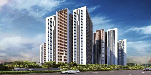
Sdr Heights 3
SAMA DAMODER REDDY AND SAMA CHAITANYA REDDY · Rangareddy · RERA P02400009472
SDR HEIGHTS 3 is a plotted development at Tooprakhurd Village, Maheshwaram Mandal, Ranga Reddy District, developed by SAMA DAMODER REDDY AND SAMA CHAITANYA REDDY. The layout covers 25589.79 sq. m and the HMDA drawing records 96 plots; the supplied records do not state a building or floor configuration. The TG-RERA registration number is P02400009472, and the promoter’s Form B declares completion by 19-Feb-2027.
01What we found
Read from TG-RERA filings, approvals, land and registration records and court records. A court case is counted only when the court record states this project's survey number with its village, or names the project.
02Check before you pay
6 items to check before you pay, 4 high - from the title chain, court records and approvals, each with what to ask the builder or your advocate. An item may not be a problem with the project: records can be incomplete.
1. Project at a glance
Project identity
| Field | Project record |
|---|---|
| Registered project name | SDR HEIGHTS 3 RERA record |
| Project type | Plotted development; HMDA drawing describes a proposed residential draft open-plotted layout RERA record |
| Phase / registered portion | No separate phase is identified in the supplied registration record. RERA record Approvals record |
| TG-RERA registration | P02400009472; the TG-RERA Form C certificate records validity from 19/02/2025 to 19/02/2027. Registration validity is distinct from the promoter’s completion undertaking. RERA record |
| Registered promoter | SAMA DAMODER REDDY AND SAMA CHAITANYA REDDY RERA record |
| RERA status | The project is recorded as a New Project; the registration certificate is supplied. RERA record |
Land and geographic identity
| Field | Project record |
|---|---|
| Locality / revenue village | TOOPRAKHURD / Tooprakhurd Village RERA record RERA filing |
| Mandal | Maheshwaram RERA record RERA filing |
| District | Ranga Reddy RERA record RERA filing |
| PIN | 509325 RERA record RERA filing |
| Project survey number(s) | SY NO 132/P; the filed drawing also refers to 132/Part. RERA record RERA filing |
| Site extent | 25589.79 sq. m; the HMDA draft layout records this as both total site area and net site area, with master-plan road-affected area shown as 0. RERA filing |
| Boundaries recorded in RERA fields | East: ROAD; West: ROAD; North: OTHERS LAND; South: ROAD. RERA filing |
Development identity
| Field | Project record |
|---|---|
| Sanctioning authority | Hyderabad Metropolitan Development Authority (HMDA) Approvals record |
| Principal HMDA reference | Draft layout letter / approval number 000017/LO/Plg/HMDA/2025, dated 19 February, 2025; application number 062548/SMD/LT/U6/HMDA/03042024. Approvals record |
| Drawing references also appearing in the filed record | Permit LP number 000153/LO/Plg/HMDA/2023 (dated 11 August, 2023 on the drawing); the drawing extract also records 000153/LD/Plg/HMDA/2023, dated 11-08-2023. Approvals record |
| Approved built-up area | 14777.68 sq. m is recorded in RERA’s “Approved Built up Area” field and corresponds to the drawing’s plotted-area figure; the supplied records do not separately establish a building built-up area for this plotted project. RERA filing Layout record |
| Building / floor configuration | Not applicable as a plotted-layout offering; no apartment-building count or floor configuration is disclosed in the supplied project records. RERA record |
| Layout plot count | HMDA drawing extraction records 96 plots. The separately software-read plot list is incomplete and identifies at least 23 plots; it is not a complete independent plot count. Layout record |
| Roads and open-space provision | Drawing extraction records 7,951.96 sq. m of roads, 2,216.67 sq. m as organized open space/park/utility, and 644.07 sq. m of social infrastructure. |
| Authority-mortgaged plots | Plots 1, 2, 26, 27, 56, 57, 69, 70, 71, 84, 85 and 86, totaling 2222.98 sq. m, are recorded as mortgaged to the Metropolitan Commissioner, HMDA. |
Offering and status
| Field | Project record |
|---|---|
| Offering | Residential plots. The RERA registration material does not supply a complete plot-by-plot inventory table in the records reviewed here. RERA record |
| Drawing-read plot sizes | Software extraction identifies 23 plots with sizes, from 125.42 sq. m (150 sq. yd) to 229.94 sq. m (275 sq. yd); the list is explicitly incomplete and should not be treated as the complete inventory. Layout record |
| Booked / available counts | Not disclosed in the supplied records. RERA record RERA filing |
| Construction / development stage | The supplied record establishes layout approval subject to development works; no independently verified on-site progress measurement is provided. RERA amenities |
| Completion date | Form B declares completion by 19-Feb-2027. The registration certificate separately remains valid through 19/02/2027, unless extended. |
| Occupancy / completion certificate | No occupancy or completion certificate is included in the supplied project documents. For this plotted-layout project, the available record concerns layout approval and development works. Document index |
2. The project story
SDR HEIGHTS 3 is registered with TG-RERA as a plotted development in SY NO 132/P at Tooprakhurd Village, Maheshwaram Mandal, Ranga Reddy District. The HMDA-filed material describes a proposed residential draft open-plotted layout over 25589.79 sq. m and records technical approval subject to conditions and forwarding to the local body for final processing. RERA record
The drawing extraction records 96 plots, internal roads, organized open space/park/utility land and social-infrastructure land. A separate software-read plot list contains only 23 sized entries and is incomplete, so it does not establish the full plot-by-plot offering. Layout record
The project’s Form B is a promoter declaration undertaking completion by 19-Feb-2027. That is not a site-progress certification: the supplied evidence does not independently verify how much of the layout’s roads, drainage, water, electrical or landscape work has been completed.
3. Master plan, architecture & building design
This is a plotted layout rather than a multi-storey residential building. The HMDA drawing extraction records 25589.79 sq. m total site area and 25589.79 sq. m net site area. Its land-use figures are: 14777.68 sq. m plotted area, 7951.96 sq. m road area, 2216.67 sq. m organized open space/park/utility, and 644.07 sq. m social infrastructure. The draft-letter extraction separately labels 644.07 sq. m as open space and lists park as 2216.67 sq. m.
The drawing records road widths of 12.19 and 12 (as supplied in the extraction); it does not state a unit in that extracted field. It identifies 12 authority-mortgaged plots totaling 2222.98 sq. m. No building footprints, building heights, floor plans, or apartment layouts are supplied for this project.
The approved drawing extraction’s 96-plot figure is distinct from the incomplete software-read list of 23 plot sizes. The latter reports observed sizes from 125.42 sq. m (150 sq. yd) to 229.94 sq. m (275 sq. yd) and should be read as drawing-derived software measurement, not a complete RERA inventory. Layout record
4. Homes, configurations & floor plans
The registered offering is plots, not flats. No RERA-filed flat configuration, carpet-area schedule, or apartment floor plan is present in the supplied evidence. RERA record
| Supplied figure | 96 |
|---|---|
| Evidence / qualification | Drawing extraction; |
| Supplied figure | 23 |
|---|---|
| Evidence / qualification | Software-read list; explicitly incomplete. Layout record |
| Supplied figure | 125.42 / 188.13 / 229.94 sq. m (150 / 225 / 275 sq. yd) |
|---|---|
| Evidence / qualification | Software-measured from the drawing; not a complete inventory. Layout record |
| Supplied figure | 225 sq. yd: 8 plots; 265 sq. yd: 4 plots; 222 sq. yd: 3 plots; 150 sq. yd: 2 plots |
|---|---|
| Evidence / qualification | Software-read drawing text; incomplete list. Layout record |
The supplied project records do not provide a complete plot-number-to-size schedule or booked/available plot counts. Confirm the specific plot’s number, area and availability against the current sanctioned layout and promoter’s current RERA inventory before booking. Layout record RERA record
5. Parking & vehicle circulation
No dedicated parking count, visitor or accessible-parking provision, parking allocation schedule, or vehicle-entry/exit arrangement is identified in the supplied project records. The layout is plotted; do not assume that a drawn plot or road area represents an individually allotted parking space. RERA amenities
The drawing records roads totaling 7951.96 sq. m. It does not provide a separate vehicle-circulation or parking specification in the supplied extraction.
6. Amenities, recreation & open spaces
The HMDA draft-layout material lists development infrastructure and open-space provisions. The RERA amenities extract marks several items as available in the filing, but records 0% progress for the listed items; that is not evidence of completed or independently inspected facilities. RERA amenities
| Facility | Description / size | Evidence source | Declared progress / verified status |
|---|---|---|---|
| Park / organized open space | Drawing records 2216.67 sq. m as organized open space/park/utility; the draft-letter extraction separately lists park as 2216.67 sq. m. | Listed in layout material; completion not independently verified. | |
| Social infrastructure | 644.07 sq. m | Area shown in layout material; facility specification or completion status not supplied. | |
| Internal roads and footpaths | Road area 7951.96 sq. m | RERA amenities | RERA amenities extract marks internal roads/footpaths “YES” with 0% progress; completion not independently verified. |
| Avenue plantation | Size not stated | Listed as a development work; completion not independently verified. | |
| Community buildings | Size / capacity not stated | RERA amenities | No completion evidence supplied. |
No clubhouse or indoor-recreation facility is identified in the supplied project records. RERA amenities Document index
7. Utilities, building services & safety
The HMDA draft-layout material specifies proposed site infrastructure, including storm water drains, underground drainage lines, common septic tank / STP, internal water supply pipe lines, over head tank, electrical supply lines, street lights, transformer, avenue plantation, park development and rain water harvesting pits. These are listed development works; the records supplied do not verify their installation, capacity or operational status.
The RERA amenities extract also lists water supply, sewerage, storm-water drains, sewage/sullage treatment and disposal, solid-waste management, rainwater harvesting, energy management, fire protection and an electrical meter room/sub-station/receiving station. It records 0% progress for the listed items; no capacities or project-specific fire-clearance document is supplied in this evidence set. RERA amenities
8. Location, access & connectivity
The registered location is TOOPRAKHURD, in Tooprakhurd Village, Maheshwaram Mandal, Ranga Reddy District, PIN 509325; the HMDA draft-layout material also identifies the site as Survey No. 132/P. RERA record RERA filing
No verified approach-road description, public-transport details, or project-specific measured distance to landmarks is supplied. The project record lists the parcel’s boundaries as road on the east, west and south, and other land on the north. RERA filing
9. Developer & development status
TG-RERA identifies SAMA DAMODER REDDY AND SAMA CHAITANYA REDDY as the project promoters. The filing describes the organization type as “Others,” with the description “TWO INDIVIDUALS”; a separate incorporated legal-entity type or corporate identifier is not established in the supplied material. RERA record RERA filing Corporate record
The Form B affidavit is a promoter declaration dated 28-February-2025. It states that the promoters have legal title or authenticated title documents and an agreement for development, declares the land free from encumbrances, and undertakes completion by 19-Feb-2027. These are statements in the filed declaration, not independent verification of title or completion progress.
The project record supplies a masked identifier ending 786B and a promoter address in Tooprakhurd; no official project contact or website is identified in the supplied records. RERA filing RERA filing
10. Approvals, official records & documents
| Reference and scope | P02400009472, SDR HEIGHTS 3; validity 19/02/2025–19/02/2027. |
|---|
| Reference and scope | 000017/LO/Plg/HMDA/2025, dated 19 February, 2025; site 25589.79 sq. m, Survey No. 132/P, Tooprakhurd Village. |
|---|
| Reference and scope | Drawing extraction records 000153/LO/Plg/HMDA/2023, 96 plots, road/open-space/social-infrastructure land and 12 mortgaged plots. |
|---|
| Reference and scope | Dated 28-February-2025; includes the promoter’s title, encumbrance and completion declarations. |
|---|
| Reference and scope | RERA-filed allotment-letter document for a plot; supplied extraction describes the project land and a later registered agreement for sale. |
|---|
| Reference and scope | Bhu Bharati result is for whole survey 132/P, with recorded extent 54384.45 sq. m; it is not stated to be the project’s net layout parcel extent. |
|---|---|
| Evidence | Cadastral map |
The HMDA drawing and draft-letter materials describe technical/draft layout approval and development conditions. The supplied evidence does not include an occupancy/completion certificate or an independent site-progress certificate. Document index
1. Project at a glance
Project identity
Registered project name: SDR HEIGHTS 3
Project type: Plotted development; HMDA drawing describes a proposed residential draft open-plotted layout
Phase / registered portion: No separate phase is identified in the supplied registration record.
TG-RERA registration: P02400009472; the TG-RERA Form C certificate records validity from 19/02/2025 to 19/02/2027. Registration validity is distinct from the promoter’s completion undertaking.
Registered promoter: SAMA DAMODER REDDY AND SAMA CHAITANYA REDDY
RERA status: The project is recorded as a New Project; the registration certificate is supplied.
Land and geographic identity
Locality / revenue village: TOOPRAKHURD / Tooprakhurd Village
Mandal: Maheshwaram
District: Ranga Reddy
PIN: 509325
Project survey number(s): SY NO 132/P; the filed drawing also refers to 132/Part.
Site extent: 25589.79 sq. m; the HMDA draft layout records this as both total site area and net site area, with master-plan road-affected area shown as 0.
Boundaries recorded in RERA fields: East: ROAD; West: ROAD; North: OTHERS LAND; South: ROAD.
Development identity
Sanctioning authority: Hyderabad Metropolitan Development Authority (HMDA)
Principal HMDA reference: Draft layout letter / approval number 000017/LO/Plg/HMDA/2025, dated 19 February, 2025; application number 062548/SMD/LT/U6/HMDA/03042024.
Drawing references also appearing in the filed record: Permit LP number 000153/LO/Plg/HMDA/2023 (dated 11 August, 2023 on the drawing); the drawing extract also records 000153/LD/Plg/HMDA/2023, dated 11-08-2023.
Approved built-up area: 14777.68 sq. m is recorded in RERA’s “Approved Built up Area” field and corresponds to the drawing’s plotted-area figure; the supplied records do not separately establish a building built-up area for this plotted project.
Building / floor configuration: Not applicable as a plotted-layout offering; no apartment-building count or floor configuration is disclosed in the supplied project records.
Layout plot count: HMDA drawing extraction records 96 plots. The separately software-read plot list is incomplete and identifies at least 23 plots; it is not a complete independent plot count.
Roads and open-space provision: Drawing extraction records 7,951.96 sq. m of roads, 2,216.67 sq. m as organized open space/park/utility, and 644.07 sq. m of social infrastructure.
Authority-mortgaged plots: Plots 1, 2, 26, 27, 56, 57, 69, 70, 71, 84, 85 and 86, totaling 2222.98 sq. m, are recorded as mortgaged to the Metropolitan Commissioner, HMDA.
Offering and status
Offering: Residential plots. The RERA registration material does not supply a complete plot-by-plot inventory table in the records reviewed here.
Drawing-read plot sizes: Software extraction identifies 23 plots with sizes, from 125.42 sq. m (150 sq. yd) to 229.94 sq. m (275 sq. yd); the list is explicitly incomplete and should not be treated as the complete inventory.
Booked / available counts: Not disclosed in the supplied records.
Construction / development stage: The supplied record establishes layout approval subject to development works; no independently verified on-site progress measurement is provided.
Completion date: Form B declares completion by 19-Feb-2027. The registration certificate separately remains valid through 19/02/2027, unless extended.
Occupancy / completion certificate: No occupancy or completion certificate is included in the supplied project documents. For this plotted-layout project, the available record concerns layout approval and development works.
2. The project story
SDR HEIGHTS 3 is registered with TG-RERA as a plotted development in SY NO 132/P at Tooprakhurd Village, Maheshwaram Mandal, Ranga Reddy District. The HMDA-filed material describes a proposed residential draft open-plotted layout over 25589.79 sq. m and records technical approval subject to conditions and forwarding to the local body for final processing.
The drawing extraction records 96 plots, internal roads, organized open space/park/utility land and social-infrastructure land. A separate software-read plot list contains only 23 sized entries and is incomplete, so it does not establish the full plot-by-plot offering.
The project’s Form B is a promoter declaration undertaking completion by 19-Feb-2027. That is not a site-progress certification: the supplied evidence does not independently verify how much of the layout’s roads, drainage, water, electrical or landscape work has been completed.
3. Master plan, architecture & building design
This is a plotted layout rather than a multi-storey residential building. The HMDA drawing extraction records 25589.79 sq. m total site area and 25589.79 sq. m net site area. Its land-use figures are: 14777.68 sq. m plotted area, 7951.96 sq. m road area, 2216.67 sq. m organized open space/park/utility, and 644.07 sq. m social infrastructure. The draft-letter extraction separately labels 644.07 sq. m as open space and lists park as 2216.67 sq. m.
The drawing records road widths of 12.19 and 12 (as supplied in the extraction); it does not state a unit in that extracted field. It identifies 12 authority-mortgaged plots totaling 2222.98 sq. m. No building footprints, building heights, floor plans, or apartment layouts are supplied for this project.
The approved drawing extraction’s 96-plot figure is distinct from the incomplete software-read list of 23 plot sizes. The latter reports observed sizes from 125.42 sq. m (150 sq. yd) to 229.94 sq. m (275 sq. yd) and should be read as drawing-derived software measurement, not a complete RERA inventory.
4. Homes, configurations & floor plans
The registered offering is plots, not flats. No RERA-filed flat configuration, carpet-area schedule, or apartment floor plan is present in the supplied evidence.
| Plot information | Supplied figure | Evidence / qualification |
|---|---|---|
| Plots shown in HMDA drawing extraction | 96 | Drawing extraction; |
| Sized plots read from drawing | 23 | Software-read list; explicitly incomplete. |
| Smallest / median / largest among sized entries | 125.42 / 188.13 / 229.94 sq. m (150 / 225 / 275 sq. yd) | Software-measured from the drawing; not a complete inventory. |
| Most common sizes in sized entries | 225 sq. yd: 8 plots; 265 sq. yd: 4 plots; 222 sq. yd: 3 plots; 150 sq. yd: 2 plots | Software-read drawing text; incomplete list. |
The supplied project records do not provide a complete plot-number-to-size schedule or booked/available plot counts. Confirm the specific plot’s number, area and availability against the current sanctioned layout and promoter’s current RERA inventory before booking.
5. Parking & vehicle circulation
No dedicated parking count, visitor or accessible-parking provision, parking allocation schedule, or vehicle-entry/exit arrangement is identified in the supplied project records. The layout is plotted; do not assume that a drawn plot or road area represents an individually allotted parking space.
The drawing records roads totaling 7951.96 sq. m. It does not provide a separate vehicle-circulation or parking specification in the supplied extraction.
6. Amenities, recreation & open spaces
The HMDA draft-layout material lists development infrastructure and open-space provisions. The RERA amenities extract marks several items as available in the filing, but records 0% progress for the listed items; that is not evidence of completed or independently inspected facilities.
| Facility | Description / size | Evidence source | Declared progress / verified status |
|---|---|---|---|
| Park / organized open space | Drawing records 2216.67 sq. m as organized open space/park/utility; the draft-letter extraction separately lists park as 2216.67 sq. m. | Listed in layout material; completion not independently verified. | |
| Social infrastructure | 644.07 sq. m | Area shown in layout material; facility specification or completion status not supplied. | |
| Internal roads and footpaths | Road area 7951.96 sq. m | RERA amenities extract marks internal roads/footpaths “YES” with 0% progress; completion not independently verified. | |
| Avenue plantation | Size not stated | Listed as a development work; completion not independently verified. | |
| Community buildings | Size / capacity not stated | No completion evidence supplied. |
No clubhouse or indoor-recreation facility is identified in the supplied project records.
7. Utilities, building services & safety
The HMDA draft-layout material specifies proposed site infrastructure, including storm water drains, underground drainage lines, common septic tank / STP, internal water supply pipe lines, over head tank, electrical supply lines, street lights, transformer, avenue plantation, park development and rain water harvesting pits. These are listed development works; the records supplied do not verify their installation, capacity or operational status.
The RERA amenities extract also lists water supply, sewerage, storm-water drains, sewage/sullage treatment and disposal, solid-waste management, rainwater harvesting, energy management, fire protection and an electrical meter room/sub-station/receiving station. It records 0% progress for the listed items; no capacities or project-specific fire-clearance document is supplied in this evidence set.
8. Location, access & connectivity
The registered location is TOOPRAKHURD, in Tooprakhurd Village, Maheshwaram Mandal, Ranga Reddy District, PIN 509325; the HMDA draft-layout material also identifies the site as Survey No. 132/P.
No verified approach-road description, public-transport details, or project-specific measured distance to landmarks is supplied. The project record lists the parcel’s boundaries as road on the east, west and south, and other land on the north.
9. Developer & development status
TG-RERA identifies SAMA DAMODER REDDY AND SAMA CHAITANYA REDDY as the project promoters. The filing describes the organization type as “Others,” with the description “TWO INDIVIDUALS”; a separate incorporated legal-entity type or corporate identifier is not established in the supplied material.
The Form B affidavit is a promoter declaration dated 28-February-2025. It states that the promoters have legal title or authenticated title documents and an agreement for development, declares the land free from encumbrances, and undertakes completion by 19-Feb-2027. These are statements in the filed declaration, not independent verification of title or completion progress.
The project record supplies a masked identifier ending 786B and a promoter address in Tooprakhurd; no official project contact or website is identified in the supplied records.
10. Approvals, official records & documents
| Reference and scope | P02400009472, SDR HEIGHTS 3; validity 19/02/2025–19/02/2027. |
|---|
| Reference and scope | 000017/LO/Plg/HMDA/2025, dated 19 February, 2025; site 25589.79 sq. m, Survey No. 132/P, Tooprakhurd Village. |
|---|
| Reference and scope | Drawing extraction records 000153/LO/Plg/HMDA/2023, 96 plots, road/open-space/social-infrastructure land and 12 mortgaged plots. |
|---|
| Reference and scope | Dated 28-February-2025; includes the promoter’s title, encumbrance and completion declarations. |
|---|
| Reference and scope | RERA-filed allotment-letter document for a plot; supplied extraction describes the project land and a later registered agreement for sale. |
|---|
| Reference and scope | Bhu Bharati result is for whole survey 132/P, with recorded extent 54384.45 sq. m; it is not stated to be the project’s net layout parcel extent. |
|---|
The HMDA drawing and draft-letter materials describe technical/draft layout approval and development conditions. The supplied evidence does not include an occupancy/completion certificate or an independent site-progress certificate.
Frequently asked questions
Is SDR HEIGHTS 3 registered with Telangana RERA?
Yes. SDR HEIGHTS 3 is registered with the Telangana Real Estate Regulatory Authority as P02400009472; the registration status is New Project.
Who is the developer of SDR HEIGHTS 3?
The promoter named in the RERA registration is SAMA DAMODER REDDY AND SAMA CHAITANYA REDDY.
Where is SDR HEIGHTS 3 located?
SDR HEIGHTS 3 is in TOOPRAKHURD, Maheshwaram, Rangareddy, Telangana (509325).
When will SDR HEIGHTS 3 be completed?
The promoter's proposed date of completion filed with RERA is 19/06/2027. This is the promoter's declaration, not a guarantee.
More projects in Tooprakhurd