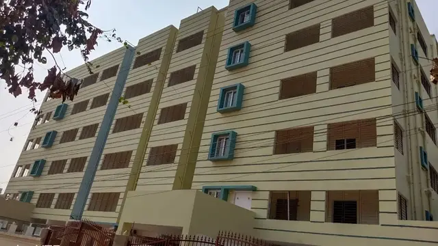
Gangareddy And Santhosh Reddy
Mr. GANGAREDDY GOVIND GARI AND Mr. ELETI SANTHOSH REDDY · Nizamabad · RERA P03100005399
GANGAREDDY AND SANTHOSH REDDY is a plotted development in Nyalkal, MOGUPAL (NEW) mandal, Nizamabad district, developed by registered promoters Mr. Gangareddy Govind Gari and Mr. Eleti Santhosh Reddy. The registered site extent is 18712.65 sq. m, and the layout comprises 55 plots; plot areas range from 122.34 sq. m to 394.73 sq. m. The project is registered with TG-RERA as P03100005399, and the promoter’s Form B undertaking gives 21sMay2025 as the project-completion date.
01What we found
Read from TG-RERA filings, approvals, land and registration records and court records. A court case is counted only when the court record states this project's survey number with its village, or names the project.
02Check before you pay
9 items to check before you pay, 3 high - from the title chain, court records and approvals, each with what to ask the builder or your advocate. An item may not be a problem with the project: records can be incomplete.
1. Project at a glance
Project identity
| Item | Record |
|---|---|
| Registered project name | GANGAREDDY AND SANTHOSH REDDY RERA record |
| Project type | Plotted development RERA record RERA filing |
| Phase / registered portion | New Project; the registration identifies the plotted layout on the survey numbers listed below. A separate phase description is not disclosed. RERA record |
| TG-RERA registration | P03100005399, granted under section 5; certificate issued 03/12/2022. |
| Registration validity | 03/12/2022 to 21/05/2025; the supplied certificate record says no extension is recorded. Validity is distinct from the completion undertaking. |
| Registered promoter | Mr. Gangareddy Govind Gari and Mr. Eleti Santhosh Reddy RERA record |
| Project status in registration data | “New Project.” The supplied registration validity ended on 21/05/2025; this does not by itself establish the project’s present completion or occupancy-certificate status. RERA record |
Land and geographic identity
| Item | Record |
|---|---|
| Locality / revenue village | Nyalkal; the project is also described in filed material as Nyalkal Village Shivar. RERA record RERA filing |
| Mandal | MOGUPAL (NEW) RERA record |
| District / PIN | Nizamabad / 503230 RERA record |
| Project survey numbers and subdivisions | 153/A, 159/E/2, 159/E/1/1 and 159/E/1/2 RERA filing |
| Registered site extent | The RERA project form records total area 18712.65 sq. m and net area 18712.65 sq. m. RERA filing |
| Layout-area figure in approval document | 18712.65 Sq. Mt. |
| Boundaries stated in RERA filing | East: Road; West: Land of Narsing Rao; North: Land of Malyal Rao and Others; South: Land of Umapathi Rao and Others. RERA filing |
Development identity
| Item | Record |
|---|---|
| Sanctioning authority | Nizamabad Urban Development Authority (NUDA); the RERA filing also names DTCP as authority. Approvals record |
| Principal layout approval reference | Draft - TLP.NO.3146/Nyalkal/2022/0003 UDA; file reference Lr.Roc.No.3146/Nyalkal/2022/0003; dated 21 May, 2022. The filed document describes a draft technical layout pattern approval communicated. Approvals record |
| Layout scale | Approval-document extraction records 55 plots. Layout record |
| Approved built-up area | 10546.77 sq. m is shown in the RERA filing as approved built-up area; for this plotted layout, the layout document separately labels 10546.77 as plotted area. RERA filing |
| Building / floor configuration | Not applicable to the plotted-layout offering as described in the supplied records; no building or floor schedule is provided. RERA record |
| Parking | A RERA filing field names mortgage area of 1649.47 sq. m; a parking count or parking arrangement is not disclosed in the supplied material. RERA filing |
Offering and status
| Item | Record |
|---|---|
| Offering | Plots in a 55-plot layout; individual plot sizes are software-read from the approved layout drawing and are detailed below. Layout record |
| Booked / available plots | Counts are not supplied. The filed allotment-letter template has blank purchaser and plot particulars. |
| Construction / development stage | RERA-field amenity entries report varying completion percentages for layout works; these are filed progress figures, not independent site verification. RERA amenities |
| Completion dates | Promoter’s Form B undertaking states 21sMay2025 as the project-completion date; the RERA certificate states registration validity ending 21/05/2025. |
| Occupancy / completion certificate | No occupancy certificate or completion certificate is included in the supplied records. The project is a plotted layout; the supplied material does not establish the certificate status of any buildings. Document index Approvals record |
2. The project story
This is a plotted-development project registered with TG-RERA as GANGAREDDY AND SANTHOSH REDDY, at Nyalkal in MOGUPAL (NEW) mandal, Nizamabad district. The registered land description covers 153/A, 159/E/2, 159/E/1/1 and 159/E/1/2. Its filed layout approval material describes a 55-plot scheme with internal roads, park/open space, utility and social-infrastructure land. RERA record RERA filing
The registration certificate records P03100005399, issued 03/12/2022 and valid through 21/05/2025. The promoter’s Form B gives a completion undertaking for 21sMay2025. These are registration-validity and promoter-declared completion dates, respectively; neither establishes that the layout works were completed or that a completion certificate was issued.
The RERA filing reports progress percentages for certain works—including internal roads, water supply, sewerage, storm-water drains and park/green strip—but those percentages are declarations in the project record, not independent verification of current site conditions. RERA amenities
3. Master plan, architecture & building design
The project is a plotted layout rather than a tower or apartment scheme. The approval-document extraction describes a 55-plot layout over 18712.65 Sq. Mt. The software-read plot schedule contains 55 plots, with plot areas ranging from 122.34 sq. m to 394.73 sq. m; the median is 178.11 sq. m. These drawing-derived measurements should be checked against the original drawing. Layout record
The layout drawing’s land-use table allocates the stated areas as follows. These are layout-document figures, not building or apartment areas:
| Layout use | Area | Share shown in drawing |
|---|---|---|
| Plotted area | 10546.77 sq. m | 56.36% |
| Roads | 6090.51 sq. m | 32.55% |
| Parks / open space | 1406.75 sq. m | 7.52% |
| Utility | 198.01 sq. m | 1.06% |
| Social infrastructure | 472.99 sq. m | 2.53% |
| Amenities | 0.00 sq. m | 0.00% |
Layout record
The extracted approval conditions refer to roads “18 mts and above,” park development and transfer of roads and open space, among other layout works. The approval document also describes draft technical layout pattern approval; it is not a building-floor plan.
4. Homes, configurations & floor plans
This is a plotted layout, so apartment configurations, apartment saleable areas and carpet areas do not apply. No booked-versus-available plot counts are supplied. RERA record
The plot sizes below are software-measured from the layout drawing, not RERA-filed unit-by-unit measurements. The source notes that the plot schedule is read from the drawing and should be verified against it. Layout record
| Plot-size band | Number of plots |
|---|---|
| 100–150 sq. yd (84–125 sq. m) | 4 |
| 150–200 sq. yd (125–167 sq. m) | 22 |
| 200–250 sq. yd (167–209 sq. m) | 14 |
| 250–300 sq. yd (209–251 sq. m) | 5 |
| 300–400 sq. yd (251–334 sq. m) | 7 |
| 400–500 sq. yd (334–418 sq. m) | 3 |
Layout record
The drawing extraction reports the smallest plot as 122.34 sq. m (146.3 sq. yd), the median as 178.11 sq. m (213.0 sq. yd) and the largest as 394.73 sq. m (472.1 sq. yd). It also identifies two plots of 200.67 sq. m and two of 122.63 sq. m. Layout record
5. Parking & vehicle circulation
The supplied records do not establish resident, visitor or accessible parking counts, a parking-allocation arrangement, or dedicated two-wheeler or EV spaces. The RERA filing’s 1649.47 sq. m “Mortgage Area” figure is not identified as parking, and the approval material describes mortgaged saleable land for layout-condition purposes. RERA filing Layout record
The layout approval extraction records roads of 18 mts and above. Detailed driveway routing, entry/exit points, pedestrian separation and parking-bay allocation are not established by the supplied extracts.
6. Amenities, recreation & open spaces
The layout approval extraction identifies park/open-space land and lists proposed layout infrastructure. Separately, the RERA amenity entries report progress percentages for several works. The percentages below are filed progress figures; no independent completion verification is supplied. RERA amenities
| Facility | Description / size | Evidence source | Declared progress / verified status |
|---|---|---|---|
| Park / open space | 1406.75 sq. m; 7.52% in the layout land-use table | Layout record | RERA amenity entry “Green Strip/TOT LOT/Park”: 60%; not independently verified. RERA amenities |
| Internal roads and footpaths | Layout roads; approval extraction states road widths of 18 mts and above | RERA amenities | RERA filing reports 60%; not independently verified. RERA amenities |
| Avenue plantation | Listed among proposed layout works; no area or quantity supplied | No separate completion figure supplied. | |
| Social infrastructure | 472.99 sq. m; 2.53% in the layout land-use table | Layout record | No completed facility or separate progress status established. |
| Clubhouse / indoor facilities | Not disclosed in the supplied records | RERA amenities | Not established. |
| Sports / recreation facilities | No specific sports facilities disclosed | RERA amenities | Not established. |
7. Utilities, building services & safety
The layout approval extraction lists proposed common septic tank/STP, internal water-supply pipelines, an overhead tank, transformer and rainwater-harvesting pits. These are listed as proposed layout works; the supplied material does not establish their capacities, current operation or independent completion.
| Service | Record and status |
|---|---|
| Water | Internal water-supply pipelines and an overhead tank are listed in the approval extraction. RERA amenity data reports “Water Supply” at 60%; source, capacity and independent verification are not supplied. RERA amenities |
| Sewerage / drainage | Common septic tank/STP is listed in the approval extraction. RERA amenity entries report sewerage (chamber, lines, septic tank, STP) at 60% and storm-water drains at 60%; treatment capacity, reuse and completion are not established. RERA amenities |
| Rainwater harvesting | Rainwater-harvesting pits are listed in the approval extraction; the RERA amenity entry reports water conservation/rainwater harvesting at 10%. RERA amenities |
| Electrical | A transformer is listed in the approval extraction. The RERA filing reports electrical meter room/sub-station/receiving station at 10%; supply capacity and backup are not disclosed. RERA amenities |
| Lighting | RERA amenity data reports street lighting at 20%. RERA amenities |
| Waste management | The RERA amenity entry for solid-waste management and disposal reports 0%; no system details are supplied. RERA amenities |
| Fire and accessibility | No specific fire-safety or accessibility system details are established in the supplied project records. RERA amenities |
8. Location, access & connectivity
The registered location is Nyalkal, MOGUPAL (NEW) mandal, Nizamabad district, Telangana, PIN 503230. The approval material describes the site as being in Nyalkal and identifies the project survey numbers as 153/A, 159/E/2, 159/E/1/1 and 159/E/1/2. RERA record
The RERA-filed boundaries are East: Road; West: Land of Narsing Rao; North: Land of Malyal Rao and Others; South: Land of Umapathi Rao and Others. A supplied connectivity record lists the nearest sampled Outer Ring Road interchange at approximately 122.8 km; no additional measured local access or public-transport details are supplied. RERA filing Location record
9. Developer & development status
The registered promoters are Mr. Gangareddy Govind Gari and Mr. Eleti Santhosh Reddy, identified in the filing as “Others” and described as “JOINT DEVELOPERS.” The entity type is not further established as a company, partnership or other incorporated legal entity in the supplied records. RERA record RERA filing Corporate record
The registration certificate gives the promoter-office field as “Village: Mandal: District: Nizamabad, Pin: 503001.” The RERA filing separately lists the project/promoter address as 1-51/29/2/4, Pangra, Nyalkal Village Shivar, Nyalkal, MOGUPAL (NEW), Nizamabad, 503230. No official website or project contact details are supplied here. RERA filing
Form B records a promoter completion undertaking of 21sMay2025. The registration certificate was valid through 21/05/2025, and the supplied record does not show an extension. Filed amenity progress percentages are reported above; no independent site inspection, completion certification or occupancy certificate is supplied. RERA amenities
10. Approvals, official records & documents
| Record | Supplied evidence |
|---|---|
| TG-RERA registration | Form C for GANGAREDDY AND SANTHOSH REDDY, registration P03100005399, issued 03/12/2022; validity stated through 21/05/2025. |
| Principal layout approval | NUDA draft technical layout pattern approval communicated; approval reference Draft - TLP.NO.3146/Nyalkal/2022/0003 UDA, file Lr.Roc.No.3146/Nyalkal/2022/0003, dated 21 May, 2022. |
| Layout drawing | Layout drawing source identified as document 249276; software extraction records two layout sheets and 55 plots. Layout record |
| Promoter declaration | Form B declaration includes the promoter’s completion undertaking and other RERA declarations. |
| Proposed allotment material | Filed allotment-letter template with purchaser and plot particulars blank. |
| Completion / occupancy documentation | No completion or occupancy certificate is present in the supplied documents. Document index |
The approval document’s extracted conditions describe the layout owner/developer as responsible for layout development and refer to transfer of roads and open space and NUDA’s mortgage of saleable land. The full conditions should be checked in the approval record; this overview does not establish completion of those conditions.
1. Project at a glance
Project identity
Registered project name: GANGAREDDY AND SANTHOSH REDDY
Project type: Plotted development
Phase / registered portion: New Project; the registration identifies the plotted layout on the survey numbers listed below. A separate phase description is not disclosed.
TG-RERA registration: P03100005399, granted under section 5; certificate issued 03/12/2022.
Registration validity: 03/12/2022 to 21/05/2025; the supplied certificate record says no extension is recorded. Validity is distinct from the completion undertaking.
Registered promoter: Mr. Gangareddy Govind Gari and Mr. Eleti Santhosh Reddy
Project status in registration data: “New Project.” The supplied registration validity ended on 21/05/2025; this does not by itself establish the project’s present completion or occupancy-certificate status.
Land and geographic identity
Locality / revenue village: Nyalkal; the project is also described in filed material as Nyalkal Village Shivar.
Mandal: MOGUPAL (NEW)
District / PIN: Nizamabad / 503230
Project survey numbers and subdivisions: 153/A, 159/E/2, 159/E/1/1 and 159/E/1/2
Registered site extent: The RERA project form records total area 18712.65 sq. m and net area 18712.65 sq. m.
Layout-area figure in approval document: 18712.65 Sq. Mt.
Boundaries stated in RERA filing: East: Road; West: Land of Narsing Rao; North: Land of Malyal Rao and Others; South: Land of Umapathi Rao and Others.
Development identity
Sanctioning authority: Nizamabad Urban Development Authority (NUDA); the RERA filing also names DTCP as authority.
Principal layout approval reference: Draft - TLP.NO.3146/Nyalkal/2022/0003 UDA; file reference Lr.Roc.No.3146/Nyalkal/2022/0003; dated 21 May, 2022. The filed document describes a draft technical layout pattern approval communicated.
Layout scale: Approval-document extraction records 55 plots.
Approved built-up area: 10546.77 sq. m is shown in the RERA filing as approved built-up area; for this plotted layout, the layout document separately labels 10546.77 as plotted area.
Building / floor configuration: Not applicable to the plotted-layout offering as described in the supplied records; no building or floor schedule is provided.
Parking: A RERA filing field names mortgage area of 1649.47 sq. m; a parking count or parking arrangement is not disclosed in the supplied material.
Offering and status
Offering: Plots in a 55-plot layout; individual plot sizes are software-read from the approved layout drawing and are detailed below.
Booked / available plots: Counts are not supplied. The filed allotment-letter template has blank purchaser and plot particulars.
Construction / development stage: RERA-field amenity entries report varying completion percentages for layout works; these are filed progress figures, not independent site verification.
Completion dates: Promoter’s Form B undertaking states 21sMay2025 as the project-completion date; the RERA certificate states registration validity ending 21/05/2025.
Occupancy / completion certificate: No occupancy certificate or completion certificate is included in the supplied records. The project is a plotted layout; the supplied material does not establish the certificate status of any buildings.
2. The project story
This is a plotted-development project registered with TG-RERA as GANGAREDDY AND SANTHOSH REDDY, at Nyalkal in MOGUPAL (NEW) mandal, Nizamabad district. The registered land description covers 153/A, 159/E/2, 159/E/1/1 and 159/E/1/2. Its filed layout approval material describes a 55-plot scheme with internal roads, park/open space, utility and social-infrastructure land.
The registration certificate records P03100005399, issued 03/12/2022 and valid through 21/05/2025. The promoter’s Form B gives a completion undertaking for 21sMay2025. These are registration-validity and promoter-declared completion dates, respectively; neither establishes that the layout works were completed or that a completion certificate was issued.
The RERA filing reports progress percentages for certain works—including internal roads, water supply, sewerage, storm-water drains and park/green strip—but those percentages are declarations in the project record, not independent verification of current site conditions.
3. Master plan, architecture & building design
The project is a plotted layout rather than a tower or apartment scheme. The approval-document extraction describes a 55-plot layout over 18712.65 Sq. Mt. The software-read plot schedule contains 55 plots, with plot areas ranging from 122.34 sq. m to 394.73 sq. m; the median is 178.11 sq. m. These drawing-derived measurements should be checked against the original drawing.
The layout drawing’s land-use table allocates the stated areas as follows. These are layout-document figures, not building or apartment areas:
| Layout use | Area | Share shown in drawing |
|---|---|---|
| Plotted area | 10546.77 sq. m | 56.36% |
| Roads | 6090.51 sq. m | 32.55% |
| Parks / open space | 1406.75 sq. m | 7.52% |
| Utility | 198.01 sq. m | 1.06% |
| Social infrastructure | 472.99 sq. m | 2.53% |
| Amenities | 0.00 sq. m | 0.00% |
The extracted approval conditions refer to roads “18 mts and above,” park development and transfer of roads and open space, among other layout works. The approval document also describes draft technical layout pattern approval; it is not a building-floor plan.
4. Homes, configurations & floor plans
This is a plotted layout, so apartment configurations, apartment saleable areas and carpet areas do not apply. No booked-versus-available plot counts are supplied.
The plot sizes below are software-measured from the layout drawing, not RERA-filed unit-by-unit measurements. The source notes that the plot schedule is read from the drawing and should be verified against it.
100–150 sq. yd (84–125 sq. m): 4
150–200 sq. yd (125–167 sq. m): 22
200–250 sq. yd (167–209 sq. m): 14
250–300 sq. yd (209–251 sq. m): 5
300–400 sq. yd (251–334 sq. m): 7
400–500 sq. yd (334–418 sq. m): 3
The drawing extraction reports the smallest plot as 122.34 sq. m (146.3 sq. yd), the median as 178.11 sq. m (213.0 sq. yd) and the largest as 394.73 sq. m (472.1 sq. yd). It also identifies two plots of 200.67 sq. m and two of 122.63 sq. m.
5. Parking & vehicle circulation
The supplied records do not establish resident, visitor or accessible parking counts, a parking-allocation arrangement, or dedicated two-wheeler or EV spaces. The RERA filing’s 1649.47 sq. m “Mortgage Area” figure is not identified as parking, and the approval material describes mortgaged saleable land for layout-condition purposes.
The layout approval extraction records roads of 18 mts and above. Detailed driveway routing, entry/exit points, pedestrian separation and parking-bay allocation are not established by the supplied extracts.
6. Amenities, recreation & open spaces
The layout approval extraction identifies park/open-space land and lists proposed layout infrastructure. Separately, the RERA amenity entries report progress percentages for several works. The percentages below are filed progress figures; no independent completion verification is supplied.
| Facility | Description / size | Evidence source | Declared progress / verified status |
|---|---|---|---|
| Park / open space | 1406.75 sq. m; 7.52% in the layout land-use table | RERA amenity entry “Green Strip/TOT LOT/Park”: 60%; not independently verified. | |
| Internal roads and footpaths | Layout roads; approval extraction states road widths of 18 mts and above | RERA filing reports 60%; not independently verified. | |
| Avenue plantation | Listed among proposed layout works; no area or quantity supplied | No separate completion figure supplied. | |
| Social infrastructure | 472.99 sq. m; 2.53% in the layout land-use table | No completed facility or separate progress status established. | |
| Clubhouse / indoor facilities | Not disclosed in the supplied records | Not established. | |
| Sports / recreation facilities | No specific sports facilities disclosed | Not established. |
7. Utilities, building services & safety
The layout approval extraction lists proposed common septic tank/STP, internal water-supply pipelines, an overhead tank, transformer and rainwater-harvesting pits. These are listed as proposed layout works; the supplied material does not establish their capacities, current operation or independent completion.
Water: Internal water-supply pipelines and an overhead tank are listed in the approval extraction. RERA amenity data reports “Water Supply” at 60%; source, capacity and independent verification are not supplied.
Sewerage / drainage: Common septic tank/STP is listed in the approval extraction. RERA amenity entries report sewerage (chamber, lines, septic tank, STP) at 60% and storm-water drains at 60%; treatment capacity, reuse and completion are not established.
Rainwater harvesting: Rainwater-harvesting pits are listed in the approval extraction; the RERA amenity entry reports water conservation/rainwater harvesting at 10%.
Electrical: A transformer is listed in the approval extraction. The RERA filing reports electrical meter room/sub-station/receiving station at 10%; supply capacity and backup are not disclosed.
Lighting: RERA amenity data reports street lighting at 20%.
Waste management: The RERA amenity entry for solid-waste management and disposal reports 0%; no system details are supplied.
Fire and accessibility: No specific fire-safety or accessibility system details are established in the supplied project records.
8. Location, access & connectivity
The registered location is Nyalkal, MOGUPAL (NEW) mandal, Nizamabad district, Telangana, PIN 503230. The approval material describes the site as being in Nyalkal and identifies the project survey numbers as 153/A, 159/E/2, 159/E/1/1 and 159/E/1/2.
The RERA-filed boundaries are East: Road; West: Land of Narsing Rao; North: Land of Malyal Rao and Others; South: Land of Umapathi Rao and Others. A supplied connectivity record lists the nearest sampled Outer Ring Road interchange at approximately 122.8 km; no additional measured local access or public-transport details are supplied.
9. Developer & development status
The registered promoters are Mr. Gangareddy Govind Gari and Mr. Eleti Santhosh Reddy, identified in the filing as “Others” and described as “JOINT DEVELOPERS.” The entity type is not further established as a company, partnership or other incorporated legal entity in the supplied records.
The registration certificate gives the promoter-office field as “Village: Mandal: District: Nizamabad, Pin: 503001.” The RERA filing separately lists the project/promoter address as 1-51/29/2/4, Pangra, Nyalkal Village Shivar, Nyalkal, MOGUPAL (NEW), Nizamabad, 503230. No official website or project contact details are supplied here.
Form B records a promoter completion undertaking of 21sMay2025. The registration certificate was valid through 21/05/2025, and the supplied record does not show an extension. Filed amenity progress percentages are reported above; no independent site inspection, completion certification or occupancy certificate is supplied.
10. Approvals, official records & documents
TG-RERA registration: Form C for GANGAREDDY AND SANTHOSH REDDY, registration P03100005399, issued 03/12/2022; validity stated through 21/05/2025.
Principal layout approval: NUDA draft technical layout pattern approval communicated; approval reference Draft - TLP.NO.3146/Nyalkal/2022/0003 UDA, file Lr.Roc.No.3146/Nyalkal/2022/0003, dated 21 May, 2022.
Layout drawing: Layout drawing source identified as document 249276; software extraction records two layout sheets and 55 plots.
Promoter declaration: Form B declaration includes the promoter’s completion undertaking and other RERA declarations.
Proposed allotment material: Filed allotment-letter template with purchaser and plot particulars blank.
Completion / occupancy documentation: No completion or occupancy certificate is present in the supplied documents.
The approval document’s extracted conditions describe the layout owner/developer as responsible for layout development and refer to transfer of roads and open space and NUDA’s mortgage of saleable land. The full conditions should be checked in the approval record; this overview does not establish completion of those conditions.
Frequently asked questions
Is GANGAREDDY AND SANTHOSH REDDY registered with Telangana RERA?
Yes. GANGAREDDY AND SANTHOSH REDDY is registered with the Telangana Real Estate Regulatory Authority as P03100005399; the registration status is New Project.
Who is the developer of GANGAREDDY AND SANTHOSH REDDY?
The promoter named in the RERA registration is Mr. GANGAREDDY GOVIND GARI AND Mr. ELETI SANTHOSH REDDY.
Where is GANGAREDDY AND SANTHOSH REDDY located?
GANGAREDDY AND SANTHOSH REDDY is in Nyalkal, MOGUPAL (NEW), Nizamabad, Telangana (503230).
When will GANGAREDDY AND SANTHOSH REDDY be completed?
The promoter's proposed date of completion filed with RERA is 21/05/2025. This is the promoter's declaration, not a guarantee.
More projects in Mogupal