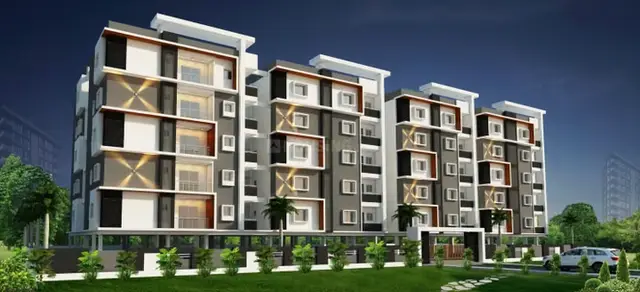
Sri Achyuta Meadows
KANKULA INFRASTRUCTURES AND DEVELOPERS LLP · Medchal-Malkajgiri · RERA P02200006958
SRI ACHYUTA MEADOWS is a plotted development in Girmapur, Medchal mandal, Medchal-Malkajgiri district, developed by KANKULA INFRASTRUCTURES AND DEVELOPERS LLP. The project covers a total site area of 40,614.58 sq.m and has 145 residential plots; buildings, floors and dwelling configurations are not stated. It is registered under TG-RERA registration number P02200006958, with proposed completion by 04th July 2026.
More from Kankula Infra Structures And Developers LLP · 2 projects →
01What we found
Read from TG-RERA filings, approvals, land and registration records and court records. A court case is counted only when the court record states this project's survey number with its village, or names the project.
02Check before you pay
13 items to check before you pay, 4 high - from the title chain, court records and approvals, each with what to ask the builder or your advocate. An item may not be a problem with the project: records can be incomplete.
1. Project at a glance
Project identity
| Field | Project record |
|---|---|
| Registered project name | SRI ACHYUTA MEADOWS RERA record |
| Project type | Plotted development / open-plot layout RERA record |
| Phase / registered portion | No separate phase name is disclosed; the RERA record identifies the project across Survey Nos. 7, 8, 48, 50, 51 and 52 RERA record |
| TG-RERA registration | P02200006958, granted under section 5 |
| Registration validity | 16/09/2023 to 04/07/2026; the registration certificate states 2 years and says extension would be by Authority approval |
| Registered promoter | KANKULA INFRASTRUCTURES AND DEVELOPERS LLP RERA record Corporate record |
| RERA status | Registration record is supplied; current status after 04/07/2026 is not established by the supplied certificate |
Land and geographic identity
| Field | Project record |
|---|---|
| Locality / revenue village | Girmapur / Girmapur RERA record Land records |
| Mandal | Medchal RERA record Land records |
| District | Medchal-Malkajgiri RERA record Land records |
| PIN | 501401 RERA record |
| Project survey numbers | 7, 8, 48, 50, 51 & 52 Land records |
| Subdivisions | The project filing identifies the survey numbers without subdivisions; parcel-specific subdivisions are not fully disclosed in the project identity record Land records |
| Total site area | 40,614.58 sq.m RERA filing |
| Road-affected area | 980.49 sq.m RERA filing |
| Net layout/site area | 39,634.09 sq.m RERA filing |
| Boundaries | North: Road; South, East and West: Neighbours Land RERA filing |
Development identity
| Field | Project record |
|---|---|
| Sanctioning authority | Hyderabad Metropolitan Development Authority (HMDA) Approvals record |
| Principal draft layout permission | 012463/LO/HMDA/2775/MED/2023, dated 24 November 2023 Approvals record |
| Final layout permit | 1937/HMDA/SWFL/2026, dated 30/03/2026 Approvals record |
| Approved built-up area | Not applicable / not disclosed for this plotted-layout record RERA filing |
| Buildings / floors | No buildings or floor configurations are part of the supplied layout description; individual plot construction permissions are to be considered separately |
| Layout plot count | Final layout letter states 145 plots |
| RERA-declared plot count | RERA record states 145 plots Layout record |
| Parking | Final layout land-use statement records 0.0 sq.m common parking area; plot-wise parking allocations are not supplied |
Offering and status
| Field | Project record |
|---|---|
| Unit type | Residential plots RERA record |
| Plot sizes / availability | RERA unit-level size, booking and availability schedules are not supplied in this evidence set RERA filing |
| Layout drawing measurements | Software-measured drawing data identifies 145 plots, with plot areas from 117.45 sq.m to 441.62 sq.m; verify against the approved drawing Layout record |
| Completion undertaking | Promoter’s Form B declares completion by 04th July 2026 |
| Architect’s completion certificate | Architect’s certificate dated 30-03-2026 states completion of the project’s construction work |
| Final layout / occupancy status | HMDA final layout letter dated 30/03/2026 is on file. It is a final layout release, not an occupancy certificate for buildings on the plots |
2. The project story
SRI ACHYUTA MEADOWS is a residential plotted layout in Girmapur village, Medchal mandal, Medchal-Malkajgiri district. The RERA record covers land identified in Survey Nos. 7, 8, 48, 50, 51 and 52 and describes a net layout area of 39,634.09 sq.m. The offering is plots for residential dwelling-house use; the final layout letter says plots are to be used for residential dwelling houses and not for shops, godowns, industry or other uses not ordinarily connected with dwelling RERA record Land records.
The RERA filing and final HMDA layout record state 145 plots. A software reading of the approved layout drawing also identifies a 145-plot schedule, but the drawing-derived count and measurements are not a substitute for the authority’s schedule Layout record. The supplied record includes a promoter completion declaration, an architect’s certificate dated 30-03-2026 and HMDA’s final layout letter. These are distinct records: the architect certificate concerns completion of the project’s construction work, while the HMDA document is the final layout release; neither establishes that any individual house has been built or received an occupancy certificate.
3. Master plan, architecture & building design
This is a plotted layout rather than a multi-storey apartment or villa development. The final layout letter records 145 plots and a net layout area of 39,634.09 sq.m. Its land-use statement allocates 24,096.18 sq.m to plots, 11,242.8 sq.m to roads, 3,004.33 sq.m to open space, 993.76 sq.m to social infrastructure and 296.55 sq.m to utilities; it records no separate amenities area.
The approved layout drawing was supplied as four sheets. Software-measured data identifies plot sizes from 117.45 sq.m to 441.62 sq.m, with a median of 139.35 sq.m; these are drawing-derived measurements and should be checked against the approved schedule Layout record. The final layout letter identifies layout permit 1937/HMDA/SWFL/2026 and states that residential building permissions on individual plots are to be considered under Building Rules–2012 and subsequent amendments. No building footprints, dwelling designs, floor configurations or approved built-up area for individual homes are disclosed in the supplied project record.
4. Homes, configurations & floor plans
The project offers plots, not a RERA-listed apartment or villa configuration. No RERA unit-wise schedule of plot sizes, booking status or availability was supplied.
| Plot information | Value | Source / measurement type |
|---|---|---|
| Plot count | 145 | RERA/layout record and final layout letter Layout record |
| Smallest plot | 117.45 sq.m | Software-measured from approved layout drawing; verify against drawing Layout record |
| Median plot | 139.35 sq.m | Software-measured from approved layout drawing; verify against drawing Layout record |
| Largest plot | 441.62 sq.m | Software-measured from approved layout drawing; verify against drawing Layout record |
The floor-plan record contains four layout sheets and no dwelling floor plans with measurable homes. Accordingly, no home carpet area, room configuration, balcony area or saleable area is stated here Floor plans. Plot area is not apartment carpet or saleable area.
5. Parking & vehicle circulation
The final HMDA layout letter records 0.0 sq.m as common parking area. The supplied record does not establish plot-wise parking spaces, visitor parking, accessible parking, EV charging, parking allotments or any exclusive parking rights.
The draft layout permission requires roads to be formed and kept open for access, including access to neighbouring sites; it also specifies road widths of 18 mts and above and 60 feet and above for the stated road categories. The final layout letter likewise requires roads to remain open for free public access and prohibits a compound wall that would block access.
6. Amenities, recreation & open spaces
The following are shown in the HMDA layout conditions or RERA amenity record. The records describe provisions and conditions; they do not independently verify the current on-site condition of each facility.
| Facility | Description / size | Evidence source | Declared progress / verified status |
|---|---|---|---|
| Open space | 3,004.33 sq.m | Final layout land-use statement | Included in final layout record; current physical condition not independently verified |
| Park / green space | Park development, avenue plantation and greenery are referenced in layout records | RERA amenities | Listed or required; completion not independently verified |
| Social infrastructure land | 993.76 sq.m | Final layout land-use statement | Included in final layout record; use/facility details not specified |
| Community buildings | No provision recorded in the RERA amenity listing | RERA amenities | Not disclosed as provided |
| Recreational open space | Amenity listing records 0% for aggregate recreational open space | RERA amenities | Not established by that listing |
7. Utilities, building services & safety
HMDA’s layout conditions describe infrastructure to be provided, including storm-water drainage, underground drainage lines and a common septic tank/STP, internal water-supply pipelines and an overhead tank, electrical supply lines, street lighting and transformer provision, rainwater-harvesting pits, avenue plantation and park development. The final layout letter states that the layout has been provided with water supply, sewerage and drainage-disposal systems, street lighting, rainwater-harvesting structure and other civic amenities, and requires their proper and effective maintenance.
The RERA amenity listing marks water supply, sewerage, storm-water drains, street lighting, sewage treatment/disposal, rainwater harvesting and an electrical meter room/sub-station/receiving station as available; it records no listed fire-safety, energy-management or solid-waste-management provision in those fields RERA amenities. The HMDA draft conditions also refer to septage treatment, solid-waste disposal and source segregation, while the final layout letter does not provide capacities or operating details for these services. No water source, storage capacity, STP capacity, electrical load, backup system, fire system, CCTV/security arrangement or accessibility specifications are supplied.
8. Location, access & connectivity
The registered location is Girmapur village, Medchal mandal, Medchal-Malkajgiri district, PIN 501401 RERA record Land records. The cadastral parcel centroid supplied for the location is 17.63326, 78.45793 Cadastral map.
The location record identifies the nearest sampled Outer Ring Road interchange at approximately 2.4 km Location record. No verified project access-road measurements, public-transport service details or independently checked travel times are supplied.
9. Developer & development status
The registered promoter is KANKULA INFRASTRUCTURES AND DEVELOPERS LLP, an LLP, with GSTIN 36AATFK0715B1ZK Corporate record RERA record. The RERA certificate lists its promoter office as “Village: Mandal: District: Hyderabad, Pin: 500100”; a complete street address and official contact details are not supplied in the certificate.
The project filing identifies Aarti Reddy Kankula as authorized signatory and lists Vasu Kakumani, Venkata Satyanarayana Raju Kanumuri and Radhika Kakkulooru as partners Parties record. The promoter’s Form B affidavit dated 16 August 2023 declares completion by 04th July 2026. The architect’s certificate records completion certification dated 30-03-2026. HMDA’s final layout letter is dated 30/03/2026. No independent site inspection or plot-by-plot construction status is supplied.
10. Approvals, official records & documents
| Identifier / date | P02200006958; issued 16/09/2023; valid through 04/07/2026 |
|---|---|
| What the supplied record establishes | Form C registration for SRI ACHYUTA MEADOWS; includes registration conditions |
| Identifier / date | 005549/LO/HMDA/1187/MED/2023; 04 July 2023 |
|---|---|
| What the supplied record establishes | Draft layout permission record for the project land and layout conditions |
| Identifier / date | 012463/LO/HMDA/2775/MED/2023; 24 November 2023 |
|---|---|
| What the supplied record establishes | Draft layout permission record; identifies 145 plots and layout land use |
| Identifier / date | 1937/HMDA/SWFL/2026; 30-03-2026 |
|---|---|
| What the supplied record establishes | Architect’s certificate states project construction work is complete |
| Identifier / date | 1937/HMDA/SWFL/2026; 30/03/2026; file 015415/HMDA/04208/SWFL/MDL1/2026 |
|---|---|
| What the supplied record establishes | Final layout release for the open-plot layout, stating 145 plots and recording land-use areas and handover/relinquishment information |
| Identifier / date | 16 August 2023 |
|---|---|
| What the supplied record establishes | Promoter declaration identifying landowner arrangements, RERA-account undertakings and completion undertaking |
The RERA registration certificate states validity only through 04/07/2026; no extension record is included here. The supplied final layout letter is a layout approval record, not an occupancy certificate for houses subsequently constructed on the plots.
1. Project at a glance
Project identity
Registered project name: SRI ACHYUTA MEADOWS
Project type: Plotted development / open-plot layout
Phase / registered portion: No separate phase name is disclosed; the RERA record identifies the project across Survey Nos. 7, 8, 48, 50, 51 and 52
TG-RERA registration: P02200006958, granted under section 5
Registration validity: 16/09/2023 to 04/07/2026; the registration certificate states 2 years and says extension would be by Authority approval
Registered promoter: KANKULA INFRASTRUCTURES AND DEVELOPERS LLP
RERA status: Registration record is supplied; current status after 04/07/2026 is not established by the supplied certificate
Land and geographic identity
Locality / revenue village: Girmapur / Girmapur
Mandal: Medchal
District: Medchal-Malkajgiri
PIN: 501401
Project survey numbers: 7, 8, 48, 50, 51 & 52
Subdivisions: The project filing identifies the survey numbers without subdivisions; parcel-specific subdivisions are not fully disclosed in the project identity record
Total site area: 40,614.58 sq.m
Road-affected area: 980.49 sq.m
Net layout/site area: 39,634.09 sq.m
Boundaries: North: Road; South, East and West: Neighbours Land
Development identity
Sanctioning authority: Hyderabad Metropolitan Development Authority (HMDA)
Principal draft layout permission: 012463/LO/HMDA/2775/MED/2023, dated 24 November 2023
Final layout permit: 1937/HMDA/SWFL/2026, dated 30/03/2026
Approved built-up area: Not applicable / not disclosed for this plotted-layout record
Buildings / floors: No buildings or floor configurations are part of the supplied layout description; individual plot construction permissions are to be considered separately
Layout plot count: Final layout letter states 145 plots
RERA-declared plot count: RERA record states 145 plots
Parking: Final layout land-use statement records 0.0 sq.m common parking area; plot-wise parking allocations are not supplied
Offering and status
Unit type: Residential plots
Plot sizes / availability: RERA unit-level size, booking and availability schedules are not supplied in this evidence set
Layout drawing measurements: Software-measured drawing data identifies 145 plots, with plot areas from 117.45 sq.m to 441.62 sq.m; verify against the approved drawing
Completion undertaking: Promoter’s Form B declares completion by 04th July 2026
Architect’s completion certificate: Architect’s certificate dated 30-03-2026 states completion of the project’s construction work
Final layout / occupancy status: HMDA final layout letter dated 30/03/2026 is on file. It is a final layout release, not an occupancy certificate for buildings on the plots
2. The project story
SRI ACHYUTA MEADOWS is a residential plotted layout in Girmapur village, Medchal mandal, Medchal-Malkajgiri district. The RERA record covers land identified in Survey Nos. 7, 8, 48, 50, 51 and 52 and describes a net layout area of 39,634.09 sq.m. The offering is plots for residential dwelling-house use; the final layout letter says plots are to be used for residential dwelling houses and not for shops, godowns, industry or other uses not ordinarily connected with dwelling.
The RERA filing and final HMDA layout record state 145 plots. A software reading of the approved layout drawing also identifies a 145-plot schedule, but the drawing-derived count and measurements are not a substitute for the authority’s schedule. The supplied record includes a promoter completion declaration, an architect’s certificate dated 30-03-2026 and HMDA’s final layout letter. These are distinct records: the architect certificate concerns completion of the project’s construction work, while the HMDA document is the final layout release; neither establishes that any individual house has been built or received an occupancy certificate.
3. Master plan, architecture & building design
This is a plotted layout rather than a multi-storey apartment or villa development. The final layout letter records 145 plots and a net layout area of 39,634.09 sq.m. Its land-use statement allocates 24,096.18 sq.m to plots, 11,242.8 sq.m to roads, 3,004.33 sq.m to open space, 993.76 sq.m to social infrastructure and 296.55 sq.m to utilities; it records no separate amenities area.
The approved layout drawing was supplied as four sheets. Software-measured data identifies plot sizes from 117.45 sq.m to 441.62 sq.m, with a median of 139.35 sq.m; these are drawing-derived measurements and should be checked against the approved schedule. The final layout letter identifies layout permit 1937/HMDA/SWFL/2026 and states that residential building permissions on individual plots are to be considered under Building Rules–2012 and subsequent amendments. No building footprints, dwelling designs, floor configurations or approved built-up area for individual homes are disclosed in the supplied project record.
4. Homes, configurations & floor plans
The project offers plots, not a RERA-listed apartment or villa configuration. No RERA unit-wise schedule of plot sizes, booking status or availability was supplied.
| Plot information | Value | Source / measurement type |
|---|---|---|
| Plot count | 145 | RERA/layout record and final layout letter |
| Smallest plot | 117.45 sq.m | Software-measured from approved layout drawing; verify against drawing |
| Median plot | 139.35 sq.m | Software-measured from approved layout drawing; verify against drawing |
| Largest plot | 441.62 sq.m | Software-measured from approved layout drawing; verify against drawing |
The floor-plan record contains four layout sheets and no dwelling floor plans with measurable homes. Accordingly, no home carpet area, room configuration, balcony area or saleable area is stated here. Plot area is not apartment carpet or saleable area.
5. Parking & vehicle circulation
The final HMDA layout letter records 0.0 sq.m as common parking area. The supplied record does not establish plot-wise parking spaces, visitor parking, accessible parking, EV charging, parking allotments or any exclusive parking rights.
The draft layout permission requires roads to be formed and kept open for access, including access to neighbouring sites; it also specifies road widths of 18 mts and above and 60 feet and above for the stated road categories. The final layout letter likewise requires roads to remain open for free public access and prohibits a compound wall that would block access.
6. Amenities, recreation & open spaces
The following are shown in the HMDA layout conditions or RERA amenity record. The records describe provisions and conditions; they do not independently verify the current on-site condition of each facility.
| Facility | Description / size | Evidence source | Declared progress / verified status |
|---|---|---|---|
| Open space | 3,004.33 sq.m | Final layout land-use statement | Included in final layout record; current physical condition not independently verified |
| Park / green space | Park development, avenue plantation and greenery are referenced in layout records | Listed or required; completion not independently verified | |
| Social infrastructure land | 993.76 sq.m | Final layout land-use statement | Included in final layout record; use/facility details not specified |
| Community buildings | No provision recorded in the RERA amenity listing | Not disclosed as provided | |
| Recreational open space | Amenity listing records 0% for aggregate recreational open space | Not established by that listing |
7. Utilities, building services & safety
HMDA’s layout conditions describe infrastructure to be provided, including storm-water drainage, underground drainage lines and a common septic tank/STP, internal water-supply pipelines and an overhead tank, electrical supply lines, street lighting and transformer provision, rainwater-harvesting pits, avenue plantation and park development. The final layout letter states that the layout has been provided with water supply, sewerage and drainage-disposal systems, street lighting, rainwater-harvesting structure and other civic amenities, and requires their proper and effective maintenance.
The RERA amenity listing marks water supply, sewerage, storm-water drains, street lighting, sewage treatment/disposal, rainwater harvesting and an electrical meter room/sub-station/receiving station as available; it records no listed fire-safety, energy-management or solid-waste-management provision in those fields. The HMDA draft conditions also refer to septage treatment, solid-waste disposal and source segregation, while the final layout letter does not provide capacities or operating details for these services. No water source, storage capacity, STP capacity, electrical load, backup system, fire system, CCTV/security arrangement or accessibility specifications are supplied.
8. Location, access & connectivity
The registered location is Girmapur village, Medchal mandal, Medchal-Malkajgiri district, PIN 501401. The cadastral parcel centroid supplied for the location is 17.63326, 78.45793.
The location record identifies the nearest sampled Outer Ring Road interchange at approximately 2.4 km. No verified project access-road measurements, public-transport service details or independently checked travel times are supplied.
9. Developer & development status
The registered promoter is KANKULA INFRASTRUCTURES AND DEVELOPERS LLP, an LLP, with GSTIN 36AATFK0715B1ZK. The RERA certificate lists its promoter office as “Village: Mandal: District: Hyderabad, Pin: 500100”; a complete street address and official contact details are not supplied in the certificate.
The project filing identifies Aarti Reddy Kankula as authorized signatory and lists Vasu Kakumani, Venkata Satyanarayana Raju Kanumuri and Radhika Kakkulooru as partners. The promoter’s Form B affidavit dated 16 August 2023 declares completion by 04th July 2026. The architect’s certificate records completion certification dated 30-03-2026. HMDA’s final layout letter is dated 30/03/2026. No independent site inspection or plot-by-plot construction status is supplied.
10. Approvals, official records & documents
| Identifier / date | P02200006958; issued 16/09/2023; valid through 04/07/2026 |
|---|---|
| What the supplied record establishes | Form C registration for SRI ACHYUTA MEADOWS; includes registration conditions |
| Identifier / date | 005549/LO/HMDA/1187/MED/2023; 04 July 2023 |
|---|---|
| What the supplied record establishes | Draft layout permission record for the project land and layout conditions |
| Identifier / date | 012463/LO/HMDA/2775/MED/2023; 24 November 2023 |
|---|---|
| What the supplied record establishes | Draft layout permission record; identifies 145 plots and layout land use |
| Identifier / date | 1937/HMDA/SWFL/2026; 30-03-2026 |
|---|---|
| What the supplied record establishes | Architect’s certificate states project construction work is complete |
| Identifier / date | 1937/HMDA/SWFL/2026; 30/03/2026; file 015415/HMDA/04208/SWFL/MDL1/2026 |
|---|---|
| What the supplied record establishes | Final layout release for the open-plot layout, stating 145 plots and recording land-use areas and handover/relinquishment information |
| Identifier / date | 16 August 2023 |
|---|---|
| What the supplied record establishes | Promoter declaration identifying landowner arrangements, RERA-account undertakings and completion undertaking |
The RERA registration certificate states validity only through 04/07/2026; no extension record is included here. The supplied final layout letter is a layout approval record, not an occupancy certificate for houses subsequently constructed on the plots.
Frequently asked questions
Is SRI ACHYUTA MEADOWS registered with Telangana RERA?
Yes. SRI ACHYUTA MEADOWS is registered with the Telangana Real Estate Regulatory Authority as P02200006958; the registration status is New Project.
Who is the developer of SRI ACHYUTA MEADOWS?
The promoter named in the RERA registration is KANKULA INFRASTRUCTURES AND DEVELOPERS LLP.
Where is SRI ACHYUTA MEADOWS located?
SRI ACHYUTA MEADOWS is in Girmapur, Medchal, Medchal-Malkajgiri, Telangana (501401).
When will SRI ACHYUTA MEADOWS be completed?
The promoter's proposed date of completion filed with RERA is 04/07/2026. This is the promoter's declaration, not a guarantee.
More projects in Girmapur