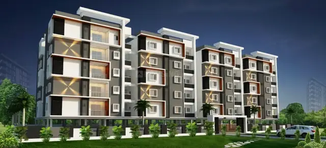
Siri Township
SHANGRILA INFRACON INDIA PRIVATE LIMITED · Medchal-Malkajgiri · RERA P02200001677
SIRI TOWNSHIP is a plotted development in Girmapur, Medchal mandal, Medchal-Malkajgiri district, developed by registered promoter SHANGRILA INFRACON INDIA PRIVATE LIMITED. The RERA land details state a total area of 66,266.73 sq.m. and a net area of 62,611.36 sq.m.; the layout drawing identifies at least 146 plots, with a drawing-derived size range of 68.91–376.51 sq.m. TG-RERA registration number P02200001677 records validity through 30/06/2022, and the Form-B declares completion on or before 30.06.2021.
More from Shangrila Infracon India Pvt Ltd · 2 projects →
01What we found
Read from TG-RERA filings, approvals, land and registration records and court records. A court case is counted only when the court record states this project's survey number with its village, or names the project.
02Check before you pay
9 items to check before you pay, 5 high - from the title chain, court records and approvals, each with what to ask the builder or your advocate. An item may not be a problem with the project: records can be incomplete.
1. Project at a glance
Project identity
| Field | Record |
|---|---|
| Registered project name | SIRI TOWNSHIP RERA record |
| Project type | Plotted development RERA record RERA filing |
| Phase / registered portion | Phase not separately identified; registration covers the plotted project on Survey Nos. 27, 30, 31 and 32 |
| TG-RERA registration | P02200001677 RERA record |
| Registration validity | 18/02/2020 to 30/06/2022, as stated in the certificate; no extension is recorded in the supplied certificate |
| Registered promoter | SHANGRILA INFRACON INDIA PRIVATE LIMITED RERA record |
| RERA status in supplied record | Certificate records registration under section 5; current registration status is not established by the supplied certificate |
Land and geographic identity
| Field | Record |
|---|---|
| Locality / revenue village | GIRMAPUR / Girmapur RERA record |
| Mandal | Medchal RERA record |
| District | Medchal-Malkajgiri RERA record |
| PIN | 501401 RERA record |
| Project survey numbers | 27, 30, 31 and 32; subdivisions are not specified in the RERA project identity RERA record |
| Registered site extent | 66,266.73 sq.m. total area; 62,611.36 sq.m. net area; 3,655.37 sq.m. affected by road widening/FTL/nala widening, as entered in the RERA land details RERA filing |
| Boundaries | East: MEDCHAL DISTRICT REVENUE LAND; West: NEIGHBOURS LAND; North: MEDCHAL TO GIRMAPUR ROAD; South: NEIGHBOURS LAND RERA filing |
Development identity
| Field | Record |
|---|---|
| Sanctioning authority | Hyderabad Metropolitan Development Authority (HMDA) |
| Principal layout approval | HMDA approval no. 000143/LO/Plg/HMDA/2019, dated 29 May, 2019; described in the filed document as a draft layout letter |
| HMDA draft-letter extent | 44,245.32 sq.m. |
| Approved built-up area | 24,851.96 sq.m., as entered in the RERA filing RERA filing |
| Plots / plot count | Layout drawing contains at least 146 plots; the extracted plot list is incomplete, so the count is a software-read minimum rather than a complete verified inventory Layout record |
| Floors, towers and building configuration | Not disclosed for this plotted development RERA filing Document index |
| Parking provision | No RERA-filed parking count or allocation is available in the supplied records Document index |
Offering and status
| Field | Record |
|---|---|
| Unit type | Plots RERA record RERA filing |
| Software-read plot sizes | 68.91–376.51 sq.m. (82.4–450.3 sq.yd); measurements and plot list are drawing-derived and require verification against the layout drawing Layout record |
| Booked / available counts | Not established in the supplied evidence Document index |
| Construction / development stage | RERA-filed progress indicators report internal roads and footpaths at 100%, water supply at 80%, sewerage at 65%, green strip/TOT LOT/park at 70%, rainwater harvesting at 65%, and electrical meter room/sub-station/receiving station at 62%; these are reported progress figures, not independent site verification RERA amenities |
| Completion dates | Form-B declares completion on or before 30.06.2021; the registration certificate states validity through 30/06/2022. These are distinct records and do not establish actual completion |
| Occupancy / completion certificate | No occupancy or completion certificate is included in the supplied project documents; status is not established Document index |
2. The project story
SIRI TOWNSHIP is a plotted residential layout registered with TG-RERA as P02200001677. The RERA project identity places it in Girmapur village, Medchal mandal, Medchal-Malkajgiri district, on Survey Nos. 27, 30, 31 and 32. The layout drawing’s software-read extraction identifies at least 146 plots, but the extracted plot list is incomplete; plot inventory and individual plot availability therefore cannot be confirmed from the supplied records. RERA record Layout record
The filed HMDA document is a draft layout letter for a plotted layout, rather than evidence of completed site works. RERA-filed infrastructure progress figures are available for selected items, but they are not independent inspections. No completion or occupancy certificate is provided, so the evidence does not establish that the development is complete or occupancy-certified. RERA amenities Document index
3. Master plan, architecture & building design
This is a plotted layout rather than a building or apartment project. The RERA land details state a total area of 66,266.73 sq.m., net area of 62,611.36 sq.m., and 3,655.37 sq.m. affected by road widening/FTL/nala widening. The HMDA draft layout letter separately records an extent of 44,245.32 sq.m. and identifies the layout as covering Survey Nos. 27, 30, 31 and 32 in Girmapur. RERA filing
The layout drawing’s area statement gives the following land-use figures, read by software from the drawing:
| Layout use | Area | Share of drawing’s net layout area |
|---|---|---|
| Plots | 24,851.96 sq.m. | 39.7% |
| Roads | 12,254.56 sq.m. | 19.6% |
| Parks / open space | 9,930.83 sq.m. | 15.9% |
| Social infrastructure | 1,207.77 sq.m. | 1.9% |
| Amenities | 0.00 sq.m. | 0.0% |
The drawing-derived land-use percentages use the stated net layout area of 62,611.36 sq.m. The plot list is incomplete, and the drawing-derived figures should be checked against the original layout drawing. The supplied records do not describe building footprints, floors, towers, or apartment circulation. Layout record
The RERA filing states an approved built-up area of 24,851.96 sq.m.; the supplied evidence does not identify this as carpet area or provide a separate saleable-area figure for the layout. RERA filing
4. Homes, configurations & floor plans
The registered offering is plots, not apartments. No complete RERA unit inventory, booked/available plot count, or unit-by-unit saleable-area schedule is available in the supplied evidence. The filed layout drawing’s software extraction identifies at least 146 plots and gives these drawing-derived size bands; the plot list is incomplete, and sizes should be verified against the drawing. RERA record Layout record
| Plot size band | Drawing-extracted plot count |
|---|---|
| 0–100 sq.yd (0–84 sq.m.) | 1 |
| 100–150 sq.yd (84–125 sq.m.) | 2 |
| 150–200 sq.yd (125–167 sq.m.) | 88 |
| 200–250 sq.yd (167–209 sq.m.) | 27 |
| 250–300 sq.yd (209–251 sq.m.) | 3 |
| 300–400 sq.yd (251–334 sq.m.) | 12 |
| 400–500 sq.yd (334–418 sq.m.) | 1 |
The drawing-derived plot-size range is 68.91–376.51 sq.m. (82.4–450.3 sq.yd), with a median of 142.14 sq.m. (170.0 sq.yd). These are software-measured layout figures, not a complete RERA-filed plot schedule. Apartment carpet area, balcony area, and common-area loading are not applicable to the plotted offering as evidenced here. Layout record
5. Parking & vehicle circulation
The layout area statement identifies 12,254.56 sq.m. of roads. The filed progress record reports internal roads and footpaths at 100%; this is a reported progress figure, not independent verification. The supplied documents do not establish parking-space counts, visitor or accessible parking, parking allocation to individual plots, vehicle entrances/exits, or EV charging provision. Layout record RERA amenities Document index
6. Amenities, recreation & open spaces
| Facility | Description / size | Evidence source | Declared progress / verified status |
|---|---|---|---|
| Internal roads and footpaths | Layout roads total 12,254.56 sq.m. in the drawing-derived area statement | Layout record RERA amenities | RERA-filed progress: 100%; not independently verified |
| Water supply | Quantity/capacity not stated | RERA amenities | RERA-filed progress: 80%; not independently verified |
| Sewerage (chamber, lines, septic tank, STP) | No capacity or system details supplied | RERA amenities | RERA-filed progress: 65%; not independently verified |
| Green strip / TOT LOT / park | Parks/open space: 9,930.83 sq.m. in the drawing-derived area statement | Layout record RERA amenities | RERA-filed progress: 70%; not independently verified |
| Social infrastructure | 1,207.77 sq.m. in the drawing-derived area statement; HMDA draft letter also identifies social infrastructure | Layout record | Progress not reported |
| Rainwater harvesting | No capacity or design details supplied | RERA amenities | RERA-filed progress: 65%; not independently verified |
| Street lighting | No further description supplied | RERA amenities | Progress recorded as 0% |
| Community buildings | No building description or size supplied | RERA amenities | Progress recorded as 0% |
The vendor record lists a swimming pool, gym, children’s play area, clubhouse, covered car parking, backup electricity, society compound, gated community, rainwater harvesting and street lighting as amenities. These are vendor-listed features, not established here as sanctioned or delivered facilities. Promoter website
7. Utilities, building services & safety
The RERA-filed progress record includes water supply at 80%, sewerage at 65%, rainwater harvesting at 65%, and electrical meter room/sub-station/receiving station at 62%; these are recorded progress percentages, not independent verification. It records storm-water drains, sewage/sullage treatment and disposal, solid-waste management, energy management, and fire protection/fire-safety requirements at 0% progress. The supplied evidence does not give capacities, technical specifications, or completion certificates for these services. RERA amenities
8. Location, access & connectivity
The registered location is Girmapur village, Medchal mandal, Medchal-Malkajgiri district, PIN 501401. The RERA land details give the northern boundary as MEDCHAL TO GIRMAPUR ROAD. The supplied location record identifies Financial District (Nanakramguda) at a measured distance of 1.2 km; the evidence does not describe the route or travel time. RERA record RERA filing Location record
9. Developer & development status
The registered promoter is SHANGRILA INFRACON INDIA PRIVATE LIMITED, identified as a company in the RERA filing. The supplied RERA certificate records the project registration period as 18/02/2020 to 30/06/2022. The Form-B affidavit dated 25/06/2019 declares that the promoter would complete the project on or before 30.06.2021. Neither the declaration nor the registration period establishes actual completion; no completion or occupancy certificate is supplied. RERA record Corporate record Document index
The supplied project records name SNA AVENUES as a revenue-share landowner/promoter participant. The Form-B declaration is the promoter’s assertion that the land was free from encumbrances and that it would meet the stated project, fund-deposit, audit and approval undertakings; it is a declaration, not independent verification of performance. Parties record
10. Approvals, official records & documents
| Record | What the supplied document establishes |
|---|---|
| TG-RERA certificate, P02200001677 | Form ‘C’ certificate records registration of SIRI TOWNSHIP under section 5, with validity from 18/02/2020 through 30/06/2022 |
| HMDA draft layout letter, 000143/LO/Plg/HMDA/2019 | Dated 29 May, 2019; concerns a draft plotted layout on Survey Nos. 27, 30, 31 and 32 in Girmapur, Medchal mandal; includes layout conditions and an HMDA mortgage over specified plots |
| Medchal Municipality intimation, NO.G1/1306/LO/2019 | Dated 19.08.2019; concerns the draft residential layout and requests ownership and land-conversion documents, charges, and fulfilment of conditions for further action |
| Form-B declaration | Promoter affidavit dated 25/06/2019 at Hyderabad, containing promoter declarations and undertakings |
| Layout drawing | One layout sheet is recorded; software extraction identifies plot layout, area statement and a plot list that is incomplete Layout record |
No occupancy/completion certificate is present in the supplied documents. The HMDA layout letter is described as a draft approval, and the municipality document as an intimation; the supplied material does not establish the subsequent completion of the requested steps. Document index
1. Project at a glance
Project identity
Registered project name: SIRI TOWNSHIP
Project type: Plotted development
Phase / registered portion: Phase not separately identified; registration covers the plotted project on Survey Nos. 27, 30, 31 and 32
TG-RERA registration: P02200001677
Registration validity: 18/02/2020 to 30/06/2022, as stated in the certificate; no extension is recorded in the supplied certificate
Registered promoter: SHANGRILA INFRACON INDIA PRIVATE LIMITED
RERA status in supplied record: Certificate records registration under section 5; current registration status is not established by the supplied certificate
Land and geographic identity
Locality / revenue village: GIRMAPUR / Girmapur
Mandal: Medchal
District: Medchal-Malkajgiri
PIN: 501401
Project survey numbers: 27, 30, 31 and 32; subdivisions are not specified in the RERA project identity
Registered site extent: 66,266.73 sq.m. total area; 62,611.36 sq.m. net area; 3,655.37 sq.m. affected by road widening/FTL/nala widening, as entered in the RERA land details
Boundaries: East: MEDCHAL DISTRICT REVENUE LAND; West: NEIGHBOURS LAND; North: MEDCHAL TO GIRMAPUR ROAD; South: NEIGHBOURS LAND
Development identity
Sanctioning authority: Hyderabad Metropolitan Development Authority (HMDA)
Principal layout approval: HMDA approval no. 000143/LO/Plg/HMDA/2019, dated 29 May, 2019; described in the filed document as a draft layout letter
HMDA draft-letter extent: 44,245.32 sq.m.
Approved built-up area: 24,851.96 sq.m., as entered in the RERA filing
Plots / plot count: Layout drawing contains at least 146 plots; the extracted plot list is incomplete, so the count is a software-read minimum rather than a complete verified inventory
Floors, towers and building configuration: Not disclosed for this plotted development
Parking provision: No RERA-filed parking count or allocation is available in the supplied records
Offering and status
Unit type: Plots
Software-read plot sizes: 68.91–376.51 sq.m. (82.4–450.3 sq.yd); measurements and plot list are drawing-derived and require verification against the layout drawing
Booked / available counts: Not established in the supplied evidence
Construction / development stage: RERA-filed progress indicators report internal roads and footpaths at 100%, water supply at 80%, sewerage at 65%, green strip/TOT LOT/park at 70%, rainwater harvesting at 65%, and electrical meter room/sub-station/receiving station at 62%; these are reported progress figures, not independent site verification
Completion dates: Form-B declares completion on or before 30.06.2021; the registration certificate states validity through 30/06/2022. These are distinct records and do not establish actual completion
Occupancy / completion certificate: No occupancy or completion certificate is included in the supplied project documents; status is not established
2. The project story
SIRI TOWNSHIP is a plotted residential layout registered with TG-RERA as P02200001677. The RERA project identity places it in Girmapur village, Medchal mandal, Medchal-Malkajgiri district, on Survey Nos. 27, 30, 31 and 32. The layout drawing’s software-read extraction identifies at least 146 plots, but the extracted plot list is incomplete; plot inventory and individual plot availability therefore cannot be confirmed from the supplied records.
The filed HMDA document is a draft layout letter for a plotted layout, rather than evidence of completed site works. RERA-filed infrastructure progress figures are available for selected items, but they are not independent inspections. No completion or occupancy certificate is provided, so the evidence does not establish that the development is complete or occupancy-certified.
3. Master plan, architecture & building design
This is a plotted layout rather than a building or apartment project. The RERA land details state a total area of 66,266.73 sq.m., net area of 62,611.36 sq.m., and 3,655.37 sq.m. affected by road widening/FTL/nala widening. The HMDA draft layout letter separately records an extent of 44,245.32 sq.m. and identifies the layout as covering Survey Nos. 27, 30, 31 and 32 in Girmapur.
The layout drawing’s area statement gives the following land-use figures, read by software from the drawing:
| Layout use | Area | Share of drawing’s net layout area |
|---|---|---|
| Plots | 24,851.96 sq.m. | 39.7% |
| Roads | 12,254.56 sq.m. | 19.6% |
| Parks / open space | 9,930.83 sq.m. | 15.9% |
| Social infrastructure | 1,207.77 sq.m. | 1.9% |
| Amenities | 0.00 sq.m. | 0.0% |
The drawing-derived land-use percentages use the stated net layout area of 62,611.36 sq.m. The plot list is incomplete, and the drawing-derived figures should be checked against the original layout drawing. The supplied records do not describe building footprints, floors, towers, or apartment circulation.
The RERA filing states an approved built-up area of 24,851.96 sq.m.; the supplied evidence does not identify this as carpet area or provide a separate saleable-area figure for the layout.
4. Homes, configurations & floor plans
The registered offering is plots, not apartments. No complete RERA unit inventory, booked/available plot count, or unit-by-unit saleable-area schedule is available in the supplied evidence. The filed layout drawing’s software extraction identifies at least 146 plots and gives these drawing-derived size bands; the plot list is incomplete, and sizes should be verified against the drawing.
0–100 sq.yd (0–84 sq.m.): 1
100–150 sq.yd (84–125 sq.m.): 2
150–200 sq.yd (125–167 sq.m.): 88
200–250 sq.yd (167–209 sq.m.): 27
250–300 sq.yd (209–251 sq.m.): 3
300–400 sq.yd (251–334 sq.m.): 12
400–500 sq.yd (334–418 sq.m.): 1
The drawing-derived plot-size range is 68.91–376.51 sq.m. (82.4–450.3 sq.yd), with a median of 142.14 sq.m. (170.0 sq.yd). These are software-measured layout figures, not a complete RERA-filed plot schedule. Apartment carpet area, balcony area, and common-area loading are not applicable to the plotted offering as evidenced here.
5. Parking & vehicle circulation
The layout area statement identifies 12,254.56 sq.m. of roads. The filed progress record reports internal roads and footpaths at 100%; this is a reported progress figure, not independent verification. The supplied documents do not establish parking-space counts, visitor or accessible parking, parking allocation to individual plots, vehicle entrances/exits, or EV charging provision.
6. Amenities, recreation & open spaces
| Facility | Description / size | Evidence source | Declared progress / verified status |
|---|---|---|---|
| Internal roads and footpaths | Layout roads total 12,254.56 sq.m. in the drawing-derived area statement | RERA-filed progress: 100%; not independently verified | |
| Water supply | Quantity/capacity not stated | RERA-filed progress: 80%; not independently verified | |
| Sewerage (chamber, lines, septic tank, STP) | No capacity or system details supplied | RERA-filed progress: 65%; not independently verified | |
| Green strip / TOT LOT / park | Parks/open space: 9,930.83 sq.m. in the drawing-derived area statement | RERA-filed progress: 70%; not independently verified | |
| Social infrastructure | 1,207.77 sq.m. in the drawing-derived area statement; HMDA draft letter also identifies social infrastructure | Progress not reported | |
| Rainwater harvesting | No capacity or design details supplied | RERA-filed progress: 65%; not independently verified | |
| Street lighting | No further description supplied | Progress recorded as 0% | |
| Community buildings | No building description or size supplied | Progress recorded as 0% |
The vendor record lists a swimming pool, gym, children’s play area, clubhouse, covered car parking, backup electricity, society compound, gated community, rainwater harvesting and street lighting as amenities. These are vendor-listed features, not established here as sanctioned or delivered facilities.
7. Utilities, building services & safety
The RERA-filed progress record includes water supply at 80%, sewerage at 65%, rainwater harvesting at 65%, and electrical meter room/sub-station/receiving station at 62%; these are recorded progress percentages, not independent verification. It records storm-water drains, sewage/sullage treatment and disposal, solid-waste management, energy management, and fire protection/fire-safety requirements at 0% progress. The supplied evidence does not give capacities, technical specifications, or completion certificates for these services.
8. Location, access & connectivity
The registered location is Girmapur village, Medchal mandal, Medchal-Malkajgiri district, PIN 501401. The RERA land details give the northern boundary as MEDCHAL TO GIRMAPUR ROAD. The supplied location record identifies Financial District (Nanakramguda) at a measured distance of 1.2 km; the evidence does not describe the route or travel time.
9. Developer & development status
The registered promoter is SHANGRILA INFRACON INDIA PRIVATE LIMITED, identified as a company in the RERA filing. The supplied RERA certificate records the project registration period as 18/02/2020 to 30/06/2022. The Form-B affidavit dated 25/06/2019 declares that the promoter would complete the project on or before 30.06.2021. Neither the declaration nor the registration period establishes actual completion; no completion or occupancy certificate is supplied.
The supplied project records name SNA AVENUES as a revenue-share landowner/promoter participant. The Form-B declaration is the promoter’s assertion that the land was free from encumbrances and that it would meet the stated project, fund-deposit, audit and approval undertakings; it is a declaration, not independent verification of performance.
10. Approvals, official records & documents
TG-RERA certificate, P02200001677: Form ‘C’ certificate records registration of SIRI TOWNSHIP under section 5, with validity from 18/02/2020 through 30/06/2022
HMDA draft layout letter, 000143/LO/Plg/HMDA/2019: Dated 29 May, 2019; concerns a draft plotted layout on Survey Nos. 27, 30, 31 and 32 in Girmapur, Medchal mandal; includes layout conditions and an HMDA mortgage over specified plots
Medchal Municipality intimation, NO.G1/1306/LO/2019: Dated 19.08.2019; concerns the draft residential layout and requests ownership and land-conversion documents, charges, and fulfilment of conditions for further action
Form-B declaration: Promoter affidavit dated 25/06/2019 at Hyderabad, containing promoter declarations and undertakings
Layout drawing: One layout sheet is recorded; software extraction identifies plot layout, area statement and a plot list that is incomplete
No occupancy/completion certificate is present in the supplied documents. The HMDA layout letter is described as a draft approval, and the municipality document as an intimation; the supplied material does not establish the subsequent completion of the requested steps.
Frequently asked questions
Is SIRI TOWNSHIP registered with Telangana RERA?
Yes. SIRI TOWNSHIP is registered with the Telangana Real Estate Regulatory Authority as P02200001677; the registration status is New Project.
Who is the developer of SIRI TOWNSHIP?
The promoter named in the RERA registration is SHANGRILA INFRACON INDIA PRIVATE LIMITED.
Where is SIRI TOWNSHIP located?
SIRI TOWNSHIP is in GIRMAPUR, Medchal, Medchal-Malkajgiri, Telangana (501401).
When will SIRI TOWNSHIP be completed?
The promoter's proposed date of completion filed with RERA is 30/06/2022. This is the promoter's declaration, not a guarantee.
More projects in Girmapur