Kaveri
Manasri Infrastructure & Developers Pvt Ltd · Medchal-Malkajgiri · RERA P02200008661
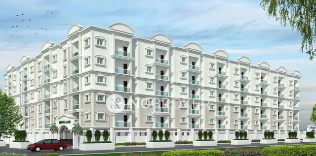
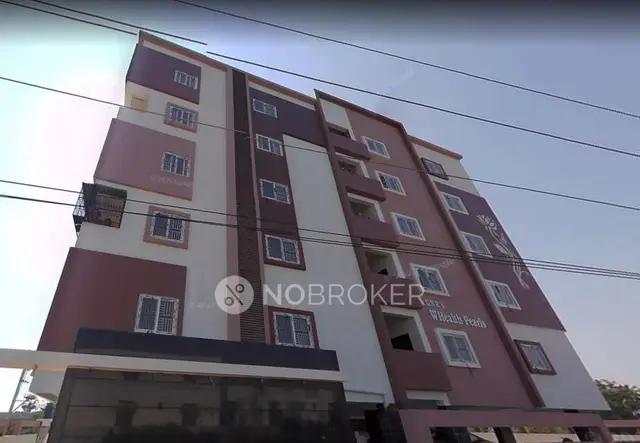
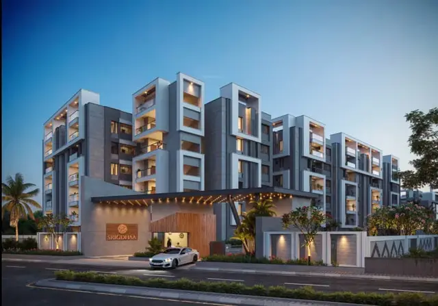
Kaveri is a residential apartment project in Chowdaryguda Jodimetla, Ghatkesar mandal, Medchal-Malkajgiri district, developed by registered promoter Manasri Infrastructure & Developers Pvt Ltd. It is on 373.46 sq. m of land and comprises one residential building with 1 stilt + 5 upper floors and 10 2BHK (“DOUBLE BEDROOM”) units. The project is registered with TG-RERA under P02200008661, with proposed completion on 30/11/2026.
More from Manasri Infrastructure & Developers Pvt Ltd · 4 projects →
01What we found
Read from TG-RERA filings, approvals, land and registration records and court records. A court case is counted only when the court record states this project's survey number with its village, or names the project.
02Check before you pay
7 items to check before you pay, 3 high - from the title chain, court records and approvals, each with what to ask the builder or your advocate. An item may not be a problem with the project: records can be incomplete.
1. Project at a glance
Project identity
| Field | Project record |
|---|---|
| Registered project name | Kaveri RERA record |
| Project type | Residential apartment project RERA record RERA filing |
| Phase / registered portion | Phase not separately identified; registration is for the Kaveri project. RERA record |
| TG-RERA registration | P02200008661 RERA record |
| Registration validity | Certificate states validity from 20/08/2024 to 27/10/2025, unless extended by the Authority. No extension record is included in this evidence pack. Registration validity is distinct from the completion deadline. RERA record |
| Registered promoter | Manasri Infrastructure & Developers Pvt Ltd RERA record |
| RERA status | The project is recorded as a registered project. Current registration status after the certificate’s stated expiry date is not established by the supplied documents. RERA record |
Land and geographic identity
| Field | Project record |
|---|---|
| Locality | Chowdaryguda Jodimetla RERA record |
| Revenue village | Korremula (also rendered “Korremul” in approval-document extracts) RERA record |
| Mandal / district / PIN | Ghatkesar / Medchal-Malkajgiri / 501301 RERA record |
| Project survey numbers and subdivisions | 773 A 1 and 773 AA 2 as stated in the TG-RERA registration record; building approval extracts render these as 773/A/1 and 773/AA/2. RERA record |
| Registered project site extent | 373.46 sq. m in the registration fields and building-approval extract. RERA filing |
| Net / total area | TG-RERA land record states total area and net area of 373.46 sq. m, with 0 area affected by road widening/FTL/Nala widening. RERA filing |
| Boundaries | East: Neighbours Land; West: Social Infrastructure and Plot No 3; North: Neighbours Land; South: 9 mts wide Road. RERA filing |
Development identity
| Field | Project record |
|---|---|
| Sanctioning authority | HMDA technical approval, with local-body sanction/permission also recorded in the filed documents. Approvals record |
| Principal building approval | 052299/GHT/R1/U6/HMDA/09022022, dated 28/10/2022. The HMDA document describes technical approval and directs the applicant to approach the local Executive Authority for sanction and release. Approvals record |
| Local-body building permission | Chowdariguda Gram Panchayat proceedings GPC/38/2023, dated 13.04.2023, for a residential building of 1 stilt + 5 upper floors. Approvals record |
| Approved building area figures | HMDA extract lists Total Built Up Area 1168.03 sq. m and Proposed Net BUA Area 969.60 sq. m; a separate plan extract lists Residential Net BUA 969.62 and Proposed Net BUA Area 984.74. These are the labels and figures in the filed approval extracts, not interchangeable area measures. |
| Building count and configuration | One residential building; 1 stilt + 5 upper floors. The approval extract records building height 14.98 MT and total height 19.73 mt. |
| Parking level | Stilt/cellar space is designated for vehicle parking in the approval conditions; the supplied record does not establish a parking-space count. |
| Unit count | Approved plan extract: 10 dwelling units; RERA unit record: 10 units. RERA unit table |
Offering and status
| Field | Project record |
|---|---|
| Unit type | 2BHK, filed as “DOUBLE BEDROOM” RERA unit table |
| RERA saleable area | 115.0 sq. m per unit RERA unit table |
| Booked / available | 0 booked / 10 available, as last read from the TG-RERA portal; the record does not provide an as-of date, so counts are indicative. RERA unit table |
| Construction stage | No independently verified construction-progress report or site-stage evidence is supplied. The filed permission is for proposed construction; the Gram Panchayat document requires an Occupancy Certificate after construction. |
| Completion dates recorded | Project header lists proposed completion 30/11/2026. The RERA registration certificate states validity ending 27/10/2025; the supplied Form B declaration dated 8 May 2024 undertakes completion by 27th OCT 2025. These dates represent different record fields and are not a confirmation of completion. RERA record |
| Occupancy / completion certificate | No OC or completion certificate is included in the supplied project documents. The permission documents require one before occupation. |
2. The project story
Kaveri is recorded with TG-RERA as a residential apartment project on Plot No. 4 in Korremula village, Ghatkesar mandal, Medchal-Malkajgiri district. Its registered land identifiers are survey subdivisions 773 A 1 and 773 AA 2. The filed building approvals describe a single building with a stilt level and five upper floors, containing 10 dwelling units. RERA record RERA filing
The RERA unit record lists ten 2BHK (“DOUBLE BEDROOM”) apartments, all shown as available and none booked in the portal snapshot; the snapshot has no recorded as-of date. The approval documents and RERA fields establish the proposed building and offering, but the evidence supplied does not establish the current physical construction stage or independently verify completion. No occupancy certificate is supplied. RERA unit table
3. Master plan, architecture & building design
The building approval is for one residential building on a plot recorded as 373.46 sq. m, with 1 stilt + 5 upper floors. The building-plan extract records a proposed coverage area of 193.92 sq. m (51.93%), a vacant plot area of 179.54 sq. m, and a 1.00 M GREEN BELT. The plan extract also states a 14.98 MT building height and 19.73 mt total height.
The approved-area figures are reported under their source labels: 1168.03 sq. m Total Built Up Area, 969.60 sq. m Proposed Net BUA Area, 969.62 Residential Net BUA, and 984.74 Proposed Net BUA Area in the relevant plan extracts. These figures are not a statement of carpet area or saleable area. The supplied drawings do not establish a reliable count of flats per floor, detailed circulation, entrances/exits, or lift count; the filed plan extract lists a lift dimension of 1.50X1.50.
A separate HMDA layout document concerns the wider layout and records survey numbers 773/A and 773/AA, site area 6998.05 sq. m, roads, park/open space, social infrastructure, and four mortgaged plots. The Kaveri building approval, by contrast, identifies Plot No. 4 and the apartment-site extent of 373.46 sq. m. The layout drawing extraction is software-read and notes that plot count and sizes should be checked against the drawing.
4. Homes, configurations & floor plans
| Configuration | Units | Booked | Available | RERA saleable area | Measured carpet area | Loading (if supplied) |
|---|---|---|---|---|---|---|
| 2BHK (“DOUBLE BEDROOM”) | 10 | 0 | 10 | 115.0 sq. m | Median 61.6 sq. m; measured range 58.4–74.5 sq. m | 46% RERA unit table Floor plans |
The unit count, booking count, availability and saleable area are from the TG-RERA unit record. The booked/available figures have no supplied as-of date and should be treated as indicative. RERA unit table
Carpet measurements are software-measured from the approved floor-plan drawing, not RERA-filed measurements; six flat designs were measured, and all six are marked as needing review. The drawing’s sample unit shows living/dining, two bedrooms, kitchen, two toilets, utility and two balcony spaces. The extracted room dimensions include a living/dining area of 6.0 × 3.36 m, kitchen 2.89 × 4.78 m, and utility 1.47 × 3.12 m; utility and balcony areas are excluded from the measured carpet area. Verify these software measurements against the drawing. Carpet area excludes the stated utility/balcony spaces; saleable area is a separate RERA-filed figure and includes more than the home’s carpet area. Floor plans RERA unit details
5. Parking & vehicle circulation
The approval conditions designate the stilt/cellar exclusively for vehicle parking and prohibit partition walls, rolling shutters or conversion to another use. The plan extraction lists “PARKING,” but the supplied evidence does not establish the number of sanctioned parking spaces, visitor or accessible spaces, or a unit-wise parking allocation. A drawn parking indication does not by itself establish exclusive ownership or allocation.
The building-plan conditions refer to road widths including 9.00, 9, and 4.5M, and the layout file records 9.14 as the abutting road width. The supplied documents do not establish ramp details, parking circulation arrangements, pedestrian separation, EV charging, or a verified spaces-per-home ratio.
6. Amenities, recreation & open spaces
| Facility | Description / size | Evidence source | Declared progress / verified status |
|---|---|---|---|
| Tot-lot | Listed as a building amenity; the layout extract labels “Tot lot Area: 664.37.” The layout land-use record separately identifies 664.37 sq. m as park/open space. | Approval/document-listed; completion not verified. | |
| Park / green space | Layout records park area 664.37 sq. m (9.49%). | Layout-recorded; completion not verified. | |
| Social infrastructure area | 179.54 sq. m (2.57%) in the layout document. | Layout-recorded; completion not verified. | |
| Layout roads | 1767.61 sq. m (25.26%) in the layout document. | Layout-recorded; completion not verified. | |
| Transformer | Listed in the layout drawing and building approval. | Document-listed; installation not verified. | |
| Community buildings / clubhouse / sports facilities | No specific facilities or sizes are established in the supplied project evidence. | RERA amenities | Not established. |
The layout approval document states that park/open-space, social-infrastructure and road areas are to be handed over to the local body by registered gift deed before release of the final layout plan. The supplied evidence does not verify completion or handover.
7. Utilities, building services & safety
The building approval lists a sump, overhead tank, septic tank, underground drainage and transformer. Its conditions also require rainwater-harvesting structures, a garbage house, and compliance with stated fire-safety and structural-safety requirements. These are approval/document requirements or listed provisions; the supplied material does not verify installation, capacity, commissioning or operational status.
The building-plan conditions specify fire extinguishers and provide a sprinkler-system condition where basement area exceeds 200 Sq. Mtrs. They also require fire-vehicle manoeuvrability through joint open spaces with neighbouring premises, and state that permanent HMWS&SB and T.S. Transco connections are not to be provided until an occupancy certificate is produced. No water-source details, storage capacities, sewage-treatment capacity, electrical backup, lift capacity, CCTV/security system, waste-segregation arrangement or accessibility features are established by the supplied evidence.
8. Location, access & connectivity
The registered location is Korremula, Ghatkesar, Medchal-Malkajgiri, 501301, with locality recorded as Chowdaryguda Jodimetla. The approval documents also refer to Korremul/Korremula and, in the Gram Panchayat permission, Chowdariguda. RERA record
The supplied location record gives the nearest sampled Outer Ring Road interchange as approximately 4.9 km. This is a measured distance in the location data, not a travel-time estimate. No public-transport details or additional landmark distances are established in the supplied evidence. Location record
9. Developer & development status
The registered promoter is Manasri Infrastructure & Developers Pvt Ltd, a private limited company. Its GSTIN is 36AAKCM5413E1ZM. The project record lists the promoter address as Nishaa-Na-Iqbal, Gaffar Khan Colony, Srinidhi Enclave, Chowdaryguda Jodimetla, Ghatkesar, Medchal-Malkajgiri, 501301; the registration certificate gives a separate promoter address in Sriram Nagar (Banjara Hills), Shaikpet, Hyderabad, PIN 500034. Corporate record Parties record
The filed documents identify the landowners as Akiti Bal Reddy and Akiti Bhaskar Reddy and the promoter as development-agreement-cum-GPA holder. The supplied record does not provide independently verified construction progress. The project header gives a proposed completion date of 30/11/2026; the registration certificate’s validity end date and the Form B completion undertaking are recorded separately above and do not establish current completion or OC status. Parties record RERA record
10. Approvals, official records & documents
| Identifier / date | P02200008661; validity stated 20/08/2024–27/10/2025 |
|---|---|
| What the supplied document establishes | Registration certificate for Kaveri naming Manasri Infrastructure & Developers Pvt Ltd as promoter. |
| Identifier / date | 052299/GHT/R1/U6/HMDA/09022022; 28/10/2022 |
|---|---|
| What the supplied document establishes | Technical approval extract for a residential building on Plot No. 4, survey subdivisions 773/A/1 and 773/AA/2, with conditions including local-authority sanction and an OC before occupation. |
| Identifier / date | 052299/GHT/R1/U6/HMDA/09022022; 28 October, 2022 |
|---|---|
| What the supplied document establishes | Plan extract records one building, 1 stilt + 5 upper floors and 10 dwelling units. |
| Identifier / date | GPC/38/2023; 13.04.2023 |
|---|---|
| What the supplied document establishes | Chowdariguda Gram Panchayat permission for 1 stilt + 5 upper floors; its conditions require an OC after construction. |
| Identifier / date | 000097/LO/Plg/HMDA/2019; 03 May, 2019; application 007581/GHT/LT/U6/HMDA/25012018 |
|---|---|
| What the supplied document establishes | Layout-plan and draft-layout extracts for survey numbers 773/A and 773/AA, with land-use components and four mortgaged plots. |
| Identifier / date | Dated 08 day of May 2024 |
|---|---|
| What the supplied document establishes | Promoter declaration for Kaveri covering title basis, encumbrance wording, project-fund commitments and a completion undertaking. |
| Identifier / date | Document 384637 |
|---|---|
| What the supplied document establishes | Contains site plan, elevation, stilt-floor plan, section, mortgage-floor plan and terrace-floor plan; the supplied extraction does not reliably identify an approval authority or approval number. |
| Identifier / date | Not supplied |
|---|---|
| What the supplied document establishes | No OC or completion certificate is established by the documents provided. |
1. Project at a glance
Project identity
Registered project name: Kaveri
Project type: Residential apartment project
Phase / registered portion: Phase not separately identified; registration is for the Kaveri project.
TG-RERA registration: P02200008661
Registration validity: Certificate states validity from 20/08/2024 to 27/10/2025, unless extended by the Authority. No extension record is included in this evidence pack. Registration validity is distinct from the completion deadline.
Registered promoter: Manasri Infrastructure & Developers Pvt Ltd
RERA status: The project is recorded as a registered project. Current registration status after the certificate’s stated expiry date is not established by the supplied documents.
Land and geographic identity
Locality: Chowdaryguda Jodimetla
Revenue village: Korremula (also rendered “Korremul” in approval-document extracts)
Mandal / district / PIN: Ghatkesar / Medchal-Malkajgiri / 501301
Project survey numbers and subdivisions: 773 A 1 and 773 AA 2 as stated in the TG-RERA registration record; building approval extracts render these as 773/A/1 and 773/AA/2.
Registered project site extent: 373.46 sq. m in the registration fields and building-approval extract.
Net / total area: TG-RERA land record states total area and net area of 373.46 sq. m, with 0 area affected by road widening/FTL/Nala widening.
Boundaries: East: Neighbours Land; West: Social Infrastructure and Plot No 3; North: Neighbours Land; South: 9 mts wide Road.
Development identity
Sanctioning authority: HMDA technical approval, with local-body sanction/permission also recorded in the filed documents.
Principal building approval: 052299/GHT/R1/U6/HMDA/09022022, dated 28/10/2022. The HMDA document describes technical approval and directs the applicant to approach the local Executive Authority for sanction and release.
Local-body building permission: Chowdariguda Gram Panchayat proceedings GPC/38/2023, dated 13.04.2023, for a residential building of 1 stilt + 5 upper floors.
Approved building area figures: HMDA extract lists Total Built Up Area 1168.03 sq. m and Proposed Net BUA Area 969.60 sq. m; a separate plan extract lists Residential Net BUA 969.62 and Proposed Net BUA Area 984.74. These are the labels and figures in the filed approval extracts, not interchangeable area measures.
Building count and configuration: One residential building; 1 stilt + 5 upper floors. The approval extract records building height 14.98 MT and total height 19.73 mt.
Parking level: Stilt/cellar space is designated for vehicle parking in the approval conditions; the supplied record does not establish a parking-space count.
Unit count: Approved plan extract: 10 dwelling units; RERA unit record: 10 units.
Offering and status
Unit type: 2BHK, filed as “DOUBLE BEDROOM”
RERA saleable area: 115.0 sq. m per unit
Booked / available: 0 booked / 10 available, as last read from the TG-RERA portal; the record does not provide an as-of date, so counts are indicative.
Construction stage: No independently verified construction-progress report or site-stage evidence is supplied. The filed permission is for proposed construction; the Gram Panchayat document requires an Occupancy Certificate after construction.
Completion dates recorded: Project header lists proposed completion 30/11/2026. The RERA registration certificate states validity ending 27/10/2025; the supplied Form B declaration dated 8 May 2024 undertakes completion by 27th OCT 2025. These dates represent different record fields and are not a confirmation of completion.
Occupancy / completion certificate: No OC or completion certificate is included in the supplied project documents. The permission documents require one before occupation.
2. The project story
Kaveri is recorded with TG-RERA as a residential apartment project on Plot No. 4 in Korremula village, Ghatkesar mandal, Medchal-Malkajgiri district. Its registered land identifiers are survey subdivisions 773 A 1 and 773 AA 2. The filed building approvals describe a single building with a stilt level and five upper floors, containing 10 dwelling units.
The RERA unit record lists ten 2BHK (“DOUBLE BEDROOM”) apartments, all shown as available and none booked in the portal snapshot; the snapshot has no recorded as-of date. The approval documents and RERA fields establish the proposed building and offering, but the evidence supplied does not establish the current physical construction stage or independently verify completion. No occupancy certificate is supplied.
3. Master plan, architecture & building design
The building approval is for one residential building on a plot recorded as 373.46 sq. m, with 1 stilt + 5 upper floors. The building-plan extract records a proposed coverage area of 193.92 sq. m (51.93%), a vacant plot area of 179.54 sq. m, and a 1.00 M GREEN BELT. The plan extract also states a 14.98 MT building height and 19.73 mt total height.
The approved-area figures are reported under their source labels: 1168.03 sq. m Total Built Up Area, 969.60 sq. m Proposed Net BUA Area, 969.62 Residential Net BUA, and 984.74 Proposed Net BUA Area in the relevant plan extracts. These figures are not a statement of carpet area or saleable area. The supplied drawings do not establish a reliable count of flats per floor, detailed circulation, entrances/exits, or lift count; the filed plan extract lists a lift dimension of 1.50X1.50.
A separate HMDA layout document concerns the wider layout and records survey numbers 773/A and 773/AA, site area 6998.05 sq. m, roads, park/open space, social infrastructure, and four mortgaged plots. The Kaveri building approval, by contrast, identifies Plot No. 4 and the apartment-site extent of 373.46 sq. m. The layout drawing extraction is software-read and notes that plot count and sizes should be checked against the drawing.
4. Homes, configurations & floor plans
| Configuration | Units | Booked | Available | RERA saleable area | Measured carpet area | Loading (if supplied) |
|---|---|---|---|---|---|---|
| 2BHK (“DOUBLE BEDROOM”) | 10 | 0 | 10 | 115.0 sq. m | Median 61.6 sq. m; measured range 58.4–74.5 sq. m | 46% |
The unit count, booking count, availability and saleable area are from the TG-RERA unit record. The booked/available figures have no supplied as-of date and should be treated as indicative.
Carpet measurements are software-measured from the approved floor-plan drawing, not RERA-filed measurements; six flat designs were measured, and all six are marked as needing review. The drawing’s sample unit shows living/dining, two bedrooms, kitchen, two toilets, utility and two balcony spaces. The extracted room dimensions include a living/dining area of 6.0 × 3.36 m, kitchen 2.89 × 4.78 m, and utility 1.47 × 3.12 m; utility and balcony areas are excluded from the measured carpet area. Verify these software measurements against the drawing. Carpet area excludes the stated utility/balcony spaces; saleable area is a separate RERA-filed figure and includes more than the home’s carpet area.
5. Parking & vehicle circulation
The approval conditions designate the stilt/cellar exclusively for vehicle parking and prohibit partition walls, rolling shutters or conversion to another use. The plan extraction lists “PARKING,” but the supplied evidence does not establish the number of sanctioned parking spaces, visitor or accessible spaces, or a unit-wise parking allocation. A drawn parking indication does not by itself establish exclusive ownership or allocation.
The building-plan conditions refer to road widths including 9.00, 9, and 4.5M, and the layout file records 9.14 as the abutting road width. The supplied documents do not establish ramp details, parking circulation arrangements, pedestrian separation, EV charging, or a verified spaces-per-home ratio.
6. Amenities, recreation & open spaces
| Facility | Description / size | Evidence source | Declared progress / verified status |
|---|---|---|---|
| Tot-lot | Listed as a building amenity; the layout extract labels “Tot lot Area: 664.37.” The layout land-use record separately identifies 664.37 sq. m as park/open space. | Approval/document-listed; completion not verified. | |
| Park / green space | Layout records park area 664.37 sq. m (9.49%). | Layout-recorded; completion not verified. | |
| Social infrastructure area | 179.54 sq. m (2.57%) in the layout document. | Layout-recorded; completion not verified. | |
| Layout roads | 1767.61 sq. m (25.26%) in the layout document. | Layout-recorded; completion not verified. | |
| Transformer | Listed in the layout drawing and building approval. | Document-listed; installation not verified. | |
| Community buildings / clubhouse / sports facilities | No specific facilities or sizes are established in the supplied project evidence. | Not established. |
The layout approval document states that park/open-space, social-infrastructure and road areas are to be handed over to the local body by registered gift deed before release of the final layout plan. The supplied evidence does not verify completion or handover.
7. Utilities, building services & safety
The building approval lists a sump, overhead tank, septic tank, underground drainage and transformer. Its conditions also require rainwater-harvesting structures, a garbage house, and compliance with stated fire-safety and structural-safety requirements. These are approval/document requirements or listed provisions; the supplied material does not verify installation, capacity, commissioning or operational status.
The building-plan conditions specify fire extinguishers and provide a sprinkler-system condition where basement area exceeds 200 Sq. Mtrs. They also require fire-vehicle manoeuvrability through joint open spaces with neighbouring premises, and state that permanent HMWS&SB and T.S. Transco connections are not to be provided until an occupancy certificate is produced. No water-source details, storage capacities, sewage-treatment capacity, electrical backup, lift capacity, CCTV/security system, waste-segregation arrangement or accessibility features are established by the supplied evidence.
8. Location, access & connectivity
The registered location is Korremula, Ghatkesar, Medchal-Malkajgiri, 501301, with locality recorded as Chowdaryguda Jodimetla. The approval documents also refer to Korremul/Korremula and, in the Gram Panchayat permission, Chowdariguda.
The supplied location record gives the nearest sampled Outer Ring Road interchange as approximately 4.9 km. This is a measured distance in the location data, not a travel-time estimate. No public-transport details or additional landmark distances are established in the supplied evidence.
9. Developer & development status
The registered promoter is Manasri Infrastructure & Developers Pvt Ltd, a private limited company. Its GSTIN is 36AAKCM5413E1ZM. The project record lists the promoter address as Nishaa-Na-Iqbal, Gaffar Khan Colony, Srinidhi Enclave, Chowdaryguda Jodimetla, Ghatkesar, Medchal-Malkajgiri, 501301; the registration certificate gives a separate promoter address in Sriram Nagar (Banjara Hills), Shaikpet, Hyderabad, PIN 500034.
The filed documents identify the landowners as Akiti Bal Reddy and Akiti Bhaskar Reddy and the promoter as development-agreement-cum-GPA holder. The supplied record does not provide independently verified construction progress. The project header gives a proposed completion date of 30/11/2026; the registration certificate’s validity end date and the Form B completion undertaking are recorded separately above and do not establish current completion or OC status.
10. Approvals, official records & documents
| Identifier / date | P02200008661; validity stated 20/08/2024–27/10/2025 |
|---|---|
| What the supplied document establishes | Registration certificate for Kaveri naming Manasri Infrastructure & Developers Pvt Ltd as promoter. |
| Identifier / date | 052299/GHT/R1/U6/HMDA/09022022; 28/10/2022 |
|---|---|
| What the supplied document establishes | Technical approval extract for a residential building on Plot No. 4, survey subdivisions 773/A/1 and 773/AA/2, with conditions including local-authority sanction and an OC before occupation. |
| Identifier / date | 052299/GHT/R1/U6/HMDA/09022022; 28 October, 2022 |
|---|---|
| What the supplied document establishes | Plan extract records one building, 1 stilt + 5 upper floors and 10 dwelling units. |
| Identifier / date | GPC/38/2023; 13.04.2023 |
|---|---|
| What the supplied document establishes | Chowdariguda Gram Panchayat permission for 1 stilt + 5 upper floors; its conditions require an OC after construction. |
| Identifier / date | 000097/LO/Plg/HMDA/2019; 03 May, 2019; application 007581/GHT/LT/U6/HMDA/25012018 |
|---|---|
| What the supplied document establishes | Layout-plan and draft-layout extracts for survey numbers 773/A and 773/AA, with land-use components and four mortgaged plots. |
| Identifier / date | Dated 08 day of May 2024 |
|---|---|
| What the supplied document establishes | Promoter declaration for Kaveri covering title basis, encumbrance wording, project-fund commitments and a completion undertaking. |
| Identifier / date | Document 384637 |
|---|---|
| What the supplied document establishes | Contains site plan, elevation, stilt-floor plan, section, mortgage-floor plan and terrace-floor plan; the supplied extraction does not reliably identify an approval authority or approval number. |
| Identifier / date | Not supplied |
|---|---|
| What the supplied document establishes | No OC or completion certificate is established by the documents provided. |
Frequently asked questions
Is Kaveri registered with Telangana RERA?
Yes. Kaveri is registered with the Telangana Real Estate Regulatory Authority as P02200008661; the registration status is New Project.
Who is the developer of Kaveri?
The promoter named in the RERA registration is Manasri Infrastructure & Developers Pvt Ltd.
Where is Kaveri located?
Kaveri is in Chowdaryguda Jodimetla, Korremula, Ghatkesar, Medchal-Malkajgiri, Telangana (501301).
When will Kaveri be completed?
The promoter's proposed date of completion filed with RERA is 30/11/2026. This is the promoter's declaration, not a guarantee.
More projects in Korremula