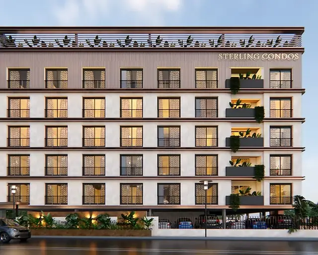
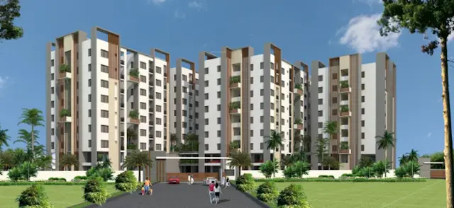
Hill County-IV
AVRS Landmark Townships Private Limited · Yadadri Bhuvanagiri · RERA P02000002942
HILL COUNTY-IV is a plotted development in YADAGIRIGUTTA MANDAL, Yadagirigutta Mandal, Yadadri Bhuvanagiri District. The registered promoter is AVRS Landmark Townships Private Limited. The RERA-filed total site area is 138,969 sq m, with 97,650.60 sq m net area and 41,318.40 sq m affected by road widening, FTL or nala widening; the registered survey schedule is 191/P, 192/P, 194/P, 195/P, 196/P and 197/P, and the plot count is not disclosed. The project is registered under TG-RERA number P02000002942, and the RERA project-information field gives a proposed completion date of 19/02/2020.
More from AVRS Landmark Townships Pvt Ltd · 10 projects →
01What we found
Read from TG-RERA filings, approvals, land and registration records and court records. A court case is counted only when the court record states this project's survey number with its village, or names the project.
02Check before you pay
8 items to check before you pay, 4 high - from the title chain, court records and approvals, each with what to ask the builder or your advocate. An item may not be a problem with the project: records can be incomplete.
Project at a glance
Project identity
| Field | Project record |
|---|---|
| Registered project name | HILL COUNTY-IV RERA record |
| Project type | Plotted development RERA record RERA filing |
| Phase / registered portion | Phase designation not disclosed; the registered survey schedule is 191/P, 192/P, 194/P, 195/P, 196/P and 197/P. |
| TG-RERA registration number | P02000002942 |
| Registration validity | The certificate states commencement on 14/05/2021 and end on 19/02/2020, with a stated period of “-1 years”; it records no extension. Registration validity is separate from the project’s completion dates. |
| Registered promoter | AVRS Landmark Townships Private Limited; company (Pvt Ltd). RERA record Corporate record |
| RERA status | Registration certificate issued under section 5; the supplied record does not provide a current portal status. |
Land and geographic identity
| Field | Project record |
|---|---|
| Locality | YADAGIRIGUTTA MANDAL RERA record |
| Revenue village | Gouraipally Village is identified in the filed layout document and title materials. The RERA land-details field itself does not disclose a village. |
| Mandal | Yadagirigutta RERA record |
| District | Yadadri Bhuvanagiri RERA record |
| PIN | 508115 RERA record |
| Project survey numbers / subdivisions | 191/P, 192/P, 194/P, 195/P, 196/P and 197/P |
| RERA-filed total site area | 138,969 sq m RERA filing |
| RERA-filed area affected in road widening / FTL / nala widening | 41,318.40 sq m RERA filing |
| RERA-filed net area | 97,650.60 sq m RERA filing |
| RERA-filed boundaries | East: others’ land; West: others’ land; North: owners’ land; South: owners’ land. RERA filing |
Development identity
| Field | Project record |
|---|---|
| Sanctioning authority stated in RERA project information | DTCP RERA filing |
| Principal approval reference shown in the RERA record | Approval No. 31/2019/H, attributed in the approvals record to Gouraipally Grampanchayat; document reference 3301/2018/H. The filed document is headed “CRAFT TECHNICAL LAYOUT PATTERN FOR RESIDENTIAL.” Approvals record |
| Approval date shown in RERA project information | 20/02/2019 RERA filing |
| Approved built-up area | 83,770 sq m RERA filing |
| Layout / plot count | Not legible in the supplied layout-document extraction; no plot schedule or count is provided here. |
| Buildings, floors and parking levels | Not disclosed for this plotted development in the supplied project record. |
| Commencement / layout document limitation | The filed document extraction does not make the applicant, extent, plot count or specific approval conditions legible. |
Offering and status
| Field | Project record |
|---|---|
| Offering | Plots; plot count, plot-size range and plot-wise inventory are not established by the supplied records. RERA record |
| Booked / available counts | Not disclosed in the supplied data. |
| Construction stage | The RERA record includes percentage figures for selected infrastructure items, but no overall construction-stage statement or independent site-verification record is supplied. RERA amenities |
| Completion dates | The RERA project-information field gives a proposed completion date of 19/02/2020. Form B dated 27/01/2020 records a promoter undertaking to complete by 20/06/2025. RERA filing |
| Occupancy / completion certificate | Not supplied in the reviewed records. The project is a plotted layout; no project OC or completion certificate is established here. |
| Registration deadline versus completion | The certificate’s stated registration end date (19/02/2020) is reported separately above; it is not the same as either completion date. |
The project story
HILL COUNTY-IV is recorded with TG-RERA as a plotted-development project in the Yadagirigutta area. Its RERA land schedule names six survey subdivisions—191/P, 192/P, 194/P, 195/P, 196/P and 197/P—and records a total site area of 138,969 sq m, net area of 97,650.60 sq m and 41,318.40 sq m affected by road widening, FTL or nala widening. RERA record RERA filing
The filed approval document describes a residential layout at Gauraipally, Yadagirutta Mandal, and prints TLP No. 31/2019/H and reference 3301/2018/H. Its OCR does not establish the plot count, extent or detailed conditions, so the precise plot arrangement and infrastructure plan cannot be described from that extraction.
The supplied RERA data reports progress percentages for some infrastructure items, including roads, water supply, sewerage, green strip/park and street lighting. These are record-declared item-level figures, not an independently verified overall completion assessment. No site inspection evidence, current inventory, plot-wise size schedule, or completion/occupancy certificate is supplied. RERA amenities
Master plan, architecture & building design
This is a plotted layout rather than a building or apartment scheme. The filed document is described as a residential layout and identifies Gouraipally Grampanchayat; its extracted text does not establish the plot count, road widths, park areas, utility-land allocation, plot dimensions or detailed land-use split. RERA filing
The RERA record states an approved built-up area of 83,770 sq m; the available evidence does not explain its scope or provide a drawing-based breakdown. No building count, floor configuration, building footprint or parking levels are disclosed. RERA filing
A layout approval reference is recorded as 31/2019/H, with document reference 3301/2018/H. The supplied extraction does not show the full sanctioned layout drawing or its conditions, so the layout geometry and sanctioned open-space and road provisions cannot be described here. Approvals record
Homes, configurations & floor plans
The RERA project is identified as plotted development, but the supplied data does not contain plot-wise inventory or plot-size bands. Consequently, unit counts, booked and available plots, and saleable-area figures cannot be reported. RERA record
| Configuration | Units | Booked | Available | RERA saleable area | Measured carpet area | Loading (if supplied) |
|---|---|---|---|---|---|---|
| Plots | Not disclosed | Not disclosed | Not disclosed | Not disclosed | Not applicable / not supplied | Not supplied |
One floor-plan drawing is listed, but it is pending scan; no flats are identified and no drawing measurement was completed. The floor-plan record says its measurement method, where applied, would be software measurement from drawing geometry and not a RERA disclosure. Floor plans
Parking & vehicle circulation
The supplied project evidence does not establish sanctioned parking counts, visitor or accessible parking, parking locations, vehicle entry/exit arrangements, internal driveway dimensions, pedestrian separation, EV charging, or plot-wise parking allocation. The RERA registration certificate includes the standard separate-account condition, but provides no project parking particulars in the materials reviewed.
Amenities, recreation & open spaces
The RERA-filed amenity information lists 14 infrastructure or facility categories and provides item-level availability and progress percentages for some items. The figures below are record declarations; no independent site verification is supplied. RERA amenities
| Facility | Description / size | Evidence source | Declared progress / verified status |
|---|---|---|---|
| Clubhouse / indoor | |||
| Community buildings | No size or description supplied. | RERA amenities | Progress: 0%; independent verification not supplied. |
| Sports / recreation | |||
| Aggregate area of recreational open space | Area not supplied. | RERA amenities | Progress: 0%; independent verification not supplied. |
| Landscape / open space | |||
| Green Strip / TOT LOT / Park | Size and configuration not supplied. | RERA amenities | Available: YES; progress: 40%; independent verification not supplied. |
| Convenience / community | |||
| Internal roads & footpaths | Dimensions and specifications not supplied. | RERA amenities | Available: YES; progress: 80%; independent verification not supplied. |
| Water supply | Sources, storage and capacity not supplied. | RERA amenities | Available: YES; progress: 97%; independent verification not supplied. |
| Sewerage (chamber, lines, septic tank, STP) | System components are named; capacities and configuration not supplied. | RERA amenities | Available: YES; progress: 60%; independent verification not supplied. |
| Storm-water drains | Details not supplied. | RERA amenities | Available: YES; progress: 0%; independent verification not supplied. |
| Street lighting | Details not supplied. | RERA amenities | Available: YES; progress: 100%; independent verification not supplied. |
| Treatment and disposal of sewage and sullage water | Details not supplied. | RERA amenities | Progress: 0%; independent verification not supplied. |
| Solid-waste management and disposal | Details not supplied. | RERA amenities | Progress: 0%; independent verification not supplied. |
| Water conservation / rainwater harvesting | Details not supplied. | RERA amenities | Progress: 0%; independent verification not supplied. |
| Energy management | Details not supplied. | RERA amenities | Progress: 0%; independent verification not supplied. |
| Fire protection and fire-safety requirements | Details not supplied. | RERA amenities | Progress: 0%; independent verification not supplied. |
| Electrical meter room / sub-station / receiving station | Details not supplied. | RERA amenities | Progress: 0%; independent verification not supplied. |
Utilities, building services & safety
The RERA-filed amenity list records water supply at 97% progress and sewerage infrastructure—described as chambers, lines, septic tank and STP—at 60%. These are declared progress figures; sources, capacities, commissioning status and independent verification are not supplied. RERA amenities
Storm-water drains are listed at 0% progress. Water conservation/rainwater harvesting, energy management, fire protection and fire-safety requirements, and electrical meter room/sub-station/receiving station are each listed at 0%; the supplied record does not provide designs, capacities, statutory clearances or completion evidence for these items. RERA amenities
No evidence is supplied for backup power, lifts, accessibility features, waste segregation arrangements, CCTV or access-control systems. RERA amenities
Location, access & connectivity
The registered project location is Yadagirigutta Mandal, Yadadri Bhuvanagiri District, PIN 508115; the RERA location field identifies the locality as “YADAGIRIGUTTA MANDAL.” RERA record RERA filing
The filed layout document identifies Gouraipally and Gouraipally Grampanchayat. A cadastral parcel-centroid point is supplied at 17.41528, 78.35459; it is a parcel-centroid geocode, not a surveyed entrance or access point. The supplied connectivity record lists Financial District (Nanakramguda) at 1.2 km; no route or measurement methodology is provided. Location record
No approach-road names, public-transport information, additional landmarks or travel times are established in the supplied data.
Developer & development status
The registered legal promoter is AVRS Landmark Townships Private Limited, a private limited company. Its supplied corporate identifier is CIN U70101TG2016PTC110468; the incorporation document records incorporation on 23 June 2016. RERA record Corporate record
The RERA registration certificate gives the promoter office as “Village: Mandal: District: Ranga Reddy, Pin: 500035.” The supplied evidence does not provide a verified project-specific contact person or contact details; a website is listed in the shared project record as https://www.landmarktownships.in. Parties record
Form B is a promoter declaration signed by P. Ravinder Reddy, dated 27/01/2020. It asserts the promoter’s legal title/development arrangement, declares the land free from encumbrances and undertakes completion by 20/06/2025. These are statements in the filed affidavit, not independent verification of title or completion.
Item-level infrastructure progress is recorded in the RERA data, but an overall construction progress, current plot inventory and completion/occupancy certification are not established in the supplied materials. RERA amenities
Approvals, official records & documents
| What the supplied material establishes | Form C registration for HILL COUNTY-IV, No. P02000002942, issued 14/05/2021 under section 5; certificate records an end date of 19/02/2020 and a stated validity of “-1 years.” |
|---|
| What the supplied material establishes | RERA project information identifies DTCP as authority and gives approval date 20/02/2019. The approvals record lists 31/2019/H and document reference 3301/2018/H, attributed to Gouraipally Grampanchayat. |
|---|---|
| Source | RERA filing Approvals record |
| What the supplied material establishes | “CRAFT TECHNICAL LAYOUT PATTERN FOR RESIDENTIAL,” identifying Gouraipally Grampanchayat and a residential layout at Gauraipally; the OCR does not expose plot count, extent, applicant or detailed conditions. |
|---|
| What the supplied material establishes | Form B affidavit dated 27/01/2020, including promoter assertions and undertakings concerning title/development arrangement, encumbrances, separate-account handling and completion. |
|---|
| What the supplied material establishes | Certificate of Incorporation for AVRS Landmark Townships Private Limited; it establishes the company’s incorporation, not project or land approval. |
|---|
| What the supplied material establishes | No completion or occupancy certificate is supplied in the reviewed project evidence. |
|---|---|
| Source | Document index |
| What the supplied material establishes | A complete, legible sanctioned layout drawing and its conditions are not established by the supplied extraction. |
|---|
Project at a glance
Project identity
Registered project name: HILL COUNTY-IV
Project type: Plotted development
Phase / registered portion: Phase designation not disclosed; the registered survey schedule is 191/P, 192/P, 194/P, 195/P, 196/P and 197/P.
TG-RERA registration number: P02000002942
Registration validity: The certificate states commencement on 14/05/2021 and end on 19/02/2020, with a stated period of “-1 years”; it records no extension. Registration validity is separate from the project’s completion dates.
Registered promoter: AVRS Landmark Townships Private Limited; company (Pvt Ltd).
RERA status: Registration certificate issued under section 5; the supplied record does not provide a current portal status.
Land and geographic identity
Locality: YADAGIRIGUTTA MANDAL
Revenue village: Gouraipally Village is identified in the filed layout document and title materials. The RERA land-details field itself does not disclose a village.
Mandal: Yadagirigutta
District: Yadadri Bhuvanagiri
PIN: 508115
Project survey numbers / subdivisions: 191/P, 192/P, 194/P, 195/P, 196/P and 197/P
RERA-filed total site area: 138,969 sq m
RERA-filed area affected in road widening / FTL / nala widening: 41,318.40 sq m
RERA-filed net area: 97,650.60 sq m
RERA-filed boundaries: East: others’ land; West: others’ land; North: owners’ land; South: owners’ land.
Development identity
Sanctioning authority stated in RERA project information: DTCP
Principal approval reference shown in the RERA record: Approval No. 31/2019/H, attributed in the approvals record to Gouraipally Grampanchayat; document reference 3301/2018/H. The filed document is headed “CRAFT TECHNICAL LAYOUT PATTERN FOR RESIDENTIAL.”
Approval date shown in RERA project information: 20/02/2019
Approved built-up area: 83,770 sq m
Layout / plot count: Not legible in the supplied layout-document extraction; no plot schedule or count is provided here.
Buildings, floors and parking levels: Not disclosed for this plotted development in the supplied project record.
Commencement / layout document limitation: The filed document extraction does not make the applicant, extent, plot count or specific approval conditions legible.
Offering and status
Offering: Plots; plot count, plot-size range and plot-wise inventory are not established by the supplied records.
Booked / available counts: Not disclosed in the supplied data.
Construction stage: The RERA record includes percentage figures for selected infrastructure items, but no overall construction-stage statement or independent site-verification record is supplied.
Completion dates: The RERA project-information field gives a proposed completion date of 19/02/2020. Form B dated 27/01/2020 records a promoter undertaking to complete by 20/06/2025.
Occupancy / completion certificate: Not supplied in the reviewed records. The project is a plotted layout; no project OC or completion certificate is established here.
Registration deadline versus completion: The certificate’s stated registration end date (19/02/2020) is reported separately above; it is not the same as either completion date.
The project story
HILL COUNTY-IV is recorded with TG-RERA as a plotted-development project in the Yadagirigutta area. Its RERA land schedule names six survey subdivisions—191/P, 192/P, 194/P, 195/P, 196/P and 197/P—and records a total site area of 138,969 sq m, net area of 97,650.60 sq m and 41,318.40 sq m affected by road widening, FTL or nala widening.
The filed approval document describes a residential layout at Gauraipally, Yadagirutta Mandal, and prints TLP No. 31/2019/H and reference 3301/2018/H. Its OCR does not establish the plot count, extent or detailed conditions, so the precise plot arrangement and infrastructure plan cannot be described from that extraction.
The supplied RERA data reports progress percentages for some infrastructure items, including roads, water supply, sewerage, green strip/park and street lighting. These are record-declared item-level figures, not an independently verified overall completion assessment. No site inspection evidence, current inventory, plot-wise size schedule, or completion/occupancy certificate is supplied.
Master plan, architecture & building design
This is a plotted layout rather than a building or apartment scheme. The filed document is described as a residential layout and identifies Gouraipally Grampanchayat; its extracted text does not establish the plot count, road widths, park areas, utility-land allocation, plot dimensions or detailed land-use split.
The RERA record states an approved built-up area of 83,770 sq m; the available evidence does not explain its scope or provide a drawing-based breakdown. No building count, floor configuration, building footprint or parking levels are disclosed.
A layout approval reference is recorded as 31/2019/H, with document reference 3301/2018/H. The supplied extraction does not show the full sanctioned layout drawing or its conditions, so the layout geometry and sanctioned open-space and road provisions cannot be described here.
Homes, configurations & floor plans
The RERA project is identified as plotted development, but the supplied data does not contain plot-wise inventory or plot-size bands. Consequently, unit counts, booked and available plots, and saleable-area figures cannot be reported.
| Configuration | Units | Booked | Available | RERA saleable area | Measured carpet area | Loading (if supplied) |
|---|---|---|---|---|---|---|
| Plots | Not disclosed | Not disclosed | Not disclosed | Not disclosed | Not applicable / not supplied | Not supplied |
One floor-plan drawing is listed, but it is pending scan; no flats are identified and no drawing measurement was completed. The floor-plan record says its measurement method, where applied, would be software measurement from drawing geometry and not a RERA disclosure.
Parking & vehicle circulation
The supplied project evidence does not establish sanctioned parking counts, visitor or accessible parking, parking locations, vehicle entry/exit arrangements, internal driveway dimensions, pedestrian separation, EV charging, or plot-wise parking allocation. The RERA registration certificate includes the standard separate-account condition, but provides no project parking particulars in the materials reviewed.
Amenities, recreation & open spaces
The RERA-filed amenity information lists 14 infrastructure or facility categories and provides item-level availability and progress percentages for some items. The figures below are record declarations; no independent site verification is supplied.
| Facility | Description / size | Evidence source | Declared progress / verified status |
|---|---|---|---|
| Clubhouse / indoor | |||
| Community buildings | No size or description supplied. | Progress: 0%; independent verification not supplied. | |
| Sports / recreation | |||
| Aggregate area of recreational open space | Area not supplied. | Progress: 0%; independent verification not supplied. | |
| Landscape / open space | |||
| Green Strip / TOT LOT / Park | Size and configuration not supplied. | Available: YES; progress: 40%; independent verification not supplied. | |
| Convenience / community | |||
| Internal roads & footpaths | Dimensions and specifications not supplied. | Available: YES; progress: 80%; independent verification not supplied. | |
| Water supply | Sources, storage and capacity not supplied. | Available: YES; progress: 97%; independent verification not supplied. | |
| Sewerage (chamber, lines, septic tank, STP) | System components are named; capacities and configuration not supplied. | Available: YES; progress: 60%; independent verification not supplied. | |
| Storm-water drains | Details not supplied. | Available: YES; progress: 0%; independent verification not supplied. | |
| Street lighting | Details not supplied. | Available: YES; progress: 100%; independent verification not supplied. | |
| Treatment and disposal of sewage and sullage water | Details not supplied. | Progress: 0%; independent verification not supplied. | |
| Solid-waste management and disposal | Details not supplied. | Progress: 0%; independent verification not supplied. | |
| Water conservation / rainwater harvesting | Details not supplied. | Progress: 0%; independent verification not supplied. | |
| Energy management | Details not supplied. | Progress: 0%; independent verification not supplied. | |
| Fire protection and fire-safety requirements | Details not supplied. | Progress: 0%; independent verification not supplied. | |
| Electrical meter room / sub-station / receiving station | Details not supplied. | Progress: 0%; independent verification not supplied. |
Utilities, building services & safety
The RERA-filed amenity list records water supply at 97% progress and sewerage infrastructure—described as chambers, lines, septic tank and STP—at 60%. These are declared progress figures; sources, capacities, commissioning status and independent verification are not supplied.
Storm-water drains are listed at 0% progress. Water conservation/rainwater harvesting, energy management, fire protection and fire-safety requirements, and electrical meter room/sub-station/receiving station are each listed at 0%; the supplied record does not provide designs, capacities, statutory clearances or completion evidence for these items.
No evidence is supplied for backup power, lifts, accessibility features, waste segregation arrangements, CCTV or access-control systems.
Location, access & connectivity
The registered project location is Yadagirigutta Mandal, Yadadri Bhuvanagiri District, PIN 508115; the RERA location field identifies the locality as “YADAGIRIGUTTA MANDAL.”
The filed layout document identifies Gouraipally and Gouraipally Grampanchayat. A cadastral parcel-centroid point is supplied at 17.41528, 78.35459; it is a parcel-centroid geocode, not a surveyed entrance or access point. The supplied connectivity record lists Financial District (Nanakramguda) at 1.2 km; no route or measurement methodology is provided.
No approach-road names, public-transport information, additional landmarks or travel times are established in the supplied data.
Developer & development status
The registered legal promoter is AVRS Landmark Townships Private Limited, a private limited company. Its supplied corporate identifier is CIN U70101TG2016PTC110468; the incorporation document records incorporation on 23 June 2016.
The RERA registration certificate gives the promoter office as “Village: Mandal: District: Ranga Reddy, Pin: 500035.” The supplied evidence does not provide a verified project-specific contact person or contact details; a website is listed in the shared project record as https://www.landmarktownships.in.
Form B is a promoter declaration signed by P. Ravinder Reddy, dated 27/01/2020. It asserts the promoter’s legal title/development arrangement, declares the land free from encumbrances and undertakes completion by 20/06/2025. These are statements in the filed affidavit, not independent verification of title or completion.
Item-level infrastructure progress is recorded in the RERA data, but an overall construction progress, current plot inventory and completion/occupancy certification are not established in the supplied materials.
Approvals, official records & documents
| What the supplied material establishes | Form C registration for HILL COUNTY-IV, No. P02000002942, issued 14/05/2021 under section 5; certificate records an end date of 19/02/2020 and a stated validity of “-1 years.” |
|---|
| What the supplied material establishes | RERA project information identifies DTCP as authority and gives approval date 20/02/2019. The approvals record lists 31/2019/H and document reference 3301/2018/H, attributed to Gouraipally Grampanchayat. |
|---|
| What the supplied material establishes | “CRAFT TECHNICAL LAYOUT PATTERN FOR RESIDENTIAL,” identifying Gouraipally Grampanchayat and a residential layout at Gauraipally; the OCR does not expose plot count, extent, applicant or detailed conditions. |
|---|
| What the supplied material establishes | Form B affidavit dated 27/01/2020, including promoter assertions and undertakings concerning title/development arrangement, encumbrances, separate-account handling and completion. |
|---|
| What the supplied material establishes | Certificate of Incorporation for AVRS Landmark Townships Private Limited; it establishes the company’s incorporation, not project or land approval. |
|---|
| What the supplied material establishes | No completion or occupancy certificate is supplied in the reviewed project evidence. |
|---|
| What the supplied material establishes | A complete, legible sanctioned layout drawing and its conditions are not established by the supplied extraction. |
|---|
Frequently asked questions
Is HILL COUNTY-IV registered with Telangana RERA?
Yes. HILL COUNTY-IV is registered with the Telangana Real Estate Regulatory Authority as P02000002942; the registration status is New Project.
Who is the developer of HILL COUNTY-IV?
The promoter named in the RERA registration is AVRS Landmark Townships Private Limited.
Where is HILL COUNTY-IV located?
HILL COUNTY-IV is in YADAGIRIGUTTA MANDAL, Yadagirigutta, Yadadri Bhuvanagiri, Telangana (508115).
When will HILL COUNTY-IV be completed?
The promoter's proposed date of completion filed with RERA is 19/02/2020. This is the promoter's declaration, not a guarantee.
More projects in Yadagirigutta