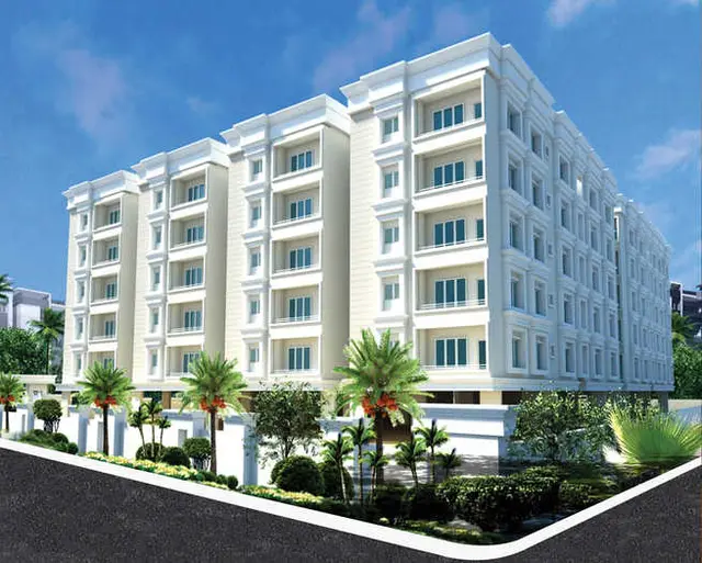
Drs Sunlite Residential Colony
DRS SUNLITE PROJECTS PRIVATE LIMITED · Mahabubnagar · RERA P01400009741
DRS SUNLITE RESIDENTIAL COLONY is a plotted residential layout at Kishtampally Revenue Village, Jadcherla Mandal, Mahabubnagar District. It is being developed by the registered promoter, DRS SUNLITE PROJECTS PRIVATE LIMITED. The registered site extent is 45,311.31 sq. m, and the layout has 140 open plots; buildings, floors and plot configurations are not stated. The project is registered under TG-RERA number P01400009741, with proposed completion on 21/08/2027.
01What we found
Read from TG-RERA filings, approvals, land and registration records and court records. A court case is counted only when the court record states this project's survey number with its village, or names the project.
02Check before you pay
6 items to check before you pay, 2 high - from the title chain, court records and approvals, each with what to ask the builder or your advocate. An item may not be a problem with the project: records can be incomplete.
1. Project at a glance
Project identity
| Field | Record |
|---|---|
| Registered project name | DRS SUNLITE RESIDENTIAL COLONY RERA record |
| Project type | Plotted development / layout with open plots RERA record |
| Phase or registered portion | Phase not separately identified; registration and layout records describe the project across the listed survey numbers RERA record |
| TG-RERA registration | P01400009741; registered 21 April 2025, valid through 21 April 2027 RERA record |
| RERA status | Registered; the supplied registration record gives the validity period above RERA record |
| Registered promoter | DRS SUNLITE PROJECTS PRIVATE LIMITED RERA record Corporate record |
Land and geographic identity
| Field | Record |
|---|---|
| Locality / revenue village | Kishtampally Revenue Village; also written as Kistampally in the approval record RERA record |
| Mandal / district / PIN | Jadcherla Mandal, Mahabubnagar District, PIN 509301 RERA record |
| Project survey numbers | 107, 110, 111, 113, 114 and 120 RERA record Land records |
| Subdivisions | The registration and layout identity state survey numbers without subdivisions. The title report lists subdivisions including 107/e91/2; 107/e92/1; 111/693; 111/ếx 1/2; 111/ếa/2/2; 111/฿#/1/2; 111/฿a/1/1; 111/6a/2/1; 111/6a/1/2; 111/6a/2/2; 111/6a/2; 111/65/3; 111/e93; 113es/1; 113eD/2; 113es/3; 113e9/1; 113e)/2; 113eg/3; 113/e91, 113/092 & 113/603; 113/e91, 113/892 & 113/693; 114/ta/2; 114/e9; 114/08/1; 114/cl; 114ta/2; 114/dx2; 114G*/3; 1140/l; 114/21; 114/2/1; 114/2/2; 114/c9/2; 114/C8/1, 114/C8/2 & 114/C/3; 114/04/1, 114/e1 & 114G8/2, 114/082, 114/ds/1 & 1140/1; 114/Ca/1, 114/er1 & 114G9/2, 114/082, 114/Cs/1 & 114G/1; 114/a1; 114/a/1 & 114/2/2; 114/es/1; 114/ts/2; 114/e9/2; 114/e9; 114/2; 114/Cs; 120/e3/2/2; 120/e9/2/2; 120/es; 120/es/2; 120/es/2/2. These are reproduced as stated in the title-report extraction; several OCR-rendered subdivision strings are unclear. |
| Registered site extent | RERA land details state 45,311.31 sq. m total and net area RERA record Land records |
| Layout-plan area figures | The tentative layout approval states Ac. 11.196 cents / 54,191.872 Sq.Yds; the layout-plan details state total layout area 49,329.82 sq.mt and net layout area 45,312.43 sq.mt |
| Boundaries | East: “OTHERS OPEN LAND”; West: “EXISTING NAKSHA BATA”; North: “OTHERS OPEN PAND”; South: “EXISTING 33 FEET WIDE ROAD TO WIDENED 60 FEET” RERA record Land records |
| Cadastral reference | Survey 107 record has a whole-survey extent of 26,770.78 sq. m; this is a survey-level record, not the project’s full parcel extent Cadastral map |
Development identity
| Field | Record |
|---|---|
| Sanctioning authority / approval | MUDA tentative layout approval, approval number 436611/LP/GP/280465/0002/2024, dated 21-04-2025; the filed layout-plan details also identify TS-DTCP and file number TS/050998/2024 Approvals record |
| Development form | New residential layout with open plots; the filed plan states proposed built-up area 0.00 both excluding and including parking |
| Plots | 140 plots stated in the tentative approval and layout-plan details |
| Approved built-up area | 0.00 proposed built-up area in the layout-plan details |
| Buildings, floors and parking levels | Not disclosed as a building development in the supplied layout records; no building count, floor configuration or parking levels are provided |
| Land-use areas in layout-plan details | Plotted area 25,932.27 sq.mt; roads 13,095.84 sq.mt; organized open space/park 4,092.26 sq.mt; social infrastructure 1,141.87 sq.mt; utility area 454.45 sq.mt; buffer zone 594.24 sq.mt; common parking area 0.00 sq.mt |
Offering and status
| Field | Record |
|---|---|
| Offering | Open plots in a 140-plot residential layout |
| Plot sizes | Software-measured from the approved layout drawing: 110.4 sq.m smallest, 160.79 sq.m median and 413.35 sq.m largest; equivalent supplied values are 132.0 sq.yd, 192.3 sq.yd and 494.4 sq.yd Layout record |
| Construction / development stage | The supplied material establishes a tentative layout approval and records development works as conditions; it does not provide independently verified site progress |
| Completion dates | The RERA registration is valid through 21 April 2027. The RERA filing also gives proposed completion 21/08/2027; the Form-B extraction records a completion undertaking transcribed as “215 April, 2027.” These are reported as recorded, without treating registration validity as the construction deadline RERA record |
| Occupancy / completion certificate | No occupancy or completion certificate is identified in the supplied project documents; the project is a plotted layout Document index |
2. The project story
DRS SUNLITE RESIDENTIAL COLONY is registered with TG-RERA as a plotted residential layout at Kishtampally Revenue Village, Jadcherla Mandal, Mahabubnagar District. Its registered land description covers survey numbers 107, 110, 111, 113, 114 and 120. The filed tentative layout approval identifies 140 plots, while the layout drawing allocates land to plots, roads, open space, social infrastructure, utilities and a buffer zone. RERA record Land records
This is not presented in the supplied approval record as an apartment or multi-storey building project: the layout-plan details state proposed built-up area of 0.00, and do not specify buildings or floors. Layout development works—including roads, drainage, water supply, sewerage disposal, rainwater harvesting, street lighting and electricity facilities—are required by the approval conditions. The documents do not establish how much of this work has been completed on site; the amenity entries show 0% progress, and no independent site-progress verification is supplied. RERA amenities
3. Master plan, architecture & building design
The filed drawing describes a residential layout with open plots, not a building scheme. It records total layout area of 49,329.82 sq.mt, net layout area of 45,312.43 sq.mt, and a road-affected area of 282.05 sq.mt. It also lists 792.47 sq.mt as nala area, including a 594.24 sq.mt buffer zone. The proposed built-up area is 0.00.
The layout-plan land-use schedule identifies:
| Layout use | Area | Share shown in layout-plan details |
|---|---|---|
| Plotted area | 25,932.27 sq.mt | 57.23% |
| Road area | 13,095.84 sq.mt | 28.90% |
| Organized open space/park area | 4,092.26 sq.mt | 9.03% |
| Social infrastructure area | 1,141.87 sq.mt | 2.52% |
| Utility area | 454.45 sq.mt | 1.00% |
| Buffer zone area | 594.24 sq.mt | 1.31% |
| Common parking area | 0.00 sq.mt | 0.00% |
The drawing lists internal road widths of 9.14M, 9.00M, 10.05 MT, 18.00 MT and 18.28 MT, as well as “33' ROAD” and “60'-0' ROAD.” It also records a required and proposed setback of 6.00. No building footprints, floor plans, heights, apartment arrangements or building-level phase configuration are supplied.
The tentative approval separately records Ac. 1.011 cents / 4,894.343 Sq.Yds of park open space, Ac. 0.112 cents / 543.522 Sq.Yds of utilities, Ac. 0.282 cents / 1,365.677 Sq.Yds of social infrastructure, Ac. 3.236 cents / 15,662.625 Sq.Yds of roads and Ac. 6.408 cents / 31,014.995 Sq.Yds of plotted area. These are the figures stated in that approval document.
4. Homes, configurations & floor plans
The TG-RERA record and approved layout describe plots, not apartments or villas. No RERA-filed apartment configuration, booked/available unit counts, saleable area schedule or unit-wise allotment data is supplied. The available drawing extraction provides plot counts and sizes instead. RERA record
| Plot information | Record |
|---|---|
| Plot count | 140 stated in the layout drawing and tentative approval |
| Smallest plot | 110.4 sq.m / 132.0 sq.yd; software-measured from the layout drawing Layout record |
| Median plot | 160.79 sq.m / 192.3 sq.yd; software-measured from the layout drawing Layout record |
| Largest plot | 413.35 sq.m / 494.4 sq.yd; software-measured from the layout drawing Layout record |
| Size bands (sq.yd) | 100–150: 5 plots; 150–200: 69; 200–250: 22; 250–300: 30; 300–400: 9; 400–500: 5 Layout record |
The layout extraction states that all 140 plot sizes were read from the drawing and that their sum matches the drawing’s plotted-area statement; the individual measurements remain software-derived and should be checked against the approved drawing. Carpet area, balcony/utility area and apartment common-area loading are not applicable to the plotted offering on the evidence supplied. Layout record
5. Parking & vehicle circulation
The layout-plan details record 0.00 sq.mt of common parking area. No sanctioned parking-space count, visitor or accessible parking provision, individual plot parking allocation, mechanical parking, EV charging, or parking-allotment terms are supplied. The drawing lists internal road widths, but does not establish a separate parking arrangement or exclusive ownership of any parking space.
6. Amenities, recreation & open spaces
The RERA-filed amenity information lists facilities and services but records 0% progress for each listed item. The tentative approval also makes development and handover of open space, social infrastructure, utility land and roads subject to stated conditions. No independent confirmation that any facility has been completed is supplied. RERA amenities
| Facility | Green Strip/TOT LOT/Park; aggregate recreational open space |
|---|---|
| Description / size | Park/open-space area shown as 4,092.26 sq.mt in layout-plan details; tentative approval states Ac. 1.011 cents / 4,894.343 Sq.Yds for open space (Park) |
| Evidence source | RERA amenity record and layout documents RERA amenities |
| Declared progress / verified status | Amenity record: 0%; no independent completion verification supplied |
| Facility | No specific sports facility disclosed |
|---|---|
| Description / size | Not stated RERA amenities |
| Evidence source | RERA amenity record RERA amenities |
| Declared progress / verified status | Not disclosed |
| Facility | No specific clubhouse or indoor facility disclosed in the project layout record |
|---|---|
| Description / size | Not stated RERA amenities |
| Evidence source | RERA amenity record RERA amenities |
| Declared progress / verified status | Not disclosed |
| Facility | Community buildings; social infrastructure area |
|---|---|
| Description / size | Social infrastructure area 1,141.87 sq.mt in layout-plan details; tentative approval states Ac. 0.282 cents / 1,365.677 Sq.Yds |
| Evidence source | RERA amenity record and layout documents RERA amenities |
| Declared progress / verified status | Amenity record: 0%; no independent completion verification supplied |
7. Utilities, building services & safety
The layout approval conditions require the applicant to undertake infrastructure works under the Executive Authority’s supervision. They include formation and surfacing of roads; side drains and nala channelisation for storm-water run-off; greenery and avenue planting; rainwater-harvesting pits; street lighting and electricity facilities; sewerage disposal and protected water supply; and construction of an overhead tank or sump and septic tank, as applicable. The conditions also refer to a water reservoir, septic tank, sewerage treatment plant, electric transformer and solid-waste management within the utility provision. These are approval requirements or specified works, not evidence that the facilities are already completed.
The RERA amenity record lists water supply, sewerage (chambers, lines, septic tank and STP), storm-water drains, treatment and disposal of sewage and sullage, solid-waste management, water conservation/rainwater harvesting, energy management, fire protection and safety, and an electrical meter room/sub-station/receiving station. Each listed amenity has 0% progress in the supplied record. No capacities, operating details, completion certificates, or independent safety-compliance evidence are provided. RERA amenities
8. Location, access & connectivity
The registered location is Kishtampally Revenue Village, Jadcherla Mandal, Mahabubnagar District, Telangana, PIN 509301. The cadastral parcel centroid supplied for survey 107 is 16.737741097109645, 78.14579453036157; it is a survey-level reference, not a surveyed entrance point. RERA record Cadastral map
The project boundary description identifies an existing 33-feet-wide road on the south, stated to be widened to 60 feet, and an existing “NAKSHA BATA” on the west. The layout drawing lists the internal road widths stated in the master-plan section. One sampled connectivity anchor identifies the nearest sampled Outer Ring Road interchange at approximately 62.5 km; no other measured distances or verified public-transport information are supplied. RERA record Land records Location record
9. Developer & development status
The registered promoter is DRS SUNLITE PROJECTS PRIVATE LIMITED, a company, with GSTIN 36AAJCD4934C1ZS. Its project-record address is KABRA COMPLEX, Mahatma Gandi Road, Kishtampally, Kishtampally, Jadcherla, Mahabubnagar, 509301. The supplied records identify Manish Agarwal as Managing Director and Agarwal Anjani Kumar as an authorized signatory. Corporate record Parties record
The project record identifies four landowners—KETHAVATH RAVINDER, SRI NAGAR KUNTA KESHAVULU, MUDAVATH SHANKAR and NENAVATH RAMESH—with area-share arrangements. Parties record The RERA filing states a proposed completion date of 21/08/2027; the registration certificate is valid through 21 April 2027. These are separate record fields. The supplied documents do not establish current on-site completion or an occupancy/completion certificate. RERA record
10. Approvals, official records & documents
| Record | What the supplied material establishes |
|---|---|
| TG-RERA registration | Form C registration certificate for DRS SUNLITE RESIDENTIAL COLONY, registration P01400009741, with validity from 21/04/2025 to 21/04/2027 |
| Tentative layout approval | MUDA approval dated 21-04-2025, approval number 436611/LP/GP/280465/0002/2024, covering survey numbers 107, 110, 111, 113, 114 and 120 at Kistampally Revenue Village and recording 140 plots |
| Layout-plan details | Filed layout-plan document identifies TS-DTCP, file number TS/050998/2024, a 140-plot residential layout and its land-use schedule |
| Location plan | Filed location-plan document identified as document 571211; no further substantive approval details are extracted |
| Title search report | Advocate’s title due-diligence report dated 02-05-2025, document 564314; the supplied extraction includes a conclusion and supporting record summaries, but the report states it is based on supplied documents and that no physical inspection was undertaken |
| Promoter Form-B declaration | Affidavit dated 10 May 2025 containing promoter declarations, including a title basis and completion undertaking |
| Occupancy/completion certificate | None identified in the supplied project documents Document index |
1. Project at a glance
Project identity
Registered project name: DRS SUNLITE RESIDENTIAL COLONY
Project type: Plotted development / layout with open plots
Phase or registered portion: Phase not separately identified; registration and layout records describe the project across the listed survey numbers
TG-RERA registration: P01400009741; registered 21 April 2025, valid through 21 April 2027
RERA status: Registered; the supplied registration record gives the validity period above
Registered promoter: DRS SUNLITE PROJECTS PRIVATE LIMITED
Land and geographic identity
Locality / revenue village: Kishtampally Revenue Village; also written as Kistampally in the approval record
Mandal / district / PIN: Jadcherla Mandal, Mahabubnagar District, PIN 509301
Project survey numbers: 107, 110, 111, 113, 114 and 120
Subdivisions: The registration and layout identity state survey numbers without subdivisions. The title report lists subdivisions including 107/e91/2; 107/e92/1; 111/693; 111/ếx 1/2; 111/ếa/2/2; 111/฿#/1/2; 111/฿a/1/1; 111/6a/2/1; 111/6a/1/2; 111/6a/2/2; 111/6a/2; 111/65/3; 111/e93; 113es/1; 113eD/2; 113es/3; 113e9/1; 113e)/2; 113eg/3; 113/e91, 113/092 & 113/603; 113/e91, 113/892 & 113/693; 114/ta/2; 114/e9; 114/08/1; 114/cl; 114ta/2; 114/dx2; 114G*/3; 1140/l; 114/21; 114/2/1; 114/2/2; 114/c9/2; 114/C8/1, 114/C8/2 & 114/C/3; 114/04/1, 114/e1 & 114G8/2, 114/082, 114/ds/1 & 1140/1; 114/Ca/1, 114/er1 & 114G9/2, 114/082, 114/Cs/1 & 114G/1; 114/a1; 114/a/1 & 114/2/2; 114/es/1; 114/ts/2; 114/e9/2; 114/e9; 114/2; 114/Cs; 120/e3/2/2; 120/e9/2/2; 120/es; 120/es/2; 120/es/2/2. These are reproduced as stated in the title-report extraction; several OCR-rendered subdivision strings are unclear.
Registered site extent: RERA land details state 45,311.31 sq. m total and net area
Layout-plan area figures: The tentative layout approval states Ac. 11.196 cents / 54,191.872 Sq.Yds; the layout-plan details state total layout area 49,329.82 sq.mt and net layout area 45,312.43 sq.mt
Boundaries: East: “OTHERS OPEN LAND”; West: “EXISTING NAKSHA BATA”; North: “OTHERS OPEN PAND”; South: “EXISTING 33 FEET WIDE ROAD TO WIDENED 60 FEET”
Cadastral reference: Survey 107 record has a whole-survey extent of 26,770.78 sq. m; this is a survey-level record, not the project’s full parcel extent
Development identity
Sanctioning authority / approval: MUDA tentative layout approval, approval number 436611/LP/GP/280465/0002/2024, dated 21-04-2025; the filed layout-plan details also identify TS-DTCP and file number TS/050998/2024
Development form: New residential layout with open plots; the filed plan states proposed built-up area 0.00 both excluding and including parking
Plots: 140 plots stated in the tentative approval and layout-plan details
Approved built-up area: 0.00 proposed built-up area in the layout-plan details
Buildings, floors and parking levels: Not disclosed as a building development in the supplied layout records; no building count, floor configuration or parking levels are provided
Land-use areas in layout-plan details: Plotted area 25,932.27 sq.mt; roads 13,095.84 sq.mt; organized open space/park 4,092.26 sq.mt; social infrastructure 1,141.87 sq.mt; utility area 454.45 sq.mt; buffer zone 594.24 sq.mt; common parking area 0.00 sq.mt
Offering and status
Offering: Open plots in a 140-plot residential layout
Plot sizes: Software-measured from the approved layout drawing: 110.4 sq.m smallest, 160.79 sq.m median and 413.35 sq.m largest; equivalent supplied values are 132.0 sq.yd, 192.3 sq.yd and 494.4 sq.yd
Construction / development stage: The supplied material establishes a tentative layout approval and records development works as conditions; it does not provide independently verified site progress
Completion dates: The RERA registration is valid through 21 April 2027. The RERA filing also gives proposed completion 21/08/2027; the Form-B extraction records a completion undertaking transcribed as “215 April, 2027.” These are reported as recorded, without treating registration validity as the construction deadline
Occupancy / completion certificate: No occupancy or completion certificate is identified in the supplied project documents; the project is a plotted layout
2. The project story
DRS SUNLITE RESIDENTIAL COLONY is registered with TG-RERA as a plotted residential layout at Kishtampally Revenue Village, Jadcherla Mandal, Mahabubnagar District. Its registered land description covers survey numbers 107, 110, 111, 113, 114 and 120. The filed tentative layout approval identifies 140 plots, while the layout drawing allocates land to plots, roads, open space, social infrastructure, utilities and a buffer zone.
This is not presented in the supplied approval record as an apartment or multi-storey building project: the layout-plan details state proposed built-up area of 0.00, and do not specify buildings or floors. Layout development works—including roads, drainage, water supply, sewerage disposal, rainwater harvesting, street lighting and electricity facilities—are required by the approval conditions. The documents do not establish how much of this work has been completed on site; the amenity entries show 0% progress, and no independent site-progress verification is supplied.
3. Master plan, architecture & building design
The filed drawing describes a residential layout with open plots, not a building scheme. It records total layout area of 49,329.82 sq.mt, net layout area of 45,312.43 sq.mt, and a road-affected area of 282.05 sq.mt. It also lists 792.47 sq.mt as nala area, including a 594.24 sq.mt buffer zone. The proposed built-up area is 0.00.
The layout-plan land-use schedule identifies:
| Layout use | Area | Share shown in layout-plan details |
|---|---|---|
| Plotted area | 25,932.27 sq.mt | 57.23% |
| Road area | 13,095.84 sq.mt | 28.90% |
| Organized open space/park area | 4,092.26 sq.mt | 9.03% |
| Social infrastructure area | 1,141.87 sq.mt | 2.52% |
| Utility area | 454.45 sq.mt | 1.00% |
| Buffer zone area | 594.24 sq.mt | 1.31% |
| Common parking area | 0.00 sq.mt | 0.00% |
The drawing lists internal road widths of 9.14M, 9.00M, 10.05 MT, 18.00 MT and 18.28 MT, as well as “33' ROAD” and “60'-0' ROAD.” It also records a required and proposed setback of 6.00. No building footprints, floor plans, heights, apartment arrangements or building-level phase configuration are supplied.
The tentative approval separately records Ac. 1.011 cents / 4,894.343 Sq.Yds of park open space, Ac. 0.112 cents / 543.522 Sq.Yds of utilities, Ac. 0.282 cents / 1,365.677 Sq.Yds of social infrastructure, Ac. 3.236 cents / 15,662.625 Sq.Yds of roads and Ac. 6.408 cents / 31,014.995 Sq.Yds of plotted area. These are the figures stated in that approval document.
4. Homes, configurations & floor plans
The TG-RERA record and approved layout describe plots, not apartments or villas. No RERA-filed apartment configuration, booked/available unit counts, saleable area schedule or unit-wise allotment data is supplied. The available drawing extraction provides plot counts and sizes instead.
Plot count: 140 stated in the layout drawing and tentative approval
Smallest plot: 110.4 sq.m / 132.0 sq.yd; software-measured from the layout drawing
Median plot: 160.79 sq.m / 192.3 sq.yd; software-measured from the layout drawing
Largest plot: 413.35 sq.m / 494.4 sq.yd; software-measured from the layout drawing
Size bands (sq.yd): 100–150: 5 plots; 150–200: 69; 200–250: 22; 250–300: 30; 300–400: 9; 400–500: 5
The layout extraction states that all 140 plot sizes were read from the drawing and that their sum matches the drawing’s plotted-area statement; the individual measurements remain software-derived and should be checked against the approved drawing. Carpet area, balcony/utility area and apartment common-area loading are not applicable to the plotted offering on the evidence supplied.
5. Parking & vehicle circulation
The layout-plan details record 0.00 sq.mt of common parking area. No sanctioned parking-space count, visitor or accessible parking provision, individual plot parking allocation, mechanical parking, EV charging, or parking-allotment terms are supplied. The drawing lists internal road widths, but does not establish a separate parking arrangement or exclusive ownership of any parking space.
6. Amenities, recreation & open spaces
The RERA-filed amenity information lists facilities and services but records 0% progress for each listed item. The tentative approval also makes development and handover of open space, social infrastructure, utility land and roads subject to stated conditions. No independent confirmation that any facility has been completed is supplied.
| Facility | Green Strip/TOT LOT/Park; aggregate recreational open space |
|---|---|
| Description / size | Park/open-space area shown as 4,092.26 sq.mt in layout-plan details; tentative approval states Ac. 1.011 cents / 4,894.343 Sq.Yds for open space (Park) |
| Evidence source | RERA amenity record and layout documents |
| Declared progress / verified status | Amenity record: 0%; no independent completion verification supplied |
| Facility | No specific sports facility disclosed |
|---|---|
| Description / size | Not stated |
| Evidence source | RERA amenity record |
| Declared progress / verified status | Not disclosed |
| Facility | No specific clubhouse or indoor facility disclosed in the project layout record |
|---|---|
| Description / size | Not stated |
| Evidence source | RERA amenity record |
| Declared progress / verified status | Not disclosed |
| Facility | Community buildings; social infrastructure area |
|---|---|
| Description / size | Social infrastructure area 1,141.87 sq.mt in layout-plan details; tentative approval states Ac. 0.282 cents / 1,365.677 Sq.Yds |
| Evidence source | RERA amenity record and layout documents |
| Declared progress / verified status | Amenity record: 0%; no independent completion verification supplied |
7. Utilities, building services & safety
The layout approval conditions require the applicant to undertake infrastructure works under the Executive Authority’s supervision. They include formation and surfacing of roads; side drains and nala channelisation for storm-water run-off; greenery and avenue planting; rainwater-harvesting pits; street lighting and electricity facilities; sewerage disposal and protected water supply; and construction of an overhead tank or sump and septic tank, as applicable. The conditions also refer to a water reservoir, septic tank, sewerage treatment plant, electric transformer and solid-waste management within the utility provision. These are approval requirements or specified works, not evidence that the facilities are already completed.
The RERA amenity record lists water supply, sewerage (chambers, lines, septic tank and STP), storm-water drains, treatment and disposal of sewage and sullage, solid-waste management, water conservation/rainwater harvesting, energy management, fire protection and safety, and an electrical meter room/sub-station/receiving station. Each listed amenity has 0% progress in the supplied record. No capacities, operating details, completion certificates, or independent safety-compliance evidence are provided.
8. Location, access & connectivity
The registered location is Kishtampally Revenue Village, Jadcherla Mandal, Mahabubnagar District, Telangana, PIN 509301. The cadastral parcel centroid supplied for survey 107 is 16.737741097109645, 78.14579453036157; it is a survey-level reference, not a surveyed entrance point.
The project boundary description identifies an existing 33-feet-wide road on the south, stated to be widened to 60 feet, and an existing “NAKSHA BATA” on the west. The layout drawing lists the internal road widths stated in the master-plan section. One sampled connectivity anchor identifies the nearest sampled Outer Ring Road interchange at approximately 62.5 km; no other measured distances or verified public-transport information are supplied.
9. Developer & development status
The registered promoter is DRS SUNLITE PROJECTS PRIVATE LIMITED, a company, with GSTIN 36AAJCD4934C1ZS. Its project-record address is KABRA COMPLEX, Mahatma Gandi Road, Kishtampally, Kishtampally, Jadcherla, Mahabubnagar, 509301. The supplied records identify Manish Agarwal as Managing Director and Agarwal Anjani Kumar as an authorized signatory.
The project record identifies four landowners—KETHAVATH RAVINDER, SRI NAGAR KUNTA KESHAVULU, MUDAVATH SHANKAR and NENAVATH RAMESH—with area-share arrangements. The RERA filing states a proposed completion date of 21/08/2027; the registration certificate is valid through 21 April 2027. These are separate record fields. The supplied documents do not establish current on-site completion or an occupancy/completion certificate.
10. Approvals, official records & documents
TG-RERA registration: Form C registration certificate for DRS SUNLITE RESIDENTIAL COLONY, registration P01400009741, with validity from 21/04/2025 to 21/04/2027
Tentative layout approval: MUDA approval dated 21-04-2025, approval number 436611/LP/GP/280465/0002/2024, covering survey numbers 107, 110, 111, 113, 114 and 120 at Kistampally Revenue Village and recording 140 plots
Layout-plan details: Filed layout-plan document identifies TS-DTCP, file number TS/050998/2024, a 140-plot residential layout and its land-use schedule
Location plan: Filed location-plan document identified as document 571211; no further substantive approval details are extracted
Title search report: Advocate’s title due-diligence report dated 02-05-2025, document 564314; the supplied extraction includes a conclusion and supporting record summaries, but the report states it is based on supplied documents and that no physical inspection was undertaken
Promoter Form-B declaration: Affidavit dated 10 May 2025 containing promoter declarations, including a title basis and completion undertaking
Occupancy/completion certificate: None identified in the supplied project documents
Frequently asked questions
Is DRS SUNLITE RESIDENTIAL COLONY registered with Telangana RERA?
Yes. DRS SUNLITE RESIDENTIAL COLONY is registered with the Telangana Real Estate Regulatory Authority as P01400009741; the registration status is New Project.
Who is the developer of DRS SUNLITE RESIDENTIAL COLONY?
The promoter named in the RERA registration is DRS SUNLITE PROJECTS PRIVATE LIMITED.
Where is DRS SUNLITE RESIDENTIAL COLONY located?
DRS SUNLITE RESIDENTIAL COLONY is in Kishtampally, Jadcherla, Mahabubnagar, Telangana (509301).
When will DRS SUNLITE RESIDENTIAL COLONY be completed?
The promoter's proposed date of completion filed with RERA is 21/08/2027. This is the promoter's declaration, not a guarantee.
More projects in Kishtampally