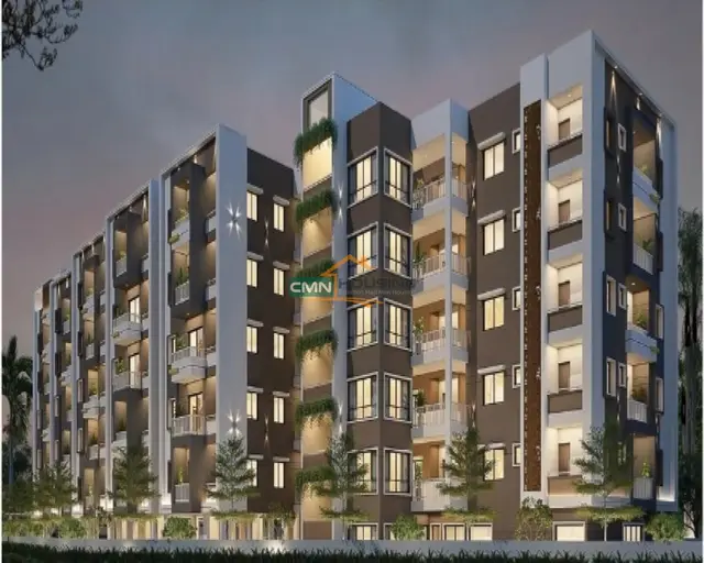
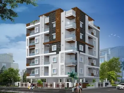
Samskriti Township
Samskriti Ventures LLP · Karimnagar · RERA P02700006307
Samskriti Township is a plotted development / residential layout in Thimmapur locality, Thimmapur (L.M.D.) mandal, Karimnagar district, developed by registered promoter Samskriti Ventures LLP. The RERA land details state a total area of 19,572.23 sq m and net area of 13,584.88 sq m, with 62 plots and no building floors disclosed. It is a residential plotted layout offering plots; apartment or villa configurations are not disclosed. TG-RERA registration number P02700006307 was valid from 07/07/2023 to 24/07/2024, and the architect’s Form–1A records a completion date of 06-08-2026.
01What we found
Read from TG-RERA filings, approvals, land and registration records and court records. A court case is counted only when the court record states this project's survey number with its village, or names the project.
02Check before you pay
7 items to check before you pay, 3 high - from the title chain, court records and approvals, each with what to ask the builder or your advocate. An item may not be a problem with the project: records can be incomplete.
1. Project at a glance
Project identity
| Item | Record |
|---|---|
| Registered project name | Samskriti Township RERA record |
| Project type | Plotted development / residential layout RERA record |
| Phase or registered portion | No separate phase description disclosed; TG-RERA registration is for Samskriti Township |
| TG-RERA registration | P02700006307 |
| Registration validity | 07/07/2023 to 24/07/2024; certificate states “1 years”; no extension is recorded in the supplied certificate |
| Registered promoter | Samskriti Ventures LLP RERA record Corporate record |
| RERA status in supplied record | Registered under section 5; certificate validity ended 24/07/2024. A later architect’s certificate records completion and an occupancy certificate, described below. |
Land and geographic identity
| Item | Record |
|---|---|
| Locality / revenue village | Thimmapur is the project locality in the RERA identity record; the filed layout documents identify the revenue village as Nusthulapur. RERA record Land records |
| Mandal | Thimmapur (L.M.D.) is stated in the final-layout proceeding. |
| District | Karimnagar RERA record |
| PIN | 505481 RERA record |
| Project survey numbers | 796, 820, 826, 827 and 828 Land records |
| Subdivisions | Subdivisions are not specified in the project identity or layout approvals. The title records separately list subdivisions including 796/B; 820/A/A/A, 820A/B/A, 820A/C and 820A/D; 826A/A, 826A/B and 826A/C; 827/A, 827/B and 827/C; and 828/A/A, 828/A/B, 828/A/C and 828/B. Land records |
| Site extent | RERA land details state 19,572.23 sq m total and 13,584.88 sq m net area; the 2021 draft-layout approval also states 19,527.23 Sq. Mt. RERA filing |
| Final-layout extent | The 2026 final-layout proceeding states 4 acres and 33.01 guntas; 23,354.37 Sq. Yards. |
| Boundaries | North, south, east and west: farming land, as recorded in RERA land details. RERA filing |
| Location coordinates | Cadastral parcel centroid: 17.41528, 78.35459. Location record |
Development identity
| Item | Record |
|---|---|
| Sanctioning authority and principal approval | Satavahana Urban Development Authority (Karimnagar), Draft Technical Layout Pattern—Approved and communicated, Draft - TLP.NO.3145/Nustulapur/2021/0078 UDA, dated 24 July, 2021; file reference Lr.Roc.No.3145/Nustulapur/2021/0078. |
| Later layout proceeding | Nusthulapur Gram Panchayat “LAYOUT WITH OPEN PLOT FINAL PROCEEDING LETTER,” application 007891/GP/00014/SWFL/2025, dated 17/06/2026. |
| Approved built-up area | RERA filing states 13,584.88 sq m. This is a plotted layout; no building count or building floor configuration is disclosed. RERA filing |
| Plot count | 62 plots, stated in the layout approval and final-layout proceeding. |
| Roads | Draft-layout approval states road widths of 18 mts and above. |
| Building floors / parking levels | Not disclosed for this plotted layout; individual dwelling permissions are to be considered separately under the final-layout conditions. |
| Parking provision | The final-layout proceeding lists “Common Parking Area”; no count, location or allocation details are supplied. |
Offering and status
| Item | Record |
|---|---|
| Offering | Plots in a residential plotted layout; no apartment or villa configurations are disclosed. RERA record |
| Plot count and sizes | The drawing-derived plot schedule identifies 62 plots. Software-measured sizes range from 140.79 sq m to 333.75 sq m, with a median of 170.12 sq m; measurements are from the drawing and require verification. Layout record |
| Booked / available counts | Not disclosed in the supplied evidence. Document index |
| Completion timeline | TG-RERA certificate validity ended 24/07/2024. The filed Form B declaration gives a completion undertaking of 23/07/2022. The architect’s Form–1A records completion date 06-08-2026 and an occupancy certificate dated 17th June 2026. |
| Occupancy / completion certificate | Architect’s Form–1A records an occupancy certificate issued by DTCP, number 007891/GP/00014/SWFL/2025, dated 17th June 2026, for the registered project; the architect certifies completion. |
2. The project story
Samskriti Township is presented in the TG-RERA record as a residential plotted development in the Thimmapur locality, in the revenue village identified in the layout documents as Nusthulapur, Karimnagar district. The layout covers survey numbers 796, 820, 826, 827 and 828 and provides for 62 plots, internal roads, open space, social infrastructure and utilities. RERA record Land records
The filed 2021 Satavahana Urban Development Authority letter communicates an approved draft technical layout pattern. A later Nusthulapur Gram Panchayat proceeding is titled as a final-layout proceeding and records 62 plots. The project evidence also includes an architect’s Form–1A certifying overall completion and recording an occupancy certificate dated 17 June 2026. These are document-recorded approvals and certifications; no independent site inspection or on-the-ground verification is supplied.
The plotted development is not described as a completed set of dwellings. The final-layout proceeding says individual building permissions are to be considered separately, and restricts each site to detached dwelling use for a single family.
3. Master plan, architecture & building design
The drawing-derived layout schedule covers 62 plots across two layout sheets. Software-measured plot areas range from 140.79 sq m to 333.75 sq m; the median is 170.12 sq m. The plotted-area total in the drawing is 11,391.43 sq m. These are measurements read from the drawing, not independently verified survey measurements. Layout record
The drawing’s land-use table reports a base of 19,527.38 sq m and allocates it as follows:
| Layout use | Area | Share shown in drawing |
|---|---|---|
| Plots | 11,391.43 sq m | 58.34% |
| Roads | 5,987.35 sq m | 30.66% |
| Parks / open space | 1,465.03 sq m | 7.50% |
| Social infrastructure | 488.25 sq m | 2.50% |
| Amenities | 0.00 sq m | 0.00% |
Layout record
The 2021 draft-layout approval also identifies 1% of the layout area for utilities and requires development works including road formation with black top, storm-water drains, underground drainage and a common septic tank/STP, internal water-supply pipelines and an overhead tank, an assured water-supply source, electrical supply lines and street lights, a transformer, avenue planting, park development and rainwater-harvesting pits.
No apartment floor plans, tower plans, building heights, floor counts, building footprints or apartment-area measurements are supplied. The supplied floor-plan review records two layout sheets and no measured apartment plans. Floor plans
4. Homes, configurations & floor plans
This is a plotted project, not an apartment configuration schedule. The drawing-derived schedule records 62 plots, with the following size bands:
| Plot-size band | Plot count |
|---|---|
| 150–200 sq yd (125–167 sq m) | 18 |
| 200–250 sq yd (167–209 sq m) | 33 |
| 250–300 sq yd (209–251 sq m) | 5 |
| 300–400 sq yd (251–334 sq m) | 6 |
Layout record
The smallest measured plot is 140.79 sq m (168.4 sq yd), the median is 170.12 sq m (203.5 sq yd) and the largest is 333.75 sq m (399.2 sq yd). These figures are software-measured from the layout drawing, not RERA-filed carpet or saleable-area measurements. No booked or available plot counts, plot-by-plot sale status, or executed allotment details are provided. Layout record Document index
5. Parking & vehicle circulation
The final-layout proceeding lists a Common Parking Area, but the supplied records give no parking-space count, dimensions, location, vehicle-type breakdown or allocation to individual plots.
The layout approval records internal roads with widths of 18 mts and above. The final-layout conditions require internal roads to remain open to provide access to neighbouring lands. No separate pedestrian route, entry/exit arrangement, driveway specification or EV-charging provision is disclosed.
6. Amenities, recreation & open spaces
| Facility | Park / organized open space |
|---|---|
| Description / size | 1,465.03 sq m (7.50%) in the drawing-derived land-use schedule; the draft approval also specifies 1,465.03. |
| Evidence source | Layout record |
| Declared progress / verified status | Included in layout approval; no independent completion verification supplied. |
| Facility | Social infrastructure |
|---|---|
| Description / size | 488.25 sq m (2.50%) in the drawing-derived land-use schedule. |
| Evidence source | Layout record |
| Declared progress / verified status | Reserved in the approval; no facility description or independent completion verification supplied. |
| Facility | Utility land |
|---|---|
| Description / size | Draft approval identifies 1%, stated as 195.32 sq m. |
| Declared progress / verified status | Reserved in the approval; no independent completion verification supplied. |
| Facility | Avenue plantation |
|---|---|
| Description / size | Required as part of the draft-approved development works. |
| Declared progress / verified status | Required; completion not independently verified. |
| Facility | Sports or indoor recreation facilities |
|---|---|
| Description / size | Not disclosed. |
| Evidence source | RERA amenities |
| Declared progress / verified status | Not established by the supplied evidence. |
| Facility | Common parking area |
|---|---|
| Description / size | Listed in the final-layout proceeding; no size or capacity given. |
| Declared progress / verified status | Listed in the proceeding; no independent completion verification supplied. |
The final-layout proceeding also lists a water reservoir, septic tank/sewerage treatment plant, electric transformer, solid-waste management, garbage bin and common parking area as site provisions. Utility services are described separately below.
7. Utilities, building services & safety
The 2021 draft-layout approval requires internal water-supply pipelines, an overhead tank and an assured water-supply source; underground drainage lines and a common septic tank/STP; storm-water drains; electrical supply lines, street lights and a transformer; and rainwater-harvesting pits. It also lists road formation and park development among the required works. These are approval conditions, not independent evidence of installed or operational services.
The final-layout proceeding lists a water reservoir, septic tank/STP, electric transformer and solid-waste management. No capacities, water-source details, treatment specifications, backup power, waste-segregation arrangements, security systems, accessibility provisions or fire-safety systems are supplied. RERA amenities
8. Location, access & connectivity
The registered project identity places the development in Thimmapur, Karimnagar district, PIN 505481; the layout approvals identify the revenue village as Nusthulapur and the final-layout proceeding states Thimmapur (L.M.D.) mandal. The recorded cadastral parcel centroid is 17.41528, 78.35459. RERA record Location record
The supplied connectivity record identifies Financial District (Nanakramguda), 1.2 km from the recorded point. No approach-road names, public-transport routes or travel-time estimates are supplied. Location record
9. Developer & development status
The registered promoter is Samskriti Ventures LLP, an LLP. Its GSTIN is 36ADXFS7814C1ZM. The Form B declaration states a registered office at Flat No. 511, Maheshwari Chambers, Punjagutta Main Road, Somajiguda, Hyderabad, Telangana - 500082. Corporate record
The project certificate records registration P02700006307, valid from 07/07/2023 to 24/07/2024. The certificate states that validity could be extended by the Authority in accordance with the Act and rules; no extension record is included in the supplied certificate. The later Form–1A records an occupancy certificate dated 17th June 2026 and gives a completion date of 06-08-2026.
The Form B affidavit, dated 13/4/22, contains the promoter’s completion undertaking of 23/07/2022 and declarations concerning title, encumbrances and project funds. These are promoter declarations, not independent findings.
10. Approvals, official records & documents
| Record | What it establishes in the supplied evidence |
|---|---|
| TG-RERA Form C registration certificate, P02700006307 | Registration granted under section 5; certificate states validity from 07/07/2023 to 24/07/2024 and includes project conditions. |
| Satavahana Urban Development Authority letter, Draft - TLP.NO.3145/Nustulapur/2021/0078 UDA, dated 24 July, 2021 | Draft technical layout pattern approved and communicated for the project’s five survey numbers; sets out layout-development and land-handover requirements. |
| Nusthulapur Gram Panchayat final-layout proceeding, application 007891/GP/00014/SWFL/2025, dated 17/06/2026 | “LAYOUT WITH OPEN PLOT FINAL PROCEEDING LETTER” recording 62 plots and layout conditions. |
| Architect’s Form–1A, approval number 007891/GP/00014/SWFL/2025 | Certifies overall completion and records an occupancy certificate dated 17th June 2026; architect licence CAI2017/87850. |
| Form B affidavit-cum-declaration | Promoter declaration for Samskriti Township, dated 13/4/22. |
| Layout drawing | Two layout sheets; software-derived plot count, plot sizes and land-use figures are available, with measurement caveats. Layout record |
The supplied evidence does not include a separate building sanction or individual dwelling approvals; the final-layout proceeding states that individual building permission is to be considered for approval separately.
1. Project at a glance
Project identity
Registered project name: Samskriti Township
Project type: Plotted development / residential layout
Phase or registered portion: No separate phase description disclosed; TG-RERA registration is for Samskriti Township
TG-RERA registration: P02700006307
Registration validity: 07/07/2023 to 24/07/2024; certificate states “1 years”; no extension is recorded in the supplied certificate
Registered promoter: Samskriti Ventures LLP
RERA status in supplied record: Registered under section 5; certificate validity ended 24/07/2024. A later architect’s certificate records completion and an occupancy certificate, described below.
Land and geographic identity
Locality / revenue village: Thimmapur is the project locality in the RERA identity record; the filed layout documents identify the revenue village as Nusthulapur.
Mandal: Thimmapur (L.M.D.) is stated in the final-layout proceeding.
District: Karimnagar
PIN: 505481
Project survey numbers: 796, 820, 826, 827 and 828
Subdivisions: Subdivisions are not specified in the project identity or layout approvals. The title records separately list subdivisions including 796/B; 820/A/A/A, 820A/B/A, 820A/C and 820A/D; 826A/A, 826A/B and 826A/C; 827/A, 827/B and 827/C; and 828/A/A, 828/A/B, 828/A/C and 828/B.
Site extent: RERA land details state 19,572.23 sq m total and 13,584.88 sq m net area; the 2021 draft-layout approval also states 19,527.23 Sq. Mt.
Final-layout extent: The 2026 final-layout proceeding states 4 acres and 33.01 guntas; 23,354.37 Sq. Yards.
Boundaries: North, south, east and west: farming land, as recorded in RERA land details.
Location coordinates: Cadastral parcel centroid: 17.41528, 78.35459.
Development identity
Sanctioning authority and principal approval: Satavahana Urban Development Authority (Karimnagar), Draft Technical Layout Pattern—Approved and communicated, Draft - TLP.NO.3145/Nustulapur/2021/0078 UDA, dated 24 July, 2021; file reference Lr.Roc.No.3145/Nustulapur/2021/0078.
Later layout proceeding: Nusthulapur Gram Panchayat “LAYOUT WITH OPEN PLOT FINAL PROCEEDING LETTER,” application 007891/GP/00014/SWFL/2025, dated 17/06/2026.
Approved built-up area: RERA filing states 13,584.88 sq m. This is a plotted layout; no building count or building floor configuration is disclosed.
Plot count: 62 plots, stated in the layout approval and final-layout proceeding.
Roads: Draft-layout approval states road widths of 18 mts and above.
Building floors / parking levels: Not disclosed for this plotted layout; individual dwelling permissions are to be considered separately under the final-layout conditions.
Parking provision: The final-layout proceeding lists “Common Parking Area”; no count, location or allocation details are supplied.
Offering and status
Offering: Plots in a residential plotted layout; no apartment or villa configurations are disclosed.
Plot count and sizes: The drawing-derived plot schedule identifies 62 plots. Software-measured sizes range from 140.79 sq m to 333.75 sq m, with a median of 170.12 sq m; measurements are from the drawing and require verification.
Booked / available counts: Not disclosed in the supplied evidence.
Completion timeline: TG-RERA certificate validity ended 24/07/2024. The filed Form B declaration gives a completion undertaking of 23/07/2022. The architect’s Form–1A records completion date 06-08-2026 and an occupancy certificate dated 17th June 2026.
Occupancy / completion certificate: Architect’s Form–1A records an occupancy certificate issued by DTCP, number 007891/GP/00014/SWFL/2025, dated 17th June 2026, for the registered project; the architect certifies completion.
2. The project story
Samskriti Township is presented in the TG-RERA record as a residential plotted development in the Thimmapur locality, in the revenue village identified in the layout documents as Nusthulapur, Karimnagar district. The layout covers survey numbers 796, 820, 826, 827 and 828 and provides for 62 plots, internal roads, open space, social infrastructure and utilities.
The filed 2021 Satavahana Urban Development Authority letter communicates an approved draft technical layout pattern. A later Nusthulapur Gram Panchayat proceeding is titled as a final-layout proceeding and records 62 plots. The project evidence also includes an architect’s Form–1A certifying overall completion and recording an occupancy certificate dated 17 June 2026. These are document-recorded approvals and certifications; no independent site inspection or on-the-ground verification is supplied.
The plotted development is not described as a completed set of dwellings. The final-layout proceeding says individual building permissions are to be considered separately, and restricts each site to detached dwelling use for a single family.
3. Master plan, architecture & building design
The drawing-derived layout schedule covers 62 plots across two layout sheets. Software-measured plot areas range from 140.79 sq m to 333.75 sq m; the median is 170.12 sq m. The plotted-area total in the drawing is 11,391.43 sq m. These are measurements read from the drawing, not independently verified survey measurements.
The drawing’s land-use table reports a base of 19,527.38 sq m and allocates it as follows:
| Layout use | Area | Share shown in drawing |
|---|---|---|
| Plots | 11,391.43 sq m | 58.34% |
| Roads | 5,987.35 sq m | 30.66% |
| Parks / open space | 1,465.03 sq m | 7.50% |
| Social infrastructure | 488.25 sq m | 2.50% |
| Amenities | 0.00 sq m | 0.00% |
The 2021 draft-layout approval also identifies 1% of the layout area for utilities and requires development works including road formation with black top, storm-water drains, underground drainage and a common septic tank/STP, internal water-supply pipelines and an overhead tank, an assured water-supply source, electrical supply lines and street lights, a transformer, avenue planting, park development and rainwater-harvesting pits.
No apartment floor plans, tower plans, building heights, floor counts, building footprints or apartment-area measurements are supplied. The supplied floor-plan review records two layout sheets and no measured apartment plans.
4. Homes, configurations & floor plans
This is a plotted project, not an apartment configuration schedule. The drawing-derived schedule records 62 plots, with the following size bands:
150–200 sq yd (125–167 sq m): 18
200–250 sq yd (167–209 sq m): 33
250–300 sq yd (209–251 sq m): 5
300–400 sq yd (251–334 sq m): 6
The smallest measured plot is 140.79 sq m (168.4 sq yd), the median is 170.12 sq m (203.5 sq yd) and the largest is 333.75 sq m (399.2 sq yd). These figures are software-measured from the layout drawing, not RERA-filed carpet or saleable-area measurements. No booked or available plot counts, plot-by-plot sale status, or executed allotment details are provided.
5. Parking & vehicle circulation
The final-layout proceeding lists a Common Parking Area, but the supplied records give no parking-space count, dimensions, location, vehicle-type breakdown or allocation to individual plots.
The layout approval records internal roads with widths of 18 mts and above. The final-layout conditions require internal roads to remain open to provide access to neighbouring lands. No separate pedestrian route, entry/exit arrangement, driveway specification or EV-charging provision is disclosed.
6. Amenities, recreation & open spaces
| Facility | Park / organized open space |
|---|---|
| Description / size | 1,465.03 sq m (7.50%) in the drawing-derived land-use schedule; the draft approval also specifies 1,465.03. |
| Declared progress / verified status | Included in layout approval; no independent completion verification supplied. |
| Facility | Social infrastructure |
|---|---|
| Description / size | 488.25 sq m (2.50%) in the drawing-derived land-use schedule. |
| Declared progress / verified status | Reserved in the approval; no facility description or independent completion verification supplied. |
| Facility | Utility land |
|---|---|
| Description / size | Draft approval identifies 1%, stated as 195.32 sq m. |
| Declared progress / verified status | Reserved in the approval; no independent completion verification supplied. |
| Facility | Avenue plantation |
|---|---|
| Description / size | Required as part of the draft-approved development works. |
| Declared progress / verified status | Required; completion not independently verified. |
| Facility | Sports or indoor recreation facilities |
|---|---|
| Description / size | Not disclosed. |
| Declared progress / verified status | Not established by the supplied evidence. |
| Facility | Common parking area |
|---|---|
| Description / size | Listed in the final-layout proceeding; no size or capacity given. |
| Declared progress / verified status | Listed in the proceeding; no independent completion verification supplied. |
The final-layout proceeding also lists a water reservoir, septic tank/sewerage treatment plant, electric transformer, solid-waste management, garbage bin and common parking area as site provisions. Utility services are described separately below.
7. Utilities, building services & safety
The 2021 draft-layout approval requires internal water-supply pipelines, an overhead tank and an assured water-supply source; underground drainage lines and a common septic tank/STP; storm-water drains; electrical supply lines, street lights and a transformer; and rainwater-harvesting pits. It also lists road formation and park development among the required works. These are approval conditions, not independent evidence of installed or operational services.
The final-layout proceeding lists a water reservoir, septic tank/STP, electric transformer and solid-waste management. No capacities, water-source details, treatment specifications, backup power, waste-segregation arrangements, security systems, accessibility provisions or fire-safety systems are supplied.
8. Location, access & connectivity
The registered project identity places the development in Thimmapur, Karimnagar district, PIN 505481; the layout approvals identify the revenue village as Nusthulapur and the final-layout proceeding states Thimmapur (L.M.D.) mandal. The recorded cadastral parcel centroid is 17.41528, 78.35459.
The supplied connectivity record identifies Financial District (Nanakramguda), 1.2 km from the recorded point. No approach-road names, public-transport routes or travel-time estimates are supplied.
9. Developer & development status
The registered promoter is Samskriti Ventures LLP, an LLP. Its GSTIN is 36ADXFS7814C1ZM. The Form B declaration states a registered office at Flat No. 511, Maheshwari Chambers, Punjagutta Main Road, Somajiguda, Hyderabad, Telangana - 500082.
The project certificate records registration P02700006307, valid from 07/07/2023 to 24/07/2024. The certificate states that validity could be extended by the Authority in accordance with the Act and rules; no extension record is included in the supplied certificate. The later Form–1A records an occupancy certificate dated 17th June 2026 and gives a completion date of 06-08-2026.
The Form B affidavit, dated 13/4/22, contains the promoter’s completion undertaking of 23/07/2022 and declarations concerning title, encumbrances and project funds. These are promoter declarations, not independent findings.
10. Approvals, official records & documents
TG-RERA Form C registration certificate, P02700006307: Registration granted under section 5; certificate states validity from 07/07/2023 to 24/07/2024 and includes project conditions.
Satavahana Urban Development Authority letter, Draft - TLP.NO.3145/Nustulapur/2021/0078 UDA, dated 24 July, 2021: Draft technical layout pattern approved and communicated for the project’s five survey numbers; sets out layout-development and land-handover requirements.
Nusthulapur Gram Panchayat final-layout proceeding, application 007891/GP/00014/SWFL/2025, dated 17/06/2026: “LAYOUT WITH OPEN PLOT FINAL PROCEEDING LETTER” recording 62 plots and layout conditions.
Architect’s Form–1A, approval number 007891/GP/00014/SWFL/2025: Certifies overall completion and records an occupancy certificate dated 17th June 2026; architect licence CAI2017/87850.
Form B affidavit-cum-declaration: Promoter declaration for Samskriti Township, dated 13/4/22.
Layout drawing: Two layout sheets; software-derived plot count, plot sizes and land-use figures are available, with measurement caveats.
The supplied evidence does not include a separate building sanction or individual dwelling approvals; the final-layout proceeding states that individual building permission is to be considered for approval separately.
Frequently asked questions
Is Samskriti Township registered with Telangana RERA?
Yes. Samskriti Township is registered with the Telangana Real Estate Regulatory Authority as P02700006307; the registration status is New Project.
Who is the developer of Samskriti Township?
The promoter named in the RERA registration is Samskriti Ventures LLP.
Where is Samskriti Township located?
Samskriti Township is in Thimmapur, Karimnagar, Telangana (505481).
When will Samskriti Township be completed?
The promoter's proposed date of completion filed with RERA is 24/07/2024. This is the promoter's declaration, not a guarantee.
More projects in Karimnagar