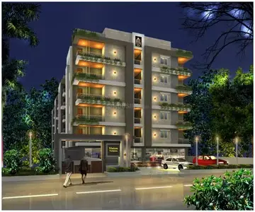
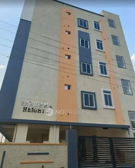
Sarigama Heights
M S BUILDERS · Rangareddy · RERA P02400002751
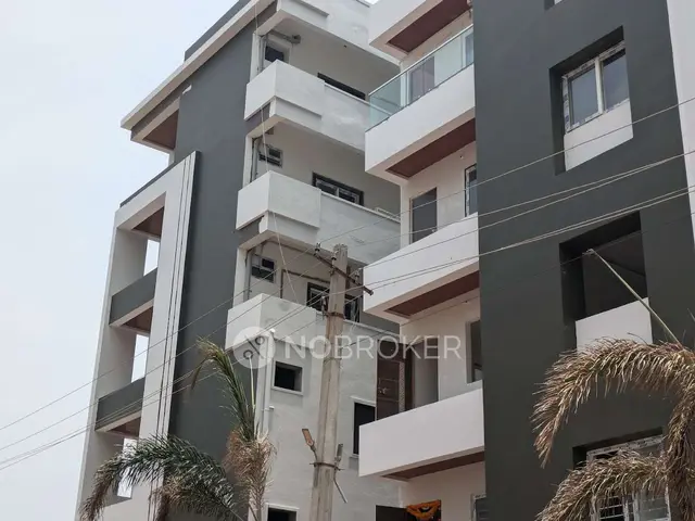
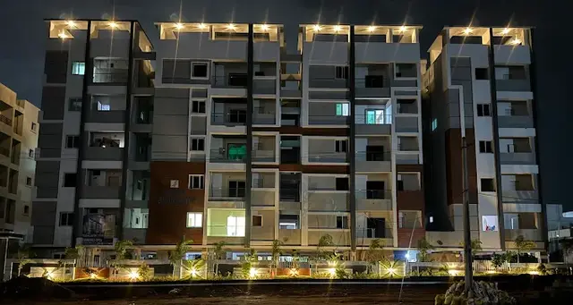
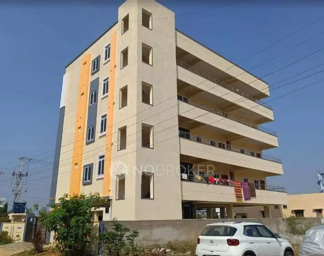
SARIGAMA HEIGHTS is a residential apartment project in Manneguda, Ragannaguda revenue village, Abdullapurmet mandal, Ranga Reddy district, developed by the registered promoter M S BUILDERS. The project covers a total site area of 438.94 sq m and comprises one building with 1 Stilt + 4 upper floors and 12 two-bedroom apartments, each with a saleable area of 81.37 sq m. It is registered under TG-RERA number P02400002751, with proposed completion by 12 June 2026.
More from M S Builders · 3 projects →
01What we found
Read from TG-RERA filings, approvals, land and registration records and court records. A court case is counted only when the court record states this project's survey number with its village, or names the project.
02Check before you pay
9 items to check before you pay, 4 high - from the title chain, court records and approvals, each with what to ask the builder or your advocate. An item may not be a problem with the project: records can be incomplete.
Project at a glance
Project identity
| Field | Record |
|---|---|
| Registered project name | SARIGAMA HEIGHTS RERA record |
| Project type / status | Residential apartment project; TG-RERA record labels it “New Project” RERA filing RERA record |
| Phase / registered portion | Phase not separately identified; registration relates to the project at Survey No. 44/B, Plot Nos. 30 and 31 |
| TG-RERA registration | P02400002751; issued 30/03/2021; stated validity 30/03/2021–12/06/2026; extension not recorded on the supplied certificate |
| Registered promoter | M S BUILDERS (also rendered “M/s. MS BUILDERS” in the filed declaration); partnership RERA record Corporate record |
| TG-RERA status | Registered under section 5; the supplied certificate’s validity end date is 12/06/2026. A current post-expiry registration status is not established by the certificate alone. |
Land and geographic identity
| Field | Record |
|---|---|
| Locality / plots | Manneguda; Plot Nos. 30 and 31 RERA filing |
| Revenue village | Ragannaguda RERA record RERA filing |
| Mandal / district / PIN | Abdullapurmet / Ranga Reddy / 501101 RERA record RERA filing |
| Project survey number(s) | 44/B RERA record Land records |
| Site area / net area | Total site area 438.94 sq m; net area 436.97 sq m in the RERA land details and building-permit extraction RERA filing |
| Road-affected area | RERA land details state 1.97 sq m; the building-permit extraction separately records road-affected area as 10 sq m. These are recorded here as source-specific fields, not reconciled. RERA filing |
| Boundaries | East: Plot Nos. 17 and 18; West: 30-feet-wide road; North: Plot No. 29; South: 33-feet-wide road RERA filing |
| Coordinates / site demarcation | A location point is available, but a surveyed boundary plan or coordinate-defined parcel perimeter is not supplied here. Location record HMDA |
Development identity
| Field | Record |
|---|---|
| Sanctioning authority | Turkayamjal Municipality; the RERA filing identifies DTCP as authority Approvals record |
| Principal building permission | Building Permit Order, approval no. 13127/W1/2020/0256, file no. 3127/W1/2020/0256, dated 12 June, 2020 |
| Approved built-up area | 914.56 sq m in the RERA filing’s built-up-area details RERA filing |
| Building count / configuration | One building; permit describes 1 Stilt + 4 upper floors for residential use RERA filing |
| Height | Permit extraction records 12 m; the occupancy-certificate extraction records both 12.00 m and “Building height (m): 13” |
| Parking levels / area | Permit records parking floors as 0.00; the occupancy-certificate extraction lists “Parking Area (m2) 914.56.” A parking-space count or parking-level plan is not provided in this evidence. |
| Units | RERA filing records 12 proposed 2BHK apartments; the project-information fields separately state one proposed building unit. RERA unit table RERA filing |
Offering and status
| Field | Record |
|---|---|
| RERA-filed configuration | 2BHK; saleable area 81.37 sq m per apartment RERA unit table RERA unit table |
| Booked / available | Portal snapshot records 0 booked and 12 available; no as-of date is supplied, so counts are indicative rather than a current inventory confirmation. RERA unit table |
| Completion date | Promoter’s RERA filing and Form B undertaking state proposed completion by 12 June 2026. RERA record |
| Occupancy certificate | An Occupancy Certificate is recorded for the residential building, approval no. 0021/OC/3127/2021, dated 29/10/2021, covering the building at Plot Nos. 30 and 31, Survey No. 44/B. Approvals record |
| Construction stage | The supplied record includes a municipal certificate stating the building was inspected and declared fit for occupation. No current independent site inspection or construction-progress measurement is supplied. RERA amenities |
The project story
SARIGAMA HEIGHTS is recorded as a single-building residential apartment project at Plot Nos. 30 and 31 in Manneguda, revenue village Ragannaguda, Abdullapurmet mandal, Ranga Reddy district. Its project parcel is identified as Survey No. 44/B. The RERA filing reports 12 two-bedroom apartments in one building. RERA record RERA filing RERA unit table
The municipal building-permit extraction describes a residential building with one stilt level and four upper floors. The supplied Occupancy Certificate states that the building was inspected and declared fit for occupation, and records a completion notice dated 27 October 2021. That certificate is building-specific to Plot Nos. 30 and 31, Survey No. 44/B; the evidence does not provide a separate phase or tower-wise completion breakdown.
The project’s stated RERA completion date was 12 June 2026. That deadline and the certificate’s occupancy status are separate record items; the materials supplied do not include a current site inspection or a current TG-RERA status update. RERA record
Master plan, architecture & building design
The RERA land details record a total area of 438.94 sq m and net area of 436.97 sq m. The permit extraction likewise lists site area of 438.94 sq m and net area of 436.97 sq m. These are site-area figures, not carpet or saleable area. The RERA filing gives approved built-up area as 914.56 sq m. RERA filing RERA filing
The permit is for one residential building, described as 1 Stilt + 4 upper floors, with a stated height of 12 m. The occupancy-certificate extraction also records 12.00 m and separately lists building height as 13 m. No detailed drawing-based account of flats per floor, lift or stair locations, internal circulation, building footprint, landscaping, or common-area distribution is supplied in the available overview data.
The RERA filing’s site description identifies Plot Nos. 30 and 31 and the surrounding plot and road boundaries. The municipal permit conditions refer to a tot-lot, transformer space, garbage house and rainwater-harvesting structure; the supplied extraction does not establish their dimensions or present delivery status. RERA filing
Homes, configurations & floor plans
The RERA filing records twelve 2BHK apartments, each with a saleable area of 81.37 sq m. The RERA portal snapshot indicates zero booked and twelve available, but gives no snapshot date. RERA unit table RERA unit table
| Configuration | Units | Booked | Available | RERA saleable area | Measured carpet area | Loading (if supplied) |
|---|---|---|---|---|---|---|
| 2BHK | 12 | 0 | 12 | 81.37 sq m | Not supplied for a RERA-matched 2BHK drawing | Not supplied |
The floor-plan measurement data describes 1BHK and 3BHK configurations, but marks both as not matched to the RERA filing; they are not presented as RERA-filed offerings. The software-measured drawing data gives 1BHK carpet area of 42.6–42.7 sq m and 3BHK carpet area of 81.1–81.2 sq m. These are drawing-geometry measurements, not RERA disclosures, and the supplied drawing data notes that measurements need review. RERA unit details Floor plans
Carpet area and saleable area are not interchangeable: the supplied floor-plan note explains that saleable area includes the home’s share of common areas, while the measured carpet area is drawn from the unit geometry. No RERA-filed carpet area or loading figure for the 2BHK configuration is provided in this evidence. Floor plans RERA unit table
Parking & vehicle circulation
The RERA filing records a declared mortgage area of 104.96 sq m; this is not a parking-space count. The building-permit extraction records parking floors as 0.00, while the occupancy-certificate extraction lists “Parking Area (m2) 914.56.” The available material does not establish the number or type of sanctioned bays, visitor or accessible parking, parking allocation to apartments, ramps, internal driveways, or pedestrian separation. RERA filing Land records
A vendor listing mentions covered car parking and dedicated bike parking, but these are third-party/promotional claims, not verified counts or legal allotments in the supplied TG-RERA documents. Promoter website
Amenities, recreation & open spaces
The RERA filing lists project-facility categories and indicates “YES” for water supply, sewerage, rainwater harvesting and fire-protection/fire-safety requirements. Many other listed fields show 0% progress; that is a filed status field, not independent verification of works on site. RERA amenities
| Description / size | Permit condition requires the tot-lot to be fenced and maintained as greenery before issue of the occupancy certificate; no size is supplied. |
|---|---|
| Evidence source | Municipal building-permit condition |
| Declared progress / verified status | Condition recorded; current physical status not independently verified |
| Description / size | Listed in the RERA amenity schedule; no description or size supplied. RERA amenities |
|---|---|
| Evidence source | TG-RERA filing |
| Declared progress / verified status | Schedule records 0%; delivery not verified |
| Description / size | Aggregate-area field is listed; no area is supplied. RERA amenities |
|---|---|
| Evidence source | TG-RERA filing |
| Declared progress / verified status | Schedule records 0%; delivery not verified |
| Description / size | Third-party listing claims these amenities; no sizes or capacities are supplied in the RERA amenity data provided here. Promoter website |
|---|---|
| Evidence source | Vendor listing |
| Declared progress / verified status | Marketing/listing claims only; not established as sanctioned or delivered |
Utilities, building services & safety
The municipal permit conditions require a rainwater-harvesting percolation pit, space for a transformer and a garbage house within the premises. The RERA amenity schedule marks water supply, sewerage, rainwater harvesting, fire protection/fire safety and an electrical meter room/sub-station/receiving station as “YES”; it does not give capacities or confirm independent completion. RERA amenities
The Occupancy Certificate extraction lists an underground static water-storage tank of 25,000 L and a terrace tank of 25,000 L for residential buildings. This is the certificate’s recorded provision; the supplied material does not describe the water source, treatment, sewerage-treatment capacity, reuse, backup power, lifts, CCTV, access control, accessible routes, or specific fire-system equipment.
A vendor listing mentions borewell water, power backup, sewage-treatment plant, waste management, CCTV, security and fire safety. These remain vendor claims in this evidence and are not treated as confirmed RERA-filed capacities or independently verified installations. Promoter website
Location, access & connectivity
The registered project location is Manneguda, revenue village Ragannaguda, Abdullapurmet mandal, Ranga Reddy district, PIN 501101. The RERA land details identify Plot Nos. 30 and 31 in Survey No. 44/B, bounded by adjacent plots and roads, including 30-feet-wide and 33-feet-wide roads. RERA record RERA filing
A supplied geocode places the site in Manneguda village Road, Abdullapurmet mandal, Ranga Reddy, Telangana; its location string carries PIN 501511, whereas the project identity and registration certificate give PIN 501101. The geocode is a location point and does not establish the parcel boundary. Location record RERA record
The location data lists the nearest sampled Outer Ring Road interchange at approximately 3.7 km. A vendor listing separately claims the Nehru Outer Ring Road is approximately 1.3 km away; that is a vendor-reported figure, not a measured distance in the supplied location record. Location record Promoter website
Developer & development status
The registered promoter is M S BUILDERS, identified in the RERA record as a partnership. The supplied corporate identifier is GSTIN 36ABMFM5187B1Z3. The RERA filing lists NAGAMALLESWARA RAO DUSANAPUDI as authorised signatory and SUDHAKAR REDDY BURUGU and SALAM SHAIK as partners. Corporate record Parties record RERA record
The RERA certificate gives the promoter office as “Village: Mandal: Saroornagar, District: Ranga Reddy, Pin: 500079.” A complete street address or official website/contact details are not supplied in the certificate extract.
The promoter’s Form B declaration, dated January 2021, identifies the landowners as Maddelabeed Narasimha Reddy and M. Muralidhar Reddy, refers to Development Agreement-cum-GPA Doc. No. 3330/2020, and undertakes completion by 12 June 2026. These are promoter declarations. The supplied Occupancy Certificate records the residential building as fit for occupation; no current independent progress inspection is included.
Approvals, official records & documents
| Identifier / date | P02400002751; issued 30/03/2021; stated valid through 12/06/2026 |
|---|---|
| Scope and source | SARIGAMA HEIGHTS; Form C certificate |
| Identifier / date | Approval no. 13127/W1/2020/0256; file no. 3127/W1/2020/0256; 12 June, 2020 |
|---|---|
| Scope and source | Turkayamjal Municipality; one residential building at Survey No. 44/B, Plot Nos. 30 and 31; permit extraction states 1 Stilt + 4 upper floors |
| Identifier / date | 0021/OC/3127/2021; 29/10/2021; application 003550/OC/DTCP/3127/0046/2021 |
|---|---|
| Scope and source | Turkayamjal Municipality / TS-bPASS; building at Survey No. 44/B, Plot Nos. 30 and 31; certificate states inspected and fit for occupation |
| Identifier / date | January 2021 |
|---|---|
| Scope and source | Promoter declaration by authorised representative for M S BUILDERS; identifies landowners and Development Agreement-cum-GPA Doc. No. 3330/2020 |
| Identifier / date | Document ID 146234 |
|---|---|
| Scope and source | Allotment-letter document for an apartment; extract states the registered agreement for sale governs sale terms |
| Identifier / date | Document ID 146235 |
|---|---|
| Scope and source | Partially completed annexure agreement; allottee identity, apartment particulars and price are blank in the supplied extraction |
| Identifier / date | Layout / Sub Divn. No. HMDAL131703/LRS/GTK/PLG/HMDA/2015-16 |
|---|---|
| Scope and source | Number appears in the permit and occupancy-certificate extracts; the public HMDA DPMS lookup was unavailable in the supplied evidence, so an independently retrieved approved layout is not included here. HMDA |
Project at a glance
Project identity
Registered project name: SARIGAMA HEIGHTS
Project type / status: Residential apartment project; TG-RERA record labels it “New Project”
Phase / registered portion: Phase not separately identified; registration relates to the project at Survey No. 44/B, Plot Nos. 30 and 31
TG-RERA registration: P02400002751; issued 30/03/2021; stated validity 30/03/2021–12/06/2026; extension not recorded on the supplied certificate
Registered promoter: M S BUILDERS (also rendered “M/s. MS BUILDERS” in the filed declaration); partnership
TG-RERA status: Registered under section 5; the supplied certificate’s validity end date is 12/06/2026. A current post-expiry registration status is not established by the certificate alone.
Land and geographic identity
Locality / plots: Manneguda; Plot Nos. 30 and 31
Revenue village: Ragannaguda
Mandal / district / PIN: Abdullapurmet / Ranga Reddy / 501101
Project survey number(s): 44/B
Site area / net area: Total site area 438.94 sq m; net area 436.97 sq m in the RERA land details and building-permit extraction
Road-affected area: RERA land details state 1.97 sq m; the building-permit extraction separately records road-affected area as 10 sq m. These are recorded here as source-specific fields, not reconciled.
Boundaries: East: Plot Nos. 17 and 18; West: 30-feet-wide road; North: Plot No. 29; South: 33-feet-wide road
Coordinates / site demarcation: A location point is available, but a surveyed boundary plan or coordinate-defined parcel perimeter is not supplied here.
Development identity
Sanctioning authority: Turkayamjal Municipality; the RERA filing identifies DTCP as authority
Principal building permission: Building Permit Order, approval no. 13127/W1/2020/0256, file no. 3127/W1/2020/0256, dated 12 June, 2020
Approved built-up area: 914.56 sq m in the RERA filing’s built-up-area details
Building count / configuration: One building; permit describes 1 Stilt + 4 upper floors for residential use
Height: Permit extraction records 12 m; the occupancy-certificate extraction records both 12.00 m and “Building height (m): 13”
Parking levels / area: Permit records parking floors as 0.00; the occupancy-certificate extraction lists “Parking Area (m2) 914.56.” A parking-space count or parking-level plan is not provided in this evidence.
Units: RERA filing records 12 proposed 2BHK apartments; the project-information fields separately state one proposed building unit.
Offering and status
RERA-filed configuration: 2BHK; saleable area 81.37 sq m per apartment
Booked / available: Portal snapshot records 0 booked and 12 available; no as-of date is supplied, so counts are indicative rather than a current inventory confirmation.
Completion date: Promoter’s RERA filing and Form B undertaking state proposed completion by 12 June 2026.
Occupancy certificate: An Occupancy Certificate is recorded for the residential building, approval no. 0021/OC/3127/2021, dated 29/10/2021, covering the building at Plot Nos. 30 and 31, Survey No. 44/B.
Construction stage: The supplied record includes a municipal certificate stating the building was inspected and declared fit for occupation. No current independent site inspection or construction-progress measurement is supplied.
The project story
SARIGAMA HEIGHTS is recorded as a single-building residential apartment project at Plot Nos. 30 and 31 in Manneguda, revenue village Ragannaguda, Abdullapurmet mandal, Ranga Reddy district. Its project parcel is identified as Survey No. 44/B. The RERA filing reports 12 two-bedroom apartments in one building.
The municipal building-permit extraction describes a residential building with one stilt level and four upper floors. The supplied Occupancy Certificate states that the building was inspected and declared fit for occupation, and records a completion notice dated 27 October 2021. That certificate is building-specific to Plot Nos. 30 and 31, Survey No. 44/B; the evidence does not provide a separate phase or tower-wise completion breakdown.
The project’s stated RERA completion date was 12 June 2026. That deadline and the certificate’s occupancy status are separate record items; the materials supplied do not include a current site inspection or a current TG-RERA status update.
Master plan, architecture & building design
The RERA land details record a total area of 438.94 sq m and net area of 436.97 sq m. The permit extraction likewise lists site area of 438.94 sq m and net area of 436.97 sq m. These are site-area figures, not carpet or saleable area. The RERA filing gives approved built-up area as 914.56 sq m.
The permit is for one residential building, described as 1 Stilt + 4 upper floors, with a stated height of 12 m. The occupancy-certificate extraction also records 12.00 m and separately lists building height as 13 m. No detailed drawing-based account of flats per floor, lift or stair locations, internal circulation, building footprint, landscaping, or common-area distribution is supplied in the available overview data.
The RERA filing’s site description identifies Plot Nos. 30 and 31 and the surrounding plot and road boundaries. The municipal permit conditions refer to a tot-lot, transformer space, garbage house and rainwater-harvesting structure; the supplied extraction does not establish their dimensions or present delivery status.
Homes, configurations & floor plans
The RERA filing records twelve 2BHK apartments, each with a saleable area of 81.37 sq m. The RERA portal snapshot indicates zero booked and twelve available, but gives no snapshot date.
| Configuration | Units | Booked | Available | RERA saleable area | Measured carpet area | Loading (if supplied) |
|---|---|---|---|---|---|---|
| 2BHK | 12 | 0 | 12 | 81.37 sq m | Not supplied for a RERA-matched 2BHK drawing | Not supplied |
The floor-plan measurement data describes 1BHK and 3BHK configurations, but marks both as not matched to the RERA filing; they are not presented as RERA-filed offerings. The software-measured drawing data gives 1BHK carpet area of 42.6–42.7 sq m and 3BHK carpet area of 81.1–81.2 sq m. These are drawing-geometry measurements, not RERA disclosures, and the supplied drawing data notes that measurements need review.
Carpet area and saleable area are not interchangeable: the supplied floor-plan note explains that saleable area includes the home’s share of common areas, while the measured carpet area is drawn from the unit geometry. No RERA-filed carpet area or loading figure for the 2BHK configuration is provided in this evidence.
Parking & vehicle circulation
The RERA filing records a declared mortgage area of 104.96 sq m; this is not a parking-space count. The building-permit extraction records parking floors as 0.00, while the occupancy-certificate extraction lists “Parking Area (m2) 914.56.” The available material does not establish the number or type of sanctioned bays, visitor or accessible parking, parking allocation to apartments, ramps, internal driveways, or pedestrian separation.
A vendor listing mentions covered car parking and dedicated bike parking, but these are third-party/promotional claims, not verified counts or legal allotments in the supplied TG-RERA documents.
Amenities, recreation & open spaces
The RERA filing lists project-facility categories and indicates “YES” for water supply, sewerage, rainwater harvesting and fire-protection/fire-safety requirements. Many other listed fields show 0% progress; that is a filed status field, not independent verification of works on site.
| Description / size | Permit condition requires the tot-lot to be fenced and maintained as greenery before issue of the occupancy certificate; no size is supplied. |
|---|---|
| Evidence source | Municipal building-permit condition |
| Declared progress / verified status | Condition recorded; current physical status not independently verified |
| Description / size | Listed in the RERA amenity schedule; no description or size supplied. |
|---|---|
| Evidence source | TG-RERA filing |
| Declared progress / verified status | Schedule records 0%; delivery not verified |
| Description / size | Aggregate-area field is listed; no area is supplied. |
|---|---|
| Evidence source | TG-RERA filing |
| Declared progress / verified status | Schedule records 0%; delivery not verified |
| Description / size | Third-party listing claims these amenities; no sizes or capacities are supplied in the RERA amenity data provided here. |
|---|---|
| Evidence source | Vendor listing |
| Declared progress / verified status | Marketing/listing claims only; not established as sanctioned or delivered |
Utilities, building services & safety
The municipal permit conditions require a rainwater-harvesting percolation pit, space for a transformer and a garbage house within the premises. The RERA amenity schedule marks water supply, sewerage, rainwater harvesting, fire protection/fire safety and an electrical meter room/sub-station/receiving station as “YES”; it does not give capacities or confirm independent completion.
The Occupancy Certificate extraction lists an underground static water-storage tank of 25,000 L and a terrace tank of 25,000 L for residential buildings. This is the certificate’s recorded provision; the supplied material does not describe the water source, treatment, sewerage-treatment capacity, reuse, backup power, lifts, CCTV, access control, accessible routes, or specific fire-system equipment.
A vendor listing mentions borewell water, power backup, sewage-treatment plant, waste management, CCTV, security and fire safety. These remain vendor claims in this evidence and are not treated as confirmed RERA-filed capacities or independently verified installations.
Location, access & connectivity
The registered project location is Manneguda, revenue village Ragannaguda, Abdullapurmet mandal, Ranga Reddy district, PIN 501101. The RERA land details identify Plot Nos. 30 and 31 in Survey No. 44/B, bounded by adjacent plots and roads, including 30-feet-wide and 33-feet-wide roads.
A supplied geocode places the site in Manneguda village Road, Abdullapurmet mandal, Ranga Reddy, Telangana; its location string carries PIN 501511, whereas the project identity and registration certificate give PIN 501101. The geocode is a location point and does not establish the parcel boundary.
The location data lists the nearest sampled Outer Ring Road interchange at approximately 3.7 km. A vendor listing separately claims the Nehru Outer Ring Road is approximately 1.3 km away; that is a vendor-reported figure, not a measured distance in the supplied location record.
Developer & development status
The registered promoter is M S BUILDERS, identified in the RERA record as a partnership. The supplied corporate identifier is GSTIN 36ABMFM5187B1Z3. The RERA filing lists NAGAMALLESWARA RAO DUSANAPUDI as authorised signatory and SUDHAKAR REDDY BURUGU and SALAM SHAIK as partners.
The RERA certificate gives the promoter office as “Village: Mandal: Saroornagar, District: Ranga Reddy, Pin: 500079.” A complete street address or official website/contact details are not supplied in the certificate extract.
The promoter’s Form B declaration, dated January 2021, identifies the landowners as Maddelabeed Narasimha Reddy and M. Muralidhar Reddy, refers to Development Agreement-cum-GPA Doc. No. 3330/2020, and undertakes completion by 12 June 2026. These are promoter declarations. The supplied Occupancy Certificate records the residential building as fit for occupation; no current independent progress inspection is included.
Approvals, official records & documents
| Identifier / date | P02400002751; issued 30/03/2021; stated valid through 12/06/2026 |
|---|---|
| Scope and source | SARIGAMA HEIGHTS; Form C certificate |
| Identifier / date | Approval no. 13127/W1/2020/0256; file no. 3127/W1/2020/0256; 12 June, 2020 |
|---|---|
| Scope and source | Turkayamjal Municipality; one residential building at Survey No. 44/B, Plot Nos. 30 and 31; permit extraction states 1 Stilt + 4 upper floors |
| Identifier / date | 0021/OC/3127/2021; 29/10/2021; application 003550/OC/DTCP/3127/0046/2021 |
|---|---|
| Scope and source | Turkayamjal Municipality / TS-bPASS; building at Survey No. 44/B, Plot Nos. 30 and 31; certificate states inspected and fit for occupation |
| Identifier / date | January 2021 |
|---|---|
| Scope and source | Promoter declaration by authorised representative for M S BUILDERS; identifies landowners and Development Agreement-cum-GPA Doc. No. 3330/2020 |
| Identifier / date | Document ID 146234 |
|---|---|
| Scope and source | Allotment-letter document for an apartment; extract states the registered agreement for sale governs sale terms |
| Identifier / date | Document ID 146235 |
|---|---|
| Scope and source | Partially completed annexure agreement; allottee identity, apartment particulars and price are blank in the supplied extraction |
| Identifier / date | Layout / Sub Divn. No. HMDAL131703/LRS/GTK/PLG/HMDA/2015-16 |
|---|---|
| Scope and source | Number appears in the permit and occupancy-certificate extracts; the public HMDA DPMS lookup was unavailable in the supplied evidence, so an independently retrieved approved layout is not included here. |
Frequently asked questions
Is SARIGAMA HEIGHTS registered with Telangana RERA?
Yes. SARIGAMA HEIGHTS is registered with the Telangana Real Estate Regulatory Authority as P02400002751; the registration status is New Project.
Who is the developer of SARIGAMA HEIGHTS?
The promoter named in the RERA registration is M S BUILDERS.
Where is SARIGAMA HEIGHTS located?
SARIGAMA HEIGHTS is in MANNEGUDA, RAGANNAGUDA, Abdullapurmet, Rangareddy, Telangana (501101).
When will SARIGAMA HEIGHTS be completed?
The promoter's proposed date of completion filed with RERA is 12/06/2026. This is the promoter's declaration, not a guarantee.
More projects in Ragannaguda