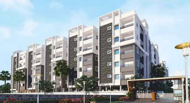
Satellite County
SRI KRISHNA DEVELOPERS AND OTHERS · Rangareddy · RERA P02400010214
SATELLITE COUNTY is a plotted development at Shadnagar, Farooqnagar Mandal, Ranga Reddy District, developed by the registered promoter SRI KRISHNA DEVELOPERS AND OTHERS. The layout covers 21303.30 sq. m of net area and includes 98 plots, with drawing-derived plot sizes ranging from 125.42 sq. m to 266.88 sq. m. The project is registered with TG-RERA under P02400010214, and its proposed completion is 23/01/2029.
📘 Project brochure from the promoter’s website ↗01What we found
Read from TG-RERA filings, approvals, land and registration records and court records. A court case is counted only when the court record states this project's survey number with its village, or names the project.
02Check before you pay
9 items to check before you pay, 4 high - from the title chain, court records and approvals, each with what to ask the builder or your advocate. An item may not be a problem with the project: records can be incomplete.
1. Project at a glance
Project identity
| Item | Record |
|---|---|
| Registered project name | SATELLITE COUNTY RERA record |
| Project type | Plotted development / open-plot layout RERA record |
| Phase / registered portion | Phase not separately identified; registration is for the named project RERA record |
| TG-RERA registration | P02400010214 RERA record |
| Registration validity | 23 September 2025–23 September 2028, unless extended by the Authority RERA record |
| Registered promoter | SRI KRISHNA DEVELOPERS AND OTHERS RERA record |
| RERA status | Registered; registration certificate identifies the project and promoter |
Land and geographic identity
| Item | Record |
|---|---|
| Locality / revenue village | Shadnagar / Shadnagar RERA record |
| Mandal / district / PIN | Farooqnagar / Ranga Reddy / 509216 RERA record |
| Project survey numbers and subdivisions | 379, 379/1, 379/2, 380/AAA, 380/E, 381, 381/1, 382, 383, 383/1, 310/AA, 380/AA RERA record |
| Additional survey references appearing on the layout drawing | 331/Part, 360/Part, 375/Part |
| Registered site extent | RERA land details state Total Area 14725.93 sq. m, Net Area 21303.30 sq. m; these labels are reproduced as filed RERA filing |
| Layout-area figures in filed draft-layout material | Total Layout Area 22763.56 sq. m; Net Layout Area 21303.3 sq. m |
| Boundaries | North: ROAD; South: OTHERS OPEN LAND; East: OPEN PLACE; West: OPEN PLACE RERA filing |
Development identity
| Item | Record |
|---|---|
| Sanctioning authority | HMDA; draft-layout material records processing through Shadnagar Municipality |
| Principal filed layout permit | 0648/HMDA/SWDL/2025 RERA record |
| Other approval numbers appearing in the record | LP NO. 31/LO/PLG/HMDA/2015; revised draft-layout permit 1952/HMDA/SWDL/2026 |
| Approval scope/status | The filed layout documents describe a draft layout; the revised draft-layout letter requires development works and transfer of specified areas before final layout plans are released |
| Approved built-up area | Not disclosed as a building scheme; this is a plotted layout RERA filing |
| Buildings, floors and parking levels | Not disclosed; no apartment-building configuration is identified in the supplied records Document index |
| Plot count | The approved-drawing extraction lists 98 plots; the plotted layout drawing schedule is also software-read as 98 plots Layout record |
Offering and status
| Item | Record |
|---|---|
| Offering | Residential plots; RERA-filed plot-by-plot inventory, booked/available counts and saleable-area schedule were not supplied RERA record RERA unit table |
| Drawing-derived plot sizes | Software-measured schedule: 98 plots, from 125.42 sq. m (150.0 sq. yd) to 266.88 sq. m (319.2 sq. yd); median 139.35 sq. m (166.7 sq. yd) Layout record |
| Construction / development stage | The registration is labelled “New Project”; the layout documents set out works to be completed, but no independently verified on-site progress is supplied RERA record |
| Completion timing | Promoter’s Form B undertaking: completion by 23-Sep-2028. The project header separately records proposed completion 23/01/2029 RERA record. |
| OC / completion certificate | No project completion or occupancy certificate is supplied; the revised draft-layout record states completion is not certified |
2. The project story
Satellite County is registered as a plotted-development project at Shadnagar, Farooqnagar Mandal, Ranga Reddy District. The supplied RERA-filed material describes an open-plot layout rather than residential towers or apartment blocks. The registration identifies the project and promoter, while the layout documents describe plot parcels, internal roads, open space, social infrastructure and utility areas. RERA record
The development record includes draft-layout permissions and a later revised draft-layout letter. Those documents require infrastructure works and transfer of designated roads, open spaces and other areas before release of final layout plans. No supplied evidence establishes that the layout works are complete or that an occupancy/completion certificate has been issued. The project’s RERA registration validity and the promoter-declared completion date are separate matters; neither establishes completion of the development.
3. Master plan, architecture & building design
This is a plotted layout, so the available design evidence concerns plot arrangement and allocation of land rather than building footprints, floor plans or apartment circulation. The filed draft-layout extraction records a net layout area of 21303.3 sq. m and a total layout area of 22763.56 sq. m. Its land-use schedule allocates 14075.98 sq. m (66.07%) to plots, 4824.85 sq. m (22.65%) to roads, 1631.28 sq. m (7.66%) to open space, 532.65 sq. m (2.50%) to social infrastructure and 238.54 sq. m (1.12%) to utilities.
The drawing extraction identifies 98 plots and internal road-width references including 9.14m Other Internal Road, 12m Existing Road Width and 30m Proposed Road Width. The draft-layout letter also refers to roads of 18 mts and above and 60 feet and above. These are drawing/document references, not a statement that all roads have been completed or opened.
The revised draft-layout material describes a separate revised layout record with 14725.93 sq. m net layout area, 9389.90 sq. m plotted area, 3623.48 sq. m road area, 1215.11 sq. m open space, 405.19 sq. m social infrastructure and 92.24 sq. m utilities. It lists 64 plots. The supplied records do not establish how this revised-draft record relates to the registered project’s current saleable inventory; this Overview does not treat it as a confirmed registered phase.
4. Homes, configurations & floor plans
No apartment or villa configurations are identified: the offering is plotted. The approved-layout drawing extraction lists 98 plots. Software measurement of the plot schedule gives the following size bands; measurements are from the drawing, not a RERA-filed saleable-area schedule. Layout record
| Plot-size band (sq. yd) | Equivalent band (sq. m) | Plots |
|---|---|---|
| 150–200 | 125–167 | 91 |
| 200–250 | 167–209 | 3 |
| 250–300 | 209–251 | 3 |
| 300–400 | 251–334 | 1 |
The software-read individual plot-size range is 125.42–266.88 sq. m; the median is 139.35 sq. m. These are drawing-derived plot measurements, not RERA-filed saleable areas. No booked or available plot count, plot-wise allocation, or current inventory schedule is supplied. Layout record RERA unit table
5. Parking & vehicle circulation
The layout drawing lists road areas but does not provide a common parking-area allocation or a count of parking spaces. The RERA project is a plotted development, and no unit-specific parking allotments or visitor/accessibility parking schedule is supplied.
The draft-layout material identifies internal roads and requires roads to be formed and made accessible; it also lists road-width references. These are plan/document provisions, not independent confirmation of completed road works.
6. Amenities, recreation & open spaces
The layout documents identify open-space, social-infrastructure and utility land. The RERA amenities record marks certain infrastructure categories as available, but records 0% progress for the listed items; no independent completion verification is supplied. RERA amenities
| Facility | Description / size | Evidence source | Declared progress / verified status |
|---|---|---|---|
| Open space / park | 1631.28 sq. m (7.66%) in the filed draft-layout land-use schedule | Shown in layout records; completion not independently verified | |
| Social infrastructure | 532.65 sq. m (2.50%) | Allocated in layout records; facility/building details and completion status not supplied | |
| Utility area | 238.54 sq. m (1.12%) | Allocated in layout records; completion not independently verified | |
| Green strip / tot lot / park | Listed in the RERA amenities record | RERA amenities | Listed as available; recorded progress 0%; not independently verified |
| Community buildings | Listed in the RERA amenities record | RERA amenities | Progress recorded as 0%; no specific facility or size supplied |
The developer brochure separately describes recreational and landscape features, including a children’s play area, fitness pockets, fountain, pergola, gazebo, pathways and sports features. These are promoter-marketed claims, not established by the supplied RERA-filed layout evidence as completed facilities.
7. Utilities, building services & safety
The HMDA draft-layout material lists proposed infrastructure works including road formation, storm-water drainage, underground drainage lines and a common septic tank/STP, internal water-supply lines, an overhead tank, an assured water-supply source, electrical supply lines, street lights, a transformer, avenue plantation, park development and rainwater-harvesting pits. The document sets these out as development works required for the layout; it does not establish that they are complete.
The RERA amenities record lists water supply, sewerage, storm-water drains, street lighting, rainwater harvesting, solid-waste management, energy management, fire-safety requirements and an electrical meter room/sub-station/receiving station. The recorded progress is 0% for the listed entries; no capacities, completion evidence or independent service tests are supplied. RERA amenities
8. Location, access & connectivity
The registered project location is Shadnagar, Farooqnagar Mandal, Ranga Reddy District, PIN 509216. The cadastral parcel centroid is recorded as 17.04402, 78.17394. RERA record Location record
The layout material identifies an existing road width of 12m and proposed road width of 30m, alongside internal-road references. The supplied location data records the nearest sampled Outer Ring Road interchange at approximately 34.2 km. No verified travel-time or public-transport schedule is provided. Location record
9. Developer & development status
The registered promoter is SRI KRISHNA DEVELOPERS AND OTHERS. The RERA filing identifies the organization type as “Others,” with the description “Firm and Individuals”; the supplied corporate record identifies GSTIN 36AFHFS4832G1ZU. A partnership deed in the project documents describes SRI KRISHNA DEVELOPERS as a firm established by D Vinita and Chadalavada Anjamma. RERA record RERA filing Corporate record
The RERA certificate is valid from 23 September 2025 to 23 September 2028, unless extended. The promoter’s Form B undertaking states a completion date of 23-Sep-2028; the project header separately records proposed completion as 23/01/2029. No construction-progress percentage or independently verified work status is supplied. No completion or occupancy certificate is supplied. RERA record
The supplied promoter information gives an address in Shadnagar, Farooqnagar, Ranga Reddy, PIN 509216. A separate project authorization document records D Vinita as authorized to act for the co-promoters in relation to RERA registration and related project matters. Parties record
10. Approvals, official records & documents
| Identifier / scope | P02400010214, SATELLITE COUNTY; validity 23/09/2025–23/09/2028 unless extended |
|---|
| Identifier / scope | 0648/HMDA/SWDL/2025; open-plot layout at Shadnagar; layout works and transfer of specified areas are conditions before final release |
|---|
| Identifier / scope | LP NO. 31/LO/PLG/HMDA/2015; drawing extraction includes plot schedule and land-use allocation |
|---|
| Identifier / scope | 1952/HMDA/SWDL/2026; revised draft-layout letter dated 01/04/2026, for a layout record with net area 14725.93 sq. m |
|---|
| Identifier / scope | Completion undertaking by 23-Sep-2028 and other promoter declarations |
|---|
| Identifier / scope | No completion or occupancy certificate supplied; the revised draft-layout record states completion is not certified |
|---|
The layout materials also record a road-affected-area gift deed, 6891/2025, and mortgages in favour of the Metropolitan Commissioner, HMDA, including deeds 10196/2025, 6502/2025 and 6303/2025 in the draft-layout record. These are listed here as document identifiers; their detailed scope and implications are addressed in the approvals and land-title sections.
1. Project at a glance
Project identity
Registered project name: SATELLITE COUNTY
Project type: Plotted development / open-plot layout
Phase / registered portion: Phase not separately identified; registration is for the named project
TG-RERA registration: P02400010214
Registration validity: 23 September 2025–23 September 2028, unless extended by the Authority
Registered promoter: SRI KRISHNA DEVELOPERS AND OTHERS
RERA status: Registered; registration certificate identifies the project and promoter
Land and geographic identity
Locality / revenue village: Shadnagar / Shadnagar
Mandal / district / PIN: Farooqnagar / Ranga Reddy / 509216
Project survey numbers and subdivisions: 379, 379/1, 379/2, 380/AAA, 380/E, 381, 381/1, 382, 383, 383/1, 310/AA, 380/AA
Additional survey references appearing on the layout drawing: 331/Part, 360/Part, 375/Part
Registered site extent: RERA land details state Total Area 14725.93 sq. m, Net Area 21303.30 sq. m; these labels are reproduced as filed
Layout-area figures in filed draft-layout material: Total Layout Area 22763.56 sq. m; Net Layout Area 21303.3 sq. m
Boundaries: North: ROAD; South: OTHERS OPEN LAND; East: OPEN PLACE; West: OPEN PLACE
Development identity
Sanctioning authority: HMDA; draft-layout material records processing through Shadnagar Municipality
Principal filed layout permit: 0648/HMDA/SWDL/2025
Other approval numbers appearing in the record: LP NO. 31/LO/PLG/HMDA/2015; revised draft-layout permit 1952/HMDA/SWDL/2026
Approval scope/status: The filed layout documents describe a draft layout; the revised draft-layout letter requires development works and transfer of specified areas before final layout plans are released
Approved built-up area: Not disclosed as a building scheme; this is a plotted layout
Buildings, floors and parking levels: Not disclosed; no apartment-building configuration is identified in the supplied records
Plot count: The approved-drawing extraction lists 98 plots; the plotted layout drawing schedule is also software-read as 98 plots
Offering and status
Offering: Residential plots; RERA-filed plot-by-plot inventory, booked/available counts and saleable-area schedule were not supplied
Drawing-derived plot sizes: Software-measured schedule: 98 plots, from 125.42 sq. m (150.0 sq. yd) to 266.88 sq. m (319.2 sq. yd); median 139.35 sq. m (166.7 sq. yd)
Construction / development stage: The registration is labelled “New Project”; the layout documents set out works to be completed, but no independently verified on-site progress is supplied
Completion timing: Promoter’s Form B undertaking: completion by 23-Sep-2028. The project header separately records proposed completion 23/01/2029.
OC / completion certificate: No project completion or occupancy certificate is supplied; the revised draft-layout record states completion is not certified
2. The project story
Satellite County is registered as a plotted-development project at Shadnagar, Farooqnagar Mandal, Ranga Reddy District. The supplied RERA-filed material describes an open-plot layout rather than residential towers or apartment blocks. The registration identifies the project and promoter, while the layout documents describe plot parcels, internal roads, open space, social infrastructure and utility areas.
The development record includes draft-layout permissions and a later revised draft-layout letter. Those documents require infrastructure works and transfer of designated roads, open spaces and other areas before release of final layout plans. No supplied evidence establishes that the layout works are complete or that an occupancy/completion certificate has been issued. The project’s RERA registration validity and the promoter-declared completion date are separate matters; neither establishes completion of the development.
3. Master plan, architecture & building design
This is a plotted layout, so the available design evidence concerns plot arrangement and allocation of land rather than building footprints, floor plans or apartment circulation. The filed draft-layout extraction records a net layout area of 21303.3 sq. m and a total layout area of 22763.56 sq. m. Its land-use schedule allocates 14075.98 sq. m (66.07%) to plots, 4824.85 sq. m (22.65%) to roads, 1631.28 sq. m (7.66%) to open space, 532.65 sq. m (2.50%) to social infrastructure and 238.54 sq. m (1.12%) to utilities.
The drawing extraction identifies 98 plots and internal road-width references including 9.14m Other Internal Road, 12m Existing Road Width and 30m Proposed Road Width. The draft-layout letter also refers to roads of 18 mts and above and 60 feet and above. These are drawing/document references, not a statement that all roads have been completed or opened.
The revised draft-layout material describes a separate revised layout record with 14725.93 sq. m net layout area, 9389.90 sq. m plotted area, 3623.48 sq. m road area, 1215.11 sq. m open space, 405.19 sq. m social infrastructure and 92.24 sq. m utilities. It lists 64 plots. The supplied records do not establish how this revised-draft record relates to the registered project’s current saleable inventory; this Overview does not treat it as a confirmed registered phase.
4. Homes, configurations & floor plans
No apartment or villa configurations are identified: the offering is plotted. The approved-layout drawing extraction lists 98 plots. Software measurement of the plot schedule gives the following size bands; measurements are from the drawing, not a RERA-filed saleable-area schedule.
| Plot-size band (sq. yd) | Equivalent band (sq. m) | Plots |
|---|---|---|
| 150–200 | 125–167 | 91 |
| 200–250 | 167–209 | 3 |
| 250–300 | 209–251 | 3 |
| 300–400 | 251–334 | 1 |
The software-read individual plot-size range is 125.42–266.88 sq. m; the median is 139.35 sq. m. These are drawing-derived plot measurements, not RERA-filed saleable areas. No booked or available plot count, plot-wise allocation, or current inventory schedule is supplied.
5. Parking & vehicle circulation
The layout drawing lists road areas but does not provide a common parking-area allocation or a count of parking spaces. The RERA project is a plotted development, and no unit-specific parking allotments or visitor/accessibility parking schedule is supplied.
The draft-layout material identifies internal roads and requires roads to be formed and made accessible; it also lists road-width references. These are plan/document provisions, not independent confirmation of completed road works.
6. Amenities, recreation & open spaces
The layout documents identify open-space, social-infrastructure and utility land. The RERA amenities record marks certain infrastructure categories as available, but records 0% progress for the listed items; no independent completion verification is supplied.
| Facility | Description / size | Evidence source | Declared progress / verified status |
|---|---|---|---|
| Open space / park | 1631.28 sq. m (7.66%) in the filed draft-layout land-use schedule | Shown in layout records; completion not independently verified | |
| Social infrastructure | 532.65 sq. m (2.50%) | Allocated in layout records; facility/building details and completion status not supplied | |
| Utility area | 238.54 sq. m (1.12%) | Allocated in layout records; completion not independently verified | |
| Green strip / tot lot / park | Listed in the RERA amenities record | Listed as available; recorded progress 0%; not independently verified | |
| Community buildings | Listed in the RERA amenities record | Progress recorded as 0%; no specific facility or size supplied |
The developer brochure separately describes recreational and landscape features, including a children’s play area, fitness pockets, fountain, pergola, gazebo, pathways and sports features. These are promoter-marketed claims, not established by the supplied RERA-filed layout evidence as completed facilities.
7. Utilities, building services & safety
The HMDA draft-layout material lists proposed infrastructure works including road formation, storm-water drainage, underground drainage lines and a common septic tank/STP, internal water-supply lines, an overhead tank, an assured water-supply source, electrical supply lines, street lights, a transformer, avenue plantation, park development and rainwater-harvesting pits. The document sets these out as development works required for the layout; it does not establish that they are complete.
The RERA amenities record lists water supply, sewerage, storm-water drains, street lighting, rainwater harvesting, solid-waste management, energy management, fire-safety requirements and an electrical meter room/sub-station/receiving station. The recorded progress is 0% for the listed entries; no capacities, completion evidence or independent service tests are supplied.
8. Location, access & connectivity
The registered project location is Shadnagar, Farooqnagar Mandal, Ranga Reddy District, PIN 509216. The cadastral parcel centroid is recorded as 17.04402, 78.17394.
The layout material identifies an existing road width of 12m and proposed road width of 30m, alongside internal-road references. The supplied location data records the nearest sampled Outer Ring Road interchange at approximately 34.2 km. No verified travel-time or public-transport schedule is provided.
9. Developer & development status
The registered promoter is SRI KRISHNA DEVELOPERS AND OTHERS. The RERA filing identifies the organization type as “Others,” with the description “Firm and Individuals”; the supplied corporate record identifies GSTIN 36AFHFS4832G1ZU. A partnership deed in the project documents describes SRI KRISHNA DEVELOPERS as a firm established by D Vinita and Chadalavada Anjamma.
The RERA certificate is valid from 23 September 2025 to 23 September 2028, unless extended. The promoter’s Form B undertaking states a completion date of 23-Sep-2028; the project header separately records proposed completion as 23/01/2029. No construction-progress percentage or independently verified work status is supplied. No completion or occupancy certificate is supplied.
The supplied promoter information gives an address in Shadnagar, Farooqnagar, Ranga Reddy, PIN 509216. A separate project authorization document records D Vinita as authorized to act for the co-promoters in relation to RERA registration and related project matters.
10. Approvals, official records & documents
| Identifier / scope | P02400010214, SATELLITE COUNTY; validity 23/09/2025–23/09/2028 unless extended |
|---|
| Identifier / scope | 0648/HMDA/SWDL/2025; open-plot layout at Shadnagar; layout works and transfer of specified areas are conditions before final release |
|---|
| Identifier / scope | LP NO. 31/LO/PLG/HMDA/2015; drawing extraction includes plot schedule and land-use allocation |
|---|
| Identifier / scope | 1952/HMDA/SWDL/2026; revised draft-layout letter dated 01/04/2026, for a layout record with net area 14725.93 sq. m |
|---|
| Identifier / scope | Completion undertaking by 23-Sep-2028 and other promoter declarations |
|---|
| Identifier / scope | No completion or occupancy certificate supplied; the revised draft-layout record states completion is not certified |
|---|
The layout materials also record a road-affected-area gift deed, 6891/2025, and mortgages in favour of the Metropolitan Commissioner, HMDA, including deeds 10196/2025, 6502/2025 and 6303/2025 in the draft-layout record. These are listed here as document identifiers; their detailed scope and implications are addressed in the approvals and land-title sections.
Frequently asked questions
Is SATELLITE COUNTY registered with Telangana RERA?
Yes. SATELLITE COUNTY is registered with the Telangana Real Estate Regulatory Authority as P02400010214; the registration status is New Project.
Who is the developer of SATELLITE COUNTY?
The promoter named in the RERA registration is SRI KRISHNA DEVELOPERS AND OTHERS.
Where is SATELLITE COUNTY located?
SATELLITE COUNTY is in SHADNAGAR, Farooqnagar, Rangareddy, Telangana (509216).
When will SATELLITE COUNTY be completed?
The promoter's proposed date of completion filed with RERA is 23/01/2029. This is the promoter's declaration, not a guarantee.
More projects in Shadnagar