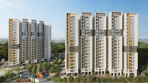
Sree Siddhi Vinayaka Township
PINNACLE LANDMARK · Sangareddy · RERA P01100009938
SREE SIDDHI VINAYAKA TOWNSHIP is a plotted development in Andole / Jogipet, Andole–Jogipet Mandal, Sangareddy District. The registered promoter is PINNACLE LANDMARK, a partnership. The layout records 61,258.03 sq. m of total land area and 203 plots; no towers or floor configuration is provided. The plots are registered under TG-RERA number P01100009938, with a proposed completion date of 06/02/2027.
01What we found
Read from TG-RERA filings, approvals, land and registration records and court records. A court case is counted only when the court record states this project's survey number with its village, or names the project.
02Check before you pay
6 items to check before you pay, 3 high - from the title chain, court records and approvals, each with what to ask the builder or your advocate. An item may not be a problem with the project: records can be incomplete.
1. Project at a glance
Project identity
| Field | Record |
|---|---|
| Exact registered name | SREE SIDDHI VINAYAKA TOWNSHIP RERA record |
| Project type | Plotted development RERA record RERA filing |
| Phase / registered portion | Phase not separately identified; registration is for the named project |
| TG-RERA registration | P01100009938 RERA record |
| Registration validity | Certificate states validity from 02/06/2025 to 06/02/2027 |
| Registered promoter | PINNACLE LANDMARK, a partnership RERA filing Corporate record |
| RERA status in supplied record | Registered; certificate captured 10 September 2026 Approvals record |
Land and geographic identity
| Field | Record |
|---|---|
| Locality | Andole / Jogipet; the RERA certificate describes the project location as Andole, Sangareddy, 502273 |
| Revenue villages | Jogipet Village and Andole Village; the approval also refers to Andole Revenue Village |
| Mandal | Andole–Jogipet Mandal in the layout-plan extraction; Andole Mandal is also named in the approval extraction |
| District / PIN | Sangareddy District; PIN 502273 in the RERA project record RERA filing |
| Project survey numbers | Sy. No. 175/P of Jogipet Village; Sy. Nos. 1696, 1697, 1698, 1699, 1700, 1701, 1702, 1703 and 1704 of Andole Village |
| Registered site extent | RERA land details state 61,258.03 sq. m total area, 29,474.33 sq. m affected area and 31,783.70 sq. m net area RERA filing |
| Layout-plan area statement | Layout extraction records total layout area 61,255.63 sq. m, net layout area 59,378.75 sq. m, and nala widening area 1,876.88 sq. m |
| Boundaries | North, south, east and west are each recorded as “NEIGHBOURS LAND” RERA filing |
Development identity
| Field | Record |
|---|---|
| Sanctioning authority | TS-DTCP; the tentative layout approval is issued by Andole–Jogipet Municipality/Municipal Corporation Approvals record |
| Principal approval | Tentative Layout Plan No. 0005/LO/3050/2025, approved 02 June 2025 Approvals record |
| Related file / application numbers | File No. TS/016784/2025; application No. 013390/LO/ANDO/3050/0009/2024 |
| Plotted development | 203 plots in the layout-plan record |
| Approved built-up area | 0.00 proposed built-up area, both excluding and including parking, in the supplied layout-plan parameters |
| Buildings / floor configuration | Not applicable to the plotted layout as described in the supplied approval material; no building or floor schedule is provided |
| Registered mortgage area | RERA form records 5,041.01 sq. m; layout extraction records 5,041.03 sq. m in its sanctioned parameters and lists 34 reserved plots RERA filing |
Offering and status
| Field | Record |
|---|---|
| Unit type | Plots RERA record RERA filing |
| Plot count | 203 |
| Plot-size information | Drawing extraction lists 203 plots with sizes; smallest 125.42 sq. m, median 143.17 sq. m, largest 908.8 sq. m. These are software-read drawing figures, not RERA unit-area disclosures. Layout record |
| Booked / available counts | Not supplied in the available project evidence RERA record Layout record |
| Construction stage | Project is treated as a new project in the RERA record. The supplied evidence does not establish independently verified on-site progress RERA filing RERA record |
| Completion deadline | RERA certificate and Form B declaration state 06/02/2027; the layout approval requires infrastructure and amenities within two years from 02 June 2025, i.e. 02 June 2027 |
| Registration validity vs. completion | The certificate’s registration end date is 06/02/2027; the layout approval’s infrastructure deadline is 02 June 2027. These are distinct recorded dates |
| Occupancy / completion certificate | No occupancy or completion certificate is supplied. The project is a plotted layout; the supplied approval is tentative |
2. The project story
SREE SIDDHI VINAYAKA TOWNSHIP is a RERA-registered plotted development associated with land in Jogipet Village and Andole Village, Sangareddy District. The tentative layout approval provides for 203 plots, roads, open space, social infrastructure and utility land; it records no proposed built-up area. The project is therefore described by the supplied approval as a land subdivision/layout rather than a residential building scheme.
The registration certificate and promoter’s Form B declaration give 06/02/2027 as the completion date. Separately, the tentative layout approval sets a two-year period from 02 June 2025 for completing infrastructure and amenities. These are documentary deadlines, not evidence that works have been completed. The supplied material contains no independently verified construction-progress report or completion/occupancy certificate.
3. Master plan, architecture & building design
The approved layout-plan extraction identifies 203 plots and a land-use statement totalling 59,376.50 sq. m. Its stated components are:
| Layout use | Area | Share |
|---|---|---|
| Plotted area | 31,782.63 sq. m | 53.53% |
| Roads | 17,719.13 sq. m | 29.84% |
| Organized open space / park | 5,356.50 sq. m | 9.02% |
| Social infrastructure | 1,488.91 sq. m | 2.51% |
| Utility area | 596.83 sq. m | 1.01% |
| Buffer zone | 2,432.50 sq. m | 4.10% |
| Total net layout | 59,376.50 sq. m | 100.00% |
The drawing extraction lists an existing 30.00 m-wide road, a proposed 30.00 m-wide road, and internal roads of 12.00 m, 10.00 m and 9.00 m. It also identifies a nala buffer / nala-widening area.
The layout approval describes the scheme as tentative and records that the roads, open-space area and utilities are to be handed over to the municipality by registered gift deed before release of the tentative layout. It also states that the approval is not proof of land title.
No building arrangement, floor plans, building footprint, floor configuration or residential/commercial built-up-area schedule is supplied. The approved built-up-area field is 0.00.
4. Homes, configurations & floor plans
This is a plotted layout; the RERA record identifies plots, not apartments or villas. The available layout drawing extraction reports the following plot count and software-read size distribution:
| Plot information | Record |
|---|---|
| Plots stated in layout | 203 |
| Plots with size read from drawing | 203 |
| Smallest plot | 125.42 sq. m |
| Median plot | 143.17 sq. m |
| Largest plot | 908.8 sq. m |
Layout record
The drawing-derived size bands are:
| Plot-size band | Number of plots |
|---|---|
| 150–200 sq. yd (125–167 sq. m) | 178 |
| 200–250 sq. yd (167–209 sq. m) | 10 |
| 250–300 sq. yd (209–251 sq. m) | 8 |
| 300–400 sq. yd (251–334 sq. m) | 6 |
| 1000+ sq. yd (836+ sq. m) | 1 |
Layout record
These figures are software-read from the layout drawing and are not identified as RERA-filed plot-size disclosures. Apartment saleable-area, carpet-area and loading measurements do not apply to the plotted offering on the evidence supplied. The floor-plan review records two layout sheets and no flat plans measured. Layout record Floor plans
5. Parking & vehicle circulation
The layout-plan extraction records 0.00 sq. m common parking area. No sanctioned parking-space count, visitor or accessible parking provision, parking-allotment arrangement, or EV-charging provision is supplied.
The drawing extraction lists roads of 30.00 m, 12.00 m, 10.00 m and 9.00 m widths. The approval states that roads must remain open for access to neighbouring sites and that the layout owner/developer must not construct a compound wall or fencing around the site. No separate pedestrian-circulation or vehicle-entry/exit design details are provided in the supplied material.
6. Amenities, recreation & open spaces
| Facility / provision | Organized open space / park |
|---|---|
| Description / size | 5,356.50 sq. m; 9.02% of the layout-plan land-use total |
| Declared progress / verified status | Layout allocation; completion not independently verified |
| Facility / provision | Green strip / tot lot / park |
|---|---|
| Description / size | Listed as available in the RERA amenity schedule, with 10% shown |
| Evidence source | RERA amenities |
| Declared progress / verified status | Schedule records a percentage; the supplied evidence does not establish completion |
| Facility / provision | Tot-lot |
|---|---|
| Description / size | Listed among approval-plan amenities/utilities; no size or capacity stated |
| Declared progress / verified status | Planned/listed; completion not independently verified |
| Facility / provision | Social infrastructure area |
|---|---|
| Description / size | 1,488.91 sq. m; 2.51% |
| Declared progress / verified status | Layout allocation; the specific facility/building is not described |
| Facility / provision | Utility area |
|---|---|
| Description / size | 596.83 sq. m; 1.01% |
| Declared progress / verified status | Layout allocation; completion not independently verified |
| Facility / provision | Community buildings |
|---|---|
| Description / size | Listed in RERA amenity schedule; 0% shown |
| Evidence source | RERA amenities |
| Declared progress / verified status | No completed facility established |
| Facility / provision | Amenity area |
|---|---|
| Description / size | 0.00 sq. m in the layout land-use table |
| Declared progress / verified status | Recorded as zero in that category |
The approval-plan extraction also lists a water reservoir, septic tank, sewerage treatment plant, electric transformer, solid-waste management, overhead tank, sump and rainwater-harvesting pits. Their construction or operational status is not independently verified in the supplied evidence.
7. Utilities, building services & safety
The layout approval lists the water reservoir, overhead tank, sump, septic tank, sewerage treatment plant, electric transformer, solid-waste management and rainwater-harvesting pits; see Amenities, recreation & open spaces above. It does not provide capacities or establish that these facilities are complete or operating.
The RERA amenity schedule lists water supply, sewerage (chambers, lines, septic tank and STP), storm-water drains, street lighting, water conservation/rainwater harvesting, and fire protection and fire-safety requirements, each shown at 10%. The same schedule lists solid-waste management and disposal, electrical meter room/sub-station/receiving station, and energy management at 0%. These are schedule entries, not independent confirmation of installation, commissioning or statutory compliance. RERA amenities
No verified water source, storage capacity, treatment capacity, electrical backup, lift, fire-system specification, CCTV/access-control system or accessibility design is documented in the supplied RERA project records. The vendor’s separate water-supply and amenity statements are not used here as RERA-established project provisions. Document index RERA amenities
8. Location, access & connectivity
The registered location is Andole, Sangareddy District, PIN 502273, with the layout spanning 175/P in Jogipet Village and 1696–1704 in Andole Village. The plan lists an existing 30.00 m-wide road, a proposed 30.00 m-wide road and internal roads of 12.00 m, 10.00 m and 9.00 m.
The supplied RERA evidence does not establish distances or travel times to public transport, landmarks or services. The project location is identified in the registration record; no independently verified connectivity measurements are provided. Location record
9. Developer & development status
The registered promoter is PINNACLE LANDMARK, identified in the project record as a partnership. The listed partners include Lakshmi Karnatapu; Narendra Kumar Karnatapu is identified as an authorized signatory and is the declarant on the Form B affidavit. The corporate record supplies GSTIN 36ABDFP5030D1ZN. Corporate record Parties record
The registration record identifies the project as new and gives 06/02/2027 as the completion date. The promoter’s Form B declaration, dated 26/06/2025, undertakes completion by that date. These are promoter/RERA-record declarations; the supplied evidence does not independently verify physical progress. RERA filing
The registration certificate lists the promoter’s address as Village, Mandal and District details not filled in, with “Ranga Reddy” and PIN 500084 recorded. The project-address record separately lists Andole, Masaipet, Sangareddy, PIN 502273. No official promoter website or contact details are supplied. RERA filing
10. Approvals, official records & documents
| Identifier / date | P01100009938; valid 02/06/2025–06/02/2027 |
|---|---|
| Scope and note | Form C certificate for SREE SIDDHI VINAYAKA TOWNSHIP and PINNACLE LANDMARK |
| Identifier / date | 0005/LO/3050/2025, approved 02 June 2025 |
|---|---|
| Scope and note | Andole–Jogipet Municipality/Municipal Corporation approval for 203 plots |
| Identifier / date | TS/016784/2025 |
|---|---|
| Scope and note | Layout drawing/extraction identifying the survey numbers, land-use schedule and road widths |
| Identifier / date | 013390/LO/ANDO/3050/0009/2024 |
|---|---|
| Scope and note | Application number recorded with the tentative layout approval |
| Identifier / date | 957/2025, dated 29 May 2025 |
|---|---|
| Scope and note | Approval records 34 specified plots mortgaged to the municipality as security for infrastructure and amenities obligations |
| Identifier / date | Form B, dated 26/06/2025 |
|---|---|
| Scope and note | Promoter declaration includes the completion undertaking and project-account and audit declarations |
The supplied record does not include a final layout release, completion certificate or occupancy certificate. The tentative approval states that infrastructure and amenities are to be completed within two years of approval and that open space, utilities and roads are to be handed over by registered gift deed before release of the tentative layout.
1. Project at a glance
Project identity
Exact registered name: SREE SIDDHI VINAYAKA TOWNSHIP
Project type: Plotted development
Phase / registered portion: Phase not separately identified; registration is for the named project
TG-RERA registration: P01100009938
Registration validity: Certificate states validity from 02/06/2025 to 06/02/2027
Registered promoter: PINNACLE LANDMARK, a partnership
RERA status in supplied record: Registered; certificate captured 10 September 2026
Land and geographic identity
Locality: Andole / Jogipet; the RERA certificate describes the project location as Andole, Sangareddy, 502273
Revenue villages: Jogipet Village and Andole Village; the approval also refers to Andole Revenue Village
Mandal: Andole–Jogipet Mandal in the layout-plan extraction; Andole Mandal is also named in the approval extraction
District / PIN: Sangareddy District; PIN 502273 in the RERA project record
Project survey numbers: Sy. No. 175/P of Jogipet Village; Sy. Nos. 1696, 1697, 1698, 1699, 1700, 1701, 1702, 1703 and 1704 of Andole Village
Registered site extent: RERA land details state 61,258.03 sq. m total area, 29,474.33 sq. m affected area and 31,783.70 sq. m net area
Layout-plan area statement: Layout extraction records total layout area 61,255.63 sq. m, net layout area 59,378.75 sq. m, and nala widening area 1,876.88 sq. m
Boundaries: North, south, east and west are each recorded as “NEIGHBOURS LAND”
Development identity
Sanctioning authority: TS-DTCP; the tentative layout approval is issued by Andole–Jogipet Municipality/Municipal Corporation
Principal approval: Tentative Layout Plan No. 0005/LO/3050/2025, approved 02 June 2025
Related file / application numbers: File No. TS/016784/2025; application No. 013390/LO/ANDO/3050/0009/2024
Plotted development: 203 plots in the layout-plan record
Approved built-up area: 0.00 proposed built-up area, both excluding and including parking, in the supplied layout-plan parameters
Buildings / floor configuration: Not applicable to the plotted layout as described in the supplied approval material; no building or floor schedule is provided
Registered mortgage area: RERA form records 5,041.01 sq. m; layout extraction records 5,041.03 sq. m in its sanctioned parameters and lists 34 reserved plots
Offering and status
Unit type: Plots
Plot count: 203
Plot-size information: Drawing extraction lists 203 plots with sizes; smallest 125.42 sq. m, median 143.17 sq. m, largest 908.8 sq. m. These are software-read drawing figures, not RERA unit-area disclosures.
Booked / available counts: Not supplied in the available project evidence
Construction stage: Project is treated as a new project in the RERA record. The supplied evidence does not establish independently verified on-site progress
Completion deadline: RERA certificate and Form B declaration state 06/02/2027; the layout approval requires infrastructure and amenities within two years from 02 June 2025, i.e. 02 June 2027
Registration validity vs. completion: The certificate’s registration end date is 06/02/2027; the layout approval’s infrastructure deadline is 02 June 2027. These are distinct recorded dates
Occupancy / completion certificate: No occupancy or completion certificate is supplied. The project is a plotted layout; the supplied approval is tentative
2. The project story
SREE SIDDHI VINAYAKA TOWNSHIP is a RERA-registered plotted development associated with land in Jogipet Village and Andole Village, Sangareddy District. The tentative layout approval provides for 203 plots, roads, open space, social infrastructure and utility land; it records no proposed built-up area. The project is therefore described by the supplied approval as a land subdivision/layout rather than a residential building scheme.
The registration certificate and promoter’s Form B declaration give 06/02/2027 as the completion date. Separately, the tentative layout approval sets a two-year period from 02 June 2025 for completing infrastructure and amenities. These are documentary deadlines, not evidence that works have been completed. The supplied material contains no independently verified construction-progress report or completion/occupancy certificate.
3. Master plan, architecture & building design
The approved layout-plan extraction identifies 203 plots and a land-use statement totalling 59,376.50 sq. m. Its stated components are:
| Layout use | Area | Share |
|---|---|---|
| Plotted area | 31,782.63 sq. m | 53.53% |
| Roads | 17,719.13 sq. m | 29.84% |
| Organized open space / park | 5,356.50 sq. m | 9.02% |
| Social infrastructure | 1,488.91 sq. m | 2.51% |
| Utility area | 596.83 sq. m | 1.01% |
| Buffer zone | 2,432.50 sq. m | 4.10% |
| Total net layout | 59,376.50 sq. m | 100.00% |
The drawing extraction lists an existing 30.00 m-wide road, a proposed 30.00 m-wide road, and internal roads of 12.00 m, 10.00 m and 9.00 m. It also identifies a nala buffer / nala-widening area.
The layout approval describes the scheme as tentative and records that the roads, open-space area and utilities are to be handed over to the municipality by registered gift deed before release of the tentative layout. It also states that the approval is not proof of land title.
No building arrangement, floor plans, building footprint, floor configuration or residential/commercial built-up-area schedule is supplied. The approved built-up-area field is 0.00.
4. Homes, configurations & floor plans
This is a plotted layout; the RERA record identifies plots, not apartments or villas. The available layout drawing extraction reports the following plot count and software-read size distribution:
Plots stated in layout: 203
Plots with size read from drawing: 203
Smallest plot: 125.42 sq. m
Median plot: 143.17 sq. m
Largest plot: 908.8 sq. m
The drawing-derived size bands are:
150–200 sq. yd (125–167 sq. m): 178
200–250 sq. yd (167–209 sq. m): 10
250–300 sq. yd (209–251 sq. m): 8
300–400 sq. yd (251–334 sq. m): 6
1000+ sq. yd (836+ sq. m): 1
These figures are software-read from the layout drawing and are not identified as RERA-filed plot-size disclosures. Apartment saleable-area, carpet-area and loading measurements do not apply to the plotted offering on the evidence supplied. The floor-plan review records two layout sheets and no flat plans measured.
5. Parking & vehicle circulation
The layout-plan extraction records 0.00 sq. m common parking area. No sanctioned parking-space count, visitor or accessible parking provision, parking-allotment arrangement, or EV-charging provision is supplied.
The drawing extraction lists roads of 30.00 m, 12.00 m, 10.00 m and 9.00 m widths. The approval states that roads must remain open for access to neighbouring sites and that the layout owner/developer must not construct a compound wall or fencing around the site. No separate pedestrian-circulation or vehicle-entry/exit design details are provided in the supplied material.
6. Amenities, recreation & open spaces
| Facility / provision | Organized open space / park |
|---|---|
| Description / size | 5,356.50 sq. m; 9.02% of the layout-plan land-use total |
| Declared progress / verified status | Layout allocation; completion not independently verified |
| Facility / provision | Green strip / tot lot / park |
|---|---|
| Description / size | Listed as available in the RERA amenity schedule, with 10% shown |
| Declared progress / verified status | Schedule records a percentage; the supplied evidence does not establish completion |
| Facility / provision | Tot-lot |
|---|---|
| Description / size | Listed among approval-plan amenities/utilities; no size or capacity stated |
| Declared progress / verified status | Planned/listed; completion not independently verified |
| Facility / provision | Social infrastructure area |
|---|---|
| Description / size | 1,488.91 sq. m; 2.51% |
| Declared progress / verified status | Layout allocation; the specific facility/building is not described |
| Facility / provision | Utility area |
|---|---|
| Description / size | 596.83 sq. m; 1.01% |
| Declared progress / verified status | Layout allocation; completion not independently verified |
| Facility / provision | Community buildings |
|---|---|
| Description / size | Listed in RERA amenity schedule; 0% shown |
| Declared progress / verified status | No completed facility established |
| Facility / provision | Amenity area |
|---|---|
| Description / size | 0.00 sq. m in the layout land-use table |
| Declared progress / verified status | Recorded as zero in that category |
The approval-plan extraction also lists a water reservoir, septic tank, sewerage treatment plant, electric transformer, solid-waste management, overhead tank, sump and rainwater-harvesting pits. Their construction or operational status is not independently verified in the supplied evidence.
7. Utilities, building services & safety
The layout approval lists the water reservoir, overhead tank, sump, septic tank, sewerage treatment plant, electric transformer, solid-waste management and rainwater-harvesting pits; see Amenities, recreation & open spaces above. It does not provide capacities or establish that these facilities are complete or operating.
The RERA amenity schedule lists water supply, sewerage (chambers, lines, septic tank and STP), storm-water drains, street lighting, water conservation/rainwater harvesting, and fire protection and fire-safety requirements, each shown at 10%. The same schedule lists solid-waste management and disposal, electrical meter room/sub-station/receiving station, and energy management at 0%. These are schedule entries, not independent confirmation of installation, commissioning or statutory compliance.
No verified water source, storage capacity, treatment capacity, electrical backup, lift, fire-system specification, CCTV/access-control system or accessibility design is documented in the supplied RERA project records. The vendor’s separate water-supply and amenity statements are not used here as RERA-established project provisions.
8. Location, access & connectivity
The registered location is Andole, Sangareddy District, PIN 502273, with the layout spanning 175/P in Jogipet Village and 1696–1704 in Andole Village. The plan lists an existing 30.00 m-wide road, a proposed 30.00 m-wide road and internal roads of 12.00 m, 10.00 m and 9.00 m.
The supplied RERA evidence does not establish distances or travel times to public transport, landmarks or services. The project location is identified in the registration record; no independently verified connectivity measurements are provided.
9. Developer & development status
The registered promoter is PINNACLE LANDMARK, identified in the project record as a partnership. The listed partners include Lakshmi Karnatapu; Narendra Kumar Karnatapu is identified as an authorized signatory and is the declarant on the Form B affidavit. The corporate record supplies GSTIN 36ABDFP5030D1ZN.
The registration record identifies the project as new and gives 06/02/2027 as the completion date. The promoter’s Form B declaration, dated 26/06/2025, undertakes completion by that date. These are promoter/RERA-record declarations; the supplied evidence does not independently verify physical progress.
The registration certificate lists the promoter’s address as Village, Mandal and District details not filled in, with “Ranga Reddy” and PIN 500084 recorded. The project-address record separately lists Andole, Masaipet, Sangareddy, PIN 502273. No official promoter website or contact details are supplied.
10. Approvals, official records & documents
| Identifier / date | P01100009938; valid 02/06/2025–06/02/2027 |
|---|---|
| Scope and note | Form C certificate for SREE SIDDHI VINAYAKA TOWNSHIP and PINNACLE LANDMARK |
| Identifier / date | 0005/LO/3050/2025, approved 02 June 2025 |
|---|---|
| Scope and note | Andole–Jogipet Municipality/Municipal Corporation approval for 203 plots |
| Identifier / date | TS/016784/2025 |
|---|---|
| Scope and note | Layout drawing/extraction identifying the survey numbers, land-use schedule and road widths |
| Identifier / date | 013390/LO/ANDO/3050/0009/2024 |
|---|---|
| Scope and note | Application number recorded with the tentative layout approval |
| Identifier / date | 957/2025, dated 29 May 2025 |
|---|---|
| Scope and note | Approval records 34 specified plots mortgaged to the municipality as security for infrastructure and amenities obligations |
| Identifier / date | Form B, dated 26/06/2025 |
|---|---|
| Scope and note | Promoter declaration includes the completion undertaking and project-account and audit declarations |
The supplied record does not include a final layout release, completion certificate or occupancy certificate. The tentative approval states that infrastructure and amenities are to be completed within two years of approval and that open space, utilities and roads are to be handed over by registered gift deed before release of the tentative layout.
Frequently asked questions
Is SREE SIDDHI VINAYAKA TOWNSHIP registered with Telangana RERA?
Yes. SREE SIDDHI VINAYAKA TOWNSHIP is registered with the Telangana Real Estate Regulatory Authority as P01100009938; the registration status is New Project.
Who is the developer of SREE SIDDHI VINAYAKA TOWNSHIP?
The promoter named in the RERA registration is PINNACLE LANDMARK.
Where is SREE SIDDHI VINAYAKA TOWNSHIP located?
SREE SIDDHI VINAYAKA TOWNSHIP is in ANDOLE VILLAGE, Masaipet, Sangareddy, Telangana (502273).
When will SREE SIDDHI VINAYAKA TOWNSHIP be completed?
The promoter's proposed date of completion filed with RERA is 06/06/2027. This is the promoter's declaration, not a guarantee.
More projects in Andole