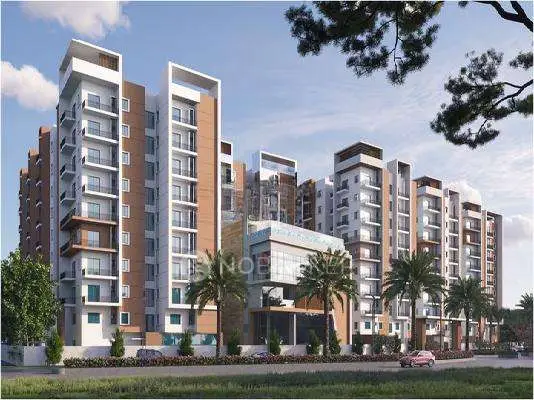
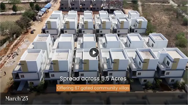
Signature Natures Edge
SATG INFRA LLP · Rangareddy · RERA P02400009757
SIGNATURE NATURES EDGE is a residential gated-community villa project in MANKHAL,SREENAGAR, Maheshwaram Mandal, Ranga Reddy District, developed by registered promoter SATG INFRA LLP. The project covers 55,195.55 sq.m and the HMDA layout record identifies 122 plots/villas; the RERA unit schedule records 121 “G PLUS 2 VILLA” entries, each with a filed saleable area of 419.92 sq.m. Its TG-RERA registration is P02400009757, valid 07/05/2025–07/05/2030, and the project header records proposed completion as 07/09/2030.
01What we found
Read from TG-RERA filings, approvals, land and registration records and court records. A court case is counted only when the court record states this project's survey number with its village, or names the project.
02Check before you pay
10 items to check before you pay, 2 high - from the title chain, court records and approvals, each with what to ask the builder or your advocate. An item may not be a problem with the project: records can be incomplete.
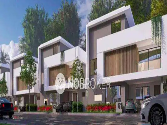
1. Project at a glance
Project identity
| Item | Project record |
|---|---|
| Registered project name | SIGNATURE NATURES EDGE RERA record |
| Project type | Residential gated-community villas; the HMDA layout drawing describes a “proposed residential layout with housing under gated community.” RERA record |
| Phase / registered portion | New Project; no phase number or separately identified phase is disclosed. RERA record RERA filing |
| TG-RERA registration | P02400009757; valid 07/05/2025–07/05/2030. Registration validity is separate from the completion commitment below. RERA record |
| Registered promoter | SATG INFRA LLP. RERA record Corporate record |
| RERA status | Filed as a new project; registration certificate supplied. Portal registration details were captured 2026-09-10 15:30:33. RERA record Approvals record |
Land and geographic identity
| Item | Project record |
|---|---|
| Locality | MANKHAL,SREENAGAR (RERA filing); the project land descriptions also identify Mallikdanguda, Mankhal and Sreenagar villages. RERA record RERA filing |
| Revenue villages | Mallikdanguda; Mankhal (also rendered “Makhal” in the registration certificate); Sreenagar. |
| Mandal / district / PIN | Maheshwaram / Ranga Reddy / 501359. RERA record |
| Survey numbers and subdivisions | Mallikdanguda: 7/A, 7/A/1/1, 7/A/1/2, 7/AA, 7/AA/1, 7/AA/1/1, 7/E, 7/E/1/2. Mankhal: 433/AA, 433/AA/1/1/1, 433/AA/1/1/1/1/2. Sreenagar: 245/EE/2. The RERA filing groups the listed survey numbers across the stated villages; the village-wise grouping above follows the supplied layout and approval records. |
| Registered site extent | 55,195.55 sq.m total site area; road-affected area 113.93 sq.m; net layout area 55,081.62 sq.m in the layout-area statement. RERA filing Layout record |
| Boundaries in RERA filing | East: ROAD AND OTHERS PROPERTY; West: ROAD AND OTHERS PROPERTY; North: LAND IN SY NO 7 PART MALKIDANGUDA; South: LAND IN SY NO 433 PART MANKHAL. RERA filing |
Development identity
| Item | Project record |
|---|---|
| Sanctioning authority / principal layout approval | HMDA; approval / application / proceedings number 013076/LO/HMDA/3528/SMD/2024, approved 09 May 2025. The filed approval material is described as a draft layout permission, with final release subject to stated development and handover conditions. RERA record Approvals record |
| Approved built-up area | HMDA layout record: 52,286.31 sq.m total built-up area. |
| Building / unit organization | The HMDA layout record identifies 122 plots/villas. The drawing’s building schedule lists proposed residential types and a clubhouse; its schedule records 61 Type A, 7 Type B1, 46 Type B, 2 “11 and 12,” 5 Type A mortgaged, and 1 clubhouse building. |
| Sanctioned floor configuration | Residential villas: G + 2 upper floors; clubhouse: G + 2 upper floors in the environmental-clearance record. The layout drawing also lists 3-floor Type A, B and B1 blocks and proposed equivalents as 1 Ground + 2 upper floors. |
| Parking levels / provision | No parking level or parking-space count is established in the supplied material. The drawing reports proposed built-up area including parking, but does not provide a verifiable parking-space inventory here. |
| Unit counts | HMDA layout record: 122 plots/villas. RERA unit table: 121 “G PLUS 2 VILLA” entries and 3 amenity entries (2 “AMENITIES,” 1 “AMENITIES G FLOOR”); the amenity rows are not homes for sale. RERA unit table RERA unit table |
Offering and status
| Item | Project record |
|---|---|
| RERA-filed home type | “G PLUS 2 VILLA”; 121 units, filed saleable area 419.92 sq.m each; portal booking data lists 0 booked and 121 available, with no as-of date supplied. RERA unit table RERA unit table |
| Drawing-measured configuration | A software measurement of the supplied approved floor-plan drawing identified a 1BHK design, but that configuration is not matched to the RERA filing. It is not presented as the filed villa offering. Floor plans RERA unit details |
| Construction stage | No construction-progress percentage or independently verified site-progress record is supplied. RERA record RERA filing |
| Completion timeline | Promoter Form B undertakes completion by 08-May-2030; the project header records proposed completion 07/09/2030. These are reported separately as supplied record fields, not treated as interchangeable. RERA record |
| OC / completion certificate | No occupancy certificate or completion certificate is supplied. The project is registered as a new project; no tower-wise or phase-wise OC status is disclosed. RERA record Document index |
2. The project story
SIGNATURE NATURES EDGE is registered with TG-RERA as a residential project comprising a gated community of villas across land in Mallikdanguda, Mankhal and Sreenagar villages, Maheshwaram Mandal, Ranga Reddy District. The HMDA layout material describes a site of 55,195.55 sq.m and a layout of 122 plots/villas, with residential villa types and a clubhouse. RERA record
The RERA unit schedule records 121 G PLUS 2 VILLA entries. The supplied layout drawing’s schedule describes Type A, Type B and Type B1 villas, alongside entries for two additional proposed buildings and five mortgaged Type A buildings. The record does not provide a unit-by-unit crosswalk between those drawing labels and RERA’s villa entries. RERA unit table
The project is registered through 07/05/2030. The promoter’s Form B gives a completion undertaking of 08-May-2030, while the project header records a proposed completion date of 07/09/2030. No construction stage, progress percentage or independently verified site inspection is supplied, and no OC or completion certificate is recorded for the project or any portion. RERA record Document index
3. Master plan, architecture & building design
The HMDA layout record gives a total site area of 55,195.55 sq.m, road-affected area of 113.93 sq.m, and net layout area of 55,081.62 sq.m. Its land-use statement records 32,712.42 sq.m plotted area (59.39%), 16,174.41 sq.m roads (29.36%), 5,705.08 sq.m organized open space/park (10.36%) and 489.70 sq.m utilities (0.89%). Layout record
The approved layout record states 52,286.31 sq.m total built-up area. A separate layout-drawing land-use schedule also labels 47,194.09 sq.m as proposed built-up area excluding parking and 50,277.28 sq.m including parking; these are distinct labels in that drawing and are not substitutes for the HMDA record’s stated total built-up area.
The drawing schedules Type A, Type B and Type B1 residential buildings, a clubhouse, two buildings labelled “11 AND 12,” and five Type A mortgaged buildings. Residential villa and clubhouse floor descriptions are G + 2 upper floors. The drawing also shows internal road widths of 10.0 m, 12.0 m and 30.0 m and a 4.50 m driveway, among other road labels.
The layout identifies parks/open space, utilities, internal roads, cycle track, tot-lot, clubhouse, swimming pool, sump, transformer, septic-tank provisions and water-harvesting pits. No building footprint, detailed villa-by-villa arrangement, lift or stair count, or parking-level plan is established in the supplied extracted material.
4. Homes, configurations & floor plans
| Configuration | Units | Booked | Available | RERA saleable area | Measured carpet area | Loading (if supplied) |
|---|---|---|---|---|---|---|
| G PLUS 2 VILLA (filed configuration label) | 121 | 0 | 121 | 419.92 sq.m each | Not measured for this RERA configuration | Not supplied |
RERA unit table RERA unit table
The RERA unit table lists the villa saleable area as 419.92 sq.m. The supplied drawing measurement separately identifies a 1BHK layout not matched to a RERA configuration: software measured carpet area across four designs at 100.4–104.6 sq.m, median 103.5 sq.m (median 1,114 sq.ft). For one measured ground-floor example, the drawing labels a bedroom, living/kitchen, toilet and dress room. These drawing-based figures are software measurements, not RERA-filed villa dimensions; they should be checked against the drawing. Floor plans RERA unit details
Saleable area and carpet area are different measures: the supplied floor-plan note says its carpet measurement is smaller than RERA saleable area, which also counts the home’s share of common areas. The filing does not provide a matched 1BHK configuration or a carpet-area disclosure for the G PLUS 2 VILLA entries. Floor plans RERA unit details
5. Parking & vehicle circulation
The HMDA drawing refers to proposed built-up area including and excluding parking, but the supplied record does not establish the number or type of parking spaces, parking levels, visitor or accessible spaces, or unit-wise parking allocation. It also does not establish ramps, a separate parking entry, EV charging, or an exclusive parking right for any villa.
The layout drawing identifies internal roads and a 4.50 m driveway; the approval material also specifies that roads and open spaces are to be handed over to the local body before release of final layout plans. No parking-space-to-home ratio is supplied.
6. Amenities, recreation & open spaces
The following are facilities or land uses identified in the supplied layout, approval, and environmental-clearance records. “Shown” or “provided for” reflects the records’ description; no independent completion verification or facility-by-facility progress information is supplied.
| Description / size | G + 2 upper floors; the drawing identifies clubhouse building use. No area is stated here as a verified delivered facility size. |
|---|---|
| Declared progress / verified status | Shown in project records; construction progress and completion not supplied. |
| Description / size | Identified in the layout drawing; no size or capacity supplied. |
|---|---|
| Declared progress / verified status | Shown; completion not verified. |
| Description / size | Organized open space/park: 5,705.08 sq.m (10.36% of net layout area); tot-lot also appears in the drawing’s facility list. |
|---|---|
| Evidence source | Layout record |
| Declared progress / verified status | Shown/provided for in the layout record; completion not verified. |
| Description / size | Identified in the layout drawing and HMDA approval material. |
|---|---|
| Declared progress / verified status | Shown/provided for; completion not verified. |
| Description / size | Layout roads: 16,174.41 sq.m; the drawing includes multiple road widths and a 4.50 m driveway. |
|---|---|
| Evidence source | Layout record |
| Declared progress / verified status | Provided for in the layout; handover is a condition before final layout release. No completion verification supplied. |
| Description / size | 489.70 sq.m in the layout-area statement. |
|---|---|
| Evidence source | Layout record |
| Declared progress / verified status | Provided for; facility-specific progress not supplied. |
| Description / size | Layout records show 0 sq.m social infrastructure area; no additional community-building detail is established by the supplied records. |
|---|---|
| Declared progress / verified status | No progress or delivery status supplied. |
7. Utilities, building services & safety
The layout and environmental-clearance records identify proposed utility and service provisions. They do not establish that these systems have been installed, commissioned or independently verified.
| Evidence in project records | Environmental-clearance parameters state total water 126.19 KLD (HMWSS&B), fresh water 69.91 KLD, and recycled water 56.28 KLD. The clearance conditions include obtaining water and sewerage connections from HMWSS&SB or the local municipality. |
|---|---|
| Status / limitation | Clearance figures and conditions; no connection or operational status supplied. |
| Evidence in project records | Records identify a 110 KLD STP, septic-tank provisions, underground drainage and sewage-treatment/reuse commitments. The environmental clearance specifies treatment and reuse, including for gardening/avenue plantation. |
|---|---|
| Status / limitation | Proposed/required in project records; completion and commissioning are not verified. |
| Evidence in project records | Storm-water drains and rainwater-harvesting pits are identified in the approval/layout material. |
|---|---|
| Status / limitation | Shown/provided for; completion not verified. |
| Evidence in project records | Transformer is identified in the layout; the environmental-clearance record lists 1 x 800 kVA. |
|---|---|
| Status / limitation | Proposed record detail; installation and energization status not supplied. |
| Evidence in project records | The RERA amenities record marks fire protection and fire-safety requirements as available in the filing, and the environmental clearance requires applicable clearances and fire-safety provisions. RERA amenities Regulatory record |
|---|---|
| Status / limitation | Filing/condition evidence only; no fire approval or completion certificate is supplied here. |
| Evidence in project records | The approval material identifies solid-waste disposal and a bio-compost unit; the RERA amenities record marks solid-waste management and disposal as available. RERA amenities |
|---|---|
| Status / limitation | Filed/provided-for claims; operating status not verified. |
| Evidence in project records | No project-specific lift count or capacity, backup-power specification, CCTV/access-control system, or accessible-circulation detail is established by the supplied RERA and approval records. |
|---|---|
| Status / limitation | Not disclosed in the supplied project records. |
8. Location, access & connectivity
The registered location is MANKHAL,SREENAGAR, Maheshwaram Mandal, Ranga Reddy District, PIN 501359; the project land and approval records identify Mallikdanguda, Mankhal and Sreenagar villages. The project is described in the HMDA material as within the Thukkuguda Municipality / Municipal Corporation jurisdiction. RERA record RERA filing
The supplied location record gives the nearest sampled Outer Ring Road interchange at approximately 10.6 km. No other measured distances, public-transport details or verified travel times are supplied. Location record
9. Developer & development status
The registered legal promoter is SATG INFRA LLP, an LLP; the supplied corporate identifier is GSTIN 36AFIFS0007G1ZA. The project records name Venkatarami Reddy Vaka as an authorized signatory. The supplied registered-office/address material lists Kolluru, Mallikdanguda, Mankhal,Sreenagar, Maheshwaram, Ranga Reddy, 501359. Corporate record Parties record RERA filing
The project is registered as a new project. No construction-progress percentage, independently verified site status, unit-wise construction schedule, or OC for any phase or villa is supplied. The promoter’s Form B states a completion commitment of 08-May-2030; the project header separately records 07/09/2030 as the proposed completion date. RERA record
10. Approvals, official records & documents
| Identifier / date | P02400009757; valid 07/05/2025–07/05/2030 |
|---|---|
| What the supplied record establishes | Registration of SIGNATURE NATURES EDGE with SATG INFRA LLP named as promoter. |
| Identifier / date | 013076/LO/HMDA/3528/SMD/2024; approved 09 May 2025; file TS/066391/2024 |
|---|---|
| What the supplied record establishes | Gated-community housing layout approval material for the stated site and survey lands, with development, mortgage and handover conditions recorded. |
| Identifier / date | 2162/2025, dated 10 February 2025 |
|---|---|
| What the supplied record establishes | HMDA approval records identify villa/plot Nos. 12, 11, 117, 118, 119, 120 and 121, with a stated mortgage area of 2,939.91 sq.m, in favour of the Metropolitan Commissioner, HMDA. |
| Identifier / date | 2163/2025, dated 10 February 2025 |
|---|---|
| What the supplied record establishes | HMDA approval material records the 113.93 sq.m road-affected area as handed over to the Commissioner, Thukkuguda Municipality. |
| Identifier / date | File / proposal SIA/TG/INFRA2/515387/2024; EC EC24C3801TG5218700N; 24/03/2025 |
|---|---|
| What the supplied record establishes | Project-specific environmental clearance for the Nature’s Edge gated-community villas project, subject to stated conditions. |
| Identifier / date | Dated 07-May-2025 |
|---|---|
| What the supplied record establishes | Promoter declaration concerning title basis, encumbrances, project funds, pending approvals and completion by 08-May-2030. |
| Identifier / date | 562282 |
|---|---|
| What the supplied record establishes | Drawing-extracted layout, land-use, building schedule, road labels and facility references. |
No occupancy or completion certificate is included in the supplied project documents. The layout approval records require specified roads, open space and utilities to be handed over before final layout release; the table above is an evidence index, not confirmation that those conditions or works have been completed.
1. Project at a glance
Project identity
Registered project name: SIGNATURE NATURES EDGE
Project type: Residential gated-community villas; the HMDA layout drawing describes a “proposed residential layout with housing under gated community.”
Phase / registered portion: New Project; no phase number or separately identified phase is disclosed.
TG-RERA registration: P02400009757; valid 07/05/2025–07/05/2030. Registration validity is separate from the completion commitment below.
Registered promoter: SATG INFRA LLP.
RERA status: Filed as a new project; registration certificate supplied. Portal registration details were captured 2026-09-10 15:30:33.
Land and geographic identity
Locality: MANKHAL,SREENAGAR (RERA filing); the project land descriptions also identify Mallikdanguda, Mankhal and Sreenagar villages.
Revenue villages: Mallikdanguda; Mankhal (also rendered “Makhal” in the registration certificate); Sreenagar.
Mandal / district / PIN: Maheshwaram / Ranga Reddy / 501359.
Survey numbers and subdivisions: Mallikdanguda: 7/A, 7/A/1/1, 7/A/1/2, 7/AA, 7/AA/1, 7/AA/1/1, 7/E, 7/E/1/2. Mankhal: 433/AA, 433/AA/1/1/1, 433/AA/1/1/1/1/2. Sreenagar: 245/EE/2. The RERA filing groups the listed survey numbers across the stated villages; the village-wise grouping above follows the supplied layout and approval records.
Registered site extent: 55,195.55 sq.m total site area; road-affected area 113.93 sq.m; net layout area 55,081.62 sq.m in the layout-area statement.
Boundaries in RERA filing: East: ROAD AND OTHERS PROPERTY; West: ROAD AND OTHERS PROPERTY; North: LAND IN SY NO 7 PART MALKIDANGUDA; South: LAND IN SY NO 433 PART MANKHAL.
Development identity
Sanctioning authority / principal layout approval: HMDA; approval / application / proceedings number 013076/LO/HMDA/3528/SMD/2024, approved 09 May 2025. The filed approval material is described as a draft layout permission, with final release subject to stated development and handover conditions.
Approved built-up area: HMDA layout record: 52,286.31 sq.m total built-up area.
Building / unit organization: The HMDA layout record identifies 122 plots/villas. The drawing’s building schedule lists proposed residential types and a clubhouse; its schedule records 61 Type A, 7 Type B1, 46 Type B, 2 “11 and 12,” 5 Type A mortgaged, and 1 clubhouse building.
Sanctioned floor configuration: Residential villas: G + 2 upper floors; clubhouse: G + 2 upper floors in the environmental-clearance record. The layout drawing also lists 3-floor Type A, B and B1 blocks and proposed equivalents as 1 Ground + 2 upper floors.
Parking levels / provision: No parking level or parking-space count is established in the supplied material. The drawing reports proposed built-up area including parking, but does not provide a verifiable parking-space inventory here.
Unit counts: HMDA layout record: 122 plots/villas. RERA unit table: 121 “G PLUS 2 VILLA” entries and 3 amenity entries (2 “AMENITIES,” 1 “AMENITIES G FLOOR”); the amenity rows are not homes for sale.
Offering and status
RERA-filed home type: “G PLUS 2 VILLA”; 121 units, filed saleable area 419.92 sq.m each; portal booking data lists 0 booked and 121 available, with no as-of date supplied.
Drawing-measured configuration: A software measurement of the supplied approved floor-plan drawing identified a 1BHK design, but that configuration is not matched to the RERA filing. It is not presented as the filed villa offering.
Construction stage: No construction-progress percentage or independently verified site-progress record is supplied.
Completion timeline: Promoter Form B undertakes completion by 08-May-2030; the project header records proposed completion 07/09/2030. These are reported separately as supplied record fields, not treated as interchangeable.
OC / completion certificate: No occupancy certificate or completion certificate is supplied. The project is registered as a new project; no tower-wise or phase-wise OC status is disclosed.
2. The project story
SIGNATURE NATURES EDGE is registered with TG-RERA as a residential project comprising a gated community of villas across land in Mallikdanguda, Mankhal and Sreenagar villages, Maheshwaram Mandal, Ranga Reddy District. The HMDA layout material describes a site of 55,195.55 sq.m and a layout of 122 plots/villas, with residential villa types and a clubhouse.
The RERA unit schedule records 121 G PLUS 2 VILLA entries. The supplied layout drawing’s schedule describes Type A, Type B and Type B1 villas, alongside entries for two additional proposed buildings and five mortgaged Type A buildings. The record does not provide a unit-by-unit crosswalk between those drawing labels and RERA’s villa entries.
The project is registered through 07/05/2030. The promoter’s Form B gives a completion undertaking of 08-May-2030, while the project header records a proposed completion date of 07/09/2030. No construction stage, progress percentage or independently verified site inspection is supplied, and no OC or completion certificate is recorded for the project or any portion.
3. Master plan, architecture & building design
The HMDA layout record gives a total site area of 55,195.55 sq.m, road-affected area of 113.93 sq.m, and net layout area of 55,081.62 sq.m. Its land-use statement records 32,712.42 sq.m plotted area (59.39%), 16,174.41 sq.m roads (29.36%), 5,705.08 sq.m organized open space/park (10.36%) and 489.70 sq.m utilities (0.89%).
The approved layout record states 52,286.31 sq.m total built-up area. A separate layout-drawing land-use schedule also labels 47,194.09 sq.m as proposed built-up area excluding parking and 50,277.28 sq.m including parking; these are distinct labels in that drawing and are not substitutes for the HMDA record’s stated total built-up area.
The drawing schedules Type A, Type B and Type B1 residential buildings, a clubhouse, two buildings labelled “11 AND 12,” and five Type A mortgaged buildings. Residential villa and clubhouse floor descriptions are G + 2 upper floors. The drawing also shows internal road widths of 10.0 m, 12.0 m and 30.0 m and a 4.50 m driveway, among other road labels.
The layout identifies parks/open space, utilities, internal roads, cycle track, tot-lot, clubhouse, swimming pool, sump, transformer, septic-tank provisions and water-harvesting pits. No building footprint, detailed villa-by-villa arrangement, lift or stair count, or parking-level plan is established in the supplied extracted material.
4. Homes, configurations & floor plans
| Configuration | Units | Booked | Available | RERA saleable area | Measured carpet area | Loading (if supplied) |
|---|---|---|---|---|---|---|
| G PLUS 2 VILLA (filed configuration label) | 121 | 0 | 121 | 419.92 sq.m each | Not measured for this RERA configuration | Not supplied |
The RERA unit table lists the villa saleable area as 419.92 sq.m. The supplied drawing measurement separately identifies a 1BHK layout not matched to a RERA configuration: software measured carpet area across four designs at 100.4–104.6 sq.m, median 103.5 sq.m (median 1,114 sq.ft). For one measured ground-floor example, the drawing labels a bedroom, living/kitchen, toilet and dress room. These drawing-based figures are software measurements, not RERA-filed villa dimensions; they should be checked against the drawing.
Saleable area and carpet area are different measures: the supplied floor-plan note says its carpet measurement is smaller than RERA saleable area, which also counts the home’s share of common areas. The filing does not provide a matched 1BHK configuration or a carpet-area disclosure for the G PLUS 2 VILLA entries.
5. Parking & vehicle circulation
The HMDA drawing refers to proposed built-up area including and excluding parking, but the supplied record does not establish the number or type of parking spaces, parking levels, visitor or accessible spaces, or unit-wise parking allocation. It also does not establish ramps, a separate parking entry, EV charging, or an exclusive parking right for any villa.
The layout drawing identifies internal roads and a 4.50 m driveway; the approval material also specifies that roads and open spaces are to be handed over to the local body before release of final layout plans. No parking-space-to-home ratio is supplied.
6. Amenities, recreation & open spaces
The following are facilities or land uses identified in the supplied layout, approval, and environmental-clearance records. “Shown” or “provided for” reflects the records’ description; no independent completion verification or facility-by-facility progress information is supplied.
| Description / size | G + 2 upper floors; the drawing identifies clubhouse building use. No area is stated here as a verified delivered facility size. |
|---|---|
| Declared progress / verified status | Shown in project records; construction progress and completion not supplied. |
| Description / size | Identified in the layout drawing; no size or capacity supplied. |
|---|---|
| Declared progress / verified status | Shown; completion not verified. |
| Description / size | Organized open space/park: 5,705.08 sq.m (10.36% of net layout area); tot-lot also appears in the drawing’s facility list. |
|---|---|
| Declared progress / verified status | Shown/provided for in the layout record; completion not verified. |
| Description / size | Identified in the layout drawing and HMDA approval material. |
|---|---|
| Declared progress / verified status | Shown/provided for; completion not verified. |
| Description / size | Layout roads: 16,174.41 sq.m; the drawing includes multiple road widths and a 4.50 m driveway. |
|---|---|
| Declared progress / verified status | Provided for in the layout; handover is a condition before final layout release. No completion verification supplied. |
| Description / size | 489.70 sq.m in the layout-area statement. |
|---|---|
| Declared progress / verified status | Provided for; facility-specific progress not supplied. |
| Description / size | Layout records show 0 sq.m social infrastructure area; no additional community-building detail is established by the supplied records. |
|---|---|
| Declared progress / verified status | No progress or delivery status supplied. |
7. Utilities, building services & safety
The layout and environmental-clearance records identify proposed utility and service provisions. They do not establish that these systems have been installed, commissioned or independently verified.
| Evidence in project records | Environmental-clearance parameters state total water 126.19 KLD (HMWSS&B), fresh water 69.91 KLD, and recycled water 56.28 KLD. The clearance conditions include obtaining water and sewerage connections from HMWSS&SB or the local municipality. |
|---|---|
| Status / limitation | Clearance figures and conditions; no connection or operational status supplied. |
| Evidence in project records | Records identify a 110 KLD STP, septic-tank provisions, underground drainage and sewage-treatment/reuse commitments. The environmental clearance specifies treatment and reuse, including for gardening/avenue plantation. |
|---|---|
| Status / limitation | Proposed/required in project records; completion and commissioning are not verified. |
| Evidence in project records | Storm-water drains and rainwater-harvesting pits are identified in the approval/layout material. |
|---|---|
| Status / limitation | Shown/provided for; completion not verified. |
| Evidence in project records | Transformer is identified in the layout; the environmental-clearance record lists 1 x 800 kVA. |
|---|---|
| Status / limitation | Proposed record detail; installation and energization status not supplied. |
| Evidence in project records | The RERA amenities record marks fire protection and fire-safety requirements as available in the filing, and the environmental clearance requires applicable clearances and fire-safety provisions. |
|---|---|
| Status / limitation | Filing/condition evidence only; no fire approval or completion certificate is supplied here. |
| Evidence in project records | The approval material identifies solid-waste disposal and a bio-compost unit; the RERA amenities record marks solid-waste management and disposal as available. |
|---|---|
| Status / limitation | Filed/provided-for claims; operating status not verified. |
| Evidence in project records | No project-specific lift count or capacity, backup-power specification, CCTV/access-control system, or accessible-circulation detail is established by the supplied RERA and approval records. |
|---|---|
| Status / limitation | Not disclosed in the supplied project records. |
8. Location, access & connectivity
The registered location is MANKHAL,SREENAGAR, Maheshwaram Mandal, Ranga Reddy District, PIN 501359; the project land and approval records identify Mallikdanguda, Mankhal and Sreenagar villages. The project is described in the HMDA material as within the Thukkuguda Municipality / Municipal Corporation jurisdiction.
The supplied location record gives the nearest sampled Outer Ring Road interchange at approximately 10.6 km. No other measured distances, public-transport details or verified travel times are supplied.
9. Developer & development status
The registered legal promoter is SATG INFRA LLP, an LLP; the supplied corporate identifier is GSTIN 36AFIFS0007G1ZA. The project records name Venkatarami Reddy Vaka as an authorized signatory. The supplied registered-office/address material lists Kolluru, Mallikdanguda, Mankhal,Sreenagar, Maheshwaram, Ranga Reddy, 501359.
The project is registered as a new project. No construction-progress percentage, independently verified site status, unit-wise construction schedule, or OC for any phase or villa is supplied. The promoter’s Form B states a completion commitment of 08-May-2030; the project header separately records 07/09/2030 as the proposed completion date.
10. Approvals, official records & documents
| Identifier / date | P02400009757; valid 07/05/2025–07/05/2030 |
|---|---|
| What the supplied record establishes | Registration of SIGNATURE NATURES EDGE with SATG INFRA LLP named as promoter. |
| Identifier / date | 013076/LO/HMDA/3528/SMD/2024; approved 09 May 2025; file TS/066391/2024 |
|---|---|
| What the supplied record establishes | Gated-community housing layout approval material for the stated site and survey lands, with development, mortgage and handover conditions recorded. |
| Identifier / date | 2162/2025, dated 10 February 2025 |
|---|---|
| What the supplied record establishes | HMDA approval records identify villa/plot Nos. 12, 11, 117, 118, 119, 120 and 121, with a stated mortgage area of 2,939.91 sq.m, in favour of the Metropolitan Commissioner, HMDA. |
| Identifier / date | 2163/2025, dated 10 February 2025 |
|---|---|
| What the supplied record establishes | HMDA approval material records the 113.93 sq.m road-affected area as handed over to the Commissioner, Thukkuguda Municipality. |
| Identifier / date | File / proposal SIA/TG/INFRA2/515387/2024; EC EC24C3801TG5218700N; 24/03/2025 |
|---|---|
| What the supplied record establishes | Project-specific environmental clearance for the Nature’s Edge gated-community villas project, subject to stated conditions. |
| Identifier / date | Dated 07-May-2025 |
|---|---|
| What the supplied record establishes | Promoter declaration concerning title basis, encumbrances, project funds, pending approvals and completion by 08-May-2030. |
| Identifier / date | 562282 |
|---|---|
| What the supplied record establishes | Drawing-extracted layout, land-use, building schedule, road labels and facility references. |
No occupancy or completion certificate is included in the supplied project documents. The layout approval records require specified roads, open space and utilities to be handed over before final layout release; the table above is an evidence index, not confirmation that those conditions or works have been completed.
Frequently asked questions
Is SIGNATURE NATURES EDGE registered with Telangana RERA?
Yes. SIGNATURE NATURES EDGE is registered with the Telangana Real Estate Regulatory Authority as P02400009757; the registration status is New Project.
Who is the developer of SIGNATURE NATURES EDGE?
The promoter named in the RERA registration is SATG INFRA LLP.
Where is SIGNATURE NATURES EDGE located?
SIGNATURE NATURES EDGE is in MANKHAL,SREENAGAR, Maheshwaram, Rangareddy, Telangana (501359).
When will SIGNATURE NATURES EDGE be completed?
The promoter's proposed date of completion filed with RERA is 07/09/2030. This is the promoter's declaration, not a guarantee.
More projects in Maheshwaram