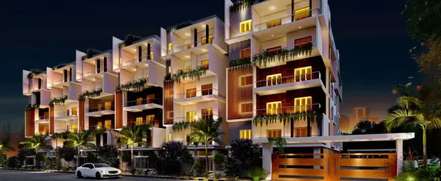
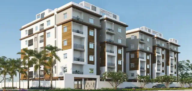
Jagruthi Township
SATTUR BASWARAJ GOUD AND OTHERS · Mahabubnagar · RERA P01400010943
JAGRUTHI TOWNSHIP is a residential plotted development at Amistapur, Bhoothpur Mandal, Mahabubnagar District, developed by registered promoter SATTUR BASWARAJ GOUD AND OTHERS. The project has a registered site extent of 42,300.52 sq. m and is a layout of residential plots; a municipal correction letter records 143 plots, with no tower or floor configuration stated. Plot sizes range from 105.75 sq. m (126.5 sq. yd) to 449.8 sq. m (538.0 sq. yd). Its TG-RERA registration is P01400010943, and the project record lists proposed and revised completion as 30/11/2026.
01What we found
Read from TG-RERA filings, approvals, land and registration records and court records. A court case is counted only when the court record states this project's survey number with its village, or names the project.
02Check before you pay
8 items to check before you pay, 3 high - from the title chain, court records and approvals, each with what to ask the builder or your advocate. An item may not be a problem with the project: records can be incomplete.
Project at a glance
Project identity
| Field | Evidence-backed profile |
|---|---|
| Registered project name | JAGRUTHI TOWNSHIP RERA record |
| Project type | Plotted development / residential layout RERA record |
| Phase or registered portion | Not identified as a separate phase; the registration names the project and the listed survey numbers. RERA record |
| TG-RERA registration | P01400010943 RERA record |
| Registration validity | 25 June 2022 to 25 June 2026; the supplied certificate states four years and says validity is subject to extension by the Authority. The project record labels the project “On-Going Project”; current registration validity or extension is not established by the supplied material. RERA record |
| Registered promoter | SATTUR BASWARAJ GOUD AND OTHERS; entity type is recorded as “Others”, described as a partnership. RERA record RERA filing |
| RERA status | The supplied record says “On-Going Project”; no current-status order or extension certificate is supplied. RERA record |
Land and geographic identity
| Field | Evidence-backed profile |
|---|---|
| Locality / revenue village | Amistapur; the layout approval describes the site as Amistapur Revenue Village. RERA record |
| Mandal | Bhoothpur RERA record |
| District | Mahabubnagar RERA record |
| PIN | 509382 RERA record |
| Project survey numbers | 362P, 372, 374, 375, 458 and 459 RERA record Land records |
| Registered site extent | 42,300.52 sq. m in the RERA land-details record. RERA filing |
| Net / total area | RERA land details state total and net area as 42,300.52 sq. m. The approved layout drawing separately states a layout extent of 10 Acer 18.1 Gts; 50,591 Sq. Yds. RERA filing |
| Boundaries (RERA filing) | East: “OTHERS LAND”; west: “EXISTING 10M WIDE ROAD”; north: “OTERS LAND”; south: “OTHERS LAND”. RERA filing |
Development identity
| Field | Evidence-backed profile |
|---|---|
| Sanctioning authority | Bhoothpur Municipality / Municipal Corporation, as named in the filed layout approval. Approvals record |
| Principal layout approval | Tentative Layout Plan No. 0003/LO/3106/2022, approved 25 June 2022. The filed application number is 003872/LO/DTCP/3106/0004/2022. Approvals record |
| Approved built-up area | 27,345.55 sq. m is recorded in the RERA fields; the supplied material does not clarify its detailed measurement basis. RERA filing |
| Layout plot count | A Bhoothpur Municipality correction letter states 143 plots. |
| Building / floor configuration | Not applicable as a multi-storey building configuration is not supplied; this is a plotted layout. RERA record |
| Parking provision | No parking count or parking layout is established by the supplied records. Document index |
Offering and status
| Field | Evidence-backed profile |
|---|---|
| Unit type | Residential plots. RERA record |
| Plot count and sizes | The layout drawing’s software-read schedule records 138 plots with sizes; the municipal correction letter records 143 plots. Software-read plot sizes range from 105.75 sq. m (126.5 sq. yd) to 449.8 sq. m (538.0 sq. yd), with a median of 183.95 sq. m (220.0 sq. yd). Verify plot-specific details against the approved drawing and individual allotment documents. Layout record |
| Booked / available counts | Not supplied. RERA filing |
| Construction / development stage | No independently verified site-progress assessment is supplied. A RERA-filed amenities record reports percentage figures for certain infrastructure items; see the amenities and services sections. RERA amenities |
| Promoter-declared completion | Form B declares completion by 25 June 2026. The project header gives proposed and revised completion as 30/11/2026. RERA record |
| Occupancy / completion certificate | No occupancy or completion certificate is supplied. Document index |
The project story
- JAGRUTHI TOWNSHIP is registered as a residential plotted development at Amistapur in Bhoothpur Mandal, Mahabubnagar District. Its registered land identity comprises survey numbers 362P, 372, 374, 375, 458 and 459. The municipality’s filed tentative layout approval describes roads, plotted land, open space, social infrastructure and utility land, and states that the layout is intended for detached single-family dwellings. RERA record Land records
- The layout approval is tentative and calls for the developer to complete infrastructure works and hand over specified roads, open space and utility land by registered gift deed. A later municipal correction letter records 143 plots. The supplied drawing analysis separately reports a software-read schedule of 138 plots with sizes; the drawing-based counts and dimensions should be checked against the plan before relying on a particular plot’s measurements. Layout record
- The evidence describes development obligations and reported infrastructure percentages, but does not establish a current, independently inspected construction stage, plot-wise availability, or completion/occupancy certification. The promoter’s Form B declares a 25 June 2026 completion date; the project record lists 30 November 2026 as both proposed and revised completion. RERA record RERA amenities
Master plan, architecture & building design
- This is a plotted layout rather than a multi-tower or apartment scheme. The tentative layout approval identifies a stated layout extent of 10 Acer 18.1 Gts; 50,591 Sq. Yds and a plotted area of 6 Acer 30.28 Gts; 32,705 Sq. Yds (64.65%). It allocates 2 Acer 14.69 Gts; 11,458 Sq. Yds (22.65%) to roads, 0 Acer 37.81 Gts; 4,575 Sq. Yds (9.04%) to park/open space, 0 Acer 11.09 Gts; 1,342 Sq. Yds (2.65%) to social infrastructure and 0 Acer 4.22 Gts; 511 Sq. Yds (1.01%) to utilities. These are approval-plan figures, not independently surveyed measurements.
- The approved plan records mortgage of 0 Acer 40.71 Gts; 4,926 Sq. Yds, described as 15.02% of plotted area, under Mortgage Deed No. 10175/2022. It lists plots 134, 125, 124, 135, 136, 123, 137, 122, 121, 138, 139, 120, 119, 140, 141, 118, 128, 127, 132, 133 and 126 as mortgaged in favour of Bhoothpur Municipality / Municipal Corporation.
- The filed layout approval calls for black-topped roads, storm-water drains, underground drainage lines, a common septic tank / STP, internal water-supply pipelines and overhead tank, an assured water-supply source, electrical supply lines and streetlights, avenue planting, park development and rainwater-harvesting pits. These are approval requirements or proposed works; the supplied evidence does not independently confirm completion. The approval also specifies detached dwellings for single-family occupation and does not permit amalgamation or subdivision without the stated authority permission.
- No building footprints, floor plans, apartment areas, tower heights or building-level floor configurations are supplied. Document index Floor plans
Homes, configurations & floor plans
The offering is residential plots, not apartment configurations. The layout record’s software-read plot schedule contains 138 sized plots; a municipal correction letter records a total of 143 plots. The software-measured sizes and bands below are drawing-derived and should be checked against the approved layout and the specific plot schedule. Layout record
| Plot size band | Software-measured plot count |
|---|---|
| 100–150 sq. yd (84–125 sq. m) | 1 |
| 150–200 sq. yd (125–167 sq. m) | 4 |
| 200–250 sq. yd (167–209 sq. m) | 105 |
| 250–300 sq. yd (209–251 sq. m) | 18 |
| 300–400 sq. yd (251–334 sq. m) | 6 |
| 400–500 sq. yd (334–418 sq. m) | 3 |
| 500–1000 sq. yd (418–836 sq. m) | 1 |
The most common software-read size is 183.95 sq. m (220.0 sq. yd), recorded for 92 plots. The layout analysis reports a smallest plot of 105.75 sq. m, a median of 183.95 sq. m, and a largest of 449.8 sq. m. These are drawing-measured plot areas, not RERA-filed apartment saleable or carpet areas. No plot-wise booking or availability figures are supplied. Layout record
Parking & vehicle circulation
The supplied records do not establish a parking-space count, visitor or accessible parking provision, EV charging, parking allocation to individual plots, or a dedicated parking layout. The approved layout provides a road network, but vehicle-entry points, road widths beyond the RERA boundary description, internal driveway details and pedestrian separation are not established in the supplied material. Document index
Amenities, recreation & open spaces
The municipality’s tentative layout approval identifies open-space and social-infrastructure land and lists infrastructure works and site facilities. Separately, the RERA-filed amenities record gives reported percentages; those figures are not independent verification of completion. RERA amenities
| Facility | Description / size | Evidence source | Declared progress / verified status |
|---|---|---|---|
| Park / open space | Approved allocation: 0 Acer 37.81 Gts; 4,575 Sq. Yds; 9.04%. | RERA-filed amenities record reports Green Strip/TOT LOT/Park at 90%; not independently verified. RERA amenities | |
| Social infrastructure | Approved allocation: 0 Acer 11.09 Gts; 1,342 Sq. Yds; 2.65%. | No facility-level delivery status supplied. | |
| Internal roads and footpaths | Included in the layout infrastructure. | RERA-filed record reports 100%; not independently verified. RERA amenities | |
| Avenue planting | Required as part of the layout development works. | No separately verified completion status supplied. | |
| Community buildings | No size or facility description supplied. | RERA amenities | RERA-filed record reports 0%. RERA amenities |
No clubhouse, indoor recreation, sports facilities or quantified community-building programme is established by the supplied evidence. RERA amenities
Utilities, building services & safety
The approval plan identifies required layout utilities and services. The RERA-filed amenities record reports percentages for several items, but does not provide capacities or establish independent inspection or completion. RERA amenities
| Service | Evidence in the supplied record |
|---|---|
| Water | The approval calls for an assured water-supply source, internal supply pipelines, a water reservoir and an overhead tank / sump. The amenities record reports Water Supply at 90%; source, storage capacity and independent completion status are not supplied. RERA amenities |
| Sewerage and drainage | The approval lists underground drainage lines, a common septic tank / STP and storm-water drains. The amenities record reports Sewerage at 100% and Storm Water Drains at 90%; capacities, treatment design and independent verification are not supplied. RERA amenities |
| Rainwater management | Rainwater-harvesting pits are included in the approval requirements; the amenities record reports Water Conservation/Rain water Harvesting at 100%. Completion is not independently verified. RERA amenities |
| Electrical | The approval lists electrical supply lines, a transformer and streetlights. The RERA amenities record reports the electrical meter room/sub-station/receiving station at 80% and Street Lighting at 0%. RERA amenities |
| Solid waste | The approval lists solid-waste management among utilities. The amenities record reports Solid Waste Management and Disposal at 0%. No system details are supplied. RERA amenities |
| Fire and life safety | The amenities record reports Fire Protection and Fire Safety Requirements at 0%. No project-specific fire-system details or clearance are supplied. RERA amenities |
| Lifts, accessibility and security | Not applicable or not evidenced for this plotted-layout record; no lift, accessibility, CCTV or access-control details are supplied. Document index |
Location, access & connectivity
- The registered location is Amistapur, Bhoothpur Mandal, Mahabubnagar District, PIN 509382. The RERA land record describes the west boundary as an “EXISTING 10M WIDE ROAD”; the other recorded boundaries are land described as “OTHERS LAND” or “OTERS LAND”. RERA record RERA filing
- A supplied location record gives an approximate nearest sampled Outer Ring Road interchange distance of 71.0 km. No public-transport details, further approach-road information or other landmark distances are supplied. Location record
Developer & development status
- The registered promoter is SATTUR BASWARAJ GOUD AND OTHERS. The RERA record categorizes the organization type as “Others” and describes it as a partnership. The registered office/address shown in the RERA record is Village: Bhoothpur, Mandal: Bhoothpur, District: Mahabubnagar, Pin: 509382. The supplied material does not provide a verified company identification number, official website or project contact details. RERA record RERA filing
- Form B is a promoter declaration by Sattur Baswaraj Goud. It states that title or title authentication and an owner-promoter development agreement are enclosed, declares the land free from encumbrances, and undertakes completion by 25t June, 2026 as printed in the extraction. These are promoter declarations, not independent determinations.
- The project header lists a proposed and revised completion date of 30/11/2026. No independent construction-progress report or occupancy/completion certificate is supplied. RERA record Document index
Approvals, official records & documents
| Record | Supplied evidence |
|---|---|
| TG-RERA registration | Form C registers JAGRUTHI TOWNSHIP, P01400010943, with validity stated as 25/06/2022 to 25/06/2026. |
| Principal layout approval | Bhoothpur Municipality / Municipal Corporation tentative residential layout approval, LP No. 0003/LO/3106/2022, dated 25 June 2022; filed application number 003872/LO/DTCP/3106/0004/2022. |
| Layout-plan record | A further filed tentative layout-plan approval identifies the same LP number and the same project survey numbers. |
| Layout validity endorsement | Bhoothpur Municipality endorsement states that validity was extended to 25/06/2026, subject to execution in accordance with the stated conditions. |
| Plot-count correction | Bhoothpur Municipality correction letter Lr.Roc.No.2066/TPO/2026 states that the layout has 143 plots. |
| Municipal mortgage | Mortgage Deed No. 10175/2022, dated 21 June 2022, is referenced in the layout approval for specified plots mortgaged to the municipality. |
| Promoter declaration | Form B filed by Sattur Baswaraj Goud records promoter declarations concerning title authentication, encumbrances, separate-account arrangements and completion. |
| Occupancy / completion certificate | No certificate is present in the supplied documents. Document index |
Project at a glance
Project identity
Registered project name: JAGRUTHI TOWNSHIP
Project type: Plotted development / residential layout
Phase or registered portion: Not identified as a separate phase; the registration names the project and the listed survey numbers.
TG-RERA registration: P01400010943
Registration validity: 25 June 2022 to 25 June 2026; the supplied certificate states four years and says validity is subject to extension by the Authority. The project record labels the project “On-Going Project”; current registration validity or extension is not established by the supplied material.
Registered promoter: SATTUR BASWARAJ GOUD AND OTHERS; entity type is recorded as “Others”, described as a partnership.
RERA status: The supplied record says “On-Going Project”; no current-status order or extension certificate is supplied.
Land and geographic identity
Locality / revenue village: Amistapur; the layout approval describes the site as Amistapur Revenue Village.
Mandal: Bhoothpur
District: Mahabubnagar
PIN: 509382
Project survey numbers: 362P, 372, 374, 375, 458 and 459
Registered site extent: 42,300.52 sq. m in the RERA land-details record.
Net / total area: RERA land details state total and net area as 42,300.52 sq. m. The approved layout drawing separately states a layout extent of 10 Acer 18.1 Gts; 50,591 Sq. Yds.
Boundaries (RERA filing): East: “OTHERS LAND”; west: “EXISTING 10M WIDE ROAD”; north: “OTERS LAND”; south: “OTHERS LAND”.
Development identity
Sanctioning authority: Bhoothpur Municipality / Municipal Corporation, as named in the filed layout approval.
Principal layout approval: Tentative Layout Plan No. 0003/LO/3106/2022, approved 25 June 2022. The filed application number is 003872/LO/DTCP/3106/0004/2022.
Approved built-up area: 27,345.55 sq. m is recorded in the RERA fields; the supplied material does not clarify its detailed measurement basis.
Layout plot count: A Bhoothpur Municipality correction letter states 143 plots.
Building / floor configuration: Not applicable as a multi-storey building configuration is not supplied; this is a plotted layout.
Parking provision: No parking count or parking layout is established by the supplied records.
Offering and status
Unit type: Residential plots.
Plot count and sizes: The layout drawing’s software-read schedule records 138 plots with sizes; the municipal correction letter records 143 plots. Software-read plot sizes range from 105.75 sq. m (126.5 sq. yd) to 449.8 sq. m (538.0 sq. yd), with a median of 183.95 sq. m (220.0 sq. yd). Verify plot-specific details against the approved drawing and individual allotment documents.
Booked / available counts: Not supplied.
Construction / development stage: No independently verified site-progress assessment is supplied. A RERA-filed amenities record reports percentage figures for certain infrastructure items; see the amenities and services sections.
Promoter-declared completion: Form B declares completion by 25 June 2026. The project header gives proposed and revised completion as 30/11/2026.
Occupancy / completion certificate: No occupancy or completion certificate is supplied.
The project story
- JAGRUTHI TOWNSHIP is registered as a residential plotted development at Amistapur in Bhoothpur Mandal, Mahabubnagar District. Its registered land identity comprises survey numbers 362P, 372, 374, 375, 458 and 459. The municipality’s filed tentative layout approval describes roads, plotted land, open space, social infrastructure and utility land, and states that the layout is intended for detached single-family dwellings.
- The layout approval is tentative and calls for the developer to complete infrastructure works and hand over specified roads, open space and utility land by registered gift deed. A later municipal correction letter records 143 plots. The supplied drawing analysis separately reports a software-read schedule of 138 plots with sizes; the drawing-based counts and dimensions should be checked against the plan before relying on a particular plot’s measurements.
- The evidence describes development obligations and reported infrastructure percentages, but does not establish a current, independently inspected construction stage, plot-wise availability, or completion/occupancy certification. The promoter’s Form B declares a 25 June 2026 completion date; the project record lists 30 November 2026 as both proposed and revised completion.
Master plan, architecture & building design
- This is a plotted layout rather than a multi-tower or apartment scheme. The tentative layout approval identifies a stated layout extent of 10 Acer 18.1 Gts; 50,591 Sq. Yds and a plotted area of 6 Acer 30.28 Gts; 32,705 Sq. Yds (64.65%). It allocates 2 Acer 14.69 Gts; 11,458 Sq. Yds (22.65%) to roads, 0 Acer 37.81 Gts; 4,575 Sq. Yds (9.04%) to park/open space, 0 Acer 11.09 Gts; 1,342 Sq. Yds (2.65%) to social infrastructure and 0 Acer 4.22 Gts; 511 Sq. Yds (1.01%) to utilities. These are approval-plan figures, not independently surveyed measurements.
- The approved plan records mortgage of 0 Acer 40.71 Gts; 4,926 Sq. Yds, described as 15.02% of plotted area, under Mortgage Deed No. 10175/2022. It lists plots 134, 125, 124, 135, 136, 123, 137, 122, 121, 138, 139, 120, 119, 140, 141, 118, 128, 127, 132, 133 and 126 as mortgaged in favour of Bhoothpur Municipality / Municipal Corporation.
- The filed layout approval calls for black-topped roads, storm-water drains, underground drainage lines, a common septic tank / STP, internal water-supply pipelines and overhead tank, an assured water-supply source, electrical supply lines and streetlights, avenue planting, park development and rainwater-harvesting pits. These are approval requirements or proposed works; the supplied evidence does not independently confirm completion. The approval also specifies detached dwellings for single-family occupation and does not permit amalgamation or subdivision without the stated authority permission.
- No building footprints, floor plans, apartment areas, tower heights or building-level floor configurations are supplied.
Homes, configurations & floor plans
The offering is residential plots, not apartment configurations. The layout record’s software-read plot schedule contains 138 sized plots; a municipal correction letter records a total of 143 plots. The software-measured sizes and bands below are drawing-derived and should be checked against the approved layout and the specific plot schedule.
100–150 sq. yd (84–125 sq. m): 1
150–200 sq. yd (125–167 sq. m): 4
200–250 sq. yd (167–209 sq. m): 105
250–300 sq. yd (209–251 sq. m): 18
300–400 sq. yd (251–334 sq. m): 6
400–500 sq. yd (334–418 sq. m): 3
500–1000 sq. yd (418–836 sq. m): 1
The most common software-read size is 183.95 sq. m (220.0 sq. yd), recorded for 92 plots. The layout analysis reports a smallest plot of 105.75 sq. m, a median of 183.95 sq. m, and a largest of 449.8 sq. m. These are drawing-measured plot areas, not RERA-filed apartment saleable or carpet areas. No plot-wise booking or availability figures are supplied.
Parking & vehicle circulation
The supplied records do not establish a parking-space count, visitor or accessible parking provision, EV charging, parking allocation to individual plots, or a dedicated parking layout. The approved layout provides a road network, but vehicle-entry points, road widths beyond the RERA boundary description, internal driveway details and pedestrian separation are not established in the supplied material.
Amenities, recreation & open spaces
The municipality’s tentative layout approval identifies open-space and social-infrastructure land and lists infrastructure works and site facilities. Separately, the RERA-filed amenities record gives reported percentages; those figures are not independent verification of completion.
| Facility | Description / size | Evidence source | Declared progress / verified status |
|---|---|---|---|
| Park / open space | Approved allocation: 0 Acer 37.81 Gts; 4,575 Sq. Yds; 9.04%. | RERA-filed amenities record reports Green Strip/TOT LOT/Park at 90%; not independently verified. | |
| Social infrastructure | Approved allocation: 0 Acer 11.09 Gts; 1,342 Sq. Yds; 2.65%. | No facility-level delivery status supplied. | |
| Internal roads and footpaths | Included in the layout infrastructure. | RERA-filed record reports 100%; not independently verified. | |
| Avenue planting | Required as part of the layout development works. | No separately verified completion status supplied. | |
| Community buildings | No size or facility description supplied. | RERA-filed record reports 0%. |
No clubhouse, indoor recreation, sports facilities or quantified community-building programme is established by the supplied evidence.
Utilities, building services & safety
The approval plan identifies required layout utilities and services. The RERA-filed amenities record reports percentages for several items, but does not provide capacities or establish independent inspection or completion.
Water: The approval calls for an assured water-supply source, internal supply pipelines, a water reservoir and an overhead tank / sump. The amenities record reports Water Supply at 90%; source, storage capacity and independent completion status are not supplied.
Sewerage and drainage: The approval lists underground drainage lines, a common septic tank / STP and storm-water drains. The amenities record reports Sewerage at 100% and Storm Water Drains at 90%; capacities, treatment design and independent verification are not supplied.
Rainwater management: Rainwater-harvesting pits are included in the approval requirements; the amenities record reports Water Conservation/Rain water Harvesting at 100%. Completion is not independently verified.
Electrical: The approval lists electrical supply lines, a transformer and streetlights. The RERA amenities record reports the electrical meter room/sub-station/receiving station at 80% and Street Lighting at 0%.
Solid waste: The approval lists solid-waste management among utilities. The amenities record reports Solid Waste Management and Disposal at 0%. No system details are supplied.
Fire and life safety: The amenities record reports Fire Protection and Fire Safety Requirements at 0%. No project-specific fire-system details or clearance are supplied.
Lifts, accessibility and security: Not applicable or not evidenced for this plotted-layout record; no lift, accessibility, CCTV or access-control details are supplied.
Location, access & connectivity
- The registered location is Amistapur, Bhoothpur Mandal, Mahabubnagar District, PIN 509382. The RERA land record describes the west boundary as an “EXISTING 10M WIDE ROAD”; the other recorded boundaries are land described as “OTHERS LAND” or “OTERS LAND”.
- A supplied location record gives an approximate nearest sampled Outer Ring Road interchange distance of 71.0 km. No public-transport details, further approach-road information or other landmark distances are supplied.
Developer & development status
- The registered promoter is SATTUR BASWARAJ GOUD AND OTHERS. The RERA record categorizes the organization type as “Others” and describes it as a partnership. The registered office/address shown in the RERA record is Village: Bhoothpur, Mandal: Bhoothpur, District: Mahabubnagar, Pin: 509382. The supplied material does not provide a verified company identification number, official website or project contact details.
- Form B is a promoter declaration by Sattur Baswaraj Goud. It states that title or title authentication and an owner-promoter development agreement are enclosed, declares the land free from encumbrances, and undertakes completion by 25t June, 2026 as printed in the extraction. These are promoter declarations, not independent determinations.
- The project header lists a proposed and revised completion date of 30/11/2026. No independent construction-progress report or occupancy/completion certificate is supplied.
Approvals, official records & documents
TG-RERA registration: Form C registers JAGRUTHI TOWNSHIP, P01400010943, with validity stated as 25/06/2022 to 25/06/2026.
Principal layout approval: Bhoothpur Municipality / Municipal Corporation tentative residential layout approval, LP No. 0003/LO/3106/2022, dated 25 June 2022; filed application number 003872/LO/DTCP/3106/0004/2022.
Layout-plan record: A further filed tentative layout-plan approval identifies the same LP number and the same project survey numbers.
Layout validity endorsement: Bhoothpur Municipality endorsement states that validity was extended to 25/06/2026, subject to execution in accordance with the stated conditions.
Plot-count correction: Bhoothpur Municipality correction letter Lr.Roc.No.2066/TPO/2026 states that the layout has 143 plots.
Municipal mortgage: Mortgage Deed No. 10175/2022, dated 21 June 2022, is referenced in the layout approval for specified plots mortgaged to the municipality.
Promoter declaration: Form B filed by Sattur Baswaraj Goud records promoter declarations concerning title authentication, encumbrances, separate-account arrangements and completion.
Occupancy / completion certificate: No certificate is present in the supplied documents.
Frequently asked questions
Is JAGRUTHI TOWNSHIP registered with Telangana RERA?
Yes. JAGRUTHI TOWNSHIP is registered with the Telangana Real Estate Regulatory Authority as P01400010943; the registration status is On-Going Project.
Who is the developer of JAGRUTHI TOWNSHIP?
The promoter named in the RERA registration is SATTUR BASWARAJ GOUD AND OTHERS.
Where is JAGRUTHI TOWNSHIP located?
JAGRUTHI TOWNSHIP is in Amistapur, Bhoothpur, Mahabubnagar, Telangana (509382).
When will JAGRUTHI TOWNSHIP be completed?
The promoter's proposed date of completion filed with RERA is 30/11/2026. This is the promoter's declaration, not a guarantee.
More projects in Amistapur