Tattvam At Golkonda
TATTVAM PROJECTS LLP · Rangareddy · RERA P02400009137
TATTVAM AT GOLKONDA is a Mixed Development (Residential & Commercial) in Alizapur, Gandipet, Ranga Reddy. The registered promoter is TATTVAM PROJECTS LLP, developing the project on a registered site extent of 19,793.32 sq.m with 33 residential villas and one amenities building, recorded as Ground + 2 upper floors. The filed offering comprises 33 “TRIPLEX VILLA” homes, each with a RERA-filed saleable area of 563.79 sq.m. Its TG-RERA registration number is P02400009137, and the project header records a proposed completion date of 20/03/2028.
01What we found
Read from TG-RERA filings, approvals, land and registration records and court records. A court case is counted only when the court record states this project's survey number with its village, or names the project.
02Check before you pay
8 items to check before you pay, 3 high - from the title chain, court records and approvals, each with what to ask the builder or your advocate. An item may not be a problem with the project: records can be incomplete.
1. Project at a glance
Project identity
| Item | Project record |
|---|---|
| Registered name | TATTVAM AT GOLKONDA RERA record |
| Project type | Mixed Development (Residential & Commercial); the filed inventory comprises villas and an amenities block RERA record RERA filing RERA unit table |
| Phase / registered portion | No separate phase name or phase number is disclosed. The registered record covers the project on the listed survey land RERA record Land records |
| TG-RERA registration | P02400009137 RERA record |
| Registration validity | 20 November 2024 to 20 November 2027, unless extended by the Authority RERA record |
| Registered promoter | TATTVAM PROJECTS LLP RERA record Corporate record |
| RERA status | Recorded as “New Project”; registration certificate issued RERA record |
Land and geographic identity
| Item | Project record |
|---|---|
| Locality | Alizapur / ALIZAPUR RERA record RERA filing |
| Revenue village | Alijapur Village (also recorded as Alizapur) |
| Mandal | Gandipet RERA record |
| District | Ranga Reddy RERA record |
| PIN | 500075 RERA record RERA filing |
| Survey numbers and subdivisions | Sy. No. 3/A/1, Sy. No. 4, and Sy. No. 4/AA RERA record Land records |
| Registered site extent | 19,793.32 sq.m RERA filing |
| Road-affected area | 1,986.20 sq.m RERA filing |
| Net area | 17,807.12 sq.m RERA filing |
| Boundaries | East: Qila Mohd Nagar; West: Sy. No. 3 Part; North: village boundary of Qila Mohd Nagar and Sy. No. 2; South: Sy. No. 5 and military land RERA filing |
Development identity
| Item | Project record |
|---|---|
| Sanctioning authority | Hyderabad Metropolitan Development Authority (HMDA) Approvals record |
| Principal layout approval | TS/029050/2023, dated 28-04-2023 Approvals record |
| Draft layout permission reference | 003359/LO/HMDA/0686/SKP/2023, dated 21 November 2024 Approvals record |
| Approved built-up area | 19,090.46 sq.m, as recorded in the layout-plan extraction |
| Building count and arrangement | 34 total buildings/units in the filing: 33 residential villas and one amenities building RERA unit table |
| Sanctioned floor configuration | Villas are generally described as Ground + 2 upper floors; the amenities building is recorded as Ground + 2 upper floors. A drawing-extracted entry also gives Ground, First, Second and Terrace floors for a grouped villa entry and the amenities building |
| Parking | The drawing extraction records “PROPOSED NUMBER OF PARKINGS 0”; it also records 1,950.30 sq.m as total parking area. No sanctioned parking-space count is established by the available record |
| Unit count | HMDA layout record: 33 plots/villas; TG-RERA unit table: 33 triplex villas plus one amenities row, 34 total entries RERA unit table |
Offering and status
| Item | Project record |
|---|---|
| Unit types | 33 “TRIPLEX VILLA” homes; one “AMENTIES” common-area row, not a home offered for sale RERA unit table |
| RERA-filed saleable area | Villas: 563.79 sq.m each; amenities row: 484.73 sq.m RERA unit table |
| Booked / available | Villas: 0 booked / 33 available; amenities row: 0 booked / 1 available. Portal counts have no supplied as-of date and are indicative RERA unit table |
| Construction stage | Not disclosed in the supplied project record; the “under-construction” description appears in third-party vendor data, not as independently verified progress Promoter website |
| Completion dates | Promoter’s Form B declaration: completion by 20 November 2027. Project header proposed completion: 20/03/2028 RERA record |
| Registration expiry | 20 November 2027 unless extended; this is the registration-validity date, not evidence of an occupancy certificate |
| Occupancy / completion certificate | No occupancy certificate or completion certificate is identified in the supplied documents; status is not established for any villa or the amenities building Document index |
2. The project story
TATTVAM AT GOLKONDA is registered as a mixed residential and commercial development in Alijapur Village, Gandipet Mandal, Ranga Reddy District. Its filed residential offering is a gated-community layout of 33 triplex villas, alongside a separate amenities building; the RERA unit table records that building as “AMENTIES,” not as a sale home. RERA record RERA filing RERA unit table
The land record identifies Sy. Nos. 3/A/1, 4 and 4/AA, with a total site extent of 19,793.32 sq.m, including 1,986.20 sq.m shown as road-affected and a net area of 17,807.12 sq.m. The approved-layout extraction describes villa construction generally as Ground + 2 upper floors and identifies internal roads, open space, utilities and an amenities area. Land records
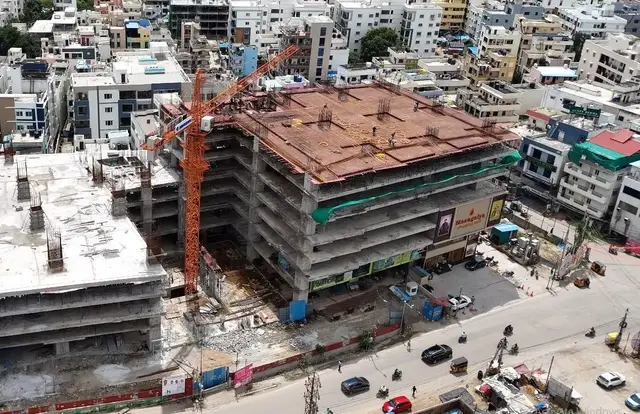
A construction-progress percentage, site-inspection record and completed-portion or occupancy-certified scope were not supplied. Accordingly, the available evidence establishes the registered offering and approved layout information, but does not establish the present physical construction stage or that any portion is completed or occupied. Document index RERA amenities
3. Master plan, architecture & building design
The HMDA layout-plan record describes a 19,793.32 sq.m site, a road-affected area of 1,986.20 sq.m and a net area of 17,807.12 sq.m. The area schedule records 11,161.61 sq.m of plotted area, 3,805.95 sq.m of roads, 1,850.08 sq.m of organized open space/park, 805.26 sq.m of amenities area and 184.21 sq.m of utility area. These are layout land-use areas, not building floor areas.
The drawing extraction records 33 villas and one amenities building. Villas are described as Ground + 2 upper floors, with a stated villa height of 9.99 m; the amenities building is stated as 10.05 m high. A grouped villa entry and the amenities entry also refer to terrace floors. The extracted schedule records approved built-up area of 19,090.46 sq.m; it separately lists total proposed built-up area excluding parking as 16,918.33 sq.m and including parking as 20,818.93 sq.m. These are distinct drawing-extracted figures and are not saleable or carpet area.
The layout drawing identifies 10 m, 12 m, 9.0 m and 10.0 m road widths, including internal and periphery roads. The extracted land-use schedule records no social-infrastructure area and no common parking area. Detailed building footprints, villa-by-villa plans, room layouts and independently measured design features are not established by the supplied material.
4. Homes, configurations & floor plans
| Configuration | Units | Booked | Available | RERA saleable area | Measured carpet area | Loading (if supplied) |
|---|---|---|---|---|---|---|
| Triplex Villa | 33 | 0 | 33 | 563.79 sq.m each | Not established from supplied drawings | Not supplied |
| Amenities building (“AMENTIES”; common area, not a home) | 1 | 0 | 1 | 484.73 sq.m | Not established from supplied drawings | Not supplied |
RERA-filed villa saleable area is 563.79 sq.m per unit. The floor-plan dataset reports two drawings, one measured and one scan pending, but no measured design matched the RERA villa configuration; its held-back 1BHK measurements are not evidence of this project’s villa layout. No verified software-measured carpet area or room dimensions are available for the villas. RERA unit table RERA unit details Floor plans
Saleable area and carpet area are different measures: the supplied evidence does not provide a verified carpet-area figure for the villas or a loading figure. The portal’s booked and available counts have no supplied as-of date and should be treated as indicative. RERA unit table Floor plans
The approved-layout extraction identifies 33 plots/villas and records villa numbers, including mortgage references to Villas 27 and 33. The materials supplied do not provide a complete villa-by-villa schedule of plot sizes or an individual unit floor-plan schedule.
5. Parking & vehicle circulation
The HMDA drawing extraction records 0 proposed parking spaces and separately lists a total parking area of 1,950.30 sq.m. The supplied material does not establish a sanctioned count of car or two-wheeler spaces, visitor or accessible spaces, parking levels, mechanical parking, EV charging, or unit-specific parking allocations. A parking area figure alone does not establish the number or ownership allocation of spaces.
The layout extraction identifies internal roads of 9.0 m and 10.0 m, a 12 m periphery road and other 10 m and 12 m road entries. It does not establish driveway or ramp details, pedestrian-vehicle separation, or parking circulation arrangements.
6. Amenities, recreation & open spaces
The table separates HMDA layout-plan features from RERA portal amenity disclosures. “Available” in the RERA amenity list is a filed status; the supplied record gives 0% progress for each listed item and does not independently verify completion. RERA amenities
| Description / size | One amenities building; 805.26 sq.m amenity land area. Drawing extraction lists gym, party hall, outdoor party lawn, MEP/miscellaneous and lift room |
|---|---|
| Evidence source | HMDA drawing extraction |
| Declared progress / verified status | No completion percentage or independent completion verification supplied |
| Description / size | 1,850.08 sq.m; 10.39% of the stated net layout area |
|---|---|
| Evidence source | HMDA drawing extraction |
| Declared progress / verified status | Planned in layout record; completion not verified |
| Description / size | Named in the drawing extraction; no size or quantity specified |
|---|---|
| Evidence source | HMDA drawing extraction |
| Declared progress / verified status | Completion not verified |
| Description / size | Road area recorded as 3,805.95 sq.m; roads include internal and periphery widths |
|---|---|
| Evidence source | HMDA drawing extraction |
| Declared progress / verified status | RERA amenity list marks internal roads and footpaths “YES,” with 0% progress; completion not verified RERA amenities |
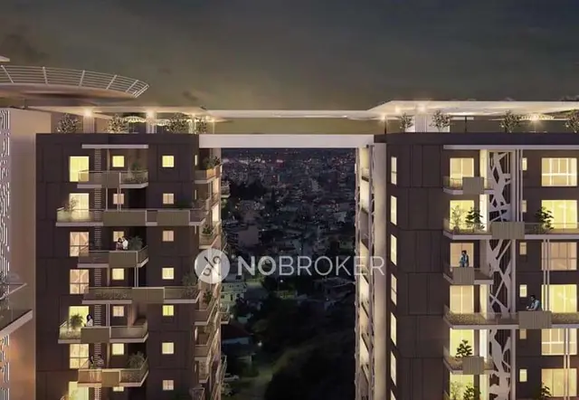
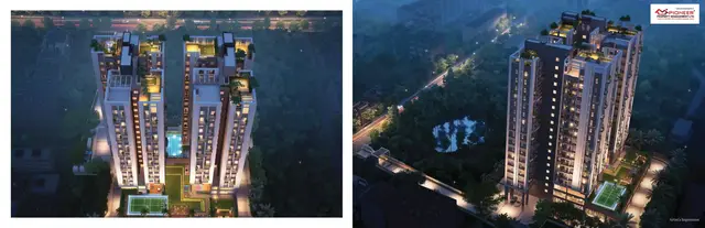
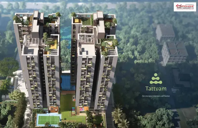
| Description / size | Third-party vendor lists bio pond, landscape area and seating, pedestrian pathway, swimming pool, children’s play area and open-air theater |
|---|---|
| Evidence source | Vendor/marketing source Promoter website |
| Declared progress / verified status | Marketing claims only; not established as sanctioned or completed facilities |
The RERA amenity list also marks water supply, sewerage, storm-water drains, street lighting, community buildings, sewage treatment/disposal, solid-waste management, rainwater harvesting, energy management, fire protection, electrical meter room/sub-station/receiving station and aggregate recreational open space as “YES,” each at 0% progress. Their implementation status is not independently verified in the supplied evidence. RERA amenities
7. Utilities, building services & safety
The HMDA layout-plan extraction lists internal water-supply pipelines and an overhead tank, electrical supply lines, street lights and a transformer; it also lists underground drainage lines, a common septic tank/STP, storm-water drainage, rainwater-harvesting pits, solid-waste arrangements and a bio-compost unit. These are approval-recorded infrastructure provisions, not evidence of completed installation or operational capacity.
The approval-plan extraction also refers to assured potable-water supply arrangements, sewerage disposal, underground utility ducting, source segregation of garbage and a septage-treatment mechanism. It does not supply capacities or establish that these systems are installed, commissioned or operating.
The RERA amenity record marks fire protection and fire-safety requirements, energy management, water supply, sewerage and storm-water drains as “YES,” but records 0% progress. No specific fire-system design, fire clearance, lift number or capacity, backup-power capacity, CCTV/security system, accessibility features or independent commissioning evidence was provided. RERA amenities
8. Location, access & connectivity
The registered project location is Alijapur/Alizapur Village, Gandipet Mandal, Ranga Reddy District, PIN 500075, on Sy. Nos. 3/A/1, 4 and 4/AA. The project’s supplied geocode is a cadastral parcel centroid at 17.41528, 78.35459. RERA record Land records Location record
The location dataset identifies the Financial District (Nanakramguda) at a supplied distance of 1.2 km. A vendor source states that the Old Mumbai Highway and NH 163 are close by, but supplies no measured distances or travel times; that is a vendor connectivity claim, not a verified route assessment. Location record Promoter website
9. Developer & development status
The registered promoter is TATTVAM PROJECTS LLP, a limited liability partnership. The supplied corporate identifier is GSTIN 36AAUFT7615A1ZZ. RERA records identify Rajeev Kumar Sharma as partner and authorized signatory. The promoter address in the project record is Siddiqui Building, Ground Floor, Road No. 9, TV5 Office, Alizapur, Gandipet, Ranga Reddy, 500075. Corporate record Parties record
The promoter’s Form B affidavit, signed by Rajeev Kumar Sharma as authorized representative and dated 02 December 2024, declares completion by 20 November 2027. The project header separately records a proposed completion date of 20/03/2028. The supplied evidence does not establish construction progress or an occupancy/completion certificate for any phase, villa or common facility. RERA record Document index
10. Approvals, official records & documents
| Identifier / date | P02400009137; valid 20/11/2024–20/11/2027 |
|---|---|
| What the supplied record establishes | Registration of TATTVAM AT GOLKONDA under TATTVAM PROJECTS LLP |
| Identifier / date | TS/029050/2023; 28-04-2023 |
|---|---|
| What the supplied record establishes | Layout drawing and extracted site, land-use and development details |
| Identifier / date | 003359/LO/HMDA/0686/SKP/2023; 21 November 2024 |
|---|---|
| What the supplied record establishes | HMDA approval record for a gated-community layout; includes conditions and infrastructure provisions |
| Identifier / date | Document No. 5159/2024; 18 April 2024 |
|---|---|
| What the supplied record establishes | Approval extraction identifies Villas/Plots 27 and 33 as mortgaged to the Metropolitan Commissioner, HMDA |
| Identifier / date | 02 December 2024 |
|---|---|
| What the supplied record establishes | Promoter declaration including completion undertaking of 20 November 2027 |
| Identifier / date | Not identified in the supplied documents |
|---|---|
| What the supplied record establishes | No certificate establishing commencement scope, completion or occupancy status for the villas or amenities building is available in this evidence set Document index |
The RERA certificate records obligations concerning agreements for sale, conveyance, the separate account and quarterly updates. It does not itself evidence a unit sale agreement, conveyance or occupancy certificate.
1. Project at a glance
Project identity
Registered name: TATTVAM AT GOLKONDA
Project type: Mixed Development (Residential & Commercial); the filed inventory comprises villas and an amenities block
Phase / registered portion: No separate phase name or phase number is disclosed. The registered record covers the project on the listed survey land
TG-RERA registration: P02400009137
Registration validity: 20 November 2024 to 20 November 2027, unless extended by the Authority
Registered promoter: TATTVAM PROJECTS LLP
RERA status: Recorded as “New Project”; registration certificate issued
Land and geographic identity
Locality: Alizapur / ALIZAPUR
Revenue village: Alijapur Village (also recorded as Alizapur)
Mandal: Gandipet
District: Ranga Reddy
PIN: 500075
Survey numbers and subdivisions: Sy. No. 3/A/1, Sy. No. 4, and Sy. No. 4/AA
Registered site extent: 19,793.32 sq.m
Road-affected area: 1,986.20 sq.m
Net area: 17,807.12 sq.m
Boundaries: East: Qila Mohd Nagar; West: Sy. No. 3 Part; North: village boundary of Qila Mohd Nagar and Sy. No. 2; South: Sy. No. 5 and military land
Development identity
Sanctioning authority: Hyderabad Metropolitan Development Authority (HMDA)
Principal layout approval: TS/029050/2023, dated 28-04-2023
Draft layout permission reference: 003359/LO/HMDA/0686/SKP/2023, dated 21 November 2024
Approved built-up area: 19,090.46 sq.m, as recorded in the layout-plan extraction
Building count and arrangement: 34 total buildings/units in the filing: 33 residential villas and one amenities building
Sanctioned floor configuration: Villas are generally described as Ground + 2 upper floors; the amenities building is recorded as Ground + 2 upper floors. A drawing-extracted entry also gives Ground, First, Second and Terrace floors for a grouped villa entry and the amenities building
Parking: The drawing extraction records “PROPOSED NUMBER OF PARKINGS 0”; it also records 1,950.30 sq.m as total parking area. No sanctioned parking-space count is established by the available record
Unit count: HMDA layout record: 33 plots/villas; TG-RERA unit table: 33 triplex villas plus one amenities row, 34 total entries
Offering and status
Unit types: 33 “TRIPLEX VILLA” homes; one “AMENTIES” common-area row, not a home offered for sale
RERA-filed saleable area: Villas: 563.79 sq.m each; amenities row: 484.73 sq.m
Booked / available: Villas: 0 booked / 33 available; amenities row: 0 booked / 1 available. Portal counts have no supplied as-of date and are indicative
Construction stage: Not disclosed in the supplied project record; the “under-construction” description appears in third-party vendor data, not as independently verified progress
Completion dates: Promoter’s Form B declaration: completion by 20 November 2027. Project header proposed completion: 20/03/2028
Registration expiry: 20 November 2027 unless extended; this is the registration-validity date, not evidence of an occupancy certificate
Occupancy / completion certificate: No occupancy certificate or completion certificate is identified in the supplied documents; status is not established for any villa or the amenities building
2. The project story
TATTVAM AT GOLKONDA is registered as a mixed residential and commercial development in Alijapur Village, Gandipet Mandal, Ranga Reddy District. Its filed residential offering is a gated-community layout of 33 triplex villas, alongside a separate amenities building; the RERA unit table records that building as “AMENTIES,” not as a sale home.
The land record identifies Sy. Nos. 3/A/1, 4 and 4/AA, with a total site extent of 19,793.32 sq.m, including 1,986.20 sq.m shown as road-affected and a net area of 17,807.12 sq.m. The approved-layout extraction describes villa construction generally as Ground + 2 upper floors and identifies internal roads, open space, utilities and an amenities area.
A construction-progress percentage, site-inspection record and completed-portion or occupancy-certified scope were not supplied. Accordingly, the available evidence establishes the registered offering and approved layout information, but does not establish the present physical construction stage or that any portion is completed or occupied.
3. Master plan, architecture & building design
The HMDA layout-plan record describes a 19,793.32 sq.m site, a road-affected area of 1,986.20 sq.m and a net area of 17,807.12 sq.m. The area schedule records 11,161.61 sq.m of plotted area, 3,805.95 sq.m of roads, 1,850.08 sq.m of organized open space/park, 805.26 sq.m of amenities area and 184.21 sq.m of utility area. These are layout land-use areas, not building floor areas.
The drawing extraction records 33 villas and one amenities building. Villas are described as Ground + 2 upper floors, with a stated villa height of 9.99 m; the amenities building is stated as 10.05 m high. A grouped villa entry and the amenities entry also refer to terrace floors. The extracted schedule records approved built-up area of 19,090.46 sq.m; it separately lists total proposed built-up area excluding parking as 16,918.33 sq.m and including parking as 20,818.93 sq.m. These are distinct drawing-extracted figures and are not saleable or carpet area.
The layout drawing identifies 10 m, 12 m, 9.0 m and 10.0 m road widths, including internal and periphery roads. The extracted land-use schedule records no social-infrastructure area and no common parking area. Detailed building footprints, villa-by-villa plans, room layouts and independently measured design features are not established by the supplied material.
4. Homes, configurations & floor plans
| Configuration | Units | Booked | Available | RERA saleable area | Measured carpet area | Loading (if supplied) |
|---|---|---|---|---|---|---|
| Triplex Villa | 33 | 0 | 33 | 563.79 sq.m each | Not established from supplied drawings | Not supplied |
| Amenities building (“AMENTIES”; common area, not a home) | 1 | 0 | 1 | 484.73 sq.m | Not established from supplied drawings | Not supplied |
RERA-filed villa saleable area is 563.79 sq.m per unit. The floor-plan dataset reports two drawings, one measured and one scan pending, but no measured design matched the RERA villa configuration; its held-back 1BHK measurements are not evidence of this project’s villa layout. No verified software-measured carpet area or room dimensions are available for the villas.
Saleable area and carpet area are different measures: the supplied evidence does not provide a verified carpet-area figure for the villas or a loading figure. The portal’s booked and available counts have no supplied as-of date and should be treated as indicative.
The approved-layout extraction identifies 33 plots/villas and records villa numbers, including mortgage references to Villas 27 and 33. The materials supplied do not provide a complete villa-by-villa schedule of plot sizes or an individual unit floor-plan schedule.
5. Parking & vehicle circulation
The HMDA drawing extraction records 0 proposed parking spaces and separately lists a total parking area of 1,950.30 sq.m. The supplied material does not establish a sanctioned count of car or two-wheeler spaces, visitor or accessible spaces, parking levels, mechanical parking, EV charging, or unit-specific parking allocations. A parking area figure alone does not establish the number or ownership allocation of spaces.
The layout extraction identifies internal roads of 9.0 m and 10.0 m, a 12 m periphery road and other 10 m and 12 m road entries. It does not establish driveway or ramp details, pedestrian-vehicle separation, or parking circulation arrangements.
6. Amenities, recreation & open spaces
The table separates HMDA layout-plan features from RERA portal amenity disclosures. “Available” in the RERA amenity list is a filed status; the supplied record gives 0% progress for each listed item and does not independently verify completion.
| Description / size | One amenities building; 805.26 sq.m amenity land area. Drawing extraction lists gym, party hall, outdoor party lawn, MEP/miscellaneous and lift room |
|---|---|
| Evidence source | HMDA drawing extraction |
| Declared progress / verified status | No completion percentage or independent completion verification supplied |
| Description / size | 1,850.08 sq.m; 10.39% of the stated net layout area |
|---|---|
| Evidence source | HMDA drawing extraction |
| Declared progress / verified status | Planned in layout record; completion not verified |
| Description / size | Named in the drawing extraction; no size or quantity specified |
|---|---|
| Evidence source | HMDA drawing extraction |
| Declared progress / verified status | Completion not verified |
| Description / size | Road area recorded as 3,805.95 sq.m; roads include internal and periphery widths |
|---|---|
| Evidence source | HMDA drawing extraction |
| Declared progress / verified status | RERA amenity list marks internal roads and footpaths “YES,” with 0% progress; completion not verified |
| Description / size | Third-party vendor lists bio pond, landscape area and seating, pedestrian pathway, swimming pool, children’s play area and open-air theater |
|---|---|
| Evidence source | Vendor/marketing source |
| Declared progress / verified status | Marketing claims only; not established as sanctioned or completed facilities |
The RERA amenity list also marks water supply, sewerage, storm-water drains, street lighting, community buildings, sewage treatment/disposal, solid-waste management, rainwater harvesting, energy management, fire protection, electrical meter room/sub-station/receiving station and aggregate recreational open space as “YES,” each at 0% progress. Their implementation status is not independently verified in the supplied evidence.
7. Utilities, building services & safety
The HMDA layout-plan extraction lists internal water-supply pipelines and an overhead tank, electrical supply lines, street lights and a transformer; it also lists underground drainage lines, a common septic tank/STP, storm-water drainage, rainwater-harvesting pits, solid-waste arrangements and a bio-compost unit. These are approval-recorded infrastructure provisions, not evidence of completed installation or operational capacity.
The approval-plan extraction also refers to assured potable-water supply arrangements, sewerage disposal, underground utility ducting, source segregation of garbage and a septage-treatment mechanism. It does not supply capacities or establish that these systems are installed, commissioned or operating.
The RERA amenity record marks fire protection and fire-safety requirements, energy management, water supply, sewerage and storm-water drains as “YES,” but records 0% progress. No specific fire-system design, fire clearance, lift number or capacity, backup-power capacity, CCTV/security system, accessibility features or independent commissioning evidence was provided.
8. Location, access & connectivity
The registered project location is Alijapur/Alizapur Village, Gandipet Mandal, Ranga Reddy District, PIN 500075, on Sy. Nos. 3/A/1, 4 and 4/AA. The project’s supplied geocode is a cadastral parcel centroid at 17.41528, 78.35459.
The location dataset identifies the Financial District (Nanakramguda) at a supplied distance of 1.2 km. A vendor source states that the Old Mumbai Highway and NH 163 are close by, but supplies no measured distances or travel times; that is a vendor connectivity claim, not a verified route assessment.
9. Developer & development status
The registered promoter is TATTVAM PROJECTS LLP, a limited liability partnership. The supplied corporate identifier is GSTIN 36AAUFT7615A1ZZ. RERA records identify Rajeev Kumar Sharma as partner and authorized signatory. The promoter address in the project record is Siddiqui Building, Ground Floor, Road No. 9, TV5 Office, Alizapur, Gandipet, Ranga Reddy, 500075.
The promoter’s Form B affidavit, signed by Rajeev Kumar Sharma as authorized representative and dated 02 December 2024, declares completion by 20 November 2027. The project header separately records a proposed completion date of 20/03/2028. The supplied evidence does not establish construction progress or an occupancy/completion certificate for any phase, villa or common facility.
10. Approvals, official records & documents
| Identifier / date | P02400009137; valid 20/11/2024–20/11/2027 |
|---|---|
| What the supplied record establishes | Registration of TATTVAM AT GOLKONDA under TATTVAM PROJECTS LLP |
| Identifier / date | TS/029050/2023; 28-04-2023 |
|---|---|
| What the supplied record establishes | Layout drawing and extracted site, land-use and development details |
| Identifier / date | 003359/LO/HMDA/0686/SKP/2023; 21 November 2024 |
|---|---|
| What the supplied record establishes | HMDA approval record for a gated-community layout; includes conditions and infrastructure provisions |
| Identifier / date | Document No. 5159/2024; 18 April 2024 |
|---|---|
| What the supplied record establishes | Approval extraction identifies Villas/Plots 27 and 33 as mortgaged to the Metropolitan Commissioner, HMDA |
| Identifier / date | 02 December 2024 |
|---|---|
| What the supplied record establishes | Promoter declaration including completion undertaking of 20 November 2027 |
| Identifier / date | Not identified in the supplied documents |
|---|---|
| What the supplied record establishes | No certificate establishing commencement scope, completion or occupancy status for the villas or amenities building is available in this evidence set |
The RERA certificate records obligations concerning agreements for sale, conveyance, the separate account and quarterly updates. It does not itself evidence a unit sale agreement, conveyance or occupancy certificate.
Frequently asked questions
Is TATTVAM AT GOLKONDA registered with Telangana RERA?
Yes. TATTVAM AT GOLKONDA is registered with the Telangana Real Estate Regulatory Authority as P02400009137; the registration status is New Project.
Who is the developer of TATTVAM AT GOLKONDA?
The promoter named in the RERA registration is TATTVAM PROJECTS LLP.
Where is TATTVAM AT GOLKONDA located?
TATTVAM AT GOLKONDA is in ALIZAPUR, Gandipet, Rangareddy, Telangana (500075).
When will TATTVAM AT GOLKONDA be completed?
The promoter's proposed date of completion filed with RERA is 20/03/2028. This is the promoter's declaration, not a guarantee.
More projects in Gandipet