SEZ County
SHUBHASRI DEVELOPERS PRIVATE LIMITED · Mahabubnagar · RERA P01400008040
SEZ COUNTY is a new residential plotted layout in GOLLAPALLY, Jadcherla Mandal, Mahabubnagar District. The registered promoter is SHUBHASRI DEVELOPERS PRIVATE LIMITED. The project covers 100220 sqmts and comprises 374 individual residential plots, with drawing-measured areas from 122.63 sqm to 373.3 sqm. It is registered with TG-RERA as P01400008040, and the promoter’s stated proposed completion date is 10-01-2026.
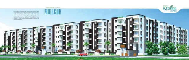
📘 Project brochure from the promoter’s website ↗01What we found
Read from TG-RERA filings, approvals, land and registration records and court records. A court case is counted only when the court record states this project's survey number with its village, or names the project.
02Check before you pay
8 items to check before you pay, 3 high - from the title chain, court records and approvals, each with what to ask the builder or your advocate. An item may not be a problem with the project: records can be incomplete.
1. Project at a glance
Project identity
| Field | Project record |
|---|---|
| Registered project name | SEZ COUNTY RERA record |
| Project type | New residential open plotted layout; TG-RERA identifies it as Plotted Development. RERA filing |
| Registered phase/portion | No separate phase name or phase number is disclosed; registration is for the project on the listed land. |
| TG-RERA registration number | P01400008040 RERA record |
| Registration validity | 08/04/2024 to 10/01/2026, as stated on the certificate. Registration validity is distinct from the project completion date. RERA record |
| Registered promoter | SHUBHASRI DEVELOPERS PRIVATE LIMITED RERA record |
| RERA status | The supplied record identifies the project as New Project. The certificate records the validity period above; no extension or later registration-status order is supplied. RERA filing |
Land and geographic identity
| Field | Project record |
|---|---|
| Revenue village | Gollapalle (also described in the filed layout approval as Gollapally Village and Gram Panchayat). RERA record |
| Locality | GOLLAPALLY RERA record RERA filing |
| Mandal / district / PIN | Jadcherla / Mahabubnagar / 500210 RERA record |
| All registered survey numbers | 42/P, 45/P, 46/P, 47, 48/P RERA record |
| Filed layout-plan survey descriptions | 42/PART, 45/PART, 46/PART, 47, 48PART |
| Site extent | RERA land details state 100220 sqmts total and 100220.00 sqmts net area. RERA filing |
| Layout drawing area | The filed drawing states 100221.39 sq.mt for net layout area. Layout record |
| Boundaries | East: ROAD WIDE 20 MTR; West: OTHERS LAND; North: EXISTING LAYOUT; South: 40 FEET WIDE ROAD. RERA filing |
Development identity
| Field | Project record |
|---|---|
| Sanctioning authority | MUDA Urban Development Authority; the approval is delegated to Gollapally Grampanchayat. The RERA record’s authority field also identifies DTCP. RERA record Approvals record |
| Principal layout approval | Tentative Layout Plan approval no. 338615/LP/GP/205278/0001/2023, dated 10-01-2024. Approvals record |
| Other drawing reference | File no. TS/067580/2023 appears in the layout-plan record. Approvals record |
| Approved built-up area | The filed layout record states Total Proposed Built Up Area Excluding Parking: 0.00 and Including Parking: 0.00; the RERA fields separately report 60038 as approved built-up area. The supplied records do not explain this field distinction. RERA filing |
| Plots | The approved layout record states 374 plots. |
| Buildings / floors | Not disclosed for this plotted layout; no apartment-building floor configuration is supplied. |
| Parking | The filed layout plan records Common Parking Area: 0.00; no parking count or allocated spaces are supplied. |
Offering and status
| Field | Project record |
|---|---|
| Offered unit type | Individual residential plots; the filed layout approval specifies detached, single-family dwelling houses as the permitted residential use. |
| Plot count and sizes | The drawing-derived schedule identifies 374 plots, with software-read areas from 122.63 sqm to 373.3 sqm; these measurements should be checked against the drawing. Layout record |
| Booked / available counts | Not disclosed in the supplied RERA records. RERA filing |
| Construction / development stage | No independently verified site-progress record is supplied. The layout approval requires infrastructure and development works; no completion certificate or final layout release is supplied. |
| Completion date | Promoter’s Form-B undertaking states 10-01-2026; the registration certificate also ends on that date. |
| Occupancy / completion certificate | No project completion or occupancy certificate is supplied. The filed Form–1A is a blank certificate template, not a project-specific completion certificate. |
2. The project story
SEZ COUNTY is registered as a plotted residential development at Gollapally/Gollapalle in Jadcherla Mandal, Mahabubnagar District. Its registered land identity comprises portions of survey numbers 42/P, 45/P, 46/P, 47 and 48/P. The project is arranged as an open layout of individual plots, rather than apartment blocks or villas delivered as buildings. RERA record
The filed tentative layout approval provides for 374 plots, internal roads, park/open space, social infrastructure and utility land. It also requires infrastructure and amenity works, and states that final layout approval is subject to completion and certification of those works. The supplied evidence does not establish how much work has been completed on site; the layout drawing and approval describe the planned development, not independently verified delivery.
The promoter undertook to complete the project by 10-01-2026. The supplied record contains no project-specific completion/occupancy certificate or evidence of a completed final-layout approval.
3. Master plan, architecture & building design
The approved drawing describes a proposed draft residential open plotted layout. Its stated net layout area is 100221.39 sq.mt. The land-use schedule in that drawing allocates 60038.23 sq mt. to plotted area (59.91%), 27507.28 sq mt. to roads (27.45%), 9029.50 sq mt. to organized open space/park (9.01%), 2552.47 sq mt. to social infrastructure (2.55%) and 1092.68 sq mt. to utility area (1.09%).
The drawing-derived plot schedule reports 374 plots, with a smallest software-read plot area of 122.63 sqm, median of 153.29 sqm, and largest of 373.3 sqm. These are drawing-based measurements, not RERA-filed saleable areas for a specific plot. The drawing includes internal road widths including 9.14M, 10.06M, 12.0M, and 20.00 MT; its full road-width annotations also include 33'-0", 40'-0", and 66'-0". Layout record
The layout approval identifies open-space/park, social-infrastructure and utility areas and requires roads, drains, planting, rainwater-harvesting pits, street lighting and sewerage and protected-water-supply systems as development works. No residential buildings, floor plans, building footprints, or phase-wise building arrangements are established by the supplied layout records.
4. Homes, configurations & floor plans
This is a plotted development, not an apartment project. The filed layout approval states 374 plots. A software-read schedule from the approved layout drawing gives these plot-size bands; the extracted plot areas should be verified against the drawing. Layout record
| Drawing-measured plot-size band | Plots |
|---|---|
| 100–150 sqyd (84–125 sqm) | 27 |
| 150–200 sqyd (125–167 sqm) | 222 |
| 200–250 sqyd (167–209 sqm) | 82 |
| 250–300 sqyd (209–251 sqm) | 32 |
| 300–400 sqyd (251–334 sqm) | 8 |
| 400–500 sqyd (334–418 sqm) | 3 |
The drawing-derived schedule reports a smallest plot of 122.63 sqm (146.7 sqyd), median 153.29 sqm (183.3 sqyd) and largest 373.3 sqm (446.5 sqyd). These are software-measured drawing values, not RERA-filed plot-wise saleable areas. Layout record
No plot-wise booking or availability schedule, individual plot dimensions, or executed allotment/sale agreements are supplied. The floor-plan dataset contains two layout sheets and no apartment floor plans; apartment carpet area, balcony area and loading figures are therefore not applicable on the available evidence. Floor plans
5. Parking & vehicle circulation
The filed layout schedule records Common Parking Area: 0.00 and does not state a parking-space count or plot-wise parking allocation. No dedicated visitor, accessible, two-wheeler or EV-charging provision is documented in the supplied project records.
The tentative approval requires roads to be opened for access to neighboring sites and prohibits a compound wall or fencing around the site. The drawing records internal road widths including 9.14M, 10.06M, 12.0M, and 20.00 MT. No separate pedestrian circulation plan or vehicle-entry/exit count is supplied.
6. Amenities, recreation & open spaces
| Description / size | 9029.50 sq mt.; 9.01% of the layout in the filed drawing. |
|---|---|
| Declared progress / verified status | Planned in the layout. Approval requires handover by registered gift deed; no completion or handover evidence is supplied. |
| Description / size | 2552.47 sq mt.; 2.55% of the layout. |
|---|---|
| Declared progress / verified status | Reserved/planned. The approval lists possible community uses, including pharmacy, clinic, school, play school, creche, dispensary and convenience shops; no individual facility is evidenced as built or operating. |
| Description / size | 1092.68 sq mt.; 1.09% of the layout. |
|---|---|
| Declared progress / verified status | Reserved/planned for utilities; no completion evidence supplied. |
| Description / size | 27507.28 sq mt.; 27.45% of the layout. |
|---|---|
| Declared progress / verified status | Planned; no independent completion verification supplied. |
| Description / size | The promoter’s brochure lists a clubhouse, kids’ play area and other recreational items. |
|---|---|
| Declared progress / verified status | Promoter-marketed only in the supplied evidence; not established as sanctioned or delivered. |
The RERA amenities record marks internal roads and footpaths, water supply, sewerage, storm-water drains, green strip/park, street lighting, water conservation/rainwater harvesting, energy management, fire-safety requirements, and an electrical meter room/sub-station/receiving station as available in the form, but records 0% progress for the listed items. These are filed declarations, not independent confirmation of completion. RERA amenities
7. Utilities, building services & safety
The filed tentative layout approval requires development works including a water reservoir or sump/overhead tank as applicable, protected water supply, septic tank, sewerage disposal, drains and nala channelization, rainwater-harvesting pits, electrical facilities and street lighting. The layout drawing labels a septic tank and water-harvesting pit. These are approval requirements or drawing labels; the supplied evidence does not verify their installation, capacity or operation.
The RERA amenities form marks water supply, sewerage (including chamber, lines, septic tank and STP), storm-water drains, water conservation/rainwater harvesting, energy management, fire-protection requirements and an electrical meter room/sub-station/receiving station as “YES,” while reporting 0% progress for the listed amenities. No water source or storage capacity, STP capacity, reuse arrangement, electrical-supply capacity, backup system, fire-system details, waste-management installation, security system or accessibility features are documented as completed. RERA amenities
8. Location, access & connectivity
The registered location is Gollapalle, Jadcherla Mandal, Mahabubnagar District, PIN 500210; the filed layout approval describes the site as Gollapally Village and Gram Panchayat. The RERA land record describes the eastern boundary as ROAD WIDE 20 MTR and the southern boundary as 40 FEET WIDE ROAD. The approval also identifies internal roads with widths including 9.14M, 10.06M and 12.0M. RERA record RERA filing
A location record gives the nearest sampled Outer Ring Road interchange as approximately 52.8 km from the cadastral parcel centroid. This is a mapped distance, not a travel-time estimate. Location record
9. Developer & development status
The registered promoter is SHUBHASRI DEVELOPERS PRIVATE LIMITED, a private limited company. The corporate identifier supplied is U70109TG2022PTC169555 and the GSTIN is 36ABKCS0127N1Z3. The RERA filing lists TAMMA INDRASENA REDDY as authorized signatory and BADDURI RAMIREDDY and BADDURI SAI YAMINI REDDY as directors. Corporate record Parties record
The RERA record gives the promoter address as 8-13, Flat No. 403, Sai Jyothi Residency, Hanuman Nagar, Gollapally, Jadcherla, Mahabubnagar, Telangana, 500210. A separate address appears on the registration certificate as Village Kannamet, Serilingampally, Ranga Reddy District, PIN 500084; the supplied evidence identifies it as the promoter address on that certificate. The project’s listed website is https://shubhasri.in/sez-county/. RERA filing Parties record
The promoter’s Form-B undertaking states a completion date of 10-01-2026. The supplied evidence does not report independently verified physical progress, plot bookings, or completion/occupancy certification. RERA amenities
10. Approvals, official records & documents
| What the supplied evidence establishes | Form C certificate for SEZ COUNTY, registration P01400008040, promoter Shubhasri Developers Private Limited, land at Gollapalle, and stated validity 08/04/2024–10/01/2026. |
|---|
| What the supplied evidence establishes | MUDA approval no. 338615/LP/GP/205278/0001/2023, dated 10-01-2024, for a tentative layout covering survey numbers 42/part, 45/part, 46/part, 47 and 48/part. |
|---|
| What the supplied evidence establishes | Drawing record with file no. TS/067580/2023, land-use allocation and a stated 374 plots. |
|---|
| What the supplied evidence establishes | Authorized signatory TAMMA INDRASENA REDDY declares title and no encumbrances and undertakes completion by 10-01-2026. |
|---|
| What the supplied evidence establishes | Blank architect’s completion-certificate template; no project-specific completion or occupancy certificate particulars are filled in. |
|---|
| What the supplied evidence establishes | Advocate-prepared title opinion dated 28-02-2024 concerning the layout land, with its scope and underlying title documents recorded in the separate land-and-title review. |
|---|
| What the supplied evidence establishes | The approval identifies development and handover requirements and states that tentative layout approval is not proof of land title; the final layout requires certified completion of the specified development works. |
|---|
1. Project at a glance
Project identity
Registered project name: SEZ COUNTY
Project type: New residential open plotted layout; TG-RERA identifies it as Plotted Development.
Registered phase/portion: No separate phase name or phase number is disclosed; registration is for the project on the listed land.
TG-RERA registration number: P01400008040
Registration validity: 08/04/2024 to 10/01/2026, as stated on the certificate. Registration validity is distinct from the project completion date.
Registered promoter: SHUBHASRI DEVELOPERS PRIVATE LIMITED
RERA status: The supplied record identifies the project as New Project. The certificate records the validity period above; no extension or later registration-status order is supplied.
Land and geographic identity
Revenue village: Gollapalle (also described in the filed layout approval as Gollapally Village and Gram Panchayat).
Locality: GOLLAPALLY
Mandal / district / PIN: Jadcherla / Mahabubnagar / 500210
All registered survey numbers: 42/P, 45/P, 46/P, 47, 48/P
Filed layout-plan survey descriptions: 42/PART, 45/PART, 46/PART, 47, 48PART
Site extent: RERA land details state 100220 sqmts total and 100220.00 sqmts net area.
Layout drawing area: The filed drawing states 100221.39 sq.mt for net layout area.
Boundaries: East: ROAD WIDE 20 MTR; West: OTHERS LAND; North: EXISTING LAYOUT; South: 40 FEET WIDE ROAD.
Development identity
Sanctioning authority: MUDA Urban Development Authority; the approval is delegated to Gollapally Grampanchayat. The RERA record’s authority field also identifies DTCP.
Principal layout approval: Tentative Layout Plan approval no. 338615/LP/GP/205278/0001/2023, dated 10-01-2024.
Other drawing reference: File no. TS/067580/2023 appears in the layout-plan record.
Approved built-up area: The filed layout record states Total Proposed Built Up Area Excluding Parking: 0.00 and Including Parking: 0.00; the RERA fields separately report 60038 as approved built-up area. The supplied records do not explain this field distinction.
Plots: The approved layout record states 374 plots.
Buildings / floors: Not disclosed for this plotted layout; no apartment-building floor configuration is supplied.
Parking: The filed layout plan records Common Parking Area: 0.00; no parking count or allocated spaces are supplied.
Offering and status
Offered unit type: Individual residential plots; the filed layout approval specifies detached, single-family dwelling houses as the permitted residential use.
Plot count and sizes: The drawing-derived schedule identifies 374 plots, with software-read areas from 122.63 sqm to 373.3 sqm; these measurements should be checked against the drawing.
Booked / available counts: Not disclosed in the supplied RERA records.
Construction / development stage: No independently verified site-progress record is supplied. The layout approval requires infrastructure and development works; no completion certificate or final layout release is supplied.
Completion date: Promoter’s Form-B undertaking states 10-01-2026; the registration certificate also ends on that date.
Occupancy / completion certificate: No project completion or occupancy certificate is supplied. The filed Form–1A is a blank certificate template, not a project-specific completion certificate.
2. The project story
SEZ COUNTY is registered as a plotted residential development at Gollapally/Gollapalle in Jadcherla Mandal, Mahabubnagar District. Its registered land identity comprises portions of survey numbers 42/P, 45/P, 46/P, 47 and 48/P. The project is arranged as an open layout of individual plots, rather than apartment blocks or villas delivered as buildings.
The filed tentative layout approval provides for 374 plots, internal roads, park/open space, social infrastructure and utility land. It also requires infrastructure and amenity works, and states that final layout approval is subject to completion and certification of those works. The supplied evidence does not establish how much work has been completed on site; the layout drawing and approval describe the planned development, not independently verified delivery.
The promoter undertook to complete the project by 10-01-2026. The supplied record contains no project-specific completion/occupancy certificate or evidence of a completed final-layout approval.
3. Master plan, architecture & building design
The approved drawing describes a proposed draft residential open plotted layout. Its stated net layout area is 100221.39 sq.mt. The land-use schedule in that drawing allocates 60038.23 sq mt. to plotted area (59.91%), 27507.28 sq mt. to roads (27.45%), 9029.50 sq mt. to organized open space/park (9.01%), 2552.47 sq mt. to social infrastructure (2.55%) and 1092.68 sq mt. to utility area (1.09%).
The drawing-derived plot schedule reports 374 plots, with a smallest software-read plot area of 122.63 sqm, median of 153.29 sqm, and largest of 373.3 sqm. These are drawing-based measurements, not RERA-filed saleable areas for a specific plot. The drawing includes internal road widths including 9.14M, 10.06M, 12.0M, and 20.00 MT; its full road-width annotations also include 33'-0", 40'-0", and 66'-0".
The layout approval identifies open-space/park, social-infrastructure and utility areas and requires roads, drains, planting, rainwater-harvesting pits, street lighting and sewerage and protected-water-supply systems as development works. No residential buildings, floor plans, building footprints, or phase-wise building arrangements are established by the supplied layout records.
4. Homes, configurations & floor plans
This is a plotted development, not an apartment project. The filed layout approval states 374 plots. A software-read schedule from the approved layout drawing gives these plot-size bands; the extracted plot areas should be verified against the drawing.
100–150 sqyd (84–125 sqm): 27
150–200 sqyd (125–167 sqm): 222
200–250 sqyd (167–209 sqm): 82
250–300 sqyd (209–251 sqm): 32
300–400 sqyd (251–334 sqm): 8
400–500 sqyd (334–418 sqm): 3
The drawing-derived schedule reports a smallest plot of 122.63 sqm (146.7 sqyd), median 153.29 sqm (183.3 sqyd) and largest 373.3 sqm (446.5 sqyd). These are software-measured drawing values, not RERA-filed plot-wise saleable areas.
No plot-wise booking or availability schedule, individual plot dimensions, or executed allotment/sale agreements are supplied. The floor-plan dataset contains two layout sheets and no apartment floor plans; apartment carpet area, balcony area and loading figures are therefore not applicable on the available evidence.
5. Parking & vehicle circulation
The filed layout schedule records Common Parking Area: 0.00 and does not state a parking-space count or plot-wise parking allocation. No dedicated visitor, accessible, two-wheeler or EV-charging provision is documented in the supplied project records.
The tentative approval requires roads to be opened for access to neighboring sites and prohibits a compound wall or fencing around the site. The drawing records internal road widths including 9.14M, 10.06M, 12.0M, and 20.00 MT. No separate pedestrian circulation plan or vehicle-entry/exit count is supplied.
6. Amenities, recreation & open spaces
| Description / size | 9029.50 sq mt.; 9.01% of the layout in the filed drawing. |
|---|---|
| Declared progress / verified status | Planned in the layout. Approval requires handover by registered gift deed; no completion or handover evidence is supplied. |
| Description / size | 2552.47 sq mt.; 2.55% of the layout. |
|---|---|
| Declared progress / verified status | Reserved/planned. The approval lists possible community uses, including pharmacy, clinic, school, play school, creche, dispensary and convenience shops; no individual facility is evidenced as built or operating. |
| Description / size | 1092.68 sq mt.; 1.09% of the layout. |
|---|---|
| Declared progress / verified status | Reserved/planned for utilities; no completion evidence supplied. |
| Description / size | 27507.28 sq mt.; 27.45% of the layout. |
|---|---|
| Declared progress / verified status | Planned; no independent completion verification supplied. |
| Description / size | The promoter’s brochure lists a clubhouse, kids’ play area and other recreational items. |
|---|---|
| Declared progress / verified status | Promoter-marketed only in the supplied evidence; not established as sanctioned or delivered. |
The RERA amenities record marks internal roads and footpaths, water supply, sewerage, storm-water drains, green strip/park, street lighting, water conservation/rainwater harvesting, energy management, fire-safety requirements, and an electrical meter room/sub-station/receiving station as available in the form, but records 0% progress for the listed items. These are filed declarations, not independent confirmation of completion.
7. Utilities, building services & safety
The filed tentative layout approval requires development works including a water reservoir or sump/overhead tank as applicable, protected water supply, septic tank, sewerage disposal, drains and nala channelization, rainwater-harvesting pits, electrical facilities and street lighting. The layout drawing labels a septic tank and water-harvesting pit. These are approval requirements or drawing labels; the supplied evidence does not verify their installation, capacity or operation.
The RERA amenities form marks water supply, sewerage (including chamber, lines, septic tank and STP), storm-water drains, water conservation/rainwater harvesting, energy management, fire-protection requirements and an electrical meter room/sub-station/receiving station as “YES,” while reporting 0% progress for the listed amenities. No water source or storage capacity, STP capacity, reuse arrangement, electrical-supply capacity, backup system, fire-system details, waste-management installation, security system or accessibility features are documented as completed.
8. Location, access & connectivity
The registered location is Gollapalle, Jadcherla Mandal, Mahabubnagar District, PIN 500210; the filed layout approval describes the site as Gollapally Village and Gram Panchayat. The RERA land record describes the eastern boundary as ROAD WIDE 20 MTR and the southern boundary as 40 FEET WIDE ROAD. The approval also identifies internal roads with widths including 9.14M, 10.06M and 12.0M.
A location record gives the nearest sampled Outer Ring Road interchange as approximately 52.8 km from the cadastral parcel centroid. This is a mapped distance, not a travel-time estimate.
9. Developer & development status
The registered promoter is SHUBHASRI DEVELOPERS PRIVATE LIMITED, a private limited company. The corporate identifier supplied is U70109TG2022PTC169555 and the GSTIN is 36ABKCS0127N1Z3. The RERA filing lists TAMMA INDRASENA REDDY as authorized signatory and BADDURI RAMIREDDY and BADDURI SAI YAMINI REDDY as directors.
The RERA record gives the promoter address as 8-13, Flat No. 403, Sai Jyothi Residency, Hanuman Nagar, Gollapally, Jadcherla, Mahabubnagar, Telangana, 500210. A separate address appears on the registration certificate as Village Kannamet, Serilingampally, Ranga Reddy District, PIN 500084; the supplied evidence identifies it as the promoter address on that certificate. The project’s listed website is https://shubhasri.in/sez-county/.
The promoter’s Form-B undertaking states a completion date of 10-01-2026. The supplied evidence does not report independently verified physical progress, plot bookings, or completion/occupancy certification.
10. Approvals, official records & documents
| What the supplied evidence establishes | Form C certificate for SEZ COUNTY, registration P01400008040, promoter Shubhasri Developers Private Limited, land at Gollapalle, and stated validity 08/04/2024–10/01/2026. |
|---|
| What the supplied evidence establishes | MUDA approval no. 338615/LP/GP/205278/0001/2023, dated 10-01-2024, for a tentative layout covering survey numbers 42/part, 45/part, 46/part, 47 and 48/part. |
|---|
| What the supplied evidence establishes | Drawing record with file no. TS/067580/2023, land-use allocation and a stated 374 plots. |
|---|
| What the supplied evidence establishes | Authorized signatory TAMMA INDRASENA REDDY declares title and no encumbrances and undertakes completion by 10-01-2026. |
|---|
| What the supplied evidence establishes | Blank architect’s completion-certificate template; no project-specific completion or occupancy certificate particulars are filled in. |
|---|
| What the supplied evidence establishes | Advocate-prepared title opinion dated 28-02-2024 concerning the layout land, with its scope and underlying title documents recorded in the separate land-and-title review. |
|---|
| What the supplied evidence establishes | The approval identifies development and handover requirements and states that tentative layout approval is not proof of land title; the final layout requires certified completion of the specified development works. |
|---|
Frequently asked questions
Is SEZ COUNTY registered with Telangana RERA?
Yes. SEZ COUNTY is registered with the Telangana Real Estate Regulatory Authority as P01400008040; the registration status is New Project.
Who is the developer of SEZ COUNTY?
The promoter named in the RERA registration is SHUBHASRI DEVELOPERS PRIVATE LIMITED.
Where is SEZ COUNTY located?
SEZ COUNTY is in GOLLAPALLY, Gollapalle, Jadcherla, Mahabubnagar, Telangana (500210).
When will SEZ COUNTY be completed?
The promoter's proposed date of completion filed with RERA is 10/01/2026. This is the promoter's declaration, not a guarantee.
More projects in Gollapalle